Magna Roman Fort: A Roman Military Post at a Road Junction
Site at a Glance
- Popularity
- High
- Country
- United Kingdom
- Primary era
- Classical
- Eras represented
- Classical
- Civilizations
- Roman
- Site type
- Military
- Remains
- Fort
On this page20 sections
History
Early occupation and the Hadrianic frontier
Magna Roman Fort, the Roman military site identified with Magnis, stands at the Roman Army Museum in Brampton, United Kingdom. Roman military occupation began here in the first century, before Hadrian’s Wall was built. The position probably helped control the junction of the Stanegate and Maiden Way, two routes across northern Britain.
A large enclosure beneath the later fort may have been a military camp established around AD 80 during the campaigns of Gnaeus Julius Agricola, a Roman governor and commander in Britain. If so, it belonged to the late Flavian period, the later years of the dynasty that ruled Rome from AD 69 to 96. The place-name is recorded as Magnis in the Ravenna Cosmography, a medieval compilation of geographical names, and the Notitia Dignitatum, a late Roman list of offices and military units. Antiquary William Hutchinson saw a now-lost inscription supporting the name in 1766. Proposed origins include Latin words meaning “great” and the Celtic maen, meaning “stone” or “rock.” A connection to the Carvetii, a Celtic people of northern Britain, has also been suggested, but is considered unlikely for a comparatively small fort. Magna and Carvoran are other names used for the site.
The first fort was made of timber and earth. It was probably left temporarily during construction of Hadrian’s Wall, which Emperor Hadrian ordered from AD 122, then occupied again around AD 136 to 137. At that point, a smaller stone fort replaced the earlier one. Magnis was probably included in the Wall’s chain of forts, although its omission from two lists of forts in the western sector leaves its formal place in that system uncertain.
A building inscription dated AD 117 to 138, together with two stones recording work by army centuries, connects construction at the fort with legionary troops. The Twentieth Legion Valeria Victrix and Sixth Legion Victrix were associated with this work. The garrison included auxiliary cohorts, units distinct from the legions, among them the First Cohort of Batavians, First Cohort of Hamian Archers, and Second Cohort of Delmatians, as well as a unit called Numerus Magnesium.
Garrison and later Roman administration
The First Cohort of Hamian Archers was stationed at Magnis from around AD 120. Its roughly 500 soldiers came from Hamath in Syria, and no other regiment of archers is known from Roman Britain. The garrison protected the road junction and may also have watched the crossing of the Tipalt Burn. Construction continued in AD 163 to 166, including work under Sextus Calpurnius Agricola, the provincial governor. After Roman forces withdrew from the Antonine Wall, another frontier barrier in what is now Scotland, the same archery unit that had served at Magnis under Hadrian returned.
Several auxiliary units served at the fort over time. In the late second century, the area belonged to Britannia Inferior, and from the fourth century it formed part of Britannia Secunda, two administrative provinces of Roman Britain. In late antiquity, the garrison belonged to Rome’s frontier forces. The military probably left the fort in the early fifth century; the last regular Roman army units withdrew from Britain around AD 410.
Abandonment and investigation
Visitors in 1599 described standing masonry and roads visible within the fort. From 1776, stone robbing and agricultural activity progressively removed much of the surviving masonry. The last above-ground remains were reported gone by 1837. A ditch identified east of Carvoran House in 1985 may belong to a third fort or a marching camp.
Geophysical surveys in 1999 covered 12 hectares containing the fort and civilian settlement. Work in 2000 established the fort’s dimensions, while excavations in 2002 showed that stone robbing had destroyed the south gate and parts of the east and west walls. Excavations begun by the Vindolanda Trust in 2023 investigated the fort wall and its outer ditches in response to climate-related risks. Prolonged dry, hot periods followed by intense rain are changing soil conditions, allowing water, oxygen, and minerals to penetrate deeper into soils that preserve archaeological and environmental evidence.
Archaeologists Robin and Pat Birley founded the nearby Roman Army Museum, which is operated by the Vindolanda Trust and was modernized in 2011.
Remains
The fort
Setting and plan
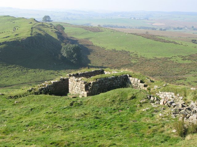
The fort occupied a west-sloping hill, with views toward the northern hinterland and the Tipalt Burn valley about 500 metres to the west. Its later stone defenses enclosed a rounded-corner rectangle, often described as a playing-card shape. The fort measured about 135 metres from north to south and 111 metres from east to west, covering roughly 1.5 hectares. It lay south of Hadrian’s Wall and was aligned northeast to southwest; geophysical survey results indicate that its entrance faced south. The earlier timber-and-earth enclosure beneath it covered about 3.2 hectares. Aerial photographs show its outline and traces of earlier camps, while structures from this phase have been observed near the fort’s southwest corner and around Carvoran House.
Walls, gates, and ditches
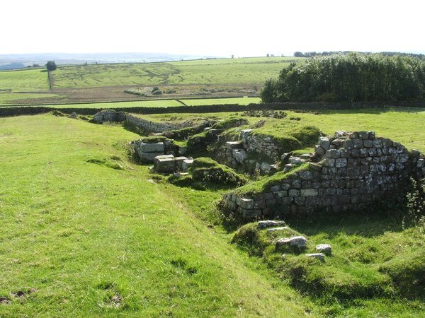
Four square towers stood against the inside of the fort’s corners. Four gates pierced the north, south, east, and west sides, probably with a square tower flanking each one. Each gate had two passages divided by a central support, and double wooden doors could close the entrances. Guard rooms occupied the flanking towers, and a ditch encircled the fort. The north and west wall foundations survive as earthworks and a slight rise; the north wall also forms a low mound. A remnant of a corner tower survives, and aerial photographs reveal the fort’s outline.
Internal buildings
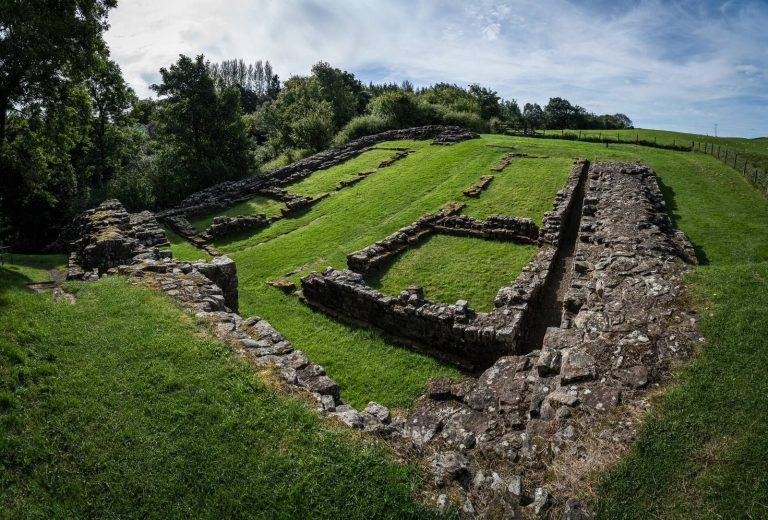
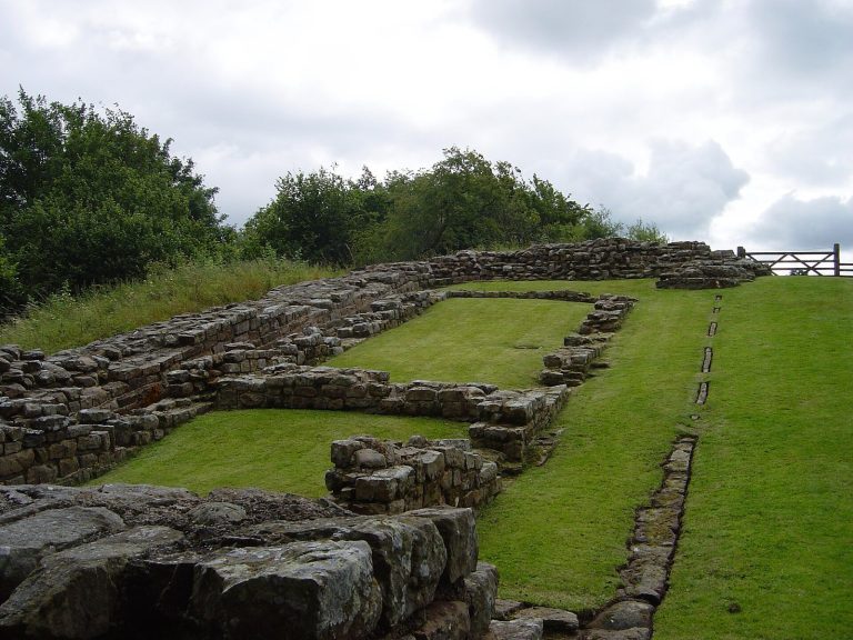
A bathhouse with plastered walls was excavated inside the southwest corner. Geophysical surveys indicate barrack blocks in the north, fields to the west, and stone houses beside the Stanegate. The fort probably also contained an administrative building, the commander’s residence, a granary, and further barracks.
Frontier, roads, and outposts
Hadrian’s Wall and the vallum
Hadrian’s Wall lies about 220 metres north of the fort, and the vallum, a ditch and associated earthwork south of the Wall, lies about 160 metres away. The fort’s defenses did not physically connect with the Wall. In this area, the Wall appears as a low rise about two metres wide. The vallum is about three metres deep and ten metres wide, and curves northward around the fort. The Wall also crossed the Tipalt Burn at Holmhead.
Roads and nearby military posts
The Stanegate ran east to west between Corbridge and Carlisle. The Maiden Way crossed it about 300 metres south of the fort, running north to south toward Bewcastle and Kirkby Thore. The site lay near a crossing of the northern English watershed. Milecastle 46 stood northwest of the fort, below the crest of a slope running west above the Tipalt Burn valley. A masonry fragment about 0.3 metres high survives west of the milecastle. From the fort, the Gillalees signal station was in view and could communicate with the outpost at Bewcastle.
Civilian settlement and cemetery
Settlement
A civilian settlement spread south and west of the fort and extended along at least three of its sides. Its main area developed beside the Stanegate. Near the east gate, two substantial buildings included one with an internal courtyard. Houses in the settlement probably served as workshops, storehouses, and homes.
Cemetery
A cemetery lay east of the fort around the Stanegate, and aerial photographs show possible Roman burial mounds to the northeast. Finds include a stone vessel containing organic remains and two gold rings. A cremation burial and several gravestones were found in 1856; a relief bearing the inscription DUVIANUS was found in 1964. Gravestones record dedications by Lucius Senofilus to his niece Lifana and by Aurelia Pusinna to her sister Aurelia. Other inscriptions commemorate Aurelia Faia, wife of the centurion Aurelius Marcus and a woman from Salonae, and Mammea, daughter of Victoria and wife of Baibus Duianus.
Inscriptions and finds
Altars and inscriptions
Sixty-nine Roman inscriptions are known from Carvoran: 34 altars or dedications, 18 building inscriptions, including stones recording work by army centuries, nine gravestones, and eight texts of unspecified content. Four inscriptions have precise dates, all between AD 117 and 166. Thirteen dedications concern Veterus, a war god identified at Carvoran with Hercules, and three are dedicated to Mars-Belatucader. Other inscriptions name Jupiter Optimus Maximus, Fortuna, Mercury alongside the Numen Augusti, meaning the emperor’s divine power, a Syrian goddess or Ceres, Regina Caelestis, Epona, Hammia, nymphs, Silvanus, the mother goddesses known as the Matres, and the Genius of Weapons. Epona was associated with horses, and Silvanus with woods and uncultivated land. One dedication to Regina Caelestis is now held at the Museum of Antiquities in Newcastle.
Milestones and grain measure
Two Roman milestones from the third and fourth centuries were recovered near the fort. One, dedicated to Aurelian, dates to AD 273 to 275. It was found in 1932 in a pit beside the Newcastle to Carlisle road, west of Fell End Farm and east of Carvoran, and may originally have stood beside the Stanegate. A second milestone, dedicated to Constantine, dates to AD 306 to 307. Found around 1716, it may have stood beside the Stanegate, the military road, or the Maiden Way.
A bronze grain measure shaped like a truncated cone was found just outside the fort’s northeast corner in 1915 and is now in the Chesters Museum collection. Its inscription gives its capacity and weight and names the reigning emperor; the letters of Domitian’s name were later hammered smooth. Dating to the end of Domitian’s reign, it weighed about 12 kilograms. Its capacity was first read as 17.5 sextarii, a smaller Roman measure of capacity, or about 9.5 litres; later measurement gave 11.3 litres. Three spokes at the top may have held a rod for turning the vessel and levelling grain at the rim, while rivet holes suggest that part of it may be missing. The extra capacity may have allowed officials to overcharge farmers paying the annual grain levy, although Roman measuring vessels were usually made accurately.
Weapons and other finds
Finds from the fort include a Roman short sword, deer antlers, and a two-barbed iron spearhead about 61 centimetres long. The spearhead came from a well about 11 metres deep; a spearhead and worked antlers are also associated with a water source inside the fort. Two-barbed weapons of this kind were often used by Germanic peoples in late antiquity. In spring 2025, a soldier’s shoe sole measuring 32 centimetres was found in an outer defensive ditch, a length corresponding approximately to European shoe size 50.
In February 2026, an approximately third-century terracotta head measuring 78 by 67 millimetres was found in the fill of a defensive ditch. It depicts a female figure with centrally parted, braided hair. Its uneven features and rough workmanship may point to a locally made practice piece; its subject could be a goddess or a member of the imperial family, but the identification remains uncertain.
The Roman Army Museum
The Roman Army Museum occupies the fort site. Its displays include Roman weapons and tools, life-size reconstructions, a full-height reconstruction of a fort wall, and a three-dimensional presentation of Hadrian’s Wall. Objects from Vindolanda are also exhibited, including a Roman helmet crest described as the only example of its kind yet found.