Arslantepe: A Settlement Mound and Regional Center in Türkiye
Site at a Glance
- Popularity
- High
- Country
- Turkey
- Primary era
- Bronze Age
- Eras represented
- Stone Age, Bronze Age, Iron Age, Classical, Medieval
- Civilizations
- Assyrian, Hittite, Roman
- Site type
- City
On this page28 sections
History
Arslantepe is a settlement mound near Malatya in Türkiye, occupied by successive communities from at least the sixth millennium BCE. A tell is a mound formed as settlements are rebuilt over earlier ones; at Arslantepe, this long sequence includes periods of growth, disruption, and renewed occupation. The site developed from a community connected to northern Mesopotamia and Syria into a major center of the Malatya Plain. During the third millennium BCE, its connections increasingly turned toward eastern Anatolia and the Transcaucasus, the region south of the Caucasus Mountains.
Early settlement and the palace center
Pottery indicates activity at Arslantepe as early as the sixth millennium BCE, while the earliest securely dated architectural phase, Level VIII, belongs to about 4300–3800 BCE. In Level VII, about 3800–3350 BCE, the settlement spread across much of the mound, and buildings became more clearly organized by function. Monumental construction points to the emergence of an elite, although the identification of one large building as an elite residence remains probable rather than certain.
During Level VI A, about 3350–3000 BCE, political and economic authority became concentrated at Arslantepe. A palace complex brought religious, administrative, storage, and collection activities together. Its clay sealings show that goods and transactions were tracked without written records. The evidence also points to a growing separation between distributing provisions and conducting religious ceremonies.
A fire around 3000 BCE destroyed the palace and brought the preceding centralized system to an end. In the Early Bronze Age that followed, mobile pastoralists first used the site, before new forms of settlement and political organization developed. The Royal Tomb, dated to about 3000–2900 BCE, and the construction of a fortified summit point to a shift in authority toward leaders with military and political roles.
Early Bronze Age and Middle Bronze Age
Another destructive fire and a period of partial abandonment preceded the occupation of the mound by pastoral groups around 2750–2500 BCE. Arslantepe’s earlier regional prominence and close links with Syria and Mesopotamia diminished as its orientation shifted eastward. Between about 2500 and 2000 BCE, the settlement expanded again and became the largest and most important on the Malatya Plain. The evidence does not make clear whether authority was centralized, while smaller autonomous centers also grew in the surrounding area.
In the second millennium BCE, Arslantepe entered the sphere of the Hittites, a major Anatolian power. During the Late Bronze Age it served as a regional administrative center in Isuwa, a kingdom in eastern Anatolia near the boundary between Hittite and Mitanni power. Around 1350 BCE, the Hittite king Suppiluliuma I conquered the city during his war against Tushratta, king of Mitanni, and used it as a base for a campaign against Washukanni, Mitanni’s capital.
Iron Age kingdoms and Assyrian conquest
From around 1100 BCE, Arslantepe flourished as the capital of Kammanu, a Luwian-speaking kingdom also known as Melid. Kammanu belonged to the group of successor states often called Neo-Hittite, which arose after the Hittite Empire collapsed. Assyrian pressure included an attack around 845 BCE and the imposition of tribute under Tiglath-Pileser I. In the eighth century BCE, Urartian campaigns and alliances influenced the kingdom’s fortunes. Melid’s king allied with Sarduri II of Urartu against Assyria, but the alliance was defeated in 743 BCE.
In 712 BCE, forces of the Neo-Assyrian king Sargon II destroyed Melid. The city may have continued to be inhabited for a time under Assyrian rule, but the conquest ended its principal period as a major center. Whether Sargon II’s successors retained control or organized Melid as an Assyrian province remains uncertain.
Later occupation and archaeological work
Small groups lived at Arslantepe during the Late Roman period, and part of the site was used as a cemetery in Byzantine or medieval times. Archaeological finds became known in the late nineteenth century. Louis Delaporte led the first major excavations in the 1930s, concentrating on the northeastern mound and uncovering the Lion Gate and its relief sculpture. Work stopped during the Second World War. Claude Schaeffer excavated briefly from 1949 to 1951 and exposed an earlier gate beneath the Lion Gate.
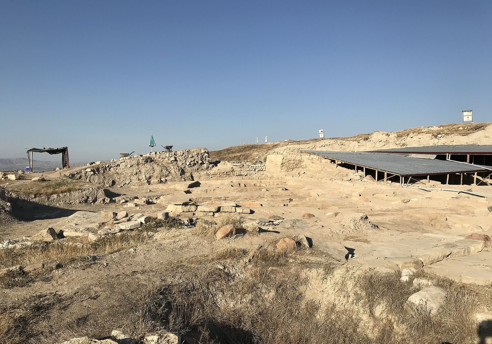
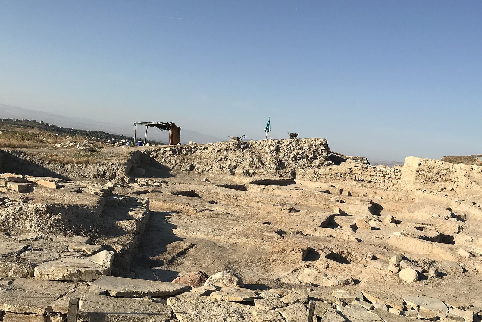
In 1961, an Italian team from the University of Rome La Sapienza resumed excavations. Work began in the northeast before shifting to the western and southern parts of the mound, where excavations revealed prehistoric and early historic buildings, including the fourth-millennium palace complex. Investigations in the northeast resumed in the mid-to-late 2000s to examine the Hittite and Neo-Hittite phases. Finds went to the Museum of Anatolian Civilizations in Ankara until the 1970s and were later transferred to the Malatya Archaeological Museum. Arslantepe was added to the UNESCO World Heritage List in 2021.
Remains
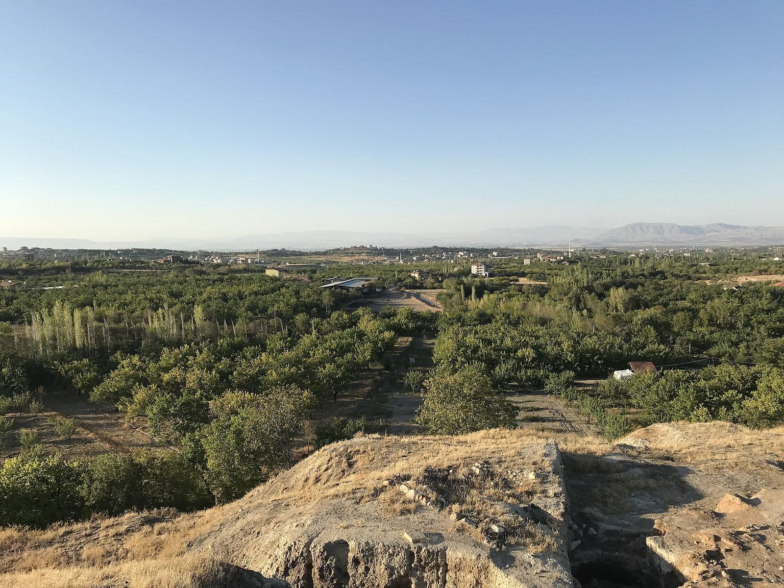
The oval mound lies on the Malatya Plain near Malatya and the Tohma River, a tributary of the upper Euphrates. It extends southwest to northeast, covers about 4.5 hectares, and rises roughly 30 metres above the plain. Its successive settlement layers preserve buildings and other remains from widely separated periods.
Early settlement and Level VII
Level VIII houses
The earliest documented buildings are three superimposed layers of Level VIII houses, dated to about 4300–3800 BCE. They had hearths and facilities for preparing food, including large ovens placed either inside or outside dwellings. Pottery made at the settlement has parallels in southeastern Anatolia and the upper Mesopotamian region. Sherds from Ubaid and Halaf pottery traditions indicate earlier activity, although they are not tied to a particular architectural layer.
Level VII houses and burials
Small mudbrick houses, usually with one to three rooms, have been excavated in the northeastern part of the mound. Hearths were often placed outside. One house had a wall painted with alternating black and white triangles. Some adults were buried in flexed positions near or beneath houses, sometimes with shell ornaments. A stone seal accompanied one burial; another person was placed on two large cooking vessels, with bowls and a cup nearby. Children and infants were sometimes buried in pots below house floors.
Monumental building
A large building stood on the higher western part of the mound, near the settlement center. Its mudbrick walls were about 1–1.2 metres thick and covered with successive layers of white plaster, often painted. A large hall had wall paintings and four mudbrick columns coated in white plaster. The hall was later divided into four spaces and put to different use. Its size, position, plan, and materials suggest that it may have been an elite residence.
Temple C and adjoining rooms
Temple C stood near the western end of the mound, southeast of the monumental building. Built at the end of Level VII, it rested on a low platform of mudbrick and stone slabs. It is the only known three-part building at the site. Its plan and the recessed niches in the short walls of its central room have parallels in Mesopotamia, while painted niches to the north and horizontal wooden beams beneath the floor reflect local Anatolian building methods. Rows of thick-walled rooms adjoined the rear of the temple and may have been used for storage or craft production.
The central room measured about 18 by 7 metres and contained a central platform that may have served for the ritual distribution of food. Large numbers of broken bowls lay on its floor. In the eastern rooms, mass-produced bowls were stacked or had fallen from shelves; the western rooms were largely destroyed. The southernmost room contained grouped clay sealings and vessels, suggesting that the temple area may also have been involved in distributing goods.
Level VII pottery
Many Level VII bowls were made from chaff-tempered clay and fired at relatively low temperatures. Most were formed on a slow wheel and are similar enough to suggest production in a single workshop; some carry potters’ marks. Their plain surfaces and repeated forms distinguish them as a substantial group among the settlement’s pottery remains.
The Level VI A palace complex
Temples A and B
The palace complex occupied several terraces on the southwestern slope, south of Temple C. Its connected buildings were linked by courtyards and corridors. Temples A and B stood on higher terraces, each smaller than Temple C and consisting of two rooms. The principal room of each temple had a single entrance, apparently intended for temple personnel, and two windows that may have allowed communication with people outside.
Storerooms and vessels
One fully excavated palace storeroom had three spaces: a central passage between a larger northern room and a southern room. Large storage vessels occupied the northern room. The southern room held three large storage jars, two other large jars, cooking pots, hundreds of mass-produced bowls, and 130 clay sealings. Other palace storage areas contained large jars, bottles, and smaller vessels. The arrangement suggests that food kept in the northern room was issued to workers in the southern one.
Clay sealings and wall paintings
About 2,200 clay sealings bearing designs from more than 200 seals came from the palace. Many were grouped and set aside in different places; others lay beside storage vessels or in stacks and heaps. Palace wall paintings included figurative scenes beside doorways and along corridors. The best-preserved painting showed two stylized human figures beside symbols, one on either side of a doorway that was later blocked. The figures may represent a man and a woman, or possibly deities or shamans. Another painting showed a cart drawn by two oxen with a driver, apparently leaving the palace. These images may have conveyed political or ideological messages.
Pottery and metal weapons
Level VI A pottery included pale, well-fired vessels made on a wheel, combining strong influence from the Uruk period, a late fourth-millennium BCE culture associated with southern Mesopotamia, with local features. Conical bowls were made rapidly on a wheel in large quantities. Handmade red-and-black pottery, linked in form and technique to central Anatolian traditions, also increased and was distinct from handmade kitchenware.
A metalwork group from the palace area, described as a weapons hall, included nine short swords or long daggers and twelve spearheads made from copper containing arsenic. Some of the swords had silver inlay. The weapons, about 45–60 centimetres long, are among the earliest known examples of swords. Their construction and materials show the range of metalworking represented in the palace remains.
Early Bronze Age settlement
Summit fortification and houses
In the Early Bronze Age, a substantial fortification enclosed part of the summit and separated it from the rest of the settlement. Its mudbrick wall, about four metres thick, stood on a stone foundation and was reinforced by internal buttresses. Below it, slope-side houses built of mudbrick generally had one to three rooms. Burnt barley, wheat, and vegetables on house floors may have fallen from upper storage levels when fire destroyed the settlement. Courtyards and open spaces between houses were used for activities including animal slaughter and metalworking.
Royal Tomb
The Royal Tomb lay at the settlement edge, outside the fortification, in an irregular pit about five metres across. Its stone burial chamber, made from slabs, measured roughly two metres on each side. An adult was laid on the right side with the knees drawn up, accompanied by pottery, personal ornaments of carnelian, rock crystal, gold, and silver, and weapons, tools, and ornaments made from copper, silver, gold, and alloys. The metal weapons appear to have been usable. Four adolescent skeletons lay on or above the tomb cover. A girl and a presumed boy near the head end had copper pins, a diadem, and a hair ornament resembling objects associated with the principal burial; they may have been related to the deceased. Two girls at the foot end lacked comparable ornaments and may have been attendants. Their placement has been interpreted as evidence of human sacrifice.
Level VI C buildings
In Level VI C, scattered round huts had compacted-earth floors. Some partly subterranean houses had plastered surfaces, and small post-built structures may have supported awnings or roofs. A later terraced building on the upper mound contained rectangular rooms with mortars set into the floors, horseshoe-shaped hearths, and two-part ovens with separate ash chambers. Repairs point to continued use. The building may have served as a large family or clan residence as well as a place to store and process food. Handmade pottery included dark-fired wares related to earlier red-and-black pottery, but with new shapes and decoration, alongside light-colored vessels with red and brown geometric designs.
Level VI D settlement
During Level VI D, buildings spread across the slopes in a denser and more deliberately planned settlement. Roads, drains, courtyards, and workshops lay among the dwellings. A substantial defensive wall followed the mound’s edge and included a strong semicircular bastion. Handmade pottery included dark-fired and painted wares; the painted designs developed into a more unified style with parallels in Elazığ Province. Metalworking workshops and numerous casting molds point to specialized production.
Middle Bronze Age dwelling
Middle Bronze Age remains, mainly on the southwestern mound, were damaged by their position near the summit and by later terracing. One surviving dwelling had a single room and a horseshoe-shaped hearth. Loom weights in its northwest corner suggest that a loom may have stood there. Pottery continued earlier traditions, while new wheel-made vessels indicate renewed, though possibly intermittent, connections with Syrian and Mesopotamian cities.
Hittite and Iron Age defenses and buildings
Hittite gate and citadel
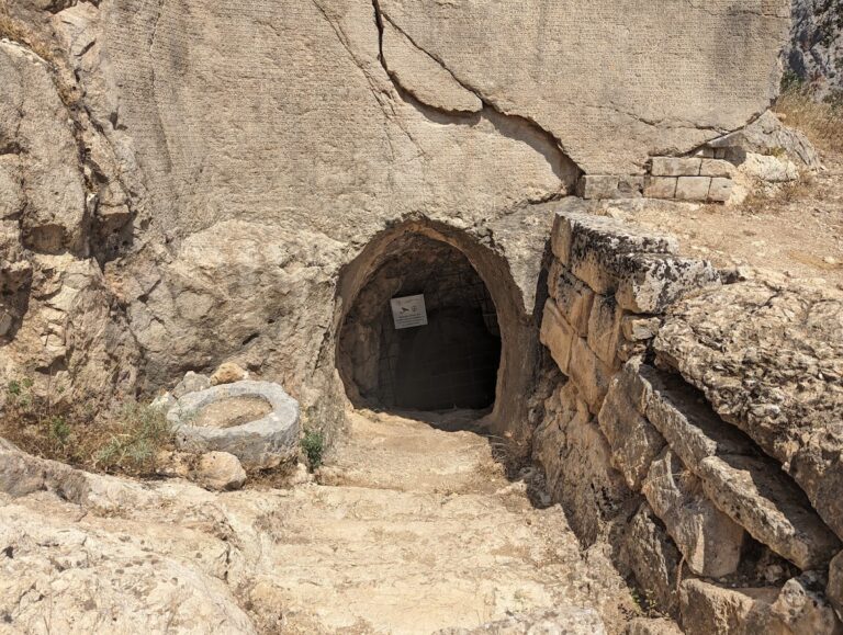
A fortified city gate with square towers was added to an existing wall during the period of Hittite influence. The entrance, formerly on the southern side, was redirected north-northeast toward the Euphrates. Later defenses remained broadly in the same area, though successive gates shifted somewhat westward. The Late Bronze Age gate was a monumental structure with a rectangular chamber and two opposing entrances on its long sides. It joined a mudbrick wall built on a solid stone base and has parallels in central Anatolia. A tunnel with a ceiling made from courses of stone projecting inward, probably leading toward a spring, was also excavated; comparable structures are known at Alişar and Alaca Höyük. A palace complex occupied the northeastern citadel during the Hittite period.
Lion Gate and carved stones
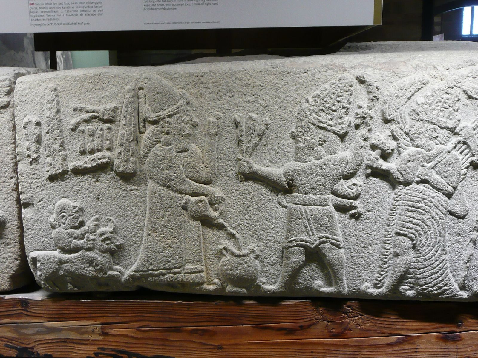
Several monumental gates were built one after another in the northern part of the mound, near the earlier Hittite entrance. The latest included the Lion Gate, flanked by stone lions whose bodies were carved in relief and whose heads were rounded. Upright stone slabs faced the sides of the entrance; they carried carved reliefs and inscriptions, and some had been reused from earlier gates. A ruler’s statue found in the gate area had fallen and was probably deliberately concealed. It may represent Mutallu of Kummuh, a neighboring kingdom.
Assyrian palaces
Three Assyrian palaces, built one above another, date from around 708 BCE. A separate large building beside the west side of the Lion Gate overlapped Neo-Hittite structures and may represent a brief phase of occupation after the Assyrian conquest.
Roman and later remains
Late Roman remains include a residential quarter in the northeast and heavily disturbed terrace structures in the southwest. A cemetery in the southwestern area may date to the medieval period. A mudbrick platform above the Assyrian palaces may have formed the base of a Turkish building of the ninth or tenth century.