Pachacámac: An Andean Sanctuary and Oracle in Peru
Site at a Glance
- Popularity
- High
- Country
- Peru
- Primary era
- Medieval
- Eras represented
- Classical, Medieval
- Civilizations
- Inca
- Site type
- Religious
- Remains
- Sanctuary
On this page26 sections
History
Pachacámac is an archaeological sanctuary near the mouth of the Lurín River on Peru’s central coast. Developed first as a local religious center by the Lima culture from about AD 200, it became a major Andean sanctuary and oracle active for more than 1,500 years. The site was associated with Pachacámac, a creator deity whose name means Earth-Maker.
Early sanctuary and regional center
Occupation began earlier, during the Formative period, an early phase of Andean prehistory. The El Panel cemetery, used from about 200 BC to AD 200, belongs to this early activity. The Lima culture, one of the successive societies of the central Andes, established the first major occupation between about AD 200 and 600 and developed the sanctuary as a local religious center.
During the Wari period, from about AD 600 to 1100, Pachacámac grew into a religious and administrative center that drew visitors from coastal, highland, and forest regions. Its influence extended along much of the Peruvian coast and into the highlands. Its standing as an established oracle contributed to its wider influence.
Ichma and Inca rule
After Wari power declined, the Ichma established a political center at Pachacámac. From roughly 1100 to 1470, they governed the central coastal valleys of the Lurín and Rímac rivers. The sanctuary served administrative, political, and ceremonial purposes. Its religious authority helped bring Ichma communities together, although their political integration remained limited. The purpose of the ramped pyramids built in this period is debated; proposed functions include elite residences, temples, administrative buildings, or combinations of these uses.
Around 1470, the Inca ruler Túpac Yupanqui brought the region into the Inca Empire. The Incas reorganized Pachacámac and its urban plan, developing it as an imperial oracle and major administrative center that attracted pilgrims from distant regions. Local priests continued their religious practices, while the sanctuary was adapted to Inca political and religious purposes.
Spanish conquest and colonial abandonment
An earthquake in 1512 and unusually heavy rainfall damaged the sanctuary before the Spanish conquest. Spanish forces sacked Pachacámac in 1532. The following year, Hernando Pizarro led an expedition there, and the destruction of the sanctuary’s principal wooden idol became part of the Spanish campaign against Indigenous worship. The precise building associated with the idol’s destruction is uncertain.
Occupation continued until 1572, even as the sanctuary was adapted for colonial uses, including as a way station, and efforts were made to suppress its earlier religious practices. Under the viceroyalty of Francisco de Toledo, Indigenous people were resettled away from their places of worship. The town of San Salvador de Pachacámac was founded in 1572, and the sanctuary lost its active religious role before being abandoned during the colonial period. Severe earthquakes later struck the area in 1687 and 1746.
Archaeology and conservation
Max Uhle began systematic investigations in 1896 and excavated at Pachacámac in 1896–97. He mapped the sanctuary and worked at the Temple of the Sun, the Painted Temple area, and the Uhle Cemetery. His 1903 monograph helped establish a chronological framework for South American archaeology by distinguishing pre-Wari, Wari, post-Wari, and Inca phases.
In 1938, work directed by Albert Giesecke exposed parts of the Painted Temple, the wooden Pachacámac idol, and remains of a doorway decorated with marine shells. Julio C. Tello continued investigations from 1939, studying the Temple of the Sun and uncovering the Pilgrims’ Plaza and water-management features. Restoration at the Acllahuasi took place in 1938 and 1940, but the building was damaged by the 1940 earthquake and later tremors. Inadequate conservation after the Painted Temple was exposed contributed to deterioration of its murals and structure.
Excavation continued under the Institute of Andean Research from 1941. From 1962, Arturo Jiménez Borja directed work that uncovered a zigzag route to the Temple of the Sun and investigated the Palace of Taurichumpi and other Inca-period residential remains. The Ichma Project, begun in 1999 under Peter Eeckhout, examined the ramped pyramids. Excavations in the Pilgrims’ Plaza from 2003 confirmed its ceremonial use through finds including idols, textiles, and ceramics. Research into the ancient water system using geophysical and satellite methods began in 2012.
An earthquake in 2007 damaged the Temple of the Sun, Ramp Pyramid 1, and the Acllahuasi, prompting emergency work and longer-term conservation, cleaning, and maintenance. Pachacámac joined the Qhapaq Ñan program in 2008 and, in 2014, was included on the UNESCO World Heritage List as part of the Qhapaq Ñan, the Inca road network. The site museum, founded by Jiménez Borja in 1965, safeguards, researches, and exhibits archaeological material from the sanctuary. A new museum building was constructed in 2015 and opened in 2016.
Remains
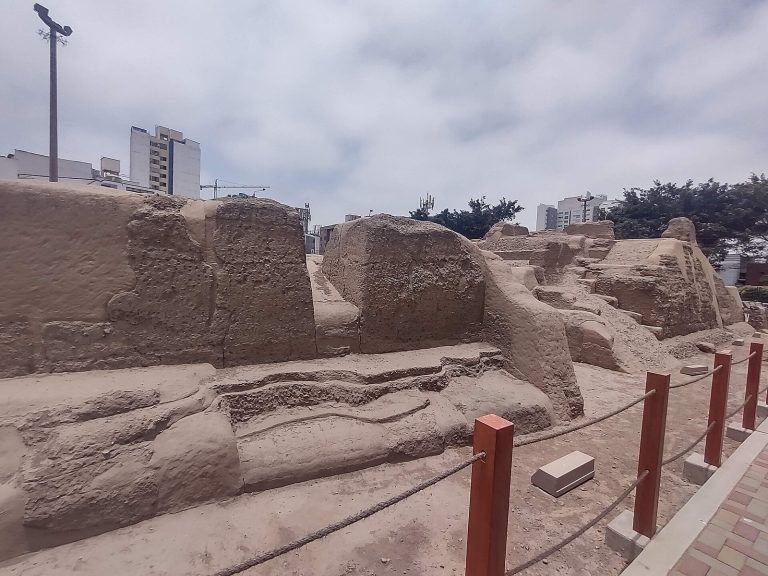
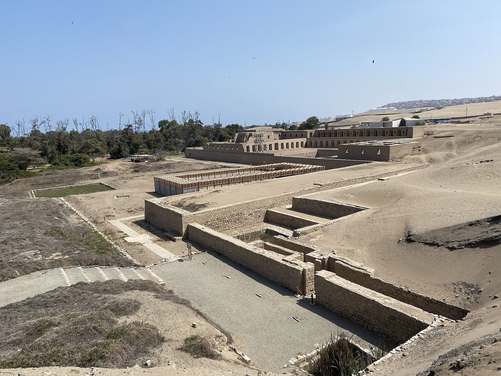
Pachacámac occupies an esplanade shaped by four rocky promontories, near the Pacific coast and opposite a group of islands with the same name. A buried marine plain underlies part of the complex. The protected sanctuary covers about 465 hectares, while the broader archaeological site covers about 500 hectares; its inner core is roughly 128 hectares. More than 50 structures include four temples, plazas, and 17 ramped pyramids. Walls, streets, and buildings preserve successive phases of construction. Windblown sand covers much of the area, while coastal conditions, erosion, earthquakes, and El Niño, a climate pattern that can bring unusually heavy rain to Peru’s coast, have affected earthen and stone structures, murals, and foundations.
Urban plan and circulation
Walls and sectors
Walls divide the site into four broadly concentric sectors. Sector I, about 18.8 hectares, contains the Temple of the Sun, the Painted Temple, and the Old Temple. Sector II includes the Acllahuasi, ramped pyramids, and Palace of Taurichumpi; together, sectors I and II form the inner core. Sector III, about 93 hectares, extends to the outer city wall and includes residential areas and a cemetery. Sector IV runs from the outer wall toward the Lurín River and was largely agricultural land, now covered by sand.
The first wall enclosed a religious area containing the Old Temple, the Painted Temple, and the Uhle Cemetery. A second wall enclosed ceremonial and palatial spaces along with administrative and economic facilities, including routes, cemeteries, plazas, and ramped pyramids. The third wall is an adobe structure, built on a stone base, about six metres wide and four metres high; an exposed stretch is about 250 metres long. It meets the north–south street at the Coastal Gateway, a 4.6-metre-wide principal northern entrance linked to a coastal route. A fourth wall lies about a kilometre north of the third.
Streets and access
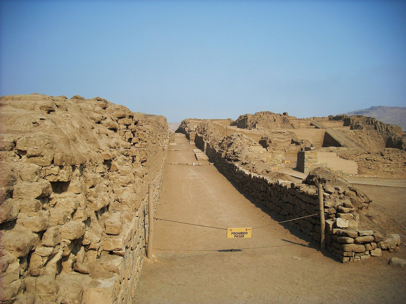
Two main streets cross at nearly right angles, dividing the city into four sectors. The north–south street, an important access route, is about 431 metres long and four to six metres wide. Stone and adobe walls along it stand about three to seven metres high. The route predates Inca rule and was modified during that period, including work to widen access to Ramp Pyramid 7. A water channel runs along part of the street, apparently toward the Acllahuasi. The east–west street is about 250 metres long and is bounded by the buildings beside it.
Water and regional routes
A network of channels, water-storage tanks, and aqueducts gathered water from underground sources. South of the Acllahuasi, a channel-and-tank system supplied the area; another channel led toward the building. Surplus water from the Acllahuasi flowed toward Urpiwachac Lagoon, and an underground water tunnel has also been described.
Pachacámac stood at the coastal end of the Inca route connecting it with Xauxa, a highland administrative and religious center. This route formed part of the empire’s northwestern road system and connected at Xauxa with the principal highland road toward Cusco. Roadside stations supplied lodging and provisions for officials and troops.
Early ceremonial buildings
Old Temple
The Old Temple, a Lima-culture complex on a rocky point, has a trapezoid-shaped plan and stepped platforms. A stone-and-mud base supports an adobe mound with several access points and platforms. Builders set handmade bricks of sun-dried mud vertically in regular sections and joined them with mud; some bricks were angled slightly for stability. Differences in wall colour distinguish three building phases: yellow, white, and polychrome. The temple is heavily ruined, with retaining walls and an eastern ramp among its surviving features.
Lima platforms and rooms
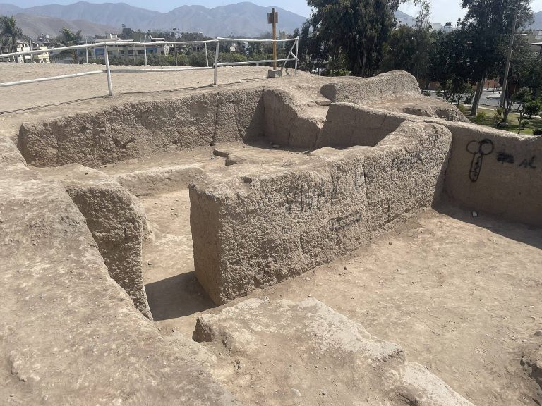
A Lima adobe complex in front of the site museum consists of superimposed platforms and five four-sided rooms arranged around T-shaped courts. Small adobe bricks were set vertically in rows using a distinctive bond. The complex has been interpreted as administrative, while later uses may have included temporary encampment, secondary burial, or refuse disposal.
A smaller adobe mound lies beneath the Temple of the Sun. Max Uhle described it in 1896, and its main structure is attributed to the Middle Lima period. Rather than forming one large adobe pyramid, it consists of stepped terraces supported by substantial retaining walls. Medium-sized adobe walls have partly dressed stone facing. The mound forms part of the sanctuary’s ceremonial core with the Old Temple.
Temple of Urpiwachac
The Lima-culture Temple of Urpiwachac, probably built around AD 500–600, lies northwest of the Temple of the Sun and faces the former Urpiwachac, or Duck, Lagoon. Its plan appears circular. A stone wall at the level of the agricultural ground forms the identified northern outer base, while some adobe remains have fallen. Three platforms may have stood on its eastern side.
Painted Temple and wooden idol
The Painted Temple is a rectangular, stepped structure attributed to the Wari period. It measures about 100 metres by 50 metres, with a stone base, upper walls of small adobe bricks, and mud plaster. A zigzag route of long ramps leads to the summit, where two large courtyards stand. On three sides, nine or more slightly curved terraces or steps rise above one another.
Murals depicted human figures, fish, birds, other marine animals, and plants in red, yellow, pink, and blue-green, sometimes outlining figures in black. Faded traces of the colours remain. The summit included a platform and a chamber for Pachacámac’s wooden idol. Found in 1938, the double-faced figure is about 2.34 metres high and 13 centimetres in diameter. Carbon analysis places its carving around AD 760–876, while its style has also been assigned to the 10th–11th centuries. Its upper section shows a two-faced human-like figure, with one face associated with maize and the other with marine animals and serpent heads. The faces may represent a man and a woman; sacred scenes below them refer to the world and cosmic elements. The figure is now an emblematic object in the site museum. Work in 1938 also revealed remains of a doorway decorated with Spondylus, a marine shell used in ancient Andean ornament and ritual.
Burial grounds and finds
Uhle Cemetery
The Uhle Cemetery lies beside and below the Painted Temple and was one of the sanctuary’s largest burial grounds. Uhle estimated that it contained about 80,000 burials. Excavations recovered wrapped burial bundles, mummies, textiles, ropes, slings, ceramics, and other grave goods. Finds include Wari- and Lambayeque-style textiles and ceramics, local pottery, late Chimú bottles, and Inca burials in the cemetery’s upper part. The Ichma also used it as their principal cemetery, and its use ended during the colonial period. About 9,000 textiles held by the Ethnological Museum of Berlin are believed to have come from this cemetery.
Other burial areas
An elite tomb excavated in the Uhle Cemetery in 2005 contained burial bundles and figures adorned with false heads and ornaments made from Amazonian parrot feathers. A tomb found in front of the sanctuary in 2012 held more than 80 skeletons and mummies, many of them infants, alongside ceramics, copper-gold alloy objects, wooden masks, dogs, and guinea pigs. A cemetery with human remains and ceramics was found in 2019 and dates to about a thousand years ago.
Near the Temple of the Sun, excavations uncovered burials of women and children associated with sacrifice. Their offerings included Inca-style jars, plates, and pedestal-based cups. A separate burial area in the southeast contains women associated with service to the Sun cult, with fine cloth and highland offerings among the grave goods.
Ichma pyramids and Inca buildings
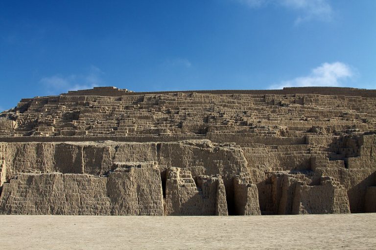
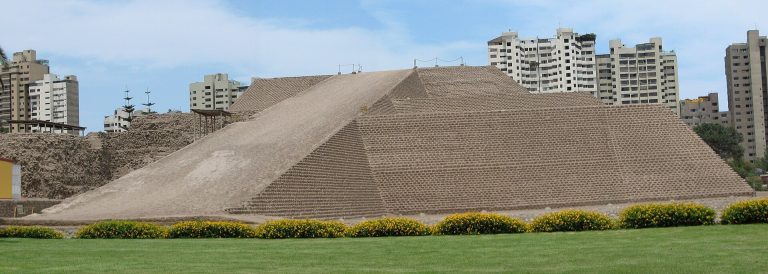
The ramped pyramids are generally adobe buildings with stone bases and plastered walls. One interpretation holds that the group was built dynastically, with a new pyramid constructed after the death of its previous occupant. A colonial-era interpretation also gave them a possible religious and diplomatic role. Their different plans and associated finds provide evidence of varied uses.
Ramp Pyramid 1
Ramp Pyramid 1, also called Building JB, has a large forecourt and a central pyramid approached by ramps. Small rooms at the top form a horseshoe-shaped arrangement, while large food-storage rooms lie behind the structure. The building was cleaned and consolidated in 1968–69.
Ramp Pyramid 2
Ramp Pyramid 2 is an elongated, four-sided complex about 210 metres long and 50 metres wide, with access on its western side. Three frontal buildings face a large enclosed courtyard. Its main entrance runs east to west, and the complex includes a ramp to a raised pyramid area, rooms, benches, storage spaces, terraces, and ritual and burial areas. A looted burial chamber was found in the southwest. Food remains and animal sculptures in the courtyard have been linked to rituals concerning water, farming, and marine food sources.
Ramp Pyramid 3
Ramp Pyramid 3, also known as the Monkey Temple, comprises three successive four-sided pyramids and two large enclosed courtyards. Pyramid B was occupied about 1400–1430/40, Pyramid A about 1435–1470, and Pyramid C has no established date. Finds include animal-sacrifice offerings, textiles, burials, molluscs, local Inca and Ichma ceramics, and pottery in late Ichma, Puerto Viejo, Chimú-Inca, and sculptural styles. A burial associated with the building’s foundation contained a child, an adult woman, and a monkey.
The structures probably served as elite residences and places to store agricultural surpluses rather than as permanent homes. They were abandoned before the Inca conquest and later reused for burials and refuse.
Temple of the Sun
The Temple of the Sun, also called Punchao Cancha, occupies a natural rocky point facing the sea and rises about 40 metres above the surrounding ground. This large, stepped, trapezoid-shaped pyramid covers about 30,000 square metres. Its stone foundations support large adobe walls bonded with mud mortar. Fine-earth plaster covered the walls, which were painted red; traces of the colour remain. Trapezoid-shaped recesses on the seaward front may have held offerings. The summit contains an open plaza surrounded by structures. Evidence from the temple includes human sacrifice and selected offerings in Inca imperial style.
Acllahuasi
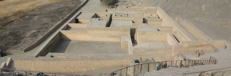
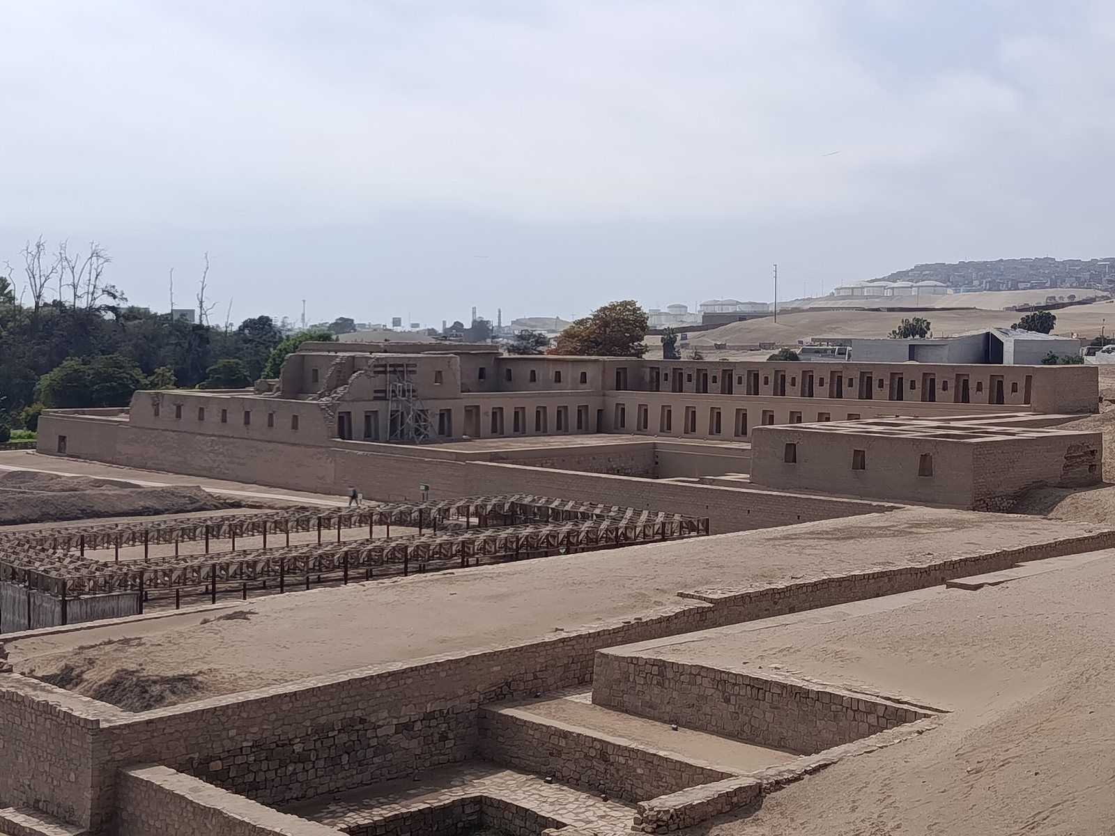
The Acllahuasi, meaning House of the Chosen Women, is an Inca building dating to the mid-15th century. An aclla was a woman selected for religious or state service. The complex has three sections with galleries, stairways, connected rooms, and large open courtyards. Trapezoid-shaped niches and windows, together with finely cut stonework, reflect its Inca construction. It stands in a wetland with springs. Water flowed through channels to internal pools, and surplus water continued toward Urpiwachac Lagoon. The building visible today is a 20th-century reconstruction.
Pilgrims’ Plaza
The Pilgrims’ Plaza is a large, level rectangular space below and west of the Temple of the Sun, near the Painted Temple. It was created during the Inca reorganization of the sacred landscape, which involved dismantling earlier structures. The plaza is several hundred metres long and about 65 metres wide. Rows of adobe columns may have supported light shade structures. On its southern side, a ceremonial platform with a central stair forms a prominent feature; rooms and an Inca masonry well stand to the north, alongside other column bases. Finds from excavations, including idols, textiles, and ceramics, fit the plaza’s ceremonial use.
Residential and administrative buildings
The Palace of Taurichumpi, named for the regional ruler at the time of the Spanish arrival, is an Inca-period residential complex of adobe and stone in the southern part of the city. It has two construction phases. The earlier plan included two adjoining courtyards to the north, surrounded by rooms, storage spaces, platforms, corridors, and ramps. In a later phase, larger spaces were divided into smaller rooms and passageways.
Building 47, also called the Solstitial Temple, stands on artificially levelled terraces in the sanctuary’s southeast sector. Large, parallel-sided adobe blocks, often resting on a cut-stone base, form two areas of connected rectangular rooms and open spaces. A double-framed entrance is a distinctive feature. Some wall alignments have been interpreted as marking the June and December solstices. Domestic pottery also points to food preparation, and the building was later used as a cattle pen.
The House of the Quipus, or Building B7, lies near the Palace of Taurichumpi and Building 47. A pit lined with adobe contained 32 Inca-style quipus, records made from knotted cords, bundled in deer hide and found in 1974. They may have tracked offerings made to the oracle. Recovered pottery includes a fine Inca-style jar and local Inca and Chimú-Inca wares.