Birdoswald Roman Fort (Banna): A Frontier Fort on Hadrian’s Wall
Site at a Glance
- Popularity
- High
- Country
- United Kingdom
- Primary era
- Classical
- Eras represented
- Classical, Medieval, Early Modern, Modern
- Civilizations
- British, English, Roman
- Site type
- Military
- Remains
- Fort
On this page19 sections
History
Birdoswald Roman Fort, generally identified with the Roman place-name Banna, stands on Hadrian’s Wall in northern England. Built in stone around AD 130, it was one of the Wall’s 16 forts and guarded the frontier’s western sector, including a crossing of the River Irthing.
Frontier construction and the fort’s Roman name
The name Banna is the leading identification for Birdoswald, but the ancient place-names in this area remain uncertain. The Ravenna Cosmography does not distinguish between Birdoswald and nearby Castlesteads, while the Notitia Dignitatum, a late Roman administrative list, refers to Amboglanna, an identification that has also been questioned. Inscribed drinking vessels found far from the forts, the Rudge Cup in Wiltshire and the Amiens patera in France, support identifying Birdoswald as Banna and Castlesteads as Camboglanna. An altar dedicated at Birdoswald to Silvanus by the group called the Venatores Bannienses, meaning hunters of Banna, adds evidence for the name.
A watch and signal tower occupied the fort’s plateau around AD 100, before the fort itself was built. Around AD 122, Emperor Hadrian ordered the construction of the frontier wall. The site was selected for a fort after the frontier moved north from the Stanegate, an earlier Roman frontier road. Preparing the ground required woodland clearance and drainage of marshland. A temporary fortified camp south of the future fort housed troops working on this section of the Wall.
The first fort, built in the early second century, used timber and earth. It appears to have been superseded before completion by a larger stone fort built around AD 130, during Hadrian’s reign. The initial fort’s date and dimensions are uncertain. The Roman frontier was intended to protect the British provinces from incursions from the north; at Banna, troops also guarded the Irthing crossing and the Maiden Way, a road linking the fort with Bewcastle to the north. Two towers along that road could relay signals between the forts.
The area belonged to Britannia Inferior in the late second century and Britannia Secunda from the fourth century. The fort was probably occupied by auxiliary cohorts, Roman army units recruited outside the citizen legions, from about AD 125 to around 400. Units associated with Banna include the First Cohort of Tungrians, nominally 1,000 soldiers, the First Cohort of Thracians and the First Aelian Cohort of Dacians. Some may have served there only temporarily. The Venatores Bannienses are also linked to the fort, though their exact military status is uncertain. Detachments from the Twentieth and Sixth Legions are associated with construction work, rather than necessarily with the regular garrison.
Changes to the frontier and late Roman occupation
When Hadrian’s successor Antoninus Pius moved the frontier north to the Antonine Wall, around AD 142 to 160, Banna’s status is unclear. It may have had a smaller garrison or been temporarily abandoned. Its position beside the Maiden Way and the Irthing crossing remained useful, and troops returned after Rome withdrew from the northern frontier, possibly including the Dacian cohort. In late Roman times, the Wall’s garrisons formed part of the limitanei, the troops assigned to frontier defence. The Dacian cohort may have remained at Banna into the early fifth century, although an ancient administrative list assigns it elsewhere.
Repairs and alterations took place at the fort between about 205 and 305, with no evidence of enemy destruction during that period. Under provincial governor Lucius Alfenus Senecio, the granaries underwent major restoration between 205 and 208. These works may have belonged to a wider programme begun under Emperor Septimius Severus. A larger road bridge across the Irthing, built in the early third century, strengthened the military supply route and made Banna an important staging point. The civilian settlement outside the fort also expanded during the century.
The fort appears to have declined during the third century. An inscription dated AD 297 to 305 says that the commander’s house had been buried and fallen into disrepair. Banna may have been abandoned late in that century and occupied again in the early fourth. Its bathhouse and workshops may belong to this later phase. Altars dedicated by the Dacian cohort suggest that troops experienced a period of relative calm, although that interpretation is uncertain. Regular military occupation continued at least into the late fourth century.
After Roman rule
As Roman administration and supply systems weakened in the early fifth century, people appear to have continued living at the fort. The community may have become a fortified settlement whose inhabitants maintained Roman traditions. Around AD 500, timber halls were constructed over the northern granary. The Romano-British population probably left around the transition to the sixth century. Archaeologist Tony Wilmott has suggested that the fort may then have been a local war leader’s residence, with authority linked to descent from a late Roman officer. The possibility that people supplied food in return for protection remains uncertain.
An eighth-century Anglo-Saxon hairpin indicates activity at the site in a later period, though it does not establish the nature or duration of any settlement. During the Middle Ages, the enclosure was used for livestock, and a settlement probably occupied its northwest corner. The west gate was altered repeatedly and appears to have remained an important entrance until the fourteenth century.
Border settlement and archaeological investigation
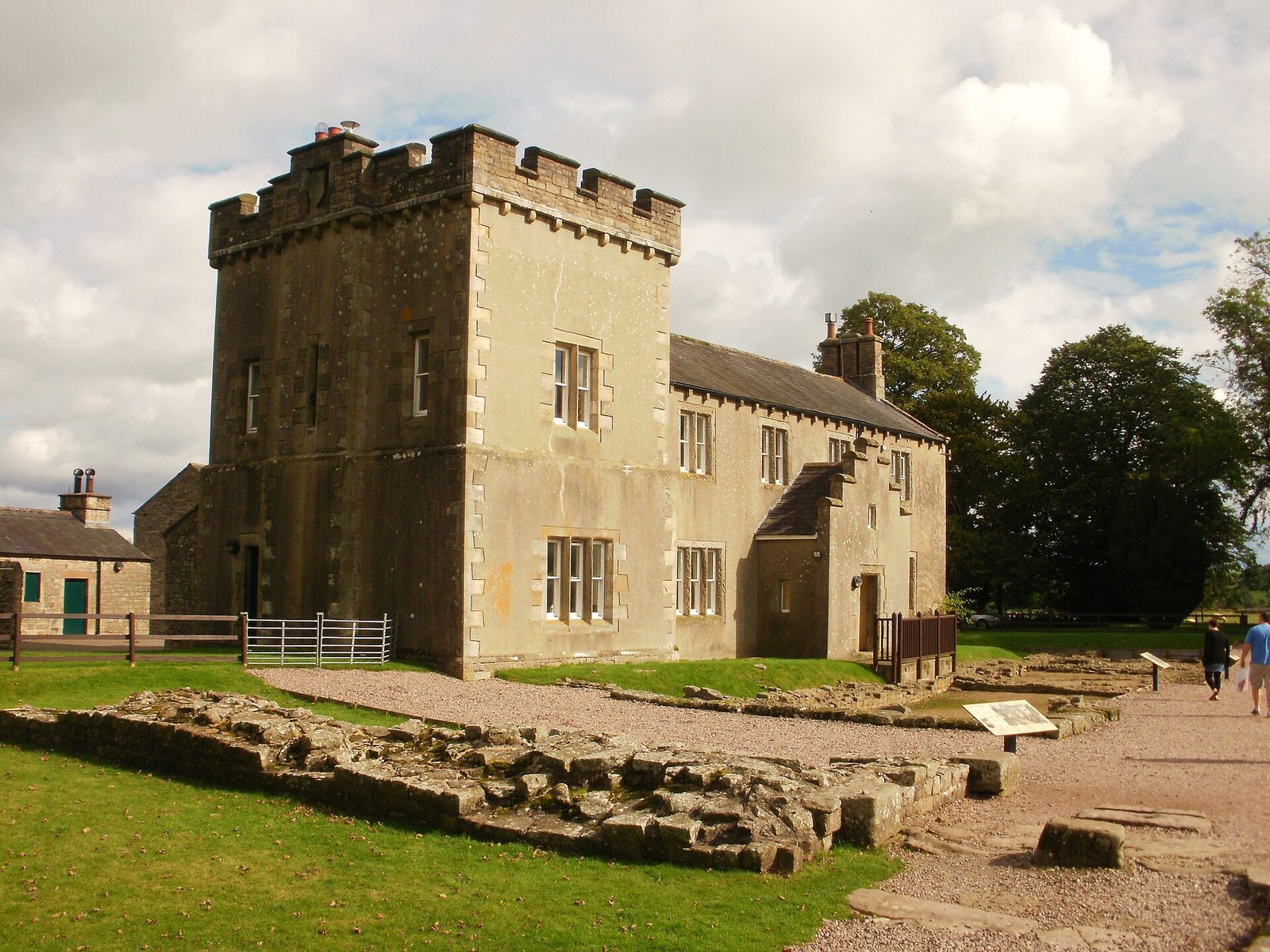
A small tower-like building was erected beside the west gate in the fifteenth century, when Border Reivers, raiders active along the Anglo-Scottish border, used the region. In the sixteenth century, the Tweddle clan largely dismantled the gate and built a fortified farmhouse, known as a bastle, in its place. James I ended the Reivers’ activities in 1603. Later, the site became a landscaped garden around a farmhouse built in 1745 and enlarged in 1858. It remained in farm use until 1984.
Reginald Bainbrigg described the ruins in 1599, and William Camden included his account in Britannia. After 1603, Lord William Howard gathered finds from Birdoswald at Naworth Castle. Antiquaries John Horsley and William Hutton visited in the eighteenth century and in 1802 respectively. Excavations began with a trial trench in 1831, which exposed the west gate. Work in 1850 revealed further walls and gates, followed by excavation at the commander’s house in 1852.
After the turf-and-earth section of Hadrian’s Wall was identified in 1895, Francis Haverfield investigated its relationship to the frontier in 1896 to 1898. He traced the Wall and the Vallum, an earthwork running south of it, towards the Irthing, and identified a Roman building over the filled Vallum. This was early evidence for a civilian settlement at Birdoswald. Investigations in 1927 to 1933 examined buildings in the fort’s eastern sector and the builders’ camp to the south. Exposed walls and gates were conserved in 1949 and 1950, and a cemetery west of the fort was discovered in 1959. Excavations in 1987 to 1992 examined the granaries, drill hall, west gate and an earth causeway over the southern ditch. Later geophysical surveys and excavations investigated the civilian settlement and cemetery, including work by Channel 4’s Time Team in 2000. A major archaeological excavation involving Newcastle University, Historic England and English Heritage began in 2021.
Remains
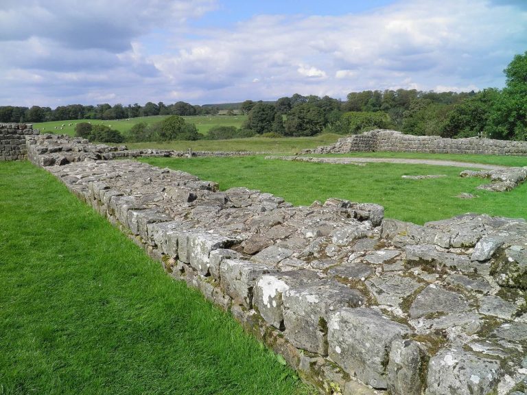
The fort occupies a triangular spur about 80 metres above the River Irthing. Cliffs and steep slopes bound the ground to the south and east, while the land rises in steps towards the northeast. Erosion has removed part of the southeastern slope, bringing the ruins to within about 50 metres of its edge. The stone fort covered about 2.1 hectares and measured roughly 177 by 122 metres, with a rectangular plan and rounded corners.
Fort perimeter and defences
Wall lines, towers and ditches
The first stretch of Hadrian’s Wall at Birdoswald was built of turf and earth, with stone turrets. Around AD 130, the Wall was rebuilt in stone on a line about 50 metres farther north, forming the north side of the stone fort. The reason for shifting the line is uncertain; improving visual or audible signals has been proposed. Birdoswald is the only known place where the two lines can be directly compared, and foundations of about two kilometres of the earlier Wall survive west of the fort. The southern Vallum was also moved south to make room for the larger fort; it was later filled or neglected and is no longer visible.
The fort’s outer wall was about 1.5 metres thick and probably stood 4.2 to 4.5 metres high. Its mortared rubble core was faced with dressed stone. An earth-and-clay ramp supported the defensive walkway, and stone thresholds indicate that the ramp’s base was about 4.8 metres wide. Battlements probably included gaps about 30 centimetres wide, examples of which were recovered at Birdoswald. A stone band on the outside helped shed rainwater. The eastern wall shows extensive repairs and was replaced in late antiquity by an earth-and-timber rampart. An excavated southeastern section showed a third-century rebuild about 3.6 metres high, without battlements or a walkway. Some large blocks may have been reused from the Willowford bridge.
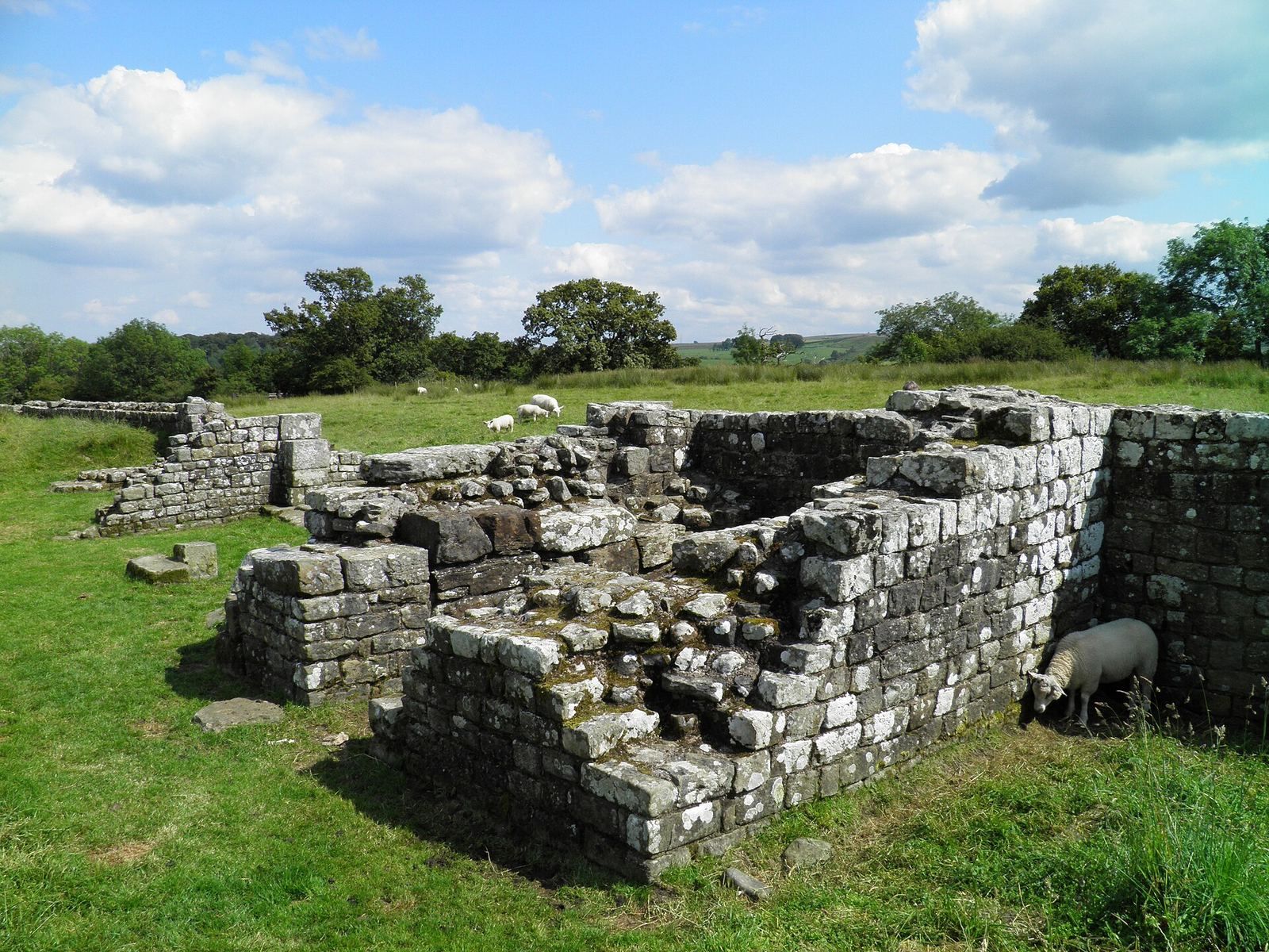
Two defensive ditches surrounded the fort. The wall and its foundations have been exposed around most of the perimeter. Remains include the south and east walls and gates, about half the west wall, and the northwest corner. The north wall lies largely beneath a modern road, while the farmhouse, gardens and outbuildings cover parts of the northern interior. Square towers strengthened the corners and wall. The elongated northwest corner tower survives near the site entrance, and remains of interval towers have been found beside the east and west gates and along the north wall. Further towers probably stood along the south wall. Some towers were later fitted with ovens; one between the northwest corner and north gate was partly demolished and converted to a bakehouse with three circular ovens. Shallow depressions mark parts of the outer ditches.
Gates
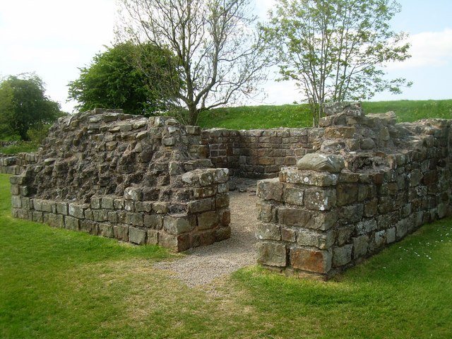
Six gates provided access to the fort: four principal gates, one on each side, and two smaller gates farther south on the east and west sides. The principal gates had paired passages divided by a central pier and flanked by square towers, probably about 12 metres high and three storeys tall. Their exact roof and battlement forms are uncertain. Wooden gate leaves turned on pivot stones set into thresholds or beside the central piers. The smaller gates had single passages built into towers and were blocked after the stone Wall was constructed.
The south gate, excavated in 1852, was similar in plan to the east gate but is less well preserved. Both its passages were blocked in the third century, and ovens were installed in the guard rooms. An inscription found during nineteenth-century work records repairs to the east gate in AD 219; its northern passage was later blocked. The west gate retains an outer pier with the springing of its arch. Excavation recovered wedge-shaped arch stones and fragments of the upper structure, including stone window arches. These remains later provided a model for the reconstructed west gate at Arbeia.
The west gate’s southern tower was substantially rebuilt in the third century using high-quality blocks probably reused from a monument or prominent building. Its southern passage was blocked around AD 230, after which parts of the towers were used for metalworking. The northern passage was blocked later and adapted as a workshop or storage area. A probable oven occupied the north flanking tower, and an iron-working area formed part of the gate complex. Medieval paving and pottery indicate continued use, consistent with the gate’s long-standing role as an entrance to the settlement.
Fort interior and services
Roads, water and drainage
Roads connected the gates and linked the fort to the surrounding landscape. The east-west road joined the main gates, while another connected the two smaller gates. The Maiden Way crossed the fort from north to south. These roads were built with large river cobbles, probably brought from the Irthing valley, topped with about 300 millimetres of gravel. A further road ran inside the perimeter beside the wall, providing access to the defensive walkway.
A stone-lined cistern discovered in the nineteenth century received water from a spring about 275 metres west of the fort. Its covered channel was still carrying water when found, and a charcoal filter was used to purify it. Stone-lined drains carried wastewater into the fort’s ditches.
Headquarters and commander’s house
The headquarters stood near the fort’s centre, above or close to the earlier watchtower site. Its excavated rear wall stood about 2.5 metres high. The building included a forecourt with a wooden-columned porch, a cross-hall, a shrine for unit standards, and offices. The hall had a central nave and two side aisles divided by arcades, with high windows for light. Carved stone screens probably separated the shrine from the hall; a possible fragment was later reused as a granary threshold. Geophysical evidence indicates a possible strongroom in the building’s southwest corner.
The commander’s house stood east of the headquarters, between it and the east gate. Geophysical surveys indicate a complex history of alterations. It included a bath suite. Beneath its floors, excavators found abandoned foundation trenches running north to south, with clay-and-river-cobble foundations and square external supports. These features suggest that storage buildings may initially have been planned there.
Granaries
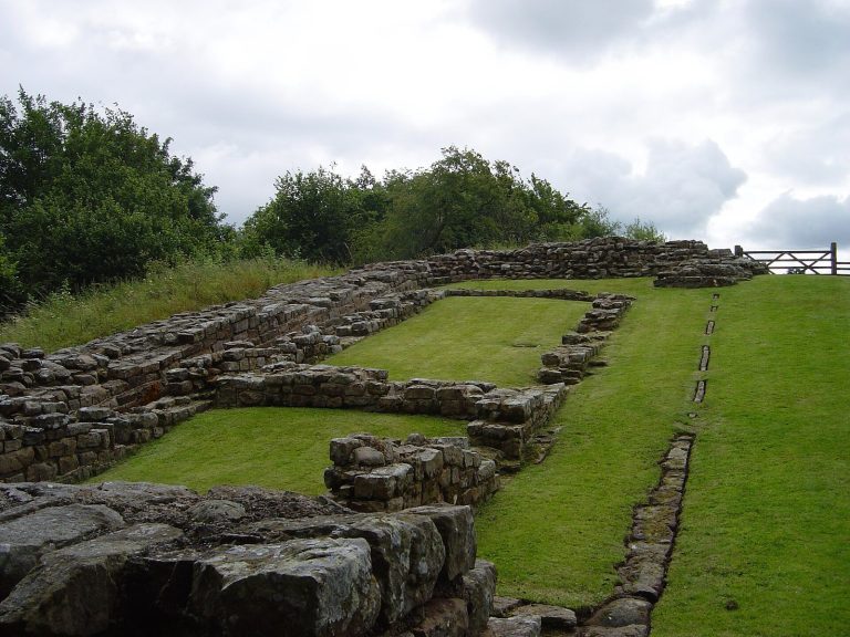
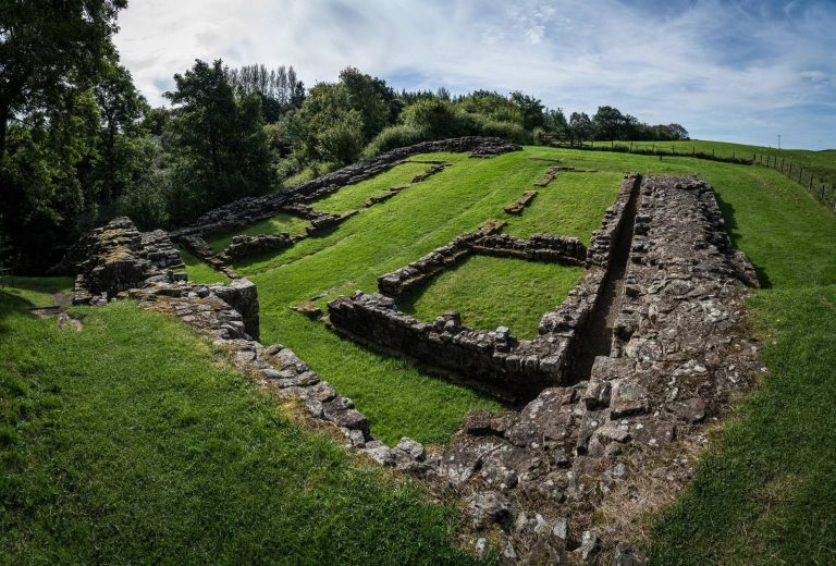
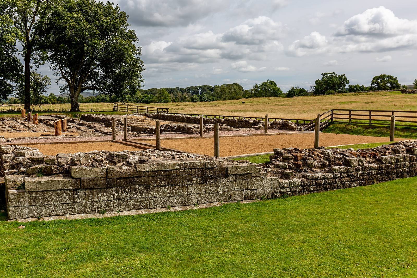
Two granaries stood near the west gate, each measuring about 28.38 by 8.26 metres. Their long axes ran east to west to fit the slope. Thick walls, substantial masonry and pilasters suggest two-storey buildings. Raised floors and ventilation openings helped keep grain dry and protect it from rodents. Wooden floor supports were later supplemented or replaced with stone supports, including continuous stone walls in the southern granary. Each building had nine large pilasters along its south exterior and further supports at its east and west ends. Their tiled roofs may each have required about 5,300 tiles.
The granaries stored wheat and barley, possibly with one building holding grain for bread and the other barley for horses. The southern granary retains a particularly well-preserved paved floor. A small opening in the northern building’s east wall may have let dogs reach rodents beneath its raised floor. The relationship between these buildings and later activity is also visible: timber halls were built over the northern granary, while the southern structure was repaired or adapted, possibly for residential use.
Drill hall and barracks
The unusual covered military drill hall measured about 43 by 16 metres. It had a central aisle about 7.5 metres wide and two side aisles about 2.5 metres wide. Two rows of arcades supported its roof, and high windows lit the central space. The hall had stone-and-gravel floors and small rooms at its western end. Its roof probably combined tiles over the central aisle with sloping roofs over the sides. The south-wall foundations are visible; the rest of the building lies beneath the visitor centre.
Two barrack blocks stood north of the drill hall, and geophysical evidence indicates further barracks in the eastern part of the fort. The western blocks may each have held ten units of eight soldiers, with separate sleeping and equipment rooms. One had an entrance porch and an officer’s suite projecting from its western end; some rooms in the suite had underfloor heating. An eastern barrack beside the east gate and main road was later fitted with underfloor heating and may also have served as an officer’s quarters. A long, narrow building beside the drill hall’s south wall had a stone floor and no identified internal divisions. It may have been a shop or workshop. A later medieval tower house and the fortified farmhouse were built over its foundations.
Structures beyond the fort
Builders’ camp and civilian settlement
A builders’ camp lay south of the fort. It had a semicircular earth rampart, a timber palisade and three outer ditches that secured the southern tip of the spur. Leather tent remains preserved in wet ditch soil show that construction troops used the camp.
The civilian settlement associated with the fort extended to its east, west and south, and probably also north of the Wall. Surveys revealed buildings, hearths, pits and ditches belonging to at least three phases. The western area appears to have had a more regular plan, a paved main street, stone buildings and possibly a marketplace. Remains to the south include mainly timber buildings and evidence for a bathhouse. Much of the southern settlement has been lost to erosion, while low mounds and ditches survive east of the fort. A stone tavern probably stood beside the road to the east.
Bathhouse and Willowford bridge
A bathhouse in the Irthing valley east of the fort was first noted during work in 1931 and more clearly identified in 2022. Its features include a stoking room, a groundwater drain about a metre deep and an aqueduct that apparently brought water from north of the fort through the Wall. Wooden pipes supplied the building. A boiler heated water and sent hot air through an underfloor heating system. The remains were covered again in 2023 to protect them.
The eastern bank of Willowford bridge lies about 600 metres east of the fort, at the foot of the Irthing escarpment. The bridge carried Hadrian’s Wall across the river and joined its stone-built section to the earlier turf-and-earth section. Rebuilt during the second century, it connected the frontier’s two construction lines. The river has shifted west over time. The eastern abutment remains visible, while erosion probably destroyed the western one.
Cemetery
A cemetery occupied high ground west of the civilian settlement, near the river escarpment. Excavations and surveys identified cremation burials and other graves, with farming damage affecting some areas. Work in 2009 uncovered the remains of 61 cremated people. Finds include urns, bone and iron nails, as well as a child’s stone sarcophagus that was reburied. Some burial practices are also known from areas corresponding to modern Poland. Figs and dates of Mediterranean origin were found at the cemetery.
Inscriptions identify a North African legionary and Aurelius Concordius, the infant son of fort commander Aurelius Julianus, a tribune of the Dacian cohort. Concordius’s tombstone was reused in a building at Birdoswald Farm until 1783.
Objects and inscriptions
Finds from inside the fort include an altar to Silvanus dedicated by the Venatores Bannienses, a seated statue of Fortuna from the commander’s bath suite, and a small gilded statuette of Hercules recovered around 1895. The Fortuna statue, found in 1852, is now in Tullie House Museum. An eighth-century Anglo-Saxon hairpin with a disc-shaped head was found during work on the east wall. Children’s shoes and gold earrings are also associated with the settlement.
Coin finds span several periods. A purse containing 28 silver coins from Hadrian’s reign was found north of the east gate in 1949 and was probably lost while the timber-and-earth fort was being built. A separate hoard found in a barrack behind the headquarters in 1931 was probably deposited during the same early phase. Other finds include five copper coins of Trajan, six coins of Antoninus Pius including a silver issue, three copper coins of Constantine I and Constantius II, and three coins dated after AD 375. Further coins were recovered between 1987 and 1990. A finger ring, coins and a nearly complete cremation burial were found in the civilian settlement or cemetery during work in 2000.