Underground in Jihlava: A Medieval Cellar and Tunnel Network
Site at a Glance
- Popularity
- Medium
- Country
- Czechia
- Primary era
- Medieval
- Eras represented
- Medieval, Early Modern, Modern
- Civilizations
- German, Habsburg, Holy Roman Empire, Kingdom of Bohemia
- Site type
- Economic
- Remains
- Warehouse
On this page26 sections
History
Medieval development
The Underground in Jihlava is a network of cellars and passages beneath the city in Czechia. Its earliest spaces developed alongside the town in the 13th century, then grew into storage and work areas as trade and crafts expanded. The network ultimately became the second-largest underground system in the Czech Republic, after the one at Znojmo.
From the second half of the 13th century, miners also made exploratory workings beneath the town. Sixteenth-century town records describe attempts to drive tunnels in search of ore, including probing near Křížová Street. Small quantities of silver-bearing ore occur in the eastern part of the Jihlava promontory, but the geology indicates that mining was not the underground network’s principal purpose.
The main expansion was likely driven by practical and economic needs. Around the middle of the 13th century, townspeople enlarged cellars beneath narrow house plots. Demand for storage and workshops increased with the growth of trade and crafts in the 14th century, while limited space above ground and the decline of nearby silver mining also contributed. A major earthquake on 5–6 August 1328 buried many local mines; others may later have flooded. Jihlava’s position at a crossroads of trade routes helped its commerce and crafts continue to develop.
From the 14th to the 16th century, miners excavated three levels in gneiss and granite, and workshops were probably established mainly in the second half of the 14th century. The passages served for storing cloth, food, wine and beer, for maturing beer and making malt, and for craft production. Some cellars held fruit and vegetables or kept meat cool. Initially, connections between cellars arose without an overall plan; later, neighboring properties were linked more deliberately. Passages were sometimes sealed when ownership changed, and wealthy households in the town centre kept the extent of the underground from the wider population.
In 1421, the abbot of Sedlec Monastery ordered valuables hidden underground, including a copy of the Zbraslav Chronicle, a medieval history of Bohemia. Made in the 1390s, the manuscript later remained in Jihlava and is now held by the State District Archive there. The cellars also became refuge during a major city fire on 18 May 1523. The blaze, probably Jihlava’s largest, is thought to have started when women made doughnuts on a hot stove. Most of the city burned, with the Dominican monastery and a few houses spared, and poor residents lived in underground spaces for nearly a year while their homes were rebuilt.
Siege, war and changing uses
During the Thirty Years’ War, a European conflict fought from 1618 to 1648, Swedish forces used the passages in 1645–1647. Civilians also moved between houses underground during bombardment. In 1647, during the imperial siege of Jihlava, Swedish colonel Samuel Österling sent a messenger through the Swedish Tunnel to Olomouc to seek help. The Jihlava chronicler Jan Rock hid documents underground to protect them from Swedish forces, which had taken documents from other towns as spoils for Queen Christina of Sweden.
Deeper passages on multiple levels were excavated between the 16th and 17th centuries. From the second half of the 17th century, brickwork strengthened vulnerable areas. Use then declined: during the 18th century, some passages were converted into drains, while private cellars remained in use. Flooding, rubbish, infilling and collapses altered parts of the network.
During the French siege of Jihlava in 1805, wealthy residents may have hidden jewelry and gold coins underground, burying them or sealing them behind brickwork. A later cholera outbreak affected a substantial part of the population, and some valuables may consequently have gone unclaimed. In the 19th century, construction of water and gas systems, together with building work, led to passages being filled with rubble and sometimes disrupted drainage. Householders also bricked up traversable routes to protect stored goods from theft, a practice that continued during Czechoslovakia’s First Republic, from 1918 to 1938.
Wartime use and public access
The underground first opened to the public in 1936, during events commemorating the 500th anniversary of the Basel Compacts, 15th-century agreements between the Council of Basel and representatives of the Hussites, a Bohemian religious reform movement. During the Second World War, German authorities sealed many house entrances because they feared partisan resistance, and the passages were probably used as an air-raid shelter. The Nazis closed the public route for security reasons.
An alleged plan to assassinate Adolf Hitler during his 1939 visit to Jihlava may have involved placing a bomb in a ventilation shaft beneath a platform in front of the town hall. The Gestapo, Nazi Germany’s secret state police, arrested Jan Appelfeld, secretary of the Jihlava Communist Party, on 15 March 1939. The alleged financiers and motive remain uncertain, and the proposed plan may have contributed to Hitler not visiting the city.
Passages beneath the town hall and square reopened in 1949. In 1957, the city cleared and electrically lit one kilometre of passage beneath the library. Building work forced another closure in 1969, and public access resumed on 30 June 1991. The civic association Jihlavský Netopýr began caring for the site around 1990.
Stabilization and later discoveries
Heavy rain in spring 1961 raised groundwater levels and damaged buildings: trucks sank in the square, and a house façade collapsed in Husova Street. Stabilization began in November 1965. Extensive concreting and related work during the 1960s reduced the danger of further collapse but also damaged much of the underground’s historic fabric. The work produced detailed mapping. A hydrogeological survey yielded a complete map in 1964; an almost-finished map made by a German builder who had descended more than a hundred times during the war had been destroyed by the Nazis.
In the 1970s, the city began excavating new utility galleries on three levels, but stopped when funds and a more developed plan were lacking. Amateur speleologists found the glowing corridor in 1978. In 1995, an exploratory mining shaft was found beneath the present rectory of St James the Elder, preserving evidence of the town’s 13th-century search for ore.
Remains
The underground covers about 50,000 square metres and extends for approximately 25 kilometres. About 19 kilometres form a connected labyrinth beneath the town centre, while another six kilometres consist of local sections, each with no more than three entrances. Before infilling and stabilization in the 1960s, the network may have reached 56 kilometres. Its irregular layout includes halls, chambers, niches, corridors and dead ends, often arranged on several levels beneath the town and many of its historic monuments.
Cellars and passage construction
Levels and dimensions
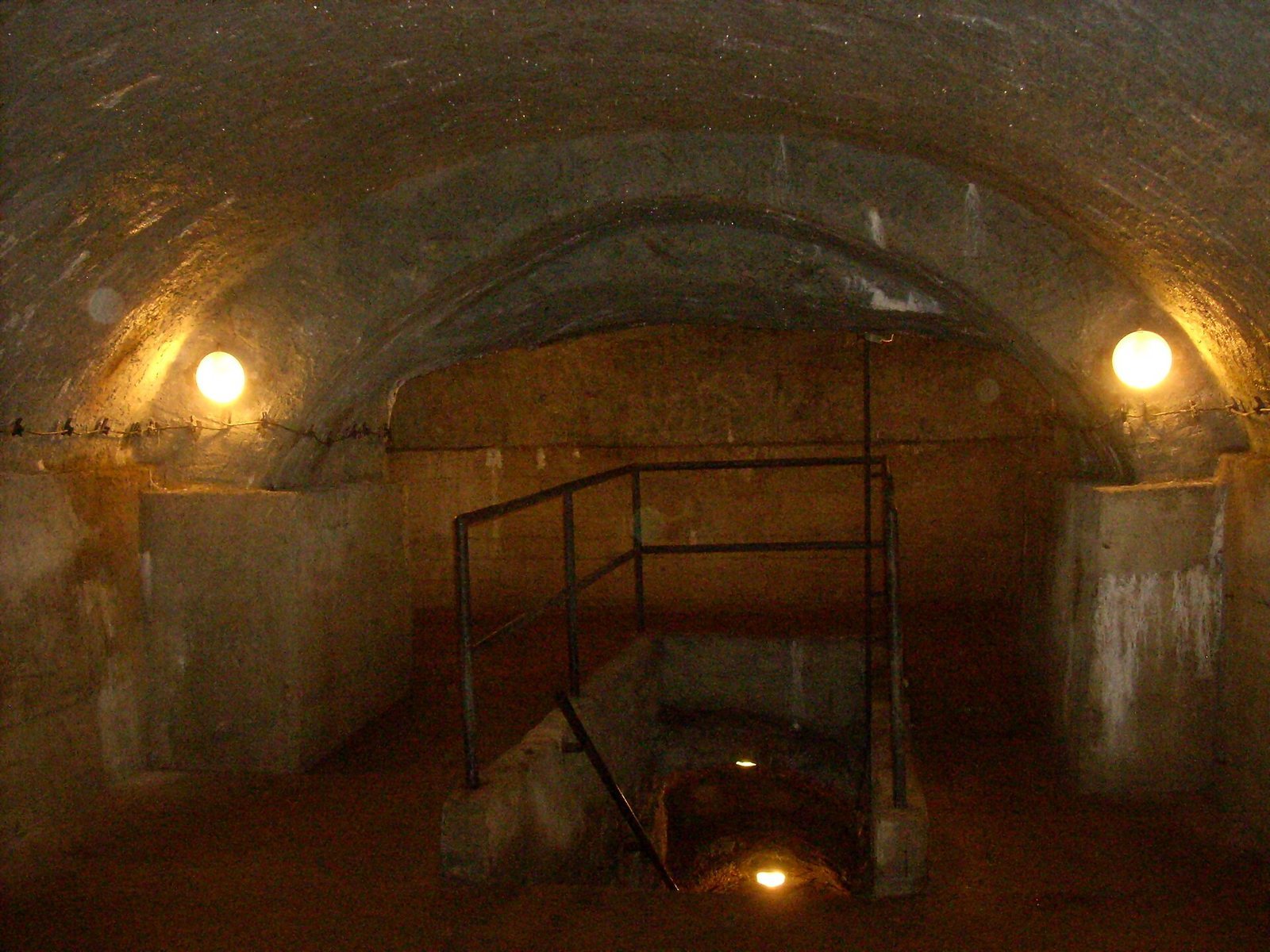
The upper level, made largely of links between cellars, lies two to four metres below ground and dates mainly to the 14th century. The second level lies about four to eight metres down, and the third generally lies eight to fourteen metres down; both lower levels were probably excavated in the 16th century. The deepest point is 22 metres below the surface. The third level occurs beneath several town-centre properties, including houses on Znojemská and Mrštíkova streets and Masaryk Square. The longest connecting passage measures 200 metres. Corridors range from 0.8 to 2.5 metres wide and 1.2 to 3.5 metres high. Brick reinforcement sometimes reduced their profiles by as much as half.
Cellars and excavation
The earliest cellars began as pits beneath houses, reached through narrow entrances from the street or a house basement. Some were extended with side branches and dead ends, and narrow shafts allowed ice to be lowered into cold-storage spaces. Wealthier owners could extend cellars beyond the footprint of the building above. Miners broke the hard rock with iron hammers, wedges, picks and bars, probably using fire-setting, in which heated rock is rapidly cooled with water to make it crack. Small shafts brought in air, while workers carried out broken stone in baskets or leather sacks. Ropes, wooden ladders and simple winches were used in later stages. A two-by-one-metre shaft advanced about two to two and a half centimetres per eight-hour shift. Miners worked three eight-hour shifts a day, five days a week, and their average life expectancy was about 32 to 35 years.
Storage and work areas
Cellars held cloth, food, wine and beer, and some spaces were used for beer maturation, malt-making and craft work. Low wooden benches supported beer barrels; some survived until the 1960s, and sulfur fumes from the barrels blackened the ceilings above them. A wooden post at some cellar entrances helped raise and lower barrels. Other spaces stored fruit and vegetables or kept meat cool. The rooms and connections reflect the network’s gradual growth from individual cellars into a maze beneath adjoining properties.
Water and ventilation systems
Wells and springs
The underground contains 256 wells and springs, most built in the 15th century. Many stand beside stairs or near cellars and connect to them by shafts; others occupy niches branching off the main passages. Openings above some niches allowed buckets to be lowered from cellars. Medieval pottery that fell into wells provides archaeological finds. The water is about 5°C, clear and high in nitrates. A private soda-water factory on U Mincovny Street once drew water from one of the wells to make lemonade.
Drainage channels
Connecting and drainage passages carried excess water towards the river. In some medieval passages, channels ran along the centre of the floor, lined and covered with flat stones. Water collected in lower levels, where it could seep into the rock or be reused. During medieval sieges, drainage routes could be closed securely. Some late-18th-century drainage tunnels are 0.6 to 0.7 metres wide and 1.0 to 1.7 metres high. Masonry partitions separate them from the wider network, and oak sluice gates once controlled outlets into the town ditches. Some medieval drains remain in service after reinforcement and connection to the modern system. The last of the recorded sluice installations was destroyed in 1951 during construction of Znojmo Bridge across the Koželužský Stream valley.
Ventilation shafts
Three types of ventilation shaft connected passage walls or ceilings to streets and squares. Flush stone slabs or raised stone plates about 60 centimetres across covered their surface openings, with a central vent protected by cross-shaped or star-shaped ironwork. Examples remain on the lower part of Masaryk Square and in the town-hall courtyard. Most shafts were blocked with gravel or asphalt in 1961; humidity thereafter averaged about 95 percent and locally reached 100 percent. Temperatures remain between 8°C and 12°C throughout the year.
Escape passages and circuits
Escape tunnels
Five escape tunnels survive, three of them traversable for their full length. One runs from beneath Matky Boží Street to a point beyond the road at V Důlkách; another leads from Znojemská Street to the former Jihlavan vocational centre, now City Park on Hradební Street. Both emerged beyond the town’s castle ditches.
Swedish Tunnel
The Swedish Tunnel runs between the city library and Heulos Park and is reached from the Old Circuit by eleven steps. It is 68 centimetres wide, with a height increasing from 152 centimetres at the entrance to 181 centimetres farther in. A bricked partition near the entrance is 60 centimetres thick and includes a hatch. A channel cut into its lower-right corner carries continuously flowing water. The tunnel’s exit, now closed by an iron door, opens in Heulos Park behind a rock club. The passage also drained water beneath the former Jesuit monastery. The Jesuits are a Catholic religious order founded by Ignatius of Loyola in the 16th century.
Old Circuit
The present Old Circuit enters near the city library and extends about 400 metres beneath the northeastern part of Masaryk Square, where town houses demolished in the 17th century once stood. Buildings of the former Jesuit monastery and the Church of St Ignatius of Loyola now occupy the surface above. About 200 metres of the circuit follow original corridors, locally reinforced with brick bands dating from the 16th to 18th centuries. In a dead end, the church’s foundation wall interrupts the connection between two underground systems. A brick band in the tunnel between the town hall and the plague column bears the date 1655.
Alfa Circuit
The closed Alfa Circuit runs beneath the southeastern side of Masaryk Square, also known as the lower square, and measures 2,370 metres. It contains the largest concentration of underground corridors in the historic centre, though extensive concrete reinforcement has altered their historic appearance.
Glowing passages
Corridor beneath the Church of St Ignatius
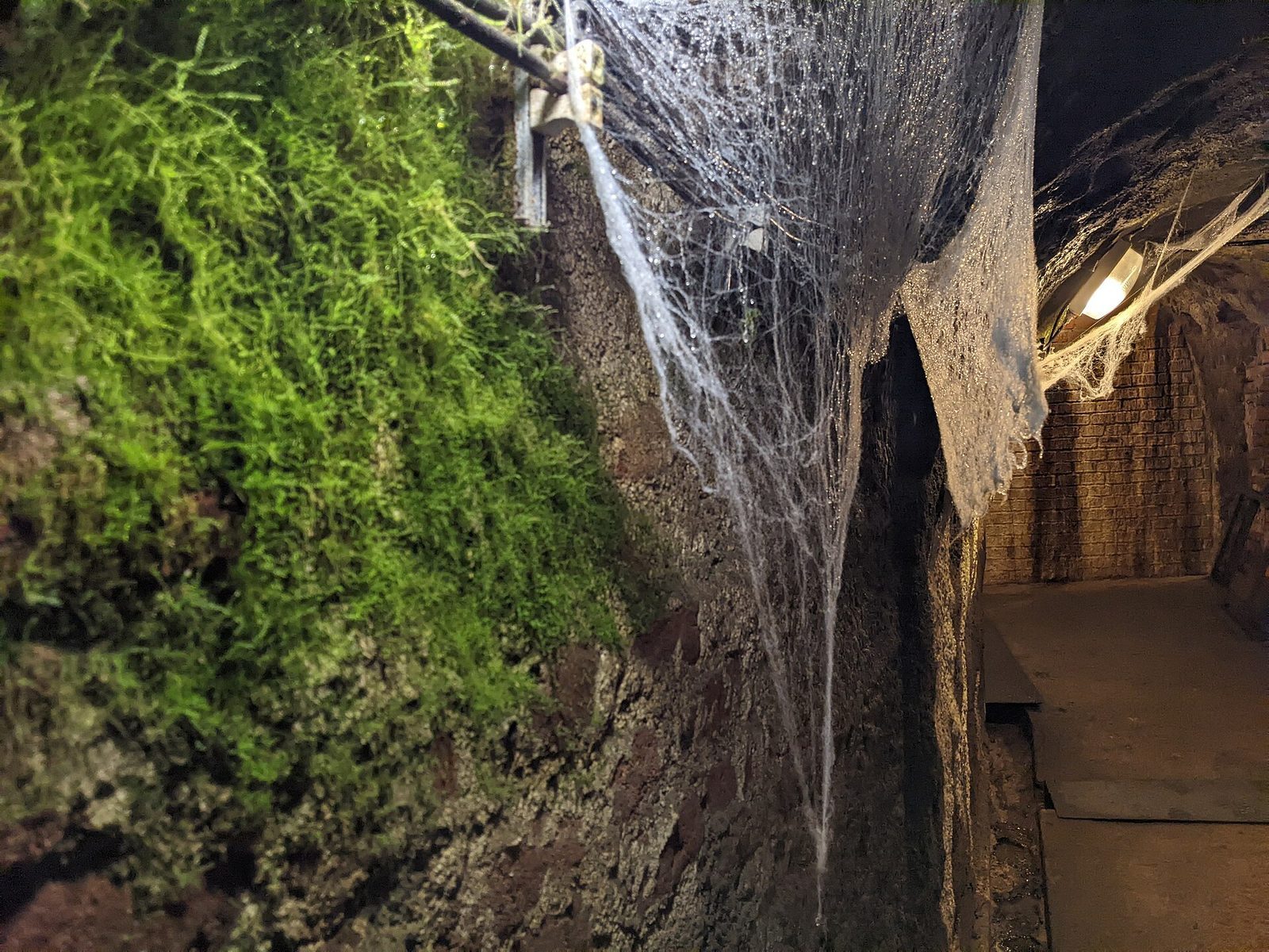
The glowing corridor lies 11.6 metres below ground beneath the Church of St Ignatius and former barracks that housed the German armed forces during the Second World War. It measures 12 metres long, 2.1 metres wide and 2.9 metres high. Its walls give off a faint greenish light after exposure to light, and a soft grey-white coating covers its surface. The passage cuts partly through rock and partly through brickwork, probably dating to the second half of the 17th century. A niche cut into the rock resembles a Gothic gateway, and a geological fault passes through it.
Analysis identified baryte, wurtzite, a form of zinc sulfide that can luminesce, and about one percent willemite, a zinc silicate, in the coating. Earlier explanations involving silver or radioactivity were ruled out. The material is probably an artificial luminous coating, possibly the German product Lichtgelb, but its date and circumstances of application remain uncertain. Radar indicated a regular square cavity beyond the niche, perhaps a chamber or descending staircase, but drilling at four points found solid rock, including at a depth of two metres.
Passage beneath Znojemská and Brněnská streets
A second glowing passage, found in the 21st century beneath the junction of Znojemská and Brněnská streets, extends about 330 metres and glows more strongly than the corridor beneath the library.
Tombs, exploratory shaft and later galleries
Tombs near the fortifications
A system of tombs built by the Roman Catholic Church near the town fortifications was used mainly during wartime.
Exploratory mining shaft
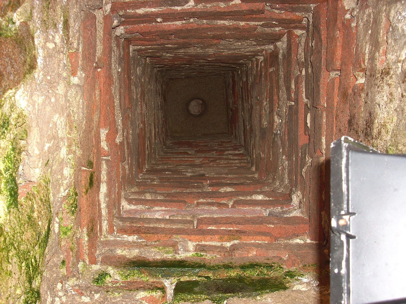
A square shaft with timber lining beneath the present rectory of St James the Elder survives from exploratory mining in the second half of the 13th century. St James the Elder is one of the apostles of Jesus.
Utility galleries and reinforced passages
Modern utility galleries form a separate system from the older network. Excavated on three levels about eight, 16 to 18, and 22 metres below ground, they remain unused. In the older passages, sprayed concrete lines most areas outside the visitor circuit, and some sections were cleaned, filled, bricked up or concreted. New drainage channels run along corridor walls. About 200 metres beneath the former District Library and part of the Holy Cross monastery retains its original state, supported by concrete pillars, although its original brick floors are covered with concrete. Across the network, floors consist of compacted earth or brick paving. Marks on corridor walls helped users find their way, and false tunnels were made to mislead unauthorized visitors.