Yaxha: A Maya Ceremonial and Political Center in Guatemala
Site at a Glance
- Popularity
- High
- Country
- Guatemala
- Primary era
- Medieval
- Eras represented
- Iron Age, Classical, Medieval
- Civilizations
- Maya
- Site type
- City
On this page30 sections
History
Yaxha is a Maya ceremonial and political center at Laguna Yaxjá in Guatemala. Its name means “blue-green water,” and its emblem glyph, a hieroglyphic title associated with a Maya polity, is read as Yax-ha. The name is considered a rare survival of a place-name from the Classic period. Yaxha was occupied for roughly sixteen centuries, from the Middle Preclassic period until about AD 900.
Early settlement and growth
The first settlement dates to the Middle Preclassic, an early period in Maya history spanning about 1000–350 BC. The earliest inhabitants are estimated to have arrived around 700 BC. During the Late Preclassic, about 350 BC to AD 250, Yaxha grew into the largest settlement in the Yaxha–Sacnab basin. Its population increased and construction expanded.
Yaxha reached its height of power in the Early Classic, about AD 250–600. It became an important center on trade routes across the Petén lakes region. Its political territory is estimated to have covered 237 square kilometers, and estimates of its peak population range from about 35,000 to 42,000. Imagery from this period reflects strong influence from Teotihuacan, a major ancient city in central Mexico, particularly after Teotihuacan intervened at Tikal in AD 378. Poor preservation of Yaxha’s Early Classic monuments leaves this period of its history only partly understood.
Near the end of the Early Classic, movement along the Yaxha Fault caused by seismic activity damaged buildings in the East Acropolis and apparently other parts of Yaxha and nearby Nakum. The damage may have led to a temporary abandonment of the East Acropolis.
Late Classic conflicts and alliances
During the Late Classic, about AD 600–900, Naranjo rose above Yaxha in political power but did not bring it wholly under its control. Yaxha remained an important trading center southeast of Tikal, and substantial building projects took place, especially in the eighth century.
On March 20, AD 710, Naranjo’s ruler K’ak’ Tiliw Chan Chaak sacked Yaxha. He opened and profaned the tomb of the deceased king Yax Bolon Chahk; Yaxha’s king was captured and sacrificed. In AD 711, Naranjo defeated Yaxha’s king Joyaj Chaahk in battle. Three years later, a Yaxha king, probably Joyaj Chaahk, appeared at Naranjo and danced with its ruler.
Later in the eighth century, Naranjo’s king K’ak’ Ukalaw Chan Chaak married a Yaxha princess, Lady Shell Star, who bore him an heir. The marriage did not bring lasting peace between the cities. Shortly before September 23, 793, K’inich Lakamtuun took the throne at Yaxha and promoted a revival under Tikal’s patronage. On August 10, 796, he defeated and captured Xub Chahk, king of Ucanal. A monument raised the following year commemorated the victory.
In AD 799, Naranjo’s king Itzamnaaj K’awiil attacked Yaxha and its allies. Naranjo’s forces captured the city center on February 18, forcing K’inich Lakamtuun to flee to Usu’l. Tikal’s king, probably Nuun Ujol K’inich, restored him to the throne on April 16. Naranjo attacked again on July 16, and K’inich Lakamtuun fled once more. On September 5, Naranjo’s forces struck his refuge and seized Yaxha’s jade.
Terminal Classic and abandonment
Yaxha did not experience the rapid political collapse seen at some nearby cities during the Terminal Classic, about AD 800–900. Construction resumed across the site as local elites sought to maintain the Late Classic political system. Some restrictions on entry were removed, apparently to encourage people from surrounding areas affected by the wider Maya collapse to come to the city.
Activity continued at Yaxha into the Terminal Classic, but the city itself had been abandoned by the Postclassic, about AD 900–1525. Later pottery and food refuse found at the site came from people living on islands in Lake Yaxha, rather than indicating that the city had been reoccupied.
Exploration and conservation
Teoberto Maler reported the ruins after visiting in 1904. The Carnegie Institution of Washington mapped the site in the 1930s, and teams remapped it and carried out test excavations in the early 1970s. A survey of structural damage took place in 1987, followed by stabilization work beginning in 1988. A research and restoration program started the next year and included Yaxha and other sites in the region. Excavations continued into the twenty-first century, including work at the South Acropolis in 2005–2007; Palace Structure 218 was restored in 2006.
Yaxha lies within Yaxha-Nakum-Naranjo National Park, a 37,160-hectare area encompassing the ancient cities of Yaxha, Topoxte, Nakum, and Naranjo, as well as smaller settlements. The park is part of the Maya Biosphere Reserve. Its wetlands are recognized as internationally important under the Ramsar Convention, a treaty concerned with wetland conservation.
Remains
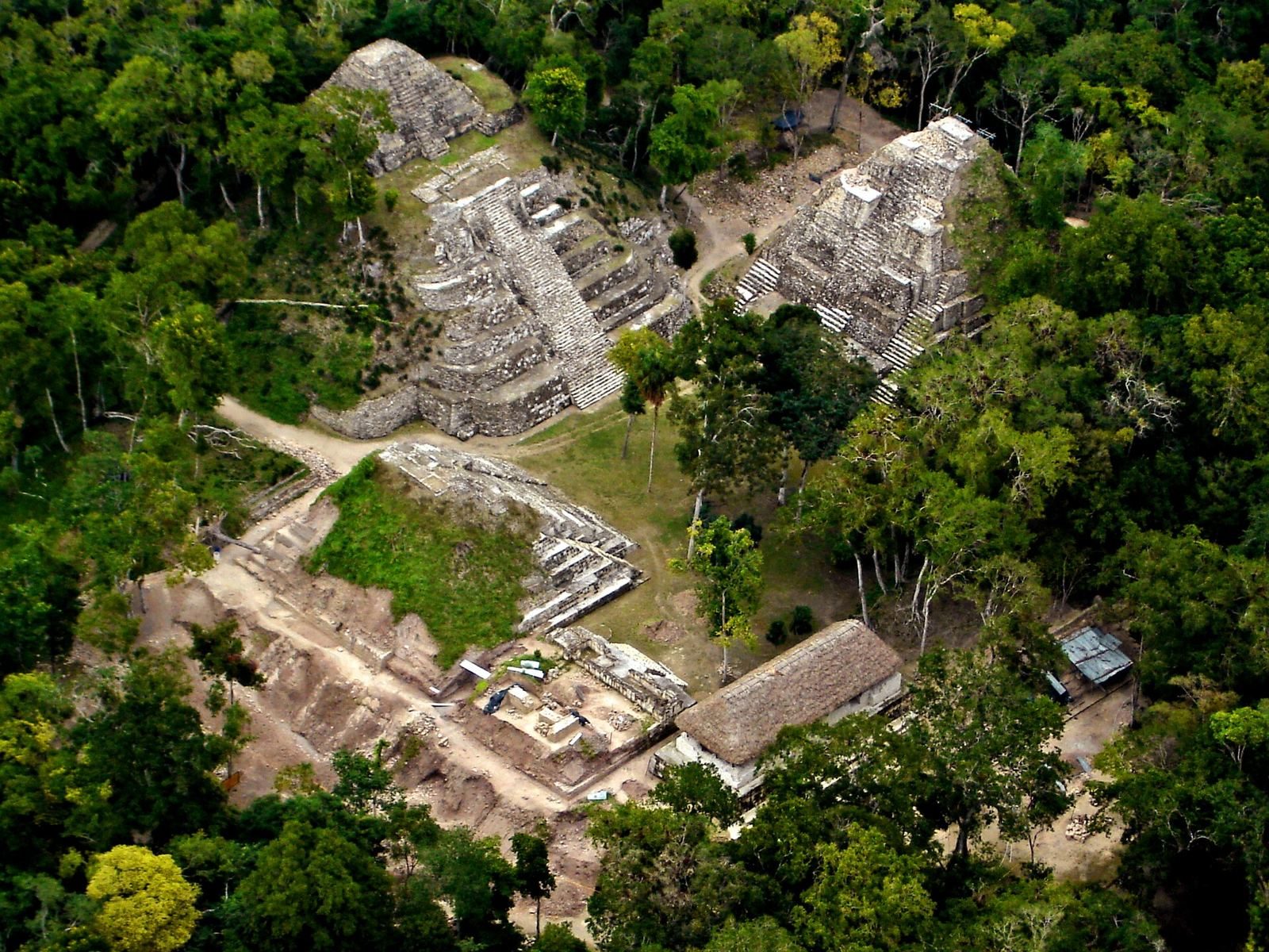
Yaxha extends along a limestone ridge between Lakes Yaxha and Sacnab, on the north shore of Lake Yaxha. The remains stretch about three kilometers along a hilltop parallel to the shore, with the highest ground at the eastern end. The city is made up of artificially levelled areas and more than 500 structures grouped at different scales, linked by causeways and paved routes. Lakes, streams, lagoons, Maya-built reservoirs, and seasonal wetlands form part of the surrounding landscape.
City plan and routes
Groups and connections
The main architectural groups include the Maler Group to the north, the South or Main Acropolis, the West Group, and the Northeast and East Acropoleis. Plazas and smaller groups occupy the spaces between them. Yaxha had ten principal communication routes: four major routes classified as causeways and a number of secondary routes.
Causeways
The Blom Causeway connects the Maler Group with the site core. The Galindo Causeway runs north–south between the East Acropolis and Plaza C, while the Lincoln Causeway extends southeast from the city center to Plaza C. The Lake Causeway runs inland from the shore of Lake Yaxha and continues through the site as Via 5.
The Lake Causeway itself is about 80 meters long, and together with Via 5 it extends about 400 meters. It probably developed from a Middle Preclassic path connecting the lakeshore with the early settlement. Its earliest built form dates to the Late Preclassic: a raised route about 10 meters wide and roughly half a meter above the surrounding ground. In the Late Classic, it was developed as Via 5 was formally extended across the city core. The route descends more than 50 meters in elevation between its southern end and its junction with Via 5.
At that northern junction, buildings narrowed the passage to about two meters. The arrangement probably served as a checkpoint where people and goods entering the city could be inspected and taxed. Parapets alongside the causeway stood about one meter high and varied from two to three meters wide. During the Terminal Classic, barriers at the junction were removed and the ground was levelled with finely dressed stone and mortar, opening the full width of the route.
The causeway’s southern end was reshaped in several phases. A stucco-covered platform was built there, with masonry walls defining its east and south sides; steps may have been cut into the limestone where the platform met the route. In a later Late Classic phase, the platform was enlarged to about 32 by 19 meters and supported on its south and east sides by refurbished sloping walls coated with stucco. The causeway was remodelled as a long ramp linking the platform, the city center, and the Via 5 junction. In the Terminal Classic, limestone fill resurfaced the causeway, and stone-covered ramps replaced the platform’s stepped sides. A plain monument, Stela A, was erected on the platform. Seasonal rainwater flowing downhill eroded the route, leaving its pottery finds scarce and poorly preserved.
Plazas and astronomical arrangements
Plazas A and B
Plaza A lies north of the East Acropolis and contains an eighth-century twin-pyramid complex. Yaxha’s group is one of the few such complexes outside Tikal. It appears to have remained unfinished and is associated with political alliances and the commemoration of a katun, a period of twenty years in the Maya calendar. Plaza B lies west of the East Acropolis.
Plazas C and F
Plaza C is southeast of the site core and forms an E-Group, an architectural arrangement associated with observing the sun. The Lincoln Causeway links it to the city center. Three Early Classic stelae stood along its eastern side. Plaza F is also identified as an astronomical complex. The arrangements at Plazas C and F were configured to mark changing solar positions, particularly at solstices and equinoxes. These alignments related to Maya observations of the sun and calendars used in agriculture and ceremony.
Plazas D and E
Plaza D occupies the northwest end of the Lincoln Causeway, immediately north of the South Acropolis and south of the Northeast Acropolis. Plaza E lies north of the South Acropolis and connects to it by a stairway.
Acropoleis and major architectural groups
East Acropolis
The East Acropolis occupies Yaxha’s highest area, south of the twin-pyramid complex and surrounded by Plazas A, B, and C. Its platform was first levelled from limestone bedrock in the Middle Preclassic. The group began as a complex of three pyramids in the Preclassic and underwent major changes in the Early Classic. In its final form, it was a closed complex of twelve structures covering about 8,100 square meters.
A monumental stairway on the west side, built in the Late Preclassic and remodelled in the Late Classic, opens onto the plaza. The group’s principal buildings were Structure 216, a pyramid-temple, and Structures 217, 218, and 219, palace-type buildings. In the Terminal Classic, large quantities of ash and domestic pottery were deposited in the acropolis. A small platform built against Structure 219 blocked access to its southwestern terrace.
Northeast Acropolis
The Northeast Acropolis dates to the Late Preclassic. It includes a three-pyramid complex incorporated into an E-Group astronomical arrangement.
South Acropolis
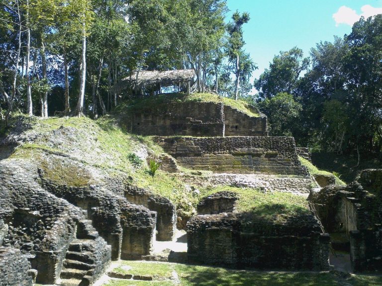
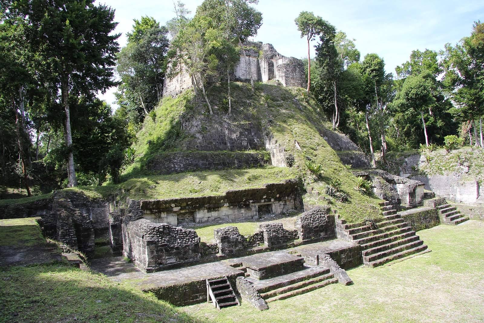
The South Acropolis stands on a high karst hill, limestone terrain shaped by water, and was built from the end of the Middle Preclassic through the Terminal Classic. Its six patio groups sit on an artificial platform. Structures with corbel-vaulted roofs, formed by masonry courses projecting inward, divide the patios and probably served as elite residences. Structure 363, a temple between Patios 5 and 6, is an exception to this pattern. A stone monument stood in front of its west façade, an unusual placement within an acropolis group.
Ballcourt 1 lies beside the acropolis. Plazas D and E border it to the north, Via 5 to the west, and Via 6 to the south. In its Terminal Classic form, the irregular base measured about 200 meters east–west by 100–120 meters north–south. It had stepped levels and rounded corners. A stairway on the western half of its north side appears to have linked Plaza E with Patios 5 and 6.
Maler Group
The Maler Group lies north of the site core and connects to it by the Blom Causeway. It includes Stelae 8 and 10, Early Classic monuments whose lower portions survive.
Buildings of the East Acropolis
Structure 216
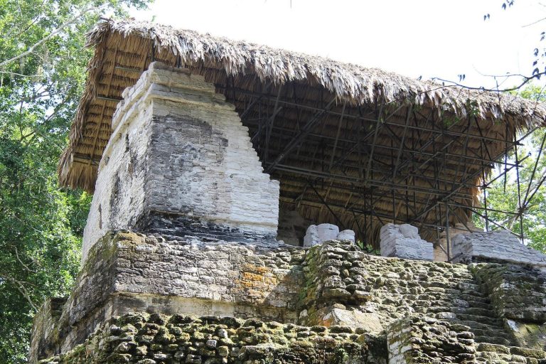
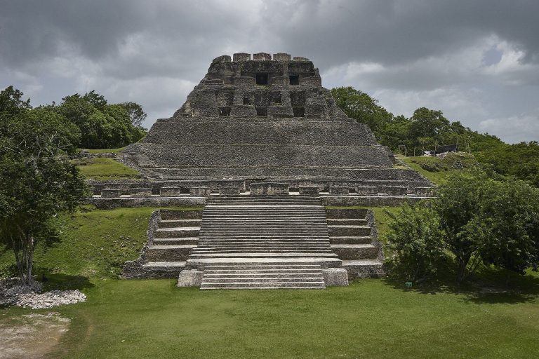
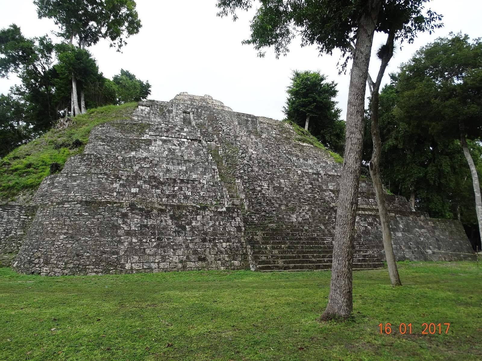
Structure 216 is Yaxha’s tallest structure, with a surviving temple shrine on a pyramidal base and a total height exceeding 30 meters. Its earliest described phase, from the Late Preclassic, was a five-level platform with sloping walls, about 11 meters high. A west-facing monumental stairway measured 17.5 meters across and had 32 steps, each with a tread 0.45 meters deep and a riser 0.35 meters high.
In the Early Classic, the building was reconstructed as a stepped platform with a stairway projecting west, possibly flanked by balustrades. This phase reached 22.75 meters. An eighth-century version stood 23.25 meters high, with eight stepped levels, rounded corners, and a projecting stairway. Its shrine had three doorways and two interior chambers. Stela 41 was raised at the stairway’s base.
An offering beneath the shrine’s first chamber contained seven eccentric objects, deliberately shaped ritual offerings: five made of obsidian and two of flint. A piece of mother-of-pearl was also found with them.
Structure 217
Structure 217 stands at the north end of Structure 218. First built in the Early Classic and redesigned in the eighth century, it rested on a base with slightly sloping walls. An east-facing stairway led to two vaulted chambers. In the ninth century, masonry was added to face its base.
Structure 218
Structure 218 began in the Early Classic as a long room with a corbel-vaulted roof. It had several doorways on the east, perhaps five, and two narrow doorways near the center of its west side. Traces of red pigment survive on its cornice. In an Early Classic remodelling, the room was divided into three chambers, a bench was added to the north chamber, and small animal-shaped masks were placed in recessed cornice panels. A small platform was later built against the west side. Subsidence at the south end of the underlying platform resulted from movement along a geological fault.
In the eighth century, the west side became the building’s main façade, the vault was lowered, and the earlier construction was filled in. This version measured 36.5 meters long and stood on a platform 1.85 meters high. Its long room had a vaulted ceiling, walls one meter thick, interior vaulting 2.6 meters high, and decorated cornices. The building may have risen more than 6.5 meters above the plaza. Three plain stepped levels formed its east side, with benches built against two corners, possibly to conceal subsidence related to earthquakes.
An offering beneath the central chamber contained nine grey obsidian eccentric objects and fourteen of flint, a spondylus shell, a small piece of greenstone, and carbon remains mixed with unidentified plant fibers. In a further eighth-century phase, Structures 217, 218, and 219 were joined to create a façade with nine doorways. Three vaulted chambers were added to the east side. The outer chambers stood over earlier benches, while stairways flanked the central chamber. Part of a large mask survived on the sloping wall between the north and central chambers; occupants in the Terminal Classic demolished the wall’s upper section.
Remnants of murals in the central chamber are badly damaged but appear to show people near a palace and ballcourt. In the ninth century, a building with three chambers and a perishable roof was constructed on the upper platform. Doorways connected its chambers, and a narrow sunken stairway built over an earthquake fissure provided access. In its final form, Structure 218 stood 38 meters high on four stepped platforms, with a wall blocking the top of its stairway.
Structure 219
Structure 219 stands at the south end of Structure 218. Its first phase dates to the Early Classic. In the eighth century, it was rebuilt in a form similar to Structure 217, with two vaulted chambers on a base and an east-facing stairway. Its base was faced with masonry in the ninth century, when two small platforms were also added at its southeast end, one against the north side and another at the southeastern corner.
Stelae, burial, and other finds
Stelae on Plaza C
About 40 stelae, upright stone monuments often carved with images or inscriptions, have been recovered at Yaxha; approximately half are sculpted. Stela 3, the northernmost of the three Early Classic monuments on Plaza C’s east side, is poorly preserved, with only its lower panel surviving. Its style is related to the Izapan tradition of the Pacific coast, and the panel resembles the corresponding part of Stela 4.
Stela 4, the middle monument, is the best preserved of the three. It depicts a standing figure with feet turned left, positioned on a grotesque head. Two glyphs appear beside the figure’s knees, including a surviving version of Yaxha’s emblem glyph. Stela 5, the southernmost, is heavily eroded but bears the date AD 357, the earliest date on a monument at the city.
Stela 11
Stela 11 stands on the east side of Plaza B, at the base of Structure 218. This well-preserved Early Classic monument depicts a warrior in Teotihuacan style with attributes of Tlaloc. The figure wears characteristic rings around the eyes, a butterfly ornament over the mouth, and a feathered headdress, and carries a spear and shield. The monument closely resembles Stela 32 at Tikal and is associated with Teotihuacan’s intervention in the Petén during the Early Classic.
Stelae 13, 30, and 31
Stela 13 stands at the base of the West Pyramid in the twin-pyramid complex. It is broken into fragments, though much of its sculpture survives. The monument depicts a Yaxha king and includes a text about an equinox celebration. Its inscription gives the date AD 793, the latest date recorded at Yaxha. In Plaza E, Stela 30 is an Early Classic monument broken in two. Late Classic Stela 31 depicts an elaborately dressed figure with a large headdress and is badly damaged, surviving in several pieces.
Stela 41
Stela 41 stands at the base of Structure 216’s stairway. Its lower end is missing, and it may have been moved from its original position. All four sides were carved in an Early Classic style. The front shows two masks facing left and a humanlike figure wearing a bracelet type used from the end of the Late Preclassic through the Early Classic. Eroded inscriptions on the north and south sides include a glyph that may be Yaxha’s emblem glyph.
Other monuments
Stela 36, on the west side of Plaza B, is badly eroded. Stela 8 and Stela 10 in the Maler Group are Early Classic monuments with only their lower portions surviving. Stela 10 is also badly damaged.
Burial YX-08
A high-status Late Classic burial, YX-08, was placed in a stone-built burial container in front of Structure 218’s main entrance and may have belonged to a member of Yaxha’s elite. The remains were those of a young adult man in his early twenties, laid on his back with his skull toward the north. His skull was deformed, and jade inlays had been set into his upper incisors. Two sculpted jade pieces lay near his neck; one was a square plaque carved with a humanlike figure. Traces of red pigment remained on both pieces.
Four other people were buried south of YX-08 during the Terminal Classic, without stone containers or offerings. Their bones represent individuals of different ages and genders. Ceramics at Yaxha served domestic and ritual purposes and varied in form and decoration. Classic-period vessels included plates, cups, and bowls decorated in multiple colors with mythical or historical scenes. Some carry glyphs describing their ritual use and naming their makers.