Anreppen: An Augustan Roman Military Camp in Germany
Site at a Glance
- Popularity
- Medium
- Country
- Germany
- Primary era
- Classical
- Eras represented
- Classical
- Civilizations
- Roman
- Site type
- Military
- Remains
- Camp
On this page19 sections
History
Anreppen was a Roman military camp at Delbrück, Germany, established in AD 4 during campaigns to bring Germania beyond Rome’s established frontier under Roman rule. Augustus, Rome’s first emperor, sought to make the region a Roman province. The camp was part of the major German campaign known as the immensum bellum, and probably remained in use for only a few years, until AD 5 or 6.
Tiberius’s campaigns
The camp probably served as a winter base for Tiberius, Augustus’s adopted son and designated successor. He was there in the winter of AD 4 and returned from the spring of AD 5. Roman historian and former campaign officer Velleius Paterculus described Tiberius’s camp as the first winter base of a legion in Germania’s interior. That description stands alongside the earlier winter camp Drusus established at Oberaden in 11 BC.
Anreppen’s identification with the camp described by Velleius rests in part on timber from a latrine and a well lining, dated to AD 5, as well as the scale and elaborate design of the commander’s residence. In AD 5, the camp supported operations by Tiberius and the provincial governor Gaius Sentius Saturninus, as Roman forces advanced to the Elbe. Anreppen may also have been a point where supplies were transferred to troops farther east, particularly if Roman boats could no longer travel along the Lippe at this point.
The camp’s end and nearby settlements
In AD 6, Tiberius began a campaign against Maroboduus, ruler of the Germanic Marcomanni. He abandoned the expedition after news arrived of a revolt in Pannonia. The end of Anreppen may have been connected with these events. Traces of fire in some buildings, together with clusters of nails thrown into a well, suggest that Roman troops may have burned parts of the camp and discarded iron to prevent its reuse in weapons. Coins from the site point to use ending before the AD 7 to 9 governorship of Publius Quinctilius Varus, whose forces were defeated in Germania in AD 9. Anreppen is therefore generally understood as a short-lived outpost rather than Aliso, the regional hub usually identified with Haltern.
Germanic communities lived in the surrounding area. A settlement to the south indicates occupation during the pre-Roman Iron Age, although it is uncertain whether people continued to live there while the Roman camp was active. A western settlement produced fine red-gloss Roman tableware, evidence of exchange with Roman communities. Another Germanic settlement at Thüle, about 3.5 km south, dates to the later first century AD and was discovered in 1975.
Discovery and protection
In 1967, farmer Ferdinand Begger found pottery fragments, including pieces of a large yellow amphora, while working his fields. Anton Doms and museum director Hans Beck learned of the finds the following year, and Doms recognized the pottery as Augustan Roman material associated with a military camp. Excavations began on 16 September 1968.
Doms worked at Anreppen from 1968 to 1982, tracing the defenses and defining the camp’s extent. This initial work helped establish the site’s boundaries so that it could receive comprehensive archaeological protection. From 1988 to 2004, the Westphalian archaeological authority, led by Johann-Sebastian Kühlborn, excavated broad areas within the enclosure, investigating about one-third of its interior. Delbrück has listed Anreppen as an archaeological monument since 14 March 1990, and the site is protected under North Rhine-Westphalia’s monument-protection law.
Remains
Plan and defenses
Layout and setting
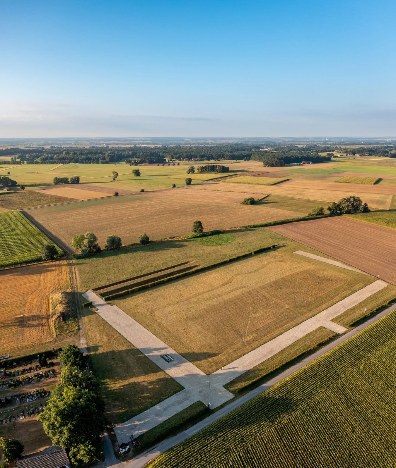
The camp covered about 23 hectares on the Lippe’s south bank, between the river and the smaller Stemmecke stream, which joins it. Its elongated, irregular oval plan measured up to 750 m from east to west and 330 m from north to south. The Roman-period riverbank may have differed from today’s because the Lippe has shifted its course. The camp stood about 5 m above the river’s present water level and remained above water during floods.
Walls and ditches
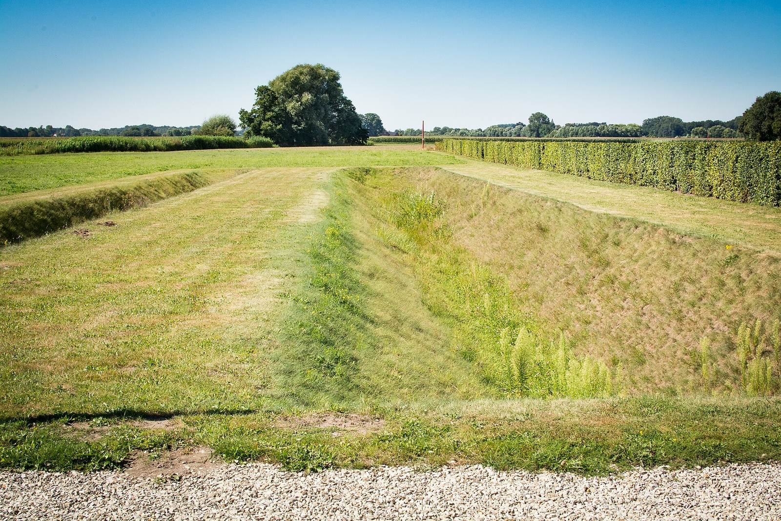
A timber-and-earth rampart, about 3 m thick, enclosed the camp. Braced wooden faces held an earth-packed core, and towers strengthened the wall at intervals. An outer ditch measured about 7 m across and reached 2.4 m deep. On the southern side, a second ditch was about 3 m wide and 1.6 m deep.
Entrances, roads, and water management
Gates and roads
Gates were probably placed on all four sides, with the eastern main entrance and the southern side entrance identified. The camp’s front faced east. Later construction has limited investigation of the eastern gate, while the southern gate is well preserved and thoroughly recorded. The road from the eastern entrance reached the main cross-camp road, which began at the southern gate and probably extended to the northern section of the road that followed the enclosure. A further cross-camp road ran parallel to it in the eastern rear of the site. Two sections of an unpaved road found about 500 m east of the camp contained Roman shoe nails.
Water management
Wells supplied water within the camp. Wooden-lined channels buried underground carried rainwater and wastewater beneath towers in the enclosure wall, then discharged it into the Lippe.
Command buildings
The commander’s residence
The commander’s residence, or praetorium (the commander’s home and office), covered about 3,375 m2 and may have had two storeys. Its eastern entrance included a 6.7 m-wide portal supported by two columns. The entrance opened onto a 198 m2 central reception court surrounded by rooms. Passages gave access to the rooms on the north side; those to the south may have formed a private residential area. A heated room of 84 m2 lay to the south, while a communal latrine stood to the north.
West of the reception court, a principal reception room and two corridors led to a 1,170 m2 colonnaded courtyard lined with rooms of different sizes. This courtyard had two building phases. A 2,130 m2 yard at the southern end, probably a garden, had a single long colonnade. The residence combined a central court associated with Roman houses with forms compared to the palaces at Pella and Greek athletic complexes.
Other command buildings
Two smaller, carefully designed buildings with courtyards and colonnades stood to the north and south of the commander’s residence. They may have housed senior officers, such as a legion commander, camp prefect, or senior military tribune. The camp’s main headquarters is thought to lie in the still-unexcavated block east of the residence, between it and the main cross-camp road.
Bath complex
The baths measured 23.5 by 42 m, covering 987 m2, in the block north of the commander’s residence and south of the camp’s northern perimeter road. A projecting entrance hall on the south faced the residence; a second entrance lay to the west beside a cross-camp road. Both opened into a colonnaded courtyard with covered walkways up to 3.5 m wide, probably used for exercise.
The 462 m2 bathing suite contained a cold room and a warm room side by side on the south, with a larger 135 m2 hot room to the north. Two furnaces in a separate service wing to the west heated the hot room and supplied hot air for underfloor heating, as well as hot or warm water. The air also passed beneath the warm room. One furnace was renovated at least once during the camp’s brief occupation.
Troop accommodation and storage
Barracks and centurions’ houses
Barracks stood along the southern perimeter road and the road leading inward from the eastern gate. They averaged about 30 m long, and holes left by upright posts indicate simple timber construction. Centurions’ houses stood separately rather than forming part of the barracks. Wells and latrines occupied the space between the houses and barracks, while refuse pits lay in lanes between the barrack buildings. Trenches for their base beams show that the centurions’ houses had timber frames with clay infill; their sizes and room arrangements varied.
Storehouses
A large storehouse near the southern gate measured 56 by 68 m, or 3,808 m2. The present Anreppen cemetery overlaps its eastern portion. Several smaller storehouses, each between 237 and 764 m2, stood in a separately enclosed area relatively close to the eastern main gate. Their number and capacity are consistent with the possibility that Anreppen served as a supply depot as well as a base for stationed troops.
Reconstructed features and finds
Partial reconstructions at their original find locations include stretches of the southern defenses and southern gate, part of a street block, and a section of a drainage channel. Finds from Anreppen are displayed mainly at the LWL Roman Museum in Haltern; other objects are held by the LWL Museum of Archaeology and Culture in Herne and the Bergkamen City Museum.