Calanais Stones: A Prehistoric Ceremonial Monument on Lewis
Site at a Glance
- Popularity
- Very High
- Country
- United Kingdom
- Primary era
- Stone Age
- Eras represented
- Stone Age, Bronze Age
- Civilizations
- Unclassified
- Site type
- Religious
- Remains
- Sanctuary
On this page13 sections
History
The Calanais Stones are a prehistoric ceremonial monument near Calanais on the Isle of Lewis in the United Kingdom. The stone circle dates to between 2900 and 2600 BC, with about 2750 BC commonly given as its approximate date. It was used for ceremonies over many centuries during the Neolithic and Bronze Age, successive periods of prehistory. The principal monument is also known as Calanais I, an archaeological label that distinguishes it from nearby stone settings.
Prehistoric development
Human activity preceded the standing stones. A broad ditch may have belonged to a structure or enclosed area, although its purpose is uncertain and may have been domestic or ritual. Around 3000 BC, farming altered the site and removed much of the earlier evidence. Grass later covered the area for a time.
The circle was part of a larger concentration of prehistoric monuments on Lewis, including at least three other circles, arcs or rows of stones, and single standing stones. Many of these settings are visible from the main monument. Callanish II and III lie about 1.2 kilometres to the southeast; each originally had at least eight stones. Together, the monuments indicate that the area was a focus of religious activity for at least 1,500 years.
The stone rows may have been built at the same time as the circle or added later. One proposed sequence begins with a single standing stone, followed by the circle and avenue. The southern row may belong to the circle’s phase, while the other rows may have been added afterward. These sequences remain uncertain.
After the stones were erected, a chambered tomb, a burial structure with an internal chamber, was placed within the eastern part of the circle. Pottery indicates that it was used for several centuries. The monument fell out of use between about 1500 and 1000 BC, when Bronze Age farming disturbed the area. Pottery seems to have been cast out of the tomb, perhaps through ordinary agricultural activity or a ritual clearing. The tomb was apparently altered or rebuilt later, possibly for domestic use.
Farming continued nearby during the Late Bronze Age or Early Iron Age, a later period of prehistory. Peat covered the stones between about 1000 and 500 BC, and the site is estimated to have been abandoned around 800 BC.
Folklore, interpretation, and protection
The earliest known written reference to the stones dates to 1680. Lewis native John Morisone described a tale in which an enchanter transformed people into stone and arranged them in a circle for worship. Around 1695, Scottish writer and traveller Martin Martin recorded local claims that the site had served as a place of worship in pagan times. In those accounts, a chief druid, a religious specialist in ancient Celtic societies, addressed people beside the central stone.
Lewis folklore also tells of giants turned to stone after refusing to become Christians; in the seventeenth century, residents called the stones “false men.” Another tradition says that the Shining One walks along the avenue on an early midsummer morning, announced by a cuckoo. A separate story holds that Vikings avoided the stones because they believed them to be trolls. The monument has also been associated with rites intended to promote fertility.
In 1726, philosopher John Toland identified Lewis with Hyperborea, a legendary land in the far north described by the ancient Greek historian Diodorus Siculus, and linked Diodorus’s spherical temple to the stones. In 1743, antiquarian William Stukeley described the circle as a druid site and interpreted the avenue as a serpent. Geologist John MacCulloch published an accurate description in 1819, and Danish historian J. J. A. Worsaae produced a sketch and plan in 1846.
In the twentieth century, engineer Alexander Thom and astronomer Gerald Hawkins proposed that the monument had functioned as a lunar observatory. Other interpretations connect the stones with the Moon and the Clisham range on Harris. The avenue’s direction has been linked to the Moon’s southern setting at a major lunar standstill, the point in its approximately 18.6-year cycle when it reaches an extreme north or south position in the sky. Proposed alignments also connect the east-northeast row with the Pleiades star cluster and the west-southwest row with sunsets at the solstices. Critics have noted that apparent alignments may occur by chance and that weathering or displacement over millennia makes the original positions uncertain.
In 1857, Lewis proprietor James Matheson ordered about 1.5 metres of peat removed, exposing the tomb and the stones’ full height. The monument entered state care in 1885. It is now cared for by Historic Environment Scotland and protected as a scheduled monument under the Ancient Monuments and Archaeological Areas Act 1979. This status identifies it as a nationally important archaeological site under legal protection.
Remains
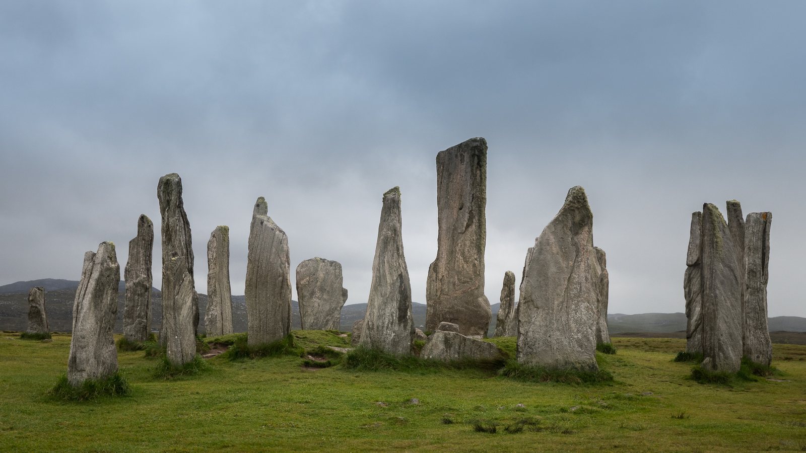
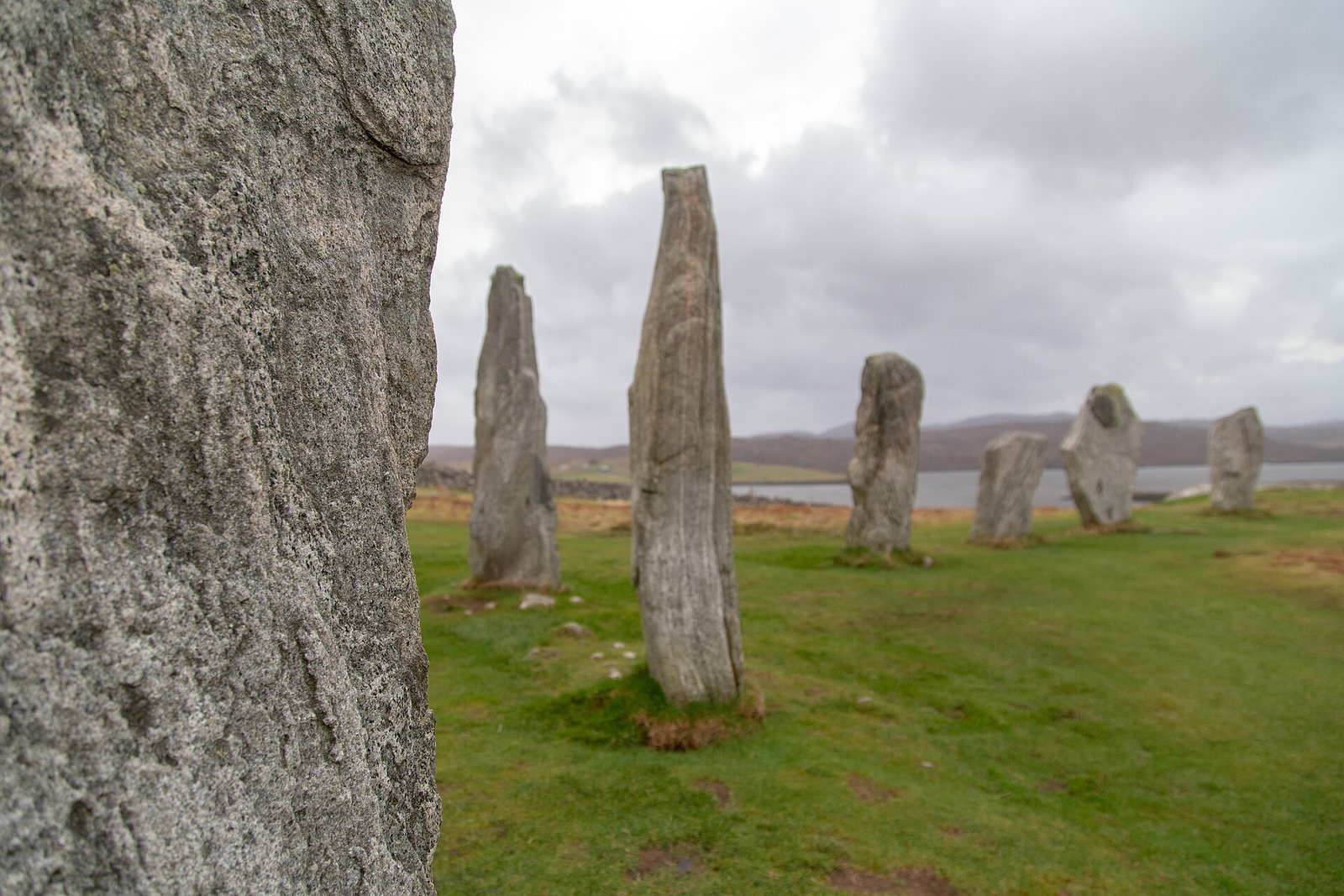
The monument stands on a low ridge above Loch Roag, near Calanais on Lewis’s west coast, with the hills of Great Bernera behind it. Made from local Lewisian gneiss, an ancient metamorphic rock found on Lewis, the stones form a cross-shaped arrangement. Thirteen stones make a circle around a central monolith, while five rows extend outward: a long avenue to the north-northeast and shorter rows to the west-southwest, south, and east-northeast.
Standing-stone arrangement
Central monolith
The central stone stands 0.8 metres west of the circle’s true centre. It is 4.8 metres high, 1.5 metres wide, and 0.3 metres thick, with its broad faces aligned nearly north to south. Its shape has been compared to a ship’s rudder, and it weighs about seven tonnes.
Stone circle
The thirteen-stone ring is 11.4 metres in diameter, but its outline is irregular: the eastern side is flattened, and the circle measures 13.4 metres from north to south and 12 metres from east to west. The stones average about three metres high, and the ring covers 124 square metres.
Northern avenue
The avenue extends 83.2 metres north-northeast. It once contained 39 stones, of which 19 remain, with nine along the eastern side and ten along the western side. Its tallest stone, at 3.5 metres, stands at the western end. The two rows spread slightly apart toward the north, measuring 6.7 metres between them there and six metres where they meet the circle. Stone heights decrease from the circle toward the avenue’s midpoint, then rise again; the eastern stones are about three-quarters as tall as those on the western side.
Other rows
The shorter rows extend to the east-northeast, south, and west-southwest. The east-northeast row has five stones and is 23.2 metres long; the southern row also has five stones and measures 27.2 metres. The west-southwest row contains four stones and extends 13 metres. None points directly to the circle’s centre: the east-northeast row’s line meets a point two metres south of it, the southern row’s line a point one metre west, and the west-southwest row’s line a point one metre south.
Burial features
Chambered tomb
The tomb is 6.4 metres long and lies east of the central monolith, between it and the circle’s eastern stones. Excavated material includes cremated bone and pottery, including beaker fragments dated to about 2000–1700 BC.
Northeastern cairn
A second cairn lies on the circle’s northeast side. It has been reduced to ground level, where a faint outline remains, and may not have belonged to the original monument.
Buried archaeological evidence
Excavations south of the stones in 1999–2000 revealed remains of a prehistoric field system beneath blanket peat, a continuous layer of peat covering the ground. The excavated area also contained buildings, walls, clearance cairns, or piles of stones gathered during field clearing, and cobbled surfaces. Together, these features indicate farming in the Late Bronze Age or Early Iron Age. Limited excavations in 1980–1981 recovered local Hebridean pottery, fragments of AOC and N4 beakers, and grooved-ware pottery; some finds date to about 2200 BC. Ground-survey evidence also indicates a lightning strike at the monument’s centre around the time it was built.
