Danevirke: A Danish Frontier Fortification System
Site at a Glance
- Popularity
- Very High
- Country
- Germany
- Primary era
- Medieval
- Eras represented
- Classical, Medieval, Modern
- Civilizations
- Danish
- Site type
- Military
- Remains
- Wall
On this page24 sections
History
Danevirke is a Danish frontier fortification system near Dannewerk in Germany, built across the land corridor between the Schlei and Treene. It guarded the southern approaches to the Danish realm and controlled a passage about 17 kilometres wide. Its earliest earthworks probably date to around AD 450–500, or earlier, although the first builders are unknown.
Early earthworks and expansion
The name Danevirke means the Danes’ defensive work. Tradition credits Queen Thyra, the wife of the early Danish king Gorm the Old, with ordering the fortifications. That story does not account for evidence of construction centuries earlier. The system grew in stages, beginning with the main rampart. By around AD 700, the Krummwall had extended the defenses westward.
Major work around AD 737 added the North Wall and East Wall, as well as a timber barrier across the Schlei, a Baltic inlet. A palisade, or fence of upright stakes, may have been added to the main rampart around AD 740, but this proposed phase is disputed. In AD 808, the Frankish Royal Annals reported that the Danish king Gudfred ordered a rampart intended to stretch from the Baltic to the North Sea, with one gate. The surviving system did not extend from sea to sea, and substantial defenses already existed. The reported work may therefore have been repairs or reinforcement; the annals’ reference to Gudfred’s Rampart has also been linked to the main rampart’s stone wall.
During the tenth century, defenses around Hedeby were joined to the wider system, while the Kograben formed a southern outwork. Hedeby was a major Viking Age trading settlement near modern Schleswig. Its semicircular rampart was built during the tenth century, but its precise date and patron remain uncertain. King Gorm or his son Harald Bluetooth may have commissioned it. Harald ordered the 3.3-kilometre connecting rampart, whose timber dates to AD 964/65 or 968. Though the semicircular rampart chiefly defended Hedeby, the two ramparts worked as a defensive and functional unit.
The Kograben was probably built after Harald Bluetooth conquered territory south of Danevirke around AD 983, though its date and patron are uncertain. Its proposed construction period ranges from the late eighth to the late tenth century. In the tenth century, ramparts around Hedeby connected with the existing defenses. The precise extent to which those works formed part of Danevirke has varied in interpretation.
Frontier conflicts and medieval use
The earliest opponents the defenses were meant to deter are unknown. Later, they faced Saxons, the Franks, the Holy Roman Empire, a medieval central European polity, and Slavic groups such as the Obotrites, a people of the southern Baltic region. The system guarded the frontier and trade routes. Danish kings also used the ramparts as assembly points for expeditions, including raids against Slavic communities around the southern Baltic. Goods travelling by ship up the Eider and Treene could be transferred overland under the defenses’ protection to Hedeby, then loaded onto vessels on the Schlei.
In AD 934, the East Frankish king Henry I broke through the defenses, defeated the Danish king Chnupa and occupied Hedeby. In 974, Holy Roman Emperor Otto II attacked and took the settlement; the chronicler Thietmar of Merseburg described his forces overcoming a gate. Danish and Obotrite forces under Harald Bluetooth ended German control of the border area in 983.
In 1043, a Polabian Slavic army crossed Danevirke seeking revenge for the Danes’ killing of Prince Ratibor the previous year. On its return, King Magnus the Good defeated the army at the Battle of Lürschau. In 1066, Slavs from the Ostholstein and Mecklenburg region destroyed Hedeby, despite its semicircular defenses.
During Denmark’s conflict with the Holy Roman Empire under King Canute IV (1080–1086), the ramparts were strengthened. In the early twelfth century, some defenses were raised, ditches deepened and part of the main rampart reinforced with a granite wall. On 7 January 1131, Magnus Nilsson, son of King Nils, killed Knud Lavard, the jarl of Schleswig, a high-ranking Scandinavian noble. Expecting an attack by Lothar III, Magnus reinforced the defenses and assembled a large Danish force there. Lothar came to avenge Knud, but the two sides negotiated compensation, assigned people to make amends and exchanged hostages before Lothar withdrew without a battle.
King Valdemar I ordered the main rampart’s last major medieval strengthening, a brick wall built between 1162 and 1170. By about 1300, changed political and military conditions had led to the system’s abandonment. Its cost and the development of siege engines also reduced its usefulness during the fourteenth century.
Military reuse and the nineteenth-century wars
Danevirke became a Danish national symbol in the nineteenth century. The journal Dannevirke, published by N. F. S. Grundtvig from 1816 to 1819 and resumed in 1838 in a more politicized climate, helped foster that association. The defenses returned to military use during the Schleswig-Holstein uprising of 1848–1851. On 23 April 1848, Danish troops occupied the main and connecting ramparts and raised defensive earthworks along their crests during the Battle of Schleswig. Fighting took place at the connecting rampart and Busdorf Causeway. The Danish retreat included a costly withdrawal by way of Friedrichsberg. Schleswig-Holstein and Prussian forces suffered 40 deaths and 366 wounded; Danish forces suffered 170 deaths and 463 wounded. Denmark fortified the line again after its victory at Idstedt in 1850, and it remained a front until the war ended.
From 1861, Danish engineers began a major modernization. They built 21 of 29 planned artillery redoubts, small enclosed defensive works, along the Krummwall, main rampart and connecting rampart. The wider position ran from Hollingstedt to Kappeln, with additional fieldworks planned to secure crossings of the Schlei. By early 1864, it contained 27 redoubts and a garrison of 38,000. Dams in the Treene and Rheider Au valleys were intended to make flooding possible. The Danish army occupied the unfinished defenses in January 1864.
The Second Schleswig War began on 1 February 1864, when Austrian and Prussian troops under Field Marshal Friedrich von Wrangel crossed the Eider. After clashes at Selk, Missunde and Arnis, Danish commander Christian Julius de Meza ordered a retreat on 5 February. Severe winter weather had frozen the Schlei and wetlands, allowing troops to cross them, while German forces had taken ground south of the defenses. De Meza judged the position insecure and withdrew toward Dybbøl. The retreat left important heavy artillery behind, and the reasons the Flensburg railway was not properly used remain disputed. The withdrawal shocked Danish public opinion, which had regarded Danevirke as nearly impregnable, and de Meza was relieved of command. This was the fortifications’ last military use.
Later interventions and archaeological work
In autumn 1944, German military authorities began digging a deep anti-tank trench beside parts of the rampart as part of a plan to counter a possible Allied advance through Jutland. About 9,000 men were assigned to the work. Danish archaeologist Søren Telling appealed to SS leader Heinrich Himmler, who authorized him to stop the project. The broader conversion plan was halted, but a trench had been dug several metres in front of the rampart. It was filled after the war. Telling lived nearby and considered himself the site’s custodian until his death in 1968.
Archaeological investigations began alongside the military rebuilding of 1861–1864, when profiles were recorded at breaches made during construction. Later work included excavations at the main rampart in 1933–1936 and 1983, and investigations at the North Wall, the Thyraburg dam, and five ramparts. Researchers surveyed the Schlei barrier from 1992 to 2002. Excavations at the main rampart between 2010 and 2014 uncovered a gate and examined the stone wall and a long cross-section through the defenses. Tree-ring dating established the dam’s construction in AD 737, earlier than the date previously considered the earliest for Danevirke.
The remains received nature protection in 1950 and legal protection as an ancient monument in 1958. Hedeby and Danevirke entered the monument register in 1965. On 30 June 2018, they were inscribed together on the UNESCO World Heritage List as the Archaeological Border Complex of Hedeby and the Danevirke.
Remains
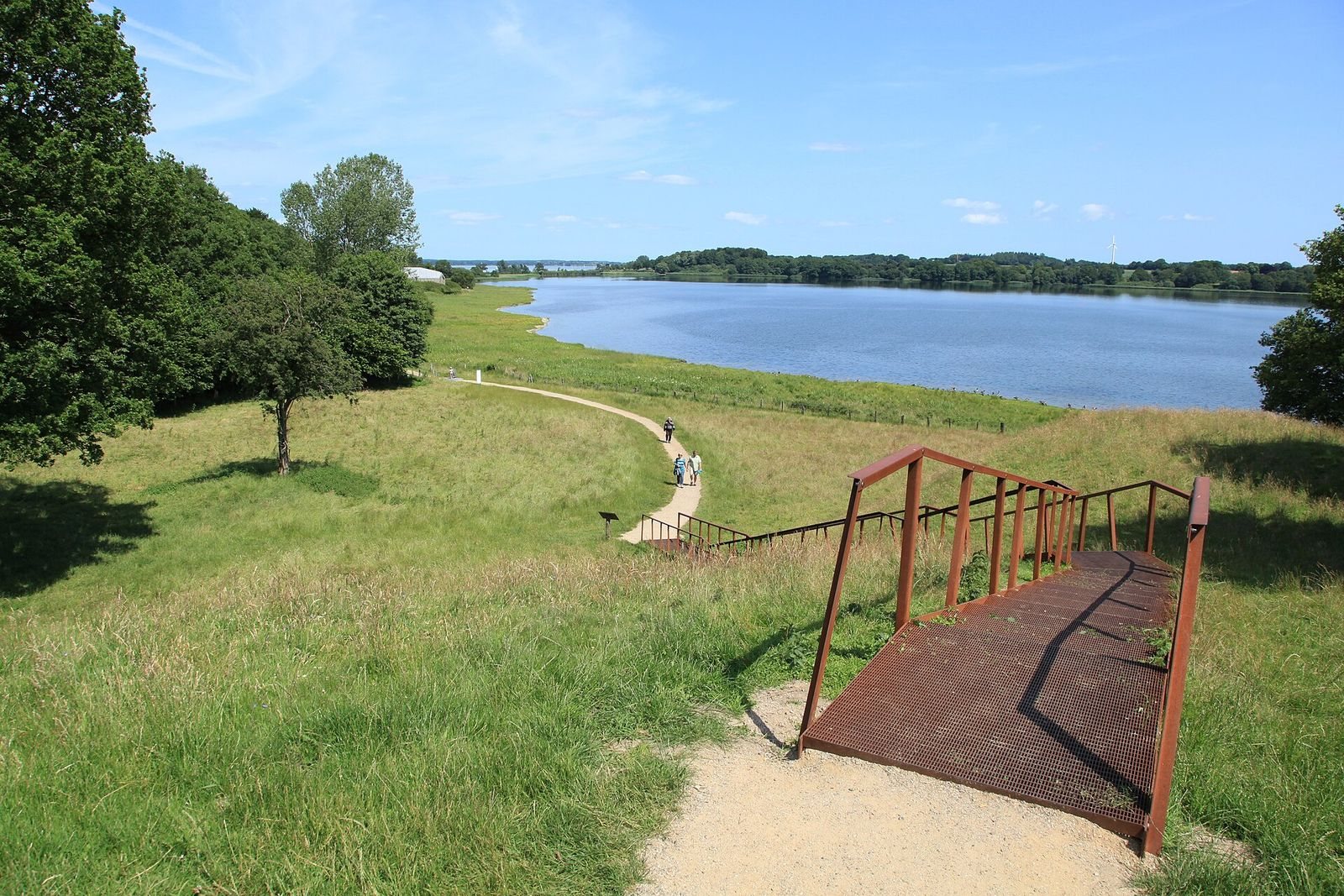
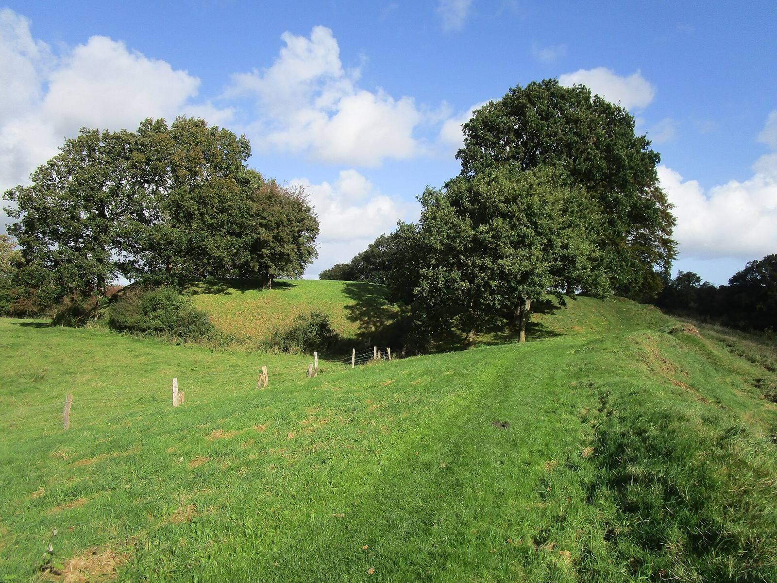
Danevirke extends for about 30 kilometres across the Jutland peninsula, principally between the Schlei to the east and the Treene and Rheider Au to the west. Its defenses combine earth banks, ditches, stone and brick walls, timber works and a barrier in the Schlei, with wetlands adding obstacles. Around 80 percent of the rampart lines survive, although some stretches are worn down or eroded.
Main rampart
Early earth banks
The main rampart runs about 5.5 kilometres southwest from the former Dannewerker Lake towards the Rheider Au valley. At four points, excavators have identified two early earth banks, each about six metres wide and respectively 1.8 and 2.2 metres high. Their dates are uncertain, but they probably belong to the Migration Period, the centuries around the transition from antiquity to the early Middle Ages. One interpretation regards them as parts of a single early building phase.
A later bank made from layers of grass, heather and peat was about 18 metres wide and four metres high. It had no ditch and continued west into the Krummwall. Its date was once placed around AD 700 based on timber, but radiocarbon analysis of heather sod supports construction in or before the fifth or sixth century. A possible palisade phase, commonly placed around AD 740, remains contested. Large postholes and reused timbers have been cited as evidence for a timber face against a newer earth bank, but a distinct building layer for such a fence has not been identified.
Fieldstone wall
The main rampart’s fieldstone wall was set in clay, with an earth bank about 17 metres wide and 3.5 metres high behind it. The wall was roughly 2.8 metres wide at its base and originally about three metres high. In front lay a flat strip three to four metres wide, then a ditch about five metres across and up to two metres deep. Builders used as many as 20 million naturally occurring surface stones, gathered from areas of glacial deposits and carried to building sites on higher, sandy ground.
Thick oak planks passed through the wall at intervals of about 1.8 metres and probably supported horizontal planks along its top. Excavation in 1983 found large stones in the lower courses and smaller ones above, all set in yellow clay. Regular tubular openings aligned with large postholes that reached 1.1 metres below the wall’s base. Stones lined the holes, and oak planks survived in groundwater. Work 50 metres to the southwest in 2010–2014 also found different stone sizes between courses, but identified grey clay below and yellow clay above. The relationship between the postholes and a proposed earlier palisade remains disputed. Timber from the wall has supported a date around AD 740, while other interpretations place its construction later.
Valdemar’s brick wall
Valdemar’s Wall extends for about four kilometres along the main rampart. This brick defense was originally four to five metres high and about two metres wide at its base, narrowing upwards, with the earth bank behind it raised. A flat strip and a broad ditch, around 22 metres wide and two metres deep, lay in front; a low outer bank stood beyond the ditch. Most of the wall is now buried beneath the main rampart. An 80-metre stretch has been exposed, and archaeological work identified its eastern end in 2010.
Western and northern lines
Krummwall
The Krummwall runs about 7.5 kilometres west from the main rampart to Hollingstedt on the Treene. Like the later earth bank of the main rampart, it was about 18 metres wide and had no ditch. Its irregular course follows the marshy Rheider Au lowlands. A stretch about 800 metres long is especially well preserved.
North Wall
The North Wall originally measured about 1.5 to 1.6 kilometres long and 14 to 15 metres wide. On higher ground, its timber face is known mainly from postholes, some reaching 1.5 metres deep. In the wet lowland near Pulverholz Brook, it consisted of a substantial oak framework. One front plank measured 5.5 metres long and 0.4 metres wide. A flat strip and a ditch about five metres wide and three metres deep lay in front. Around 700 metres survive, but the old bank is heavily worn, with an overgrown, eroding hedge along its crest.
East Wall
The East Wall had two stretches northwest and east of Kochendorf. Its full length is uncertain because it is not known whether the defense also crossed the present settlement. It linked the Osterbek lowland with Windebyer Noor, closing a passage between the Schlei’s Great Broad and the former Baltic inlet at Windebyer Noor and controlling access to the Schwansen peninsula. The western stretch was a stake-fronted bank without a ditch, probably built around the same time as the North Wall. The shorter eastern stretch was a simpler earth bank with a ditch and may be older. Erosion and removal have badly damaged or destroyed substantial portions.
Hedeby and connecting defenses
Semicircular rampart
The rampart around Hedeby is about 1,300 metres long and rises to more than ten metres in the south. Built from earth and sod, it has a ditch in front. Its earliest form was about four metres wide and two metres high; later enlargement brought it to around seven metres high, with a ditch six metres wide and at least two metres deep. Gates stood to the north and south. Further defenses lay southwest of the rampart, including ditches about 70 and 130 metres away and a more distant outer bank. Danish engineers greatly enlarged the rampart in 1848.
Connecting rampart
The connecting rampart runs about 3.3 kilometres between the main defenses and Hedeby. At its western end, an 800-metre section forms a double bank from the former Dannewerker Lake towards the motorway. A bow-shaped bank, about 500 metres long, lies between this section and the North Wall. Farther east, the line passes through Busdorf Gorge and the settlement of Busdorf before joining Hedeby’s semicircular rampart. The short gap at the junction was part of the original layout; planks had been laid across the marshy ground to make the crossing passable.
Excavation of the double bank identified two stages in its northern side, first about 13 metres wide and at least two metres high, then about 18 metres wide. Its southern bank was roughly 11 metres wide and survived to a height of two metres. At Busdorf, the bank grew through three stages from about 13 metres wide and four metres high to 20 metres wide and as much as 6.5 metres high. The final stage had a V-shaped ditch, 5.5 metres wide and up to two metres deep, six to seven metres in front.
Outworks and water barrier
Kograben
The Kograben, also called Kovirke, runs in a straight line for about 6.5 to 7 kilometres from Selker Noor to the Rheider Au lowland. It consisted of a stake fence about three metres high, with an earth bank about two metres high and seven metres wide behind it. A V-shaped ditch lay in front, about four metres wide and 2.5 to 3 metres deep. A gate four metres wide was found during motorway construction in 1972. A second gate, possibly crossed by the Ox Road, has been proposed.
Schlei barrier
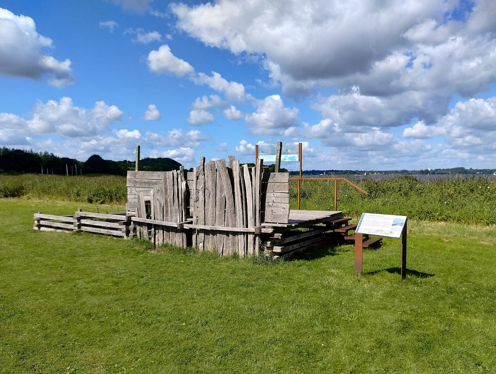
The timber barrier across the Schlei was built around AD 740. Underwater, it consists of nearly square sections formed from logs; its shape above water is unknown. It ran west to east from the southern tip of the Reesholm peninsula. One section reached into the Schlei’s Kleine Breite, while a longer one extended to Kockbarg, a rise on the lakebed east of Reesholm. Its original length has been estimated at 1.6 kilometres. The barrier was intended to obstruct or impede a northern crossing at a narrow point and help control shipping.
Thyraburg, the dam and gates
Thyraburg and dam
Thyraburg is a roughly rectangular raised plateau at the northeastern end of the main rampart, beside the former Dannewerker Lake, now a damp lowland. It measures about 57 by 46 metres and has a rectangular terrace about 54 by 31 metres on its southeast side. Shallow ditches along its western and northern edges are remnants of defensive ditches. Its date is unknown, although high-medieval pottery was found on the surface. Several hundred metres to the north, the North Wall and later connecting rampart ended on the lake’s eastern shore.
A timber dam was found in a hollow at the plateau’s western edge during the 1970s. Its oak-beam box structure measures about six by four metres and survived well in wet ground. It probably helped stabilize the main rampart and secure an east–west passage to Thyraburg. Above it lay remains of a construction dated to around AD 940, with a margin of several years; a timber spread to the north dates to AD 730. The excavated dam structure is displayed at the Moesgaard Museum.
Gates and roads
A gate discovered in 2010 lies where the historic Ox Road crossed the main rampart near Klein Dannewerk. The opening is six metres wide through the fieldstone wall and probably corresponds to the gate called Wieglesdor by Thietmar of Merseburg in 1018. It remained in use for at least 450 years and was probably filled during the thirteenth century. Excavators found a sunken, unpaved road with a sandy surface 3.4 metres wide and shallow depressions interpreted as wheel tracks. The trade route from Hollingstedt crossed the rampart here, as indicated by Eifel tuff, a stone transported to Schleswig in the twelfth century.
A further gate is known in the western East Wall, where an old military road crossed it about 200 metres east of Dürwade ford.
Changes from nineteenth-century military use
The main rampart’s present shape largely reflects work in the early 1860s. A ditch was cut into the flat strip in front of Valdemar’s Wall, the older ditch was filled, and the front of the rampart was made steeper. Defensive earthworks raised in 1848 remain along part of the main rampart between the Danevirke Museum and Thyraburg. Redoubt II at Busdorf Pond included a concrete artillery bunker described as the first of its kind in Europe. Redoubt 14, built for the 1864 defenses, was reconstructed near the museum and the historic Rothenkrug inn in 2001.