Dos Pilas: A Maya Royal Center in Guatemala
Site at a Glance
- Popularity
- High
- Country
- Guatemala
- Primary era
- Medieval
- Eras represented
- Medieval
- Civilizations
- Maya
- Site type
- City
On this page23 sections
History
Dos Pilas is a Maya archaeological site in Sayaxché, Guatemala, founded in AD 629 by an offshoot of Tikal’s ruling dynasty. Its major architecture belongs to the Late Classic period, one of the periods used to organize ancient Maya history. The city was established to control trade routes in the Petexbatún region, especially those along the Pasión River, and later became one of the two capitals of its ruling dynasty.
Foundation and changing allegiance
Before Dos Pilas rose to power, a Maya kingdom centered on Tamarindito and Arroyo de Piedra had dominated the Petexbatún region since the Early Classic period. Dos Pilas was founded within that kingdom’s territory and soon became the area’s leading city. Tikal’s king, K’inich Muwaan Jol II, placed his four-year-old son B’alaj Chan K’awiil on its throne. The new city adopted Tikal’s emblem glyph, a sign associated with a Maya ruling center or dynasty, and B’alaj Chan K’awiil fought alongside Tikal for about two decades.
In 648, Dos Pilas broke with Tikal amid warfare between the two cities and intervention by Calakmul. Calakmul’s ruler, Yuknoom Ch’een II, helped secure B’alaj Chan K’awiil’s position, and Dos Pilas became Calakmul’s vassal. A vassal ruler kept local authority while acknowledging the power of a stronger kingdom. Despite the political shift, the first two Dos Pilas kings continued to use Tikal’s emblem glyph.
War and regional expansion
Tikal’s ruler Nuun Ujol Chaak captured Dos Pilas in 672, driving B’alaj Chan K’awiil into five years of exile, probably at Calakmul. B’alaj returned in 677, when Calakmul had won a military success against Tikal. Two years later, Dos Pilas defeated Tikal. The victory strengthened the city, though neither kingdom secured a decisive advantage. Dos Pilas inscriptions describe the battle with images of pools of blood and piles of heads, and Calakmul probably supplied military support.
B’alaj Chan K’awiil also built alliances through marriage. He married a noblewoman from Itzan, while his daughter Wak Chanil Ajaw left Dos Pilas to restore Naranjo’s ruling dynasty. He attended ceremonies at Calakmul in 682 and 686. After Tikal defeated Calakmul in 695, Calakmul and its allies lost power. B’alaj died around this time. His son Itzamnaaj B’alam ruled briefly before his brother Itzamnaaj K’awiil took power in 698. Itzamnaaj K’awiil was born in 673, probably at Calakmul while his family was in exile; differing dates on monuments may reflect efforts to place his birth at Dos Pilas.
In 705, Dos Pilas again defeated Tikal and captured its ruler. The military commander Ucha’an K’in B’alam oversaw the victory. Tribute in labor and wealth helped fuel rapid growth, and Itzamnaaj K’awiil commissioned the El Duende complex after the campaign. Further victories against unidentified, probably smaller enemies were recorded for 717 and 721.
Itzamnaaj K’awiil died in 726 and was buried four days later. Ucha’an K’in B’alam, a prominent military and ritual figure, became ruler in 727, probably at first acting as regent for the young heir K’awiil Chan K’inich. Ucha’an ruled until his death in 741. In 735 he attacked Ceibal and captured its king, Yich’aak B’alam, who became a Dos Pilas vassal rather than being killed. Around this time Aguateca became the kingdom’s other capital, and both cities received monuments celebrating victories.
K’awiil Chan K’inich took the throne in June 741, 26 days after Ucha’an’s death. He fought Ahkul and El Chorro in 743, then Yaxchilán and Motul de San José in 745. Inscriptions name the captured rulers of El Chorro, Yaxchilán, and Motul de San José. Dos Pilas continued to control Ceibal, where K’awiil Chan K’inich presided over ceremonies between 745 and 747.
Revolt and abandonment
In 761, Tamarindito and other Petexbatún centers rebelled against Dos Pilas’s regional dominance. The city was abandoned, and K’awiil Chan K’inich fled; he is not mentioned again. The royal family probably moved to defensible Aguateca. Warfare spread through the Petexbatún region late in the eighth century, and almost all settlements of the former kingdom were abandoned. Inscriptions at Ixlú resemble those of Dos Pilas, prompting the suggestion that its lords may have been refugees from the region’s collapse.
A small refugee community later returned to Dos Pilas and built defenses using stone taken from abandoned temples and palaces. The settlement was overrun and deserted in the early ninth century, ending its history as an inhabited place. As Dos Pilas declined, Itzan, Cancuén, and Machaquilá appear to have regained strength. The name Dos Pilas is generally understood in Guatemalan Spanish to mean two wells or two water containers; Pierre Ivanoff proposed the alternative meaning two stelae.
Rediscovery and archaeological work
Brothers José and Lisandro Flores of Sayaxché first reported the ruins in 1953–54, although local people probably knew of them earlier. Pierre Ivanoff led an expedition in 1960 and published a book about the site in 1973. Excavations directed by Arthur Demarest and Juan Antonio Valdés ran from 1989 to 1994. Hieroglyphic Stairway 4 came to light in 1990, and a tomb attributed to Itzamnaaj K’awiil was excavated in 1991. Guatemala declared Dos Pilas a National Monument on June 12, 1970.
Remains
Setting and overall plan
The site covers about one square kilometre in the Petexbatún region of the Petén Basin, between the Pasión and Salinas rivers, at an elevation of roughly 160 metres. Forested ridges, wetlands, rivers, and lakes shape the surrounding landscape, where annual rainfall averages about 2,500 millimetres. Dos Pilas lies about four kilometres from the earlier settlement of Arroyo de Piedra. Its three monumental complexes follow an east–west axis: the Main Group stands at the western end, El Duende at the eastern end, and the Bat Palace between them. Major Late Classic buildings align with the region’s large cave systems.
Preservation across the site is poor. Before the final abandonment, stone was removed from major buildings for defensive construction. Hastily built, concentric walls of rubble enclosed the Main Group and El Duende complex, with a wooden palisade along their tops.
The Main Group
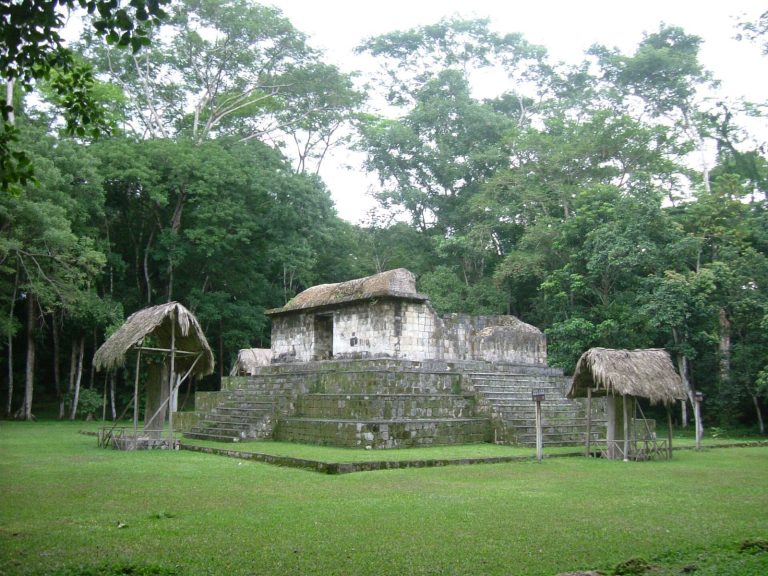
B’alaj Chan K’awiil laid out the Main Group around a central plaza, with buildings on all four sides. At least two were reached by staircases bearing inscriptions, known as hieroglyphic stairways. Smaller raised plazas to the south had more restricted access and were bordered by multi-room buildings; two further inscribed stairways were found there. Inscriptions at Dos Pilas use Ch’olan, a branch of the Mayan language family.
Plaza stelae
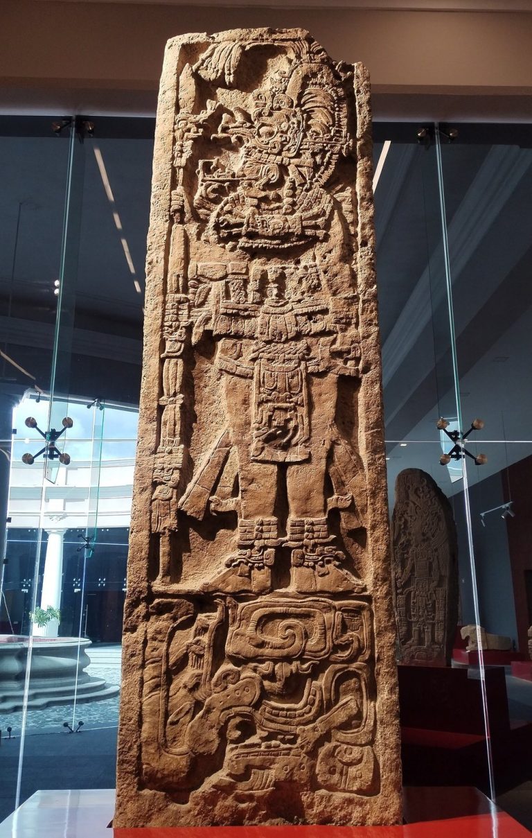
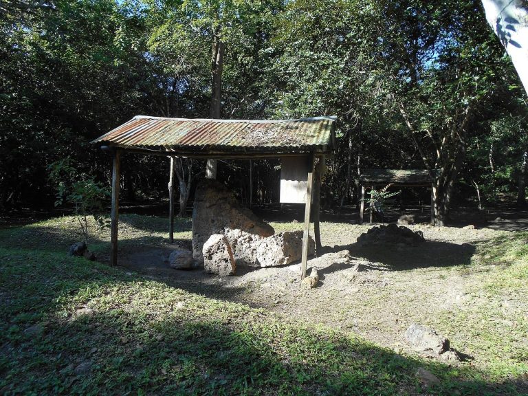
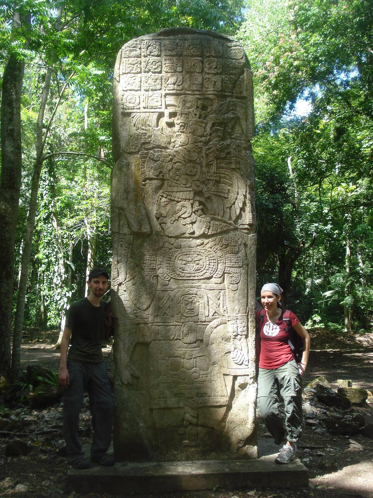
Stelae 1 and 2 stand in the plaza’s centre. A stela is an upright stone monument, often carved with images and inscriptions. Dated to AD 706, Stela 1 shows Itzamnaaj K’awiil in elaborate dress and records a defeat of a Tikal ruler. Its inscription is the latest known reference to Tikal recovered at Dos Pilas. Stela 2 is badly damaged and depicts Ucha’an K’in B’alam’s defeat of Yich’aak B’alam of Ceibal.
Structure L4-35 and Hieroglyphic Stairway 1
Structure L4-35 stands on the plaza’s west side. Hieroglyphic Stairway 1 begins at its base, and its inscribed steps recount events in Itzamnaaj K’awiil’s life.
LD-49 and Hieroglyphic Stairway 2
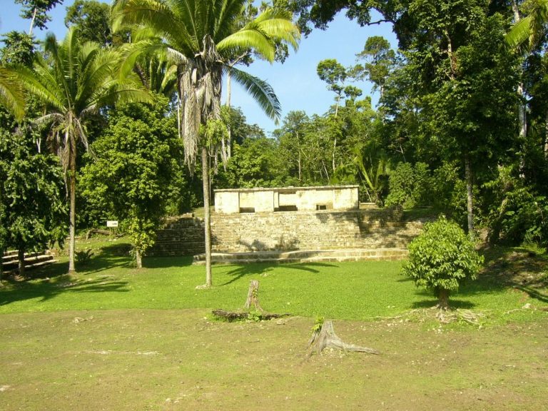
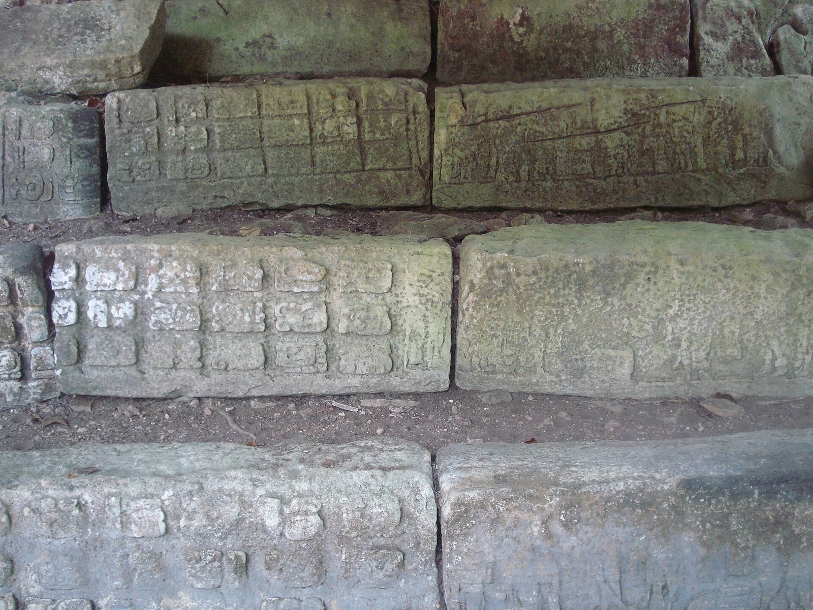
South of the plaza, the large pyramid LD-49, also called L5-49, rises about 20 metres above plaza level and is the largest building in the site core. Three temple sanctuaries stood on top. Its main staircase, Hieroglyphic Stairway 2, has at least 18 inscribed steps describing B’alaj Chan K’awiil’s arrival and life. Eight further steps found in 2001–02 led to a reassessment of the city’s early history and its break with Tikal. In January 2003, looters stole a section of Step 6 containing four glyphs, or written signs. Replicas now occupy its place, while the original steps were moved to a secure location.
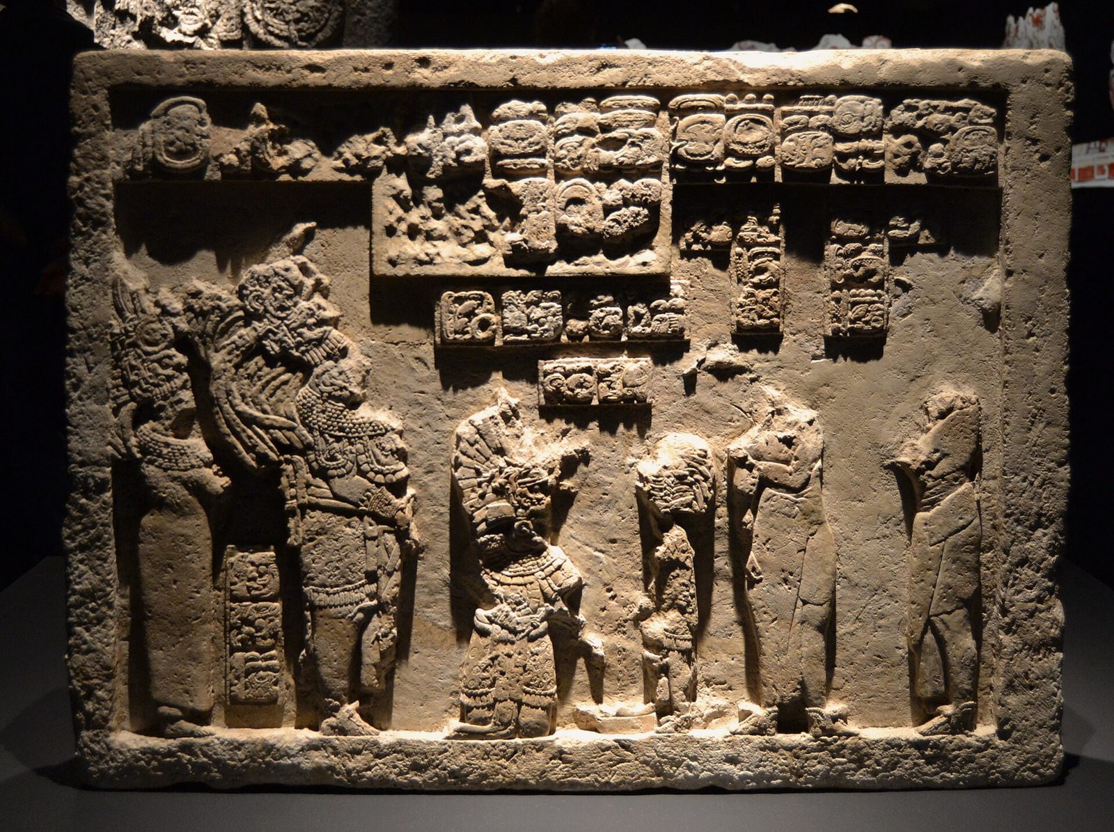
Inscribed Panels 6 and 7 flank the staircase at its eastern and western ends. Panel 10, well preserved, stands partway up the pyramid’s eastern side. It was originally a stela at Arroyo de Piedra and was moved to Dos Pilas after that settlement was conquered.
LD-25 and Hieroglyphic Stairway 3
About 120 metres south of the plaza’s southeastern corner, LD-25 is a temple-pyramid built by K’awiil Chan K’inich. Hieroglyphic Stairway 3 forms part of the structure, and its inscriptions recount victories in 743 and 745.
Structure L5-1 and the burial
Structure L5-1 is a ruined building on the plaza’s east side. A burial chamber lies nine metres below its summit. It held human remains with a heavy jade collar and wristlets, finely painted pottery, and nearly 400 shell-mosaic pieces from a headdress. The burial is believed to be that of Itzamnaaj K’awiil, partly because Stela 8 stands in front of the building and recounts his life, death, and burial. Erected there, the stela records his death and interment in 726.
The palace and Hieroglyphic Stairway 4
B’alaj Chan K’awiil’s palace stood about 100 metres south of the plaza, behind LD-49, but was dismantled for defensive construction by the settlement’s last inhabitants. Hieroglyphic Stairway 4 is on the palace’s eastern side. Its inscriptions recount B’alaj Chan K’awiil’s history and the founding of the Dos Pilas dynasty.
Ball court
A ball court occupies the plaza’s northeastern corner. Its side buildings, L4-16 and L4-17, carry heavily eroded Panels 11 and 12. Each panel shows a standing lord holding a spear.
El Duende and the Bat Palace
El Duende complex
About one kilometre east of the site core, El Duende’s largest pyramid incorporates a natural hill enlarged with terraces, giving it the form of a single massive structure. The terraces supported five pairs of stelae and altars, and smaller buildings flank the main platform. A stela on the hill below the complex bears a glyph associated with water. An underground lake lies beneath the hill, and the glyph probably refers to it; the complex’s original name was connected with this subterranean water source.
Bat Palace
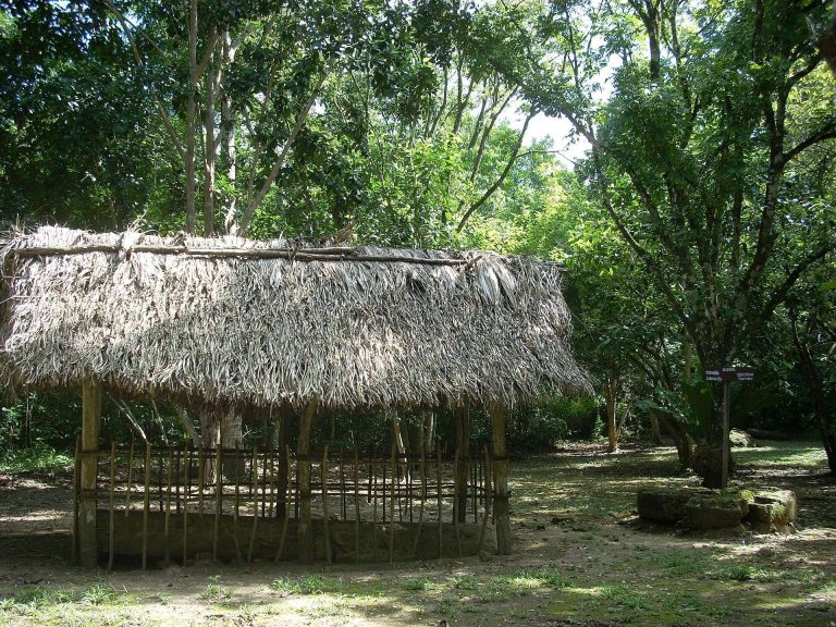
The Bat Palace, also known as the Murciélagos Group, lies about 500 metres east of the Main Group plaza and 500 metres west of El Duende’s pyramid. Excavations revealed an elite compound with ritual associations. A shrine marked a buried cave entrance within the palace. Two small stone temples flanked the complex entrance, which led to two courtyards enclosed by stone buildings with roofs made from perishable materials. A smashed royal throne was recovered there.
Cave systems
Twenty-two caves have been located near Dos Pilas, with a combined length exceeding 11 kilometres. Five major caves were excavated: Cueva de El Duende, Cueva de Río El Duende, Cueva de Río Murciélagos, Cueva de Sangre, and Cueva de Kaxon Pec. Their offerings included substantial quantities of Preclassic pottery, evidence of use before the city’s later monumental phase.
Cueva de El Duende
A plaza group just southwest of El Duende’s pyramid sits directly above the main chamber of Cueva de El Duende, which is distinct from Cueva de Río El Duende. A refuse deposit two metres deep points to intensive use during the Preclassic and Classic periods. The deposit also contained a ceramic vessel bearing the earliest dynastic text recovered at Dos Pilas.
Sterile yellow clay covers much of the chamber floor and appears to have been deliberately placed over the entrance to the cave’s longest tunnel. That passage runs beneath El Duende’s pyramid and joins Cueva de Río El Duende. Finely worked stone from nearby buildings blocked the cave entrance. Archaeologist James E. Brady interpreted the closure as a termination ritual, a ceremony marking the deliberate end of a place’s use. Entrances to Cueva de Sangre and possibly the western entrance of Cueva de Río El Duende were also blocked.
Cueva de Río El Duende
Discovered during excavations in 1991 after a landslide near the western edge of El Duende, this cave extends about 1.5 kilometres directly beneath the temple. It contained numerous artifacts and human bones and connects with the tunnel system beneath the complex.
Cueva de Río Murciélagos
The entrance to Cueva de Río Murciélagos lies about 75 metres northwest of the Bat Palace. In the dry season it is relatively dry, but after rain water can surge from the opening at about eight cubic metres per second. The cave drains the larger cave system and connects with Cueva de Río El Duende. A passage also emerges inside the Bat Palace, where a shrine marked the opening. The forceful seasonal flow has been interpreted as giving the cave ceremonial importance.
Cueva de Sangre
About two kilometres east of El Duende, Cueva de Sangre runs for more than three kilometres beneath a small hill. Two of its four entrances were blocked with rubble. The western entrance appears to have been the main entrance used by the ancient inhabitants. A small building stood above it, and a stone wall enclosed both the building and the cave opening. Preclassic pottery fragments were found inside.