Büyükkale: The Hittite Administrative and Palace Center at Ḫattuša
Site at a Glance
- Popularity
- Low
- Country
- Turkey
- Primary era
- Bronze Age
- Eras represented
- Bronze Age, Iron Age, Classical
- Civilizations
- Hittite, Phrygian, Roman
- Site type
- Military
- Remains
- Citadel
On this page22 sections
History
Büyükkale is a fortified ridge in Boğazkale, Türkiye, developed by the Hittites as the administrative and palace center of their Great Kings at Ḫattuša. The title Great King referred to the sovereign ruler of the Hittite state. The ridge was occupied from the late third millennium BC into Roman times, and its successive settlements reflect major changes in the history of the city.
Early settlement and Hittite rule
The earliest traces of settlement at Büyükkale predate 2000 BC, though their precise age is uncertain. Before Hittite rule, the inhabitants were probably Hattians, an early population of central Anatolia. The ridge was also occupied during the Karum period, the era of Assyrian merchant colonies and trade networks in Anatolia.
The wider city of Ḫattuša was destroyed around 1700 BC by Anitta, a ruler of Kaniš. Resettlement began about a century later, when the Hittite king Ḫattušili I refounded the city around 1600 BC. Around the turn of the seventeenth to sixteenth centuries BC, Ḫantili I probably built the city’s first wall, possibly in response to raids by the Kaška, a people north of the Hittite heartland who often fought the Hittite state.
Internal disputes began during Ḫantili’s rule and contributed to political and economic decline. The city burned again and gradually deteriorated. After 1500 BC, King Telipinu issued a proclamation regulating royal succession. The measures helped consolidate rule and made rebuilding possible, including the creation of Büyükkale’s first organized palace center.
The imperial palace and the end of Hittite rule
After 1280 BC, the palace center was destroyed again, probably during a struggle over the succession between the designated ruler Urḫi-Teššup, also known as Muršili III, and his uncle Ḫattušili III. Ḫattušili III and his son Tudḫaliya IV oversaw the rebuilding of the final imperial palace. Its buildings were destroyed around 1180 BC, at the end of the Hittite Empire.
Ḫattuša was abandoned in the early twelfth century BC. The relatively sparse furnishings at Büyükkale suggest that people left in an orderly way after about 1190 BC, taking valuable possessions while leaving heavier items, including tablets. Fires in the remains of the royal palace probably occurred after the city had been deserted.
Phrygian, Hellenistic, and Roman occupation
Phrygians, an ancient people and kingdom of Anatolia, resettled Büyükkale from the eighth century BC. Their first settlement on the ridge was unfortified; later occupants built fortifications and a palace. The end of the earlier phase is sometimes connected with Cimmerian incursions in the late seventh century BC, but that explanation remains disputed because both the proposed Cimmerian presence in central Anatolia and the date of Gordion’s destruction are uncertain.
A later Phrygian settlement began in the early seventh century BC. Its fortifications may have ceased to function around the transition from the sixth to fifth centuries BC, when the southeastern gate was destroyed. Occupation may have continued after the defenses fell out of use.
A fortified settlement existed on the ridge again in Hellenistic and Roman times. Finds place its beginning in the late second century BC and its end probably in the third century AD. The archaeological sequence gives no indication of a long break between Phrygian and Hellenistic occupation. Coins and pottery also show that people visited the plateau in Byzantine, Seljuk, and Ottoman times.
Excavation and the tablet archives
Travelers and archaeologists recorded Büyükkale during the nineteenth century. Charles Texier marked the fortress on a city plan in 1834, when he identified the nearby ruins as ancient Pteria. William John Hamilton reported pits or cisterns and pottery after visiting in 1836, and Carl Humann’s 1882 plan also showed the fortress. In 1893, Ernest Chantre found fragments of cuneiform tablets, writing made by pressing wedge-shaped signs into clay, and conducted a test excavation the following year.
Hugo Winckler and Theodor Makridi excavated from 1905 to 1907, concentrating on the tablets. Their finds led Winckler to identify the ruins as Ḫattuša. Work paused until 1931, partly because of the First World War. Kurt Bittel then led excavations through 1939. Work resumed in 1952 with Rudolf Naumann; Peter Neve directed investigations at Büyükkale from 1954 to 1966 and later took overall charge of the Ḫattuša excavations in 1978. Jürgen Seeher led from 1994, followed by Andreas Schachner in 2006. From Bittel’s campaign onward, excavators systematically recorded architectural remains from successive layers, and Neve published the first comprehensive architectural survey in 1982.
The tablets make Büyükkale important to Hittitology, the study of the Hittites, their language, history, and culture. The wider Ḫattuša collection comprises about 30,000 inscribed tablets. The oldest date to the Karum period, while most contain Hittite-period texts about trade, diplomacy, treaties, religion, and administration. Their contents illuminate both the Hittite state and the activities conducted at its royal center.
Remains
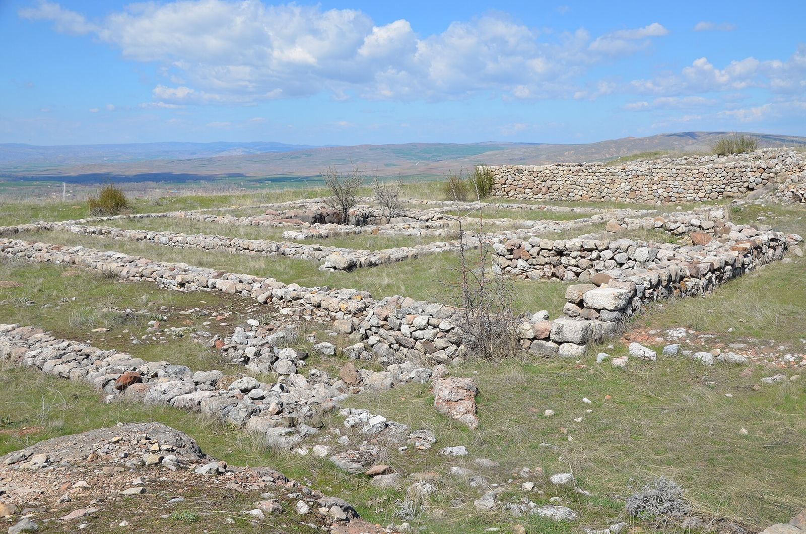
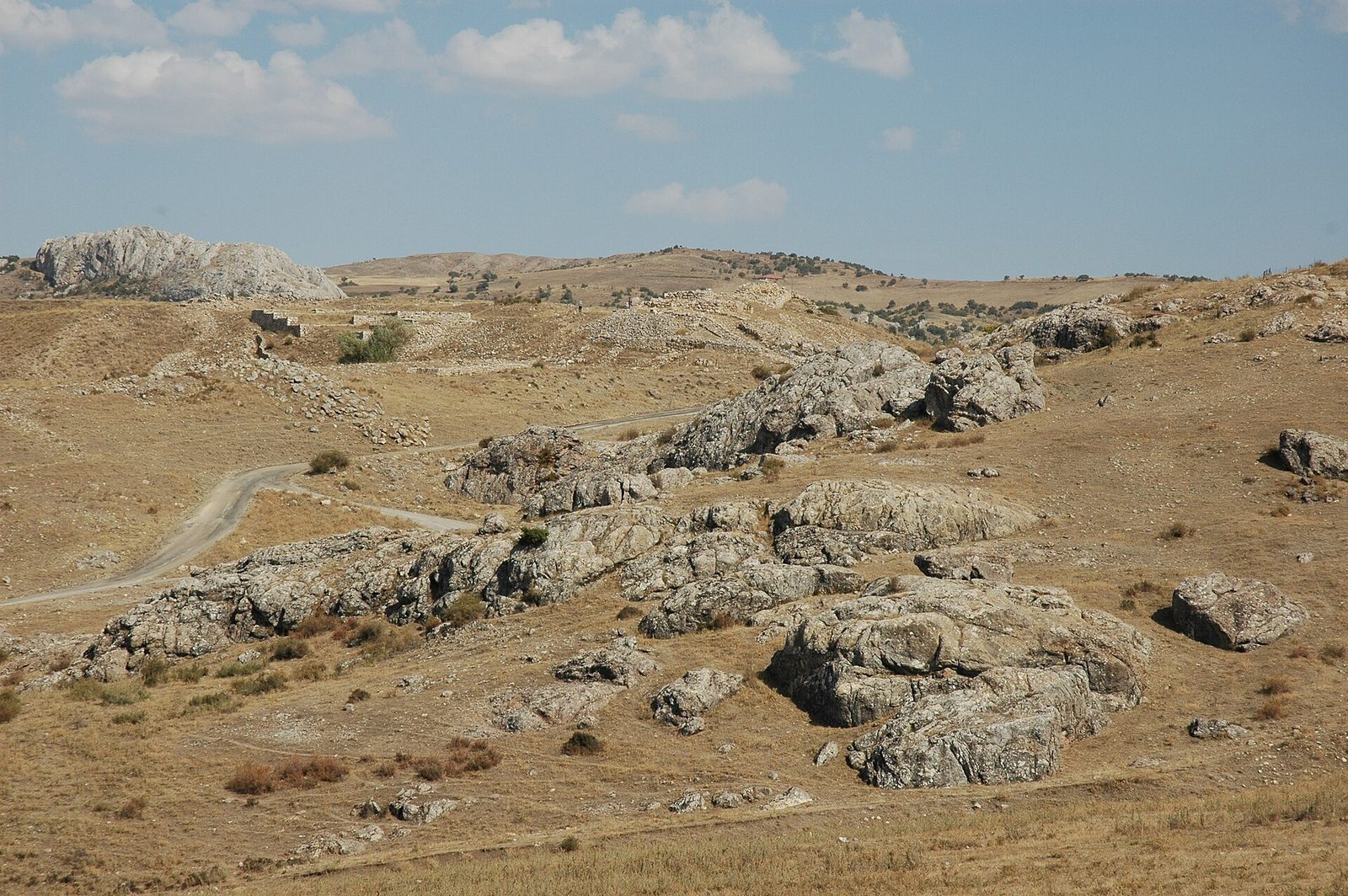
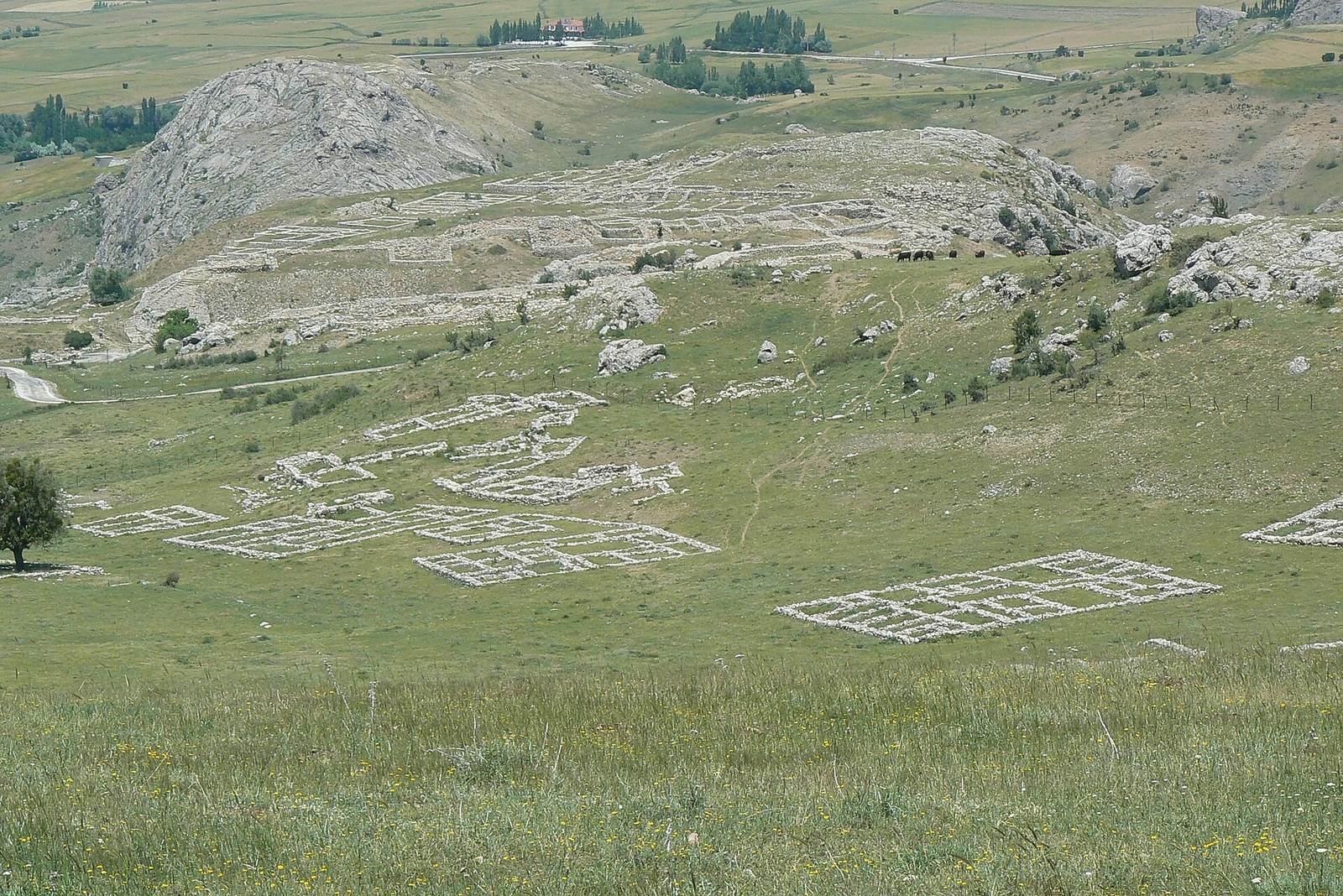
Büyükkale occupies a southwest-to-northeast ridge of Mesozoic limestone. Its high plateau measures about 260 by 150 metres, with a rocky high point in the northeast reaching 1,128 metres above sea level. Building and natural processes have levelled ground that was originally more uneven. Steep cliffs protect the north and east sides, while the southern and western slopes are gentler. At the eastern edge of Ḫattuša, the ridge stands between the Upper and Lower City and overlooks much of both. The Postern Wall, a city defense containing a secondary gate, forms the ridge’s southern boundary and links with the northern fortifications.
Early settlement and Old Hittite remains
Early pits and foundations
Round pits cut into clay mark some of the earliest activity on the plateau. They occur in the south and southwest, near the areas later occupied by the Upper Citadel Court and Buildings M and N. The pits range from 0.25 to 0.95 metres deep and from 0.60 to 1.95 metres across. They were probably used for storage before serving as refuse pits. Their contents included fragments of a Copper Age storage jar, painted Alişar III pottery, and handmade and wheel-made pottery. Their date remains uncertain.
In the pre-Hittite layers, rubble-stone foundations occur mainly in the south. Their uses are unclear, although a substantial wall facing south near the later Citadel Gate Court may have had a defensive purpose. Finds include handmade and wheel-made pottery, thin-walled vessels known as flowerpot ware, and a spatula-shaped bronze tool.
Houses of Layer Vc
Near the later Lower Citadel Court, houses had clay floors and stone foundations, with some mudbrick courses still in place. The largest had eight rooms arranged over three terraces. It yielded two door leaves, each measuring 85 by 180 centimetres, that had been completely charred. The building may have belonged to a high-status resident; another house may have had two storeys.
These houses contained storage jars, tableware, hearths, pot stands, a stone casting mould, a bone pin, seals, and burnt grain. A human skeleton was also found. Fire destroyed the buildings, and radiocarbon analysis of wood fragments dates them to between 1800 and 1600 BC. Later construction in Layers Va and Vb partly dismantled and levelled earlier remains, leaving only sparse foundations.
Early Hittite buildings and fortifications
Layer IVd includes a wall more than four metres wide near the Lower Citadel Gate, the earliest identified fortification on the ridge. The largest surviving building of this phase measured 23 by 21 metres and contained at least twelve rooms around a courtyard with a hearth. Some rooms may have had upper storeys. The courtyard yielded tableware, part of a red-deer antler apparently associated with a meal, and a child’s skeleton indicating burial use. Other finds included decorated jugs, bowls, painted tower-shaped vases, animal-shaped pouring vessels, a grindstone, bronze pins, lead sheet, and more than 100 clay pieces bearing seal impressions.
The later Postern Wall was built in the final phase of Layer IVc and formed the earliest Hittite city fortification. From Büyükkale it extended northwest around the developing Lower City, partly beneath modern Boğazkale, before joining the northern ridge wall. It was built without mortar, with two rubble-stone faces and a core of gravel and fieldstones. The planned total thickness was 7.5 metres. At the ridge’s southwestern foot, a gate had inner and outer passages 3.6 and 3.8 metres wide. Two unusual clay pipes found nearby, each closed at one end and pierced by a narrow opening, may have served to ventilate kilns.
Scattered sections of the wall remain visible on the ridge, and another eastern stretch shows that it continued for at least 100 metres. A 37-metre tunnel climbed steeply from the southeastern foot toward the later Upper Citadel Gate. It was built from dressed rubble using corbelled masonry, in which successive courses project inward to span an opening. The tunnel stood 4.0 to 4.3 metres high and rose at an incline of as much as 35 degrees.
The imperial citadel
Fortress walls and gates
The monumental palace and fortress of Layer III occupied the entire plateau. Its encircling wall had 21 towers or bastions, projecting defensive structures generally aligned with natural rock outcrops. At the south, the new wall replaced the Postern Wall at a higher level; elsewhere it followed the uneven terrain. The southern section was about seven metres thick, with towers up to 12 metres wide. Other wall sections were about five metres thick, and the towers projected between 3.5 and 9 metres. Depending on their storeys, the walls may have reached 10 to 12 metres high and the towers 14 to 18 metres.
The southern wall rested on the earlier Postern Wall’s foundations. Elsewhere, builders cut stepped foundations into bedrock, sometimes adding an outer ledge to keep the masonry in place. Rubble stone formed the lower courses, while carefully cut stone, known as ashlar, was used at gates and tower fronts. Above the stonework, a timber frame with mudbrick infill formed a double-faced wall. The wall tops probably had clay paving and a walkway with battlements.
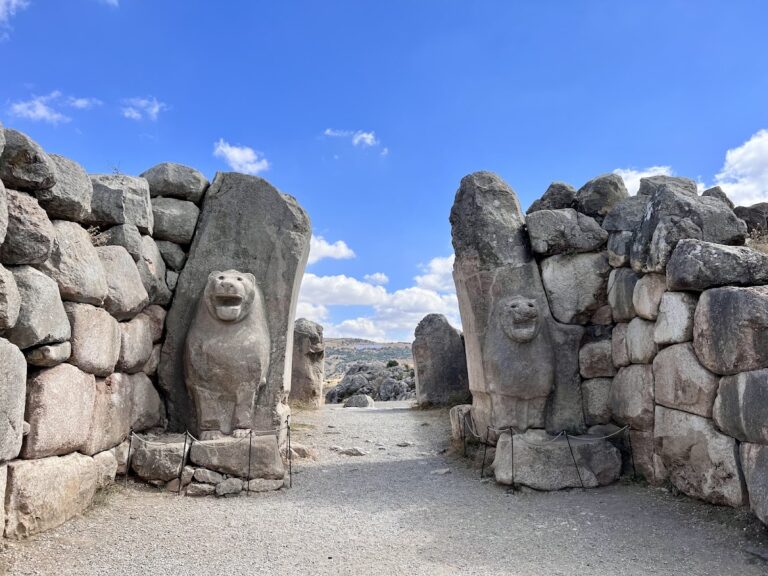
Entrances opened to the southwest, south, and east. The principal southern gate was approached by a raised structure from the southwest. Its reconstructed stone base survives east of the modern road and supported a tall mudbrick upper section, perhaps with a timber covering for carts. The approach led into a forecourt and then through two gateways. Flanking towers held a guardroom and stairs to upper floors and the wall walkway. The design resembled the Lion, Sphinx, and King Gates of the Upper City, and lion sculptures stood at the outer passage. A fragment of a lion relief and four incomplete pieces of a stone with Luwian hieroglyphs have been found on the slope.
Phrygian construction of a deep well destroyed the southwest gate, leaving its threshold and a door-frame stone. The gate connected directly with the Lower City by a path running alongside the wall. Büyükkale’s only water source lay below this entrance. The eastern gate, between Building K and the northern wall, gave direct access to the upper palace and royal quarters without passing through the lower courts.
Courts and formal approach
The southern entrance opened into the roughly triangular Citadel Gate Court, bounded by fortress walls to the south and west. From its northeastern entrance, a red-paved route crossed the Lower Citadel Court and continued through gates and the Middle and Upper Citadel Courts. This sequence formed the formal approach to the ruler’s reception area. Most ridge buildings had at least two storeys, and the slope often placed their entrances on an upper level.
Colonnaded halls lined both sides of the Lower Citadel Court. On the northwest stood Buildings M, N, and H; Buildings G and A occupied the southeast side. Buildings M and G had similar plans and may have served representative functions or housed senior court officials. Building N, between M and H, was a small gatehouse at the end of the ascent from the southwest entrance.
Buildings B, C, and H
A passage at the northern corner of the Lower Citadel Court led to Buildings B, C, and H. Building B contained ten rooms on different levels, and one room yielded 24 fragments of cuneiform tablets. Roughly square Building C had six rooms, pottery fragments, and a heavily worn carved slab bearing the name Tudḫaliya, probably Tudḫaliya IV. The slab had been reused, perhaps as a threshold. Its central room was sunk below the surrounding floor and contained a basin for collecting water. These features suggest that Building C, possibly together with Building B, had a religious function.
Building H, reached by a separate lane southwest of Building C, had four long rectangular rooms across two floors. It is interpreted as a storehouse and was connected to Building C by a retaining wall. A multi-storey gate at the northeastern end of the Lower Court led to the Middle Court. It contained twelve rooms and had ashlar bases; lion sculptures flanked it. A fallen lion fragment and part of a framed royal name belonging to Tudḫaliya were found in the debris.
Middle Court and Building D
The Middle Citadel Court formed the inner palace area, with rows of columns on its northwest, northeast, and southeast sides. Building D stood behind the northwestern row and connected to the gatehouse by a passage. It measured 39 by 48 metres and initially had 14 rooms. Additions included an entrance forecourt, a main entrance, a side entrance near Building B, and six smaller rooms that served as entrance and side chambers.
Long rooms in Building D formed a near-square base measuring 35.3 by 35.5 metres despite a floor-level difference of more than six metres across the slope. They supported the Great King’s audience hall, whose upper level is reconstructed with wooden pillars or columns, probably arranged in five rows of five. Sculpture fragments, including lions and bulls, found near the entrance may have served as bases for the columns. Tablet fragments and 280 sealed clay pieces, or bullae, were also recovered. These finds support the interpretation of Building D as a formal reception building with associated archive and storage rooms.
Buildings A and K
Building A, at the southwestern edge of the Middle Court, measured up to 36 by 34 metres. The slope divided it into upper and lower sections. The upper section had two long rooms parallel to the court, while the lower contained five long rooms at right angles to them. Four larger rooms had limestone and granite bases with holes for fittings, probably used to support shelving. About 4,000 tablet fragments came from the building’s debris and clay floors. Building A is interpreted as a storehouse and archive; its upper rooms may have served as offices or a school for scribes.
East of Building A, a small gate opened to another court that could also be reached from the fortress’s eastern entrance. Building K, which continued the western fortress wall, measured 27.5 by 22.5 metres. Its central portion had three rooms, while eleven chambers in two rows were added after a fire. More than 200 tablet fragments point to an archive. The building may also have served a representative purpose linked to the eastern entrance.
Upper Court and Buildings E and F
A probable row of columns separated the Middle and Upper Courts. An artificial rock ledge, 24.5 metres long and up to 2.2 metres high, bounded the Upper Court on the southeast. Pillar bases beside and in front of the ledge indicate a pillared hall, designated Building L. Remains at its southern end, including hinge-stone fragments and a carved lion’s head, may mark a monumental gate.
Buildings E and F stood northwest of the Upper Court at a lower elevation. Both had two storeys and entrances on the court side. Building E measured 26.6 by 22.2 metres and had 13 rooms. Its largest central room was approached through a forecourt that may have been a columned hall; surrounding rooms and lower rooms probably served as storage or archives. Numerous tablet fragments came from two lower rooms. Building F, at the end of the northern terrace, measured 33.1 by 29.2 metres. Five long parallel rooms at its center may have supported a columned hall above. The buildings are interpreted as private quarters for the royal couple.
South Lane and Building J
The South Lane ran northwest of Building K, between the fortress wall and Building J to the south and the backs of Buildings A and G to the north. It was first paved with stone, over a drain that carried water through the Citadel Gate Court toward the western slope. A later clay surface, 35 to 50 centimetres thick, contained another drainage system. Building J formed part of the fortress wall about ten metres west of Building K. It was 20 metres long and contained ten small rooms; its southern section and adjoining wall have collapsed.
A basin in the South Square, roughly parallel to Building J, measured 24 metres from east to west. It was five metres wide at its eastern end and 1.5 metres at the west. Votive jugs, cups, and bowls found inside point to a religious use, while the basin may also have supplied water to the fortress.
Archives and painted fragments
Tablet archives were found in several citadel buildings, including A, E, and K. The tablets include secular and religious writings in Hittite and other ancient languages of Anatolia and neighboring regions. A palace-service instruction known as the Mešedi text describes a ruler’s court and a neighboring court of royal guards. Proposed matches connect these spaces with the Upper and Middle Citadel Courts, but the identifications remain uncertain. Small fragments of wall paintings, dated to the second half of the thirteenth century BC, came from a pit near Building G and debris from the southern fortification. They preserve rosettes, spirals, and bands in black, white, red, blue, and ochre yellow.
Phrygian and later settlements
Phrygian buildings and defenses
The earliest Phrygian settlement occupied the southern part of the ridge and extended into the former Upper Court. Its houses had one or two rooms, and some were partly dug into the ground. Most were later built over, leaving limited traces. The ruler’s residence was probably in the upper-court area.
Later Phrygian defenses followed parts of the earlier layout across the southwest, south, and southeast. Unlike the Hittite timber-framed walls, they were solid structures, mainly of rubble stone, with brick used at one gate. Wall sections reached 35 metres, while separate towers probably rose above them. Older and newer gates stood in the west and southeast. The monumental later southeastern entrance included offering places, reliefs, and a religious niche with a statue of Cybele, an Anatolian mother goddess. A stairway linked a well at the southwestern spring with the southwestern bastion.
Two interior walls divided the settlement into three areas. The northern area contained a trapezoidal palace measuring about 30 metres east to west and 16 to 25 metres north to south. A five-room entrance vestibule led from a northern courtyard to a central room measuring 8 by 11 metres, surrounded by rooms in double rows. Economic buildings stood to the west. Other areas contained rectangular buildings interpreted as workshops, storehouses, administrative or religious buildings, as well as less regular houses. The Phrygian houses were built of rubble stone.
Hellenistic and Roman defenses
Foundations of southeastern and southwestern walls belong to the Hellenistic and Roman settlements. These defenses had no towers or projecting structures and used facing walls with a rubble-filled core, a method also used in the Phrygian walls. Buildings adjoining the defenses may have served as guardrooms, while other structures inside the enclosure may have been residences.