Isar: An Ancient Settlement and Necropolis in North Macedonia
Site at a Glance
- Popularity
- Low
- Country
- North Macedonia
- Primary era
- Classical
- Eras represented
- Iron Age, Classical, Medieval
- Civilizations
- Byzantine, Kingdom of Macedon, Roman
- Site type
- City
On this page17 sections
History
Early settlement and Hellenistic growth
Isar is an archaeological settlement and burial ground on a hill southwest of Marvinci in North Macedonia. Its occupation extended from the seventh century BCE to the sixth century CE, while research on its cemeteries suggests that activity may have begun as early as the tenth century BCE. The settlement’s ancient name remains uncertain. Archaeologist Victoria Sokolovska identified it as Dober, while finds from the fourth century BCE have also been taken to indicate the name Idomenae.
From a small group of dwellings, Isar developed into a town and a regional center for economic, strategic, and religious activity. Farming and animal husbandry were important, and ore was processed at the settlement. Pottery production was established by the fourth century BCE and continued into the Roman period, reaching a peak in the third century CE.
During the Hellenistic period, the era following Alexander the Great’s conquests, the town maintained commercial and cultural links with Corinth, Asia Minor, Thasos, Rhodes, and major Macedonian cities such as Pella, Beroea, Thessalonica, and Amphipolis. Coins from these cities circulated at Isar. Local artisans produced household pottery, mold-made Megarian ware, and terracotta figures. The oldest identified settlement layer was destroyed by fire, probably near the beginning of the third century BCE; this may have been connected with the Celtic invasion of 279 BCE. The final Hellenistic phase in excavated areas ended in widespread building collapses and stagnation, a decline that coincided with Rome’s subjugation of Macedonia.
Roman town and Late Antiquity
Isar later recovered under Augustus, the first Roman emperor. In the first century CE, it was an autonomous polis, or Greek civic community, with a population of Roman settlers. Its civic magistrates, called politarchs, reflected a Greek-Macedonian form of local government. Trade remained active with cities in Asia Minor, Thessaly, and Macedonia.
A Macedoniarch, a senior official in the Macedonian koinon, the collective political institution of Macedonian communities, built a temple dedicated to Heracles and associated with Emperor Commodus. The town expanded in the early Roman Empire. Around the middle of the third century CE, it suffered extensive damage, probably during the Gothic invasion of 268, but was rebuilt soon afterward and continued to prosper. A fortified enclosure was later established at the southeastern foot of the hill, probably during the reign of Diocletian, amid wider fortification works in the Balkans.
The southern cemetery was used from the end of the fifth to the middle of the second century BCE, and again in the third and fourth centuries CE. Later burials disturbed many earlier graves. Some grave goods point to the arrival of a cultural group whose burial objects differed from Roman customs. Buildings and finds indicate activity at Isar in the fifth and sixth centuries CE, although its duration and intensity in this period remain uncertain.
Archaeological study and protection
Finds from Isar, including material from the older Iron Age, came to light during the First World War. Surveys registered the site in 1952–53, and archaeologist Borka Josifovska-Dragojević studied and published chance finds, including inscriptions and coins. The Archaeological Museum of Macedonia in Skopje carried out a rescue excavation at Porta in 1961. Excavations have continued since 1977 as part of a project on the Vardar Valley in the first millennium BCE. Finds from excavations between 1977 and 1986 and from later work are held at the Museum of Macedonia; chance finds are kept at the Museum of the Gevgelija region. Isar was declared cultural heritage of Macedonia in 1957, with the decision supplemented in 2003.
Remains
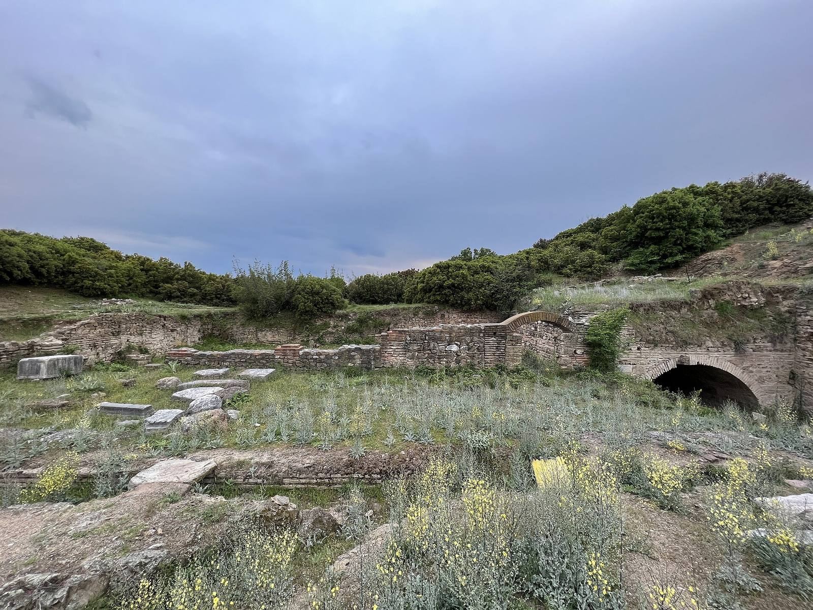
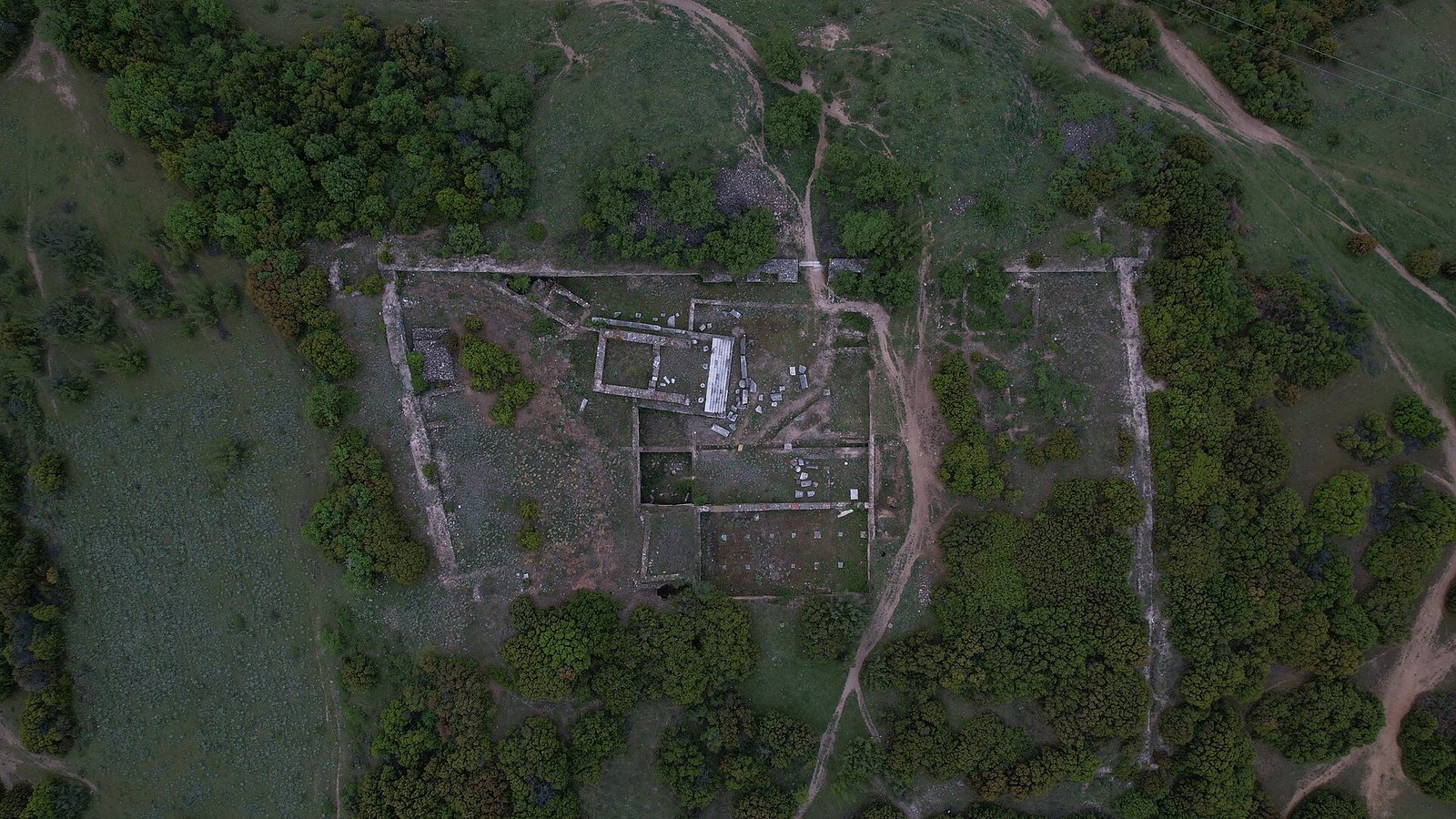
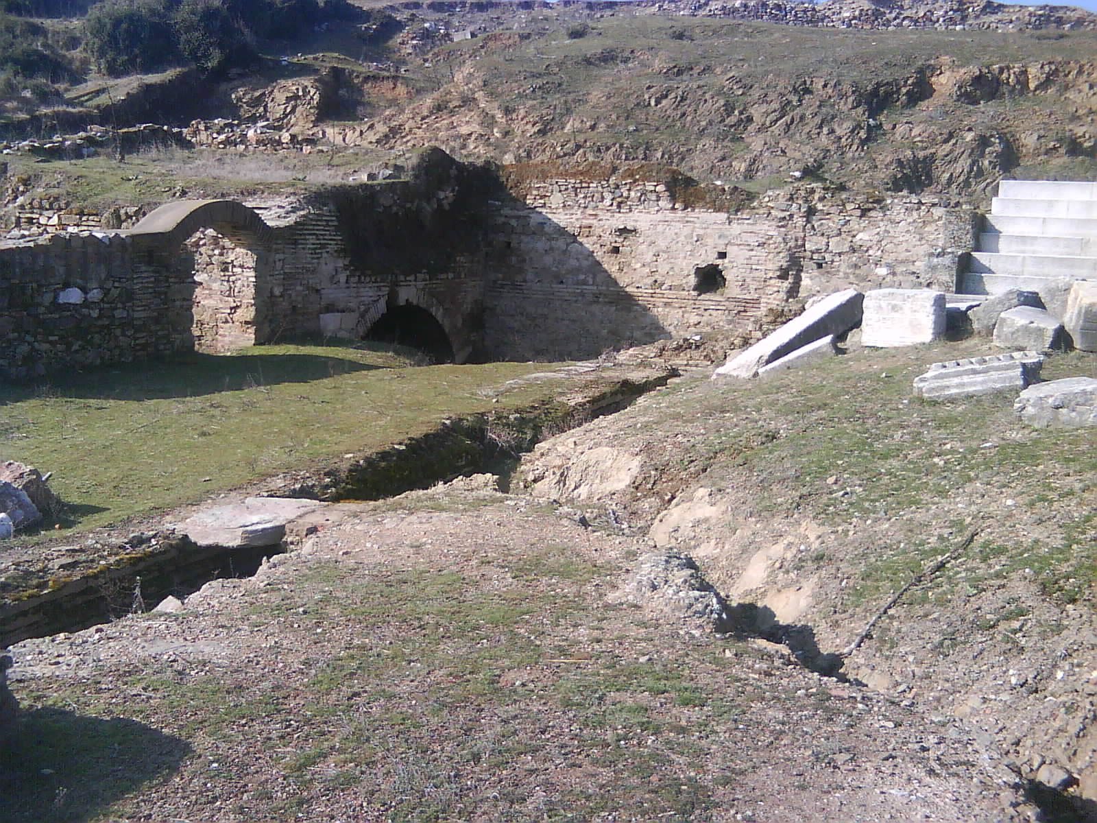
The settlement’s remains extend across a hill overlooking the Valandovo basin and the Vardar valley. Houses are most concentrated on the summit, while other parts of the settlement occupied terraces and the surrounding slopes. The excavated buildings include rectangular houses, first built with wattle-and-daub walls and later with dressed stone set in mud. The archaeological site is partially preserved.
Settlement layout and defenses
Hilltop settlement
The settlement’s earliest known extent covered about five hectares across Isar I and Isar II. Isar I, the acropolis or upper fortified area, occupied the hill’s highest point, 131 metres above sea level. Steep slopes border three sides, while a broad saddle gives access from the south. Defensive walls enclosed the acropolis throughout the Hellenistic period. Rows of large storage jars, sunk deep into the ground along the western edge of the plateau, were used to store grain.
Isar II and the terraces
Houses have been identified in sector 5 of Isar II, including in test trench 6. A defensive wall may have protected the western terrace there, although this interpretation is based on the terrain rather than confirmation from excavation. The settlement later extended onto nearby terraces.
Houses and public structures
Residential buildings
Investigated Hellenistic buildings are mainly houses with rectangular plans. Some follow the pastas layout, organized around a covered passage or porch. The earliest known construction used walls of woven branches and clay, supported by heavy beams. From the middle of the fourth century BCE, builders also used regularly laid, dressed stone held together with mud. Mortar was not used to bind Hellenistic walls, although it was applied as a coating over rough stone. Three or four occupation layers have been identified in excavated areas.
Water supply and baths
On the northeastern terrace, in sector 8, residential buildings stood beside an aqueduct. In the Roman period, water was brought from Vrezhi Dol. Springs near Yanova Cheshma supplied drinking water, while the Vardar provided water for irrigation. The remains also include urban baths.
Temple and fortified enclosure
A temple stood at the southwestern foot of the acropolis. Architectural blocks found in sector 1 and reused in later walls indicate that substantial public or private buildings had stood nearby. At the southeastern foot, a defensive wall enclosed a later fortified area. Its masonry reused monuments and blocks with architectural decoration. The latest identified buildings within this area had irregular plans and stone-and-mud foundations incorporating reused blocks.
Other structures
On the northwestern terrace, excavators found a building with a floor formed from fitted pieces of stone. Buildings are also known at the northeastern foot of the hill; finds indicate use during the fourth century CE, though their construction date is uncertain. The site includes the remains of a stadium built in Roman style.
Burial grounds and finds
Cemeteries
The burial grounds occupy a broad area around the settlement, near its outermost houses, and contain more than 200 graves. An ancient route from the acropolis passed through the southern cemetery toward Grchishte, also known as Gloska Chuka, and the Vardar. At this point, the river’s rocky bed could be crossed.
The 2008 tomb
A tomb excavated in 2008 contained six intact ceramic urns and a rare burial in a bronze urn. Its finds included a bronze head of Silenus, shown with a curly beard, furrowed brows, and a wreath of grapevines, as well as a bronze horse’s head. Gold leaves worked in relief had decorated the deceased’s chest. Other objects included gold earrings, ceramic vessels, and terracotta figures and vessels intended for the dead’s afterlife.
Pottery, sculpture, and other objects
Pottery moulds include examples for Megarian ware, a mold-made type of pottery. Several well-preserved terracotta heads of women have distinctive local features. The products of one local potter can be recognized by their consistent clay and vessel shapes; that potter used a crab as an emblem. A female statue is represented by its surviving base, which carries the sculptor’s signature; the sculptor was born in Beroea.
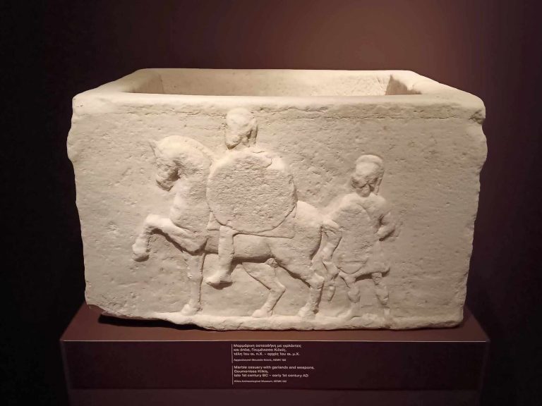
Other finds include marble statues and reliefs, portrait tomb monuments, inscriptions, and coins. Imported pottery came from older Iron Age graves, while objects from later periods include amphorae from Thasos and Rhodes and pottery associated with Corinth and Asia Minor. A coin of Byzantine emperor Isaac Angelos, who ruled in the late twelfth century, was found in excavation square K15.