Villa rustica of Büßlingen: A Roman Rural Estate in Germany
Site at a Glance
- Popularity
- Low
- Country
- Germany
- Primary era
- Classical
- Eras represented
- Classical
- Civilizations
- Roman
- Site type
- Domestic
- Remains
- Villa
On this page19 sections
History
The Villa rustica of Büßlingen was a Roman rural estate in Tengen, Germany, founded around AD 75–80 in Germania Superior, the Roman province of the upper Rhine region. A late first-century bowl of Terra Sigillata, fine Roman tableware with a smooth red surface, supports this date. The estate is the second-largest known Roman farm complex of its kind in southern Germany, after the villa at Meßkirch. It is also the only known example in which all buildings identified through aerial archaeology have been excavated.
Foundation and agricultural economy
Some pottery from the site may be Celtic in origin, raising the possibility that Romans and Celts lived at the estate together. The earliest buildings may have been made of timber, but finds from Büßlingen do not confirm this. Stone construction is considered likely from the mid-second century, based on comparison with villas in the surrounding area.
The estate lay between the Roman settlements of Schleitheim, known as Iuliomagus, to the southwest and Orsingen to the east, each about 15 kilometres away. Stein and Eschenz, the latter known as Tasgetium, lay farther southeast. The frontier forts at Hüfingen and Tuttlingen were about 24 kilometres away, while other Roman settlements and estates at Storzeln, Binningen, Tengen, Beuren, and Watterdingen were much closer, within roughly 1.5 kilometres.
The surrounding soils were rich in clay and nutrients but poorly aerated and prone to waterlogging. Elevation around the Hegau volcanoes and the Randen also shortened the growing season, making the land less suited to crops. Livestock raising was probably the estate’s main activity. Cattle bones indicate that oxen were kept, possibly for pulling draft teams, while pig bones include older females suitable for breeding.
Estimates suggest that about 40–50 people lived and worked in four buildings with roughly 1,230 square metres of usable space. The cultivated area may have covered as much as 100 hectares, supporting around 50–60 cattle, 100 sheep or goats, and 50 pigs. The expected agricultural surplus could have supplied the settlements of Tasgetium or Iuliomagus.
Roman occupation and later use
A hoard of 100 coins found in a wall of Building 8 was collected and left there by a resident between AD 240 and 259. Its value was about one and a half months’ pay for an ordinary Roman soldier. Alamanni, a group of Germanic peoples associated with the region in late antiquity, moved south after AD 260 and may have destroyed the estate, leaving its owner unable to recover the coins.
An Antoninianus, a Roman coin used in the third century, in the group may have been minted no earlier than AD 262 or in mid-263, although its association with the hoard is uncertain. If it belonged to the hoard, the estate’s end could not have come before 263. Roman use lasted about 190 years, or six to seven generations.
Activity after the secure period of Roman occupation remains uncertain. Romans and Alamanni may both have used the site in the third and fourth centuries. A knobbed bow brooch, a dress fastener with an arched bow and knob-shaped end, provides evidence for fourth-century use. Postholes in the main house courtyard may relate to a building from the early Migration Period, the era of population movements across Europe in the later Roman and post-Roman centuries. The evidence does not establish lasting settlement: the estate may have served as a Roman burial place, or the Alamanni may have reused its agricultural infrastructure without occupying the residential buildings.
Discovery and investigation
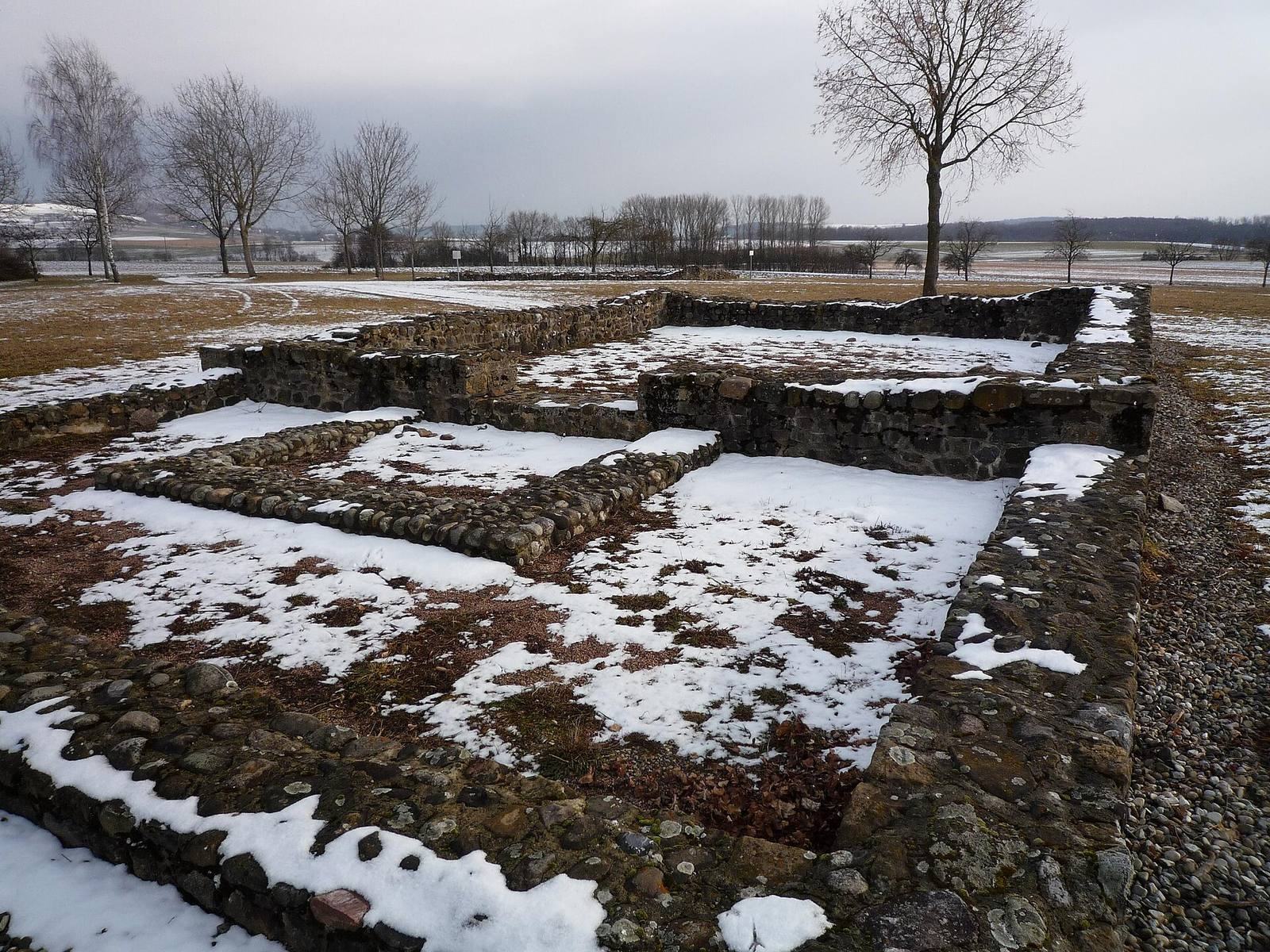
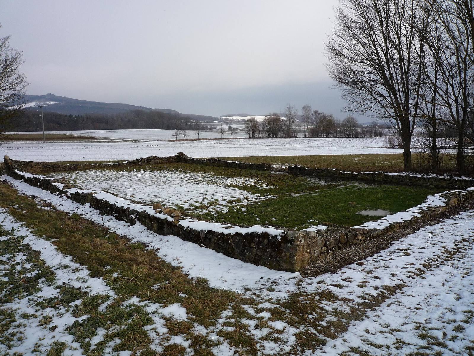
Finds came to light during drainage work around the turn of the twentieth century. In 1913, Otto Fritsch published an early account of relief-decorated Terra Sigillata fragments, probably found around 1900. Excavation began in 1976 when land consolidation threatened the area. About one-third of the 5.4-hectare site was exposed, and one-sixth was investigated in greater detail. The work was directed by Konstanz district archaeologist Jörg Aufdermauer and concluded in 1982, including reconstruction work and path construction. Buildings were excavated in plan, while areas between them were opened with an excavator; limited staffing meant that the investigation did not meet modern excavation standards. The remains now form an open-air museum. The site is protected as a registered cultural monument under section 2 of Baden-Württemberg’s monument-protection law.
Remains
Site plan and construction
Setting and layout
The remains cover 5.4 hectares on a gentle south-facing slope at about 515 metres above sea level, south-southeast of Büßlingen and west of the incised Biber valley. A small stream runs east of the site in the Zeltengraben, with a channelled feeder extending southeast from the estate toward it. The excavated area has an approximately trapezoidal plan, characteristic of a dispersed farm complex, and contains nine identified buildings. A stone wall measuring about 190 by 250 metres enclosed the area. A three-metre-wide, stone-paved service track ran eastward toward the main house. The buildings’ outlines have been reproduced using modern methods, incorporating surviving original fabric.
Foundations, walls, and finishes
The buildings shared a foundation system made with glacial cobbles. Trenches followed the natural slope and varied from 40 to 120 centimetres deep and from 60 to 120 centimetres wide. Hegau basalt and phonolite, a volcanic rock, formed permeable stone beds that helped drain rainwater. Foundations matched the trench width and were built as two rows of masonry, generally two layers high, using mostly unworked calcareous sandstone, with occasional shell-limestone fragments and pebble-rich stone. Lime mortar probably bound the stones, and some corner blocks were dressed. Walls above the foundations were about 10 centimetres narrower and also used two rows of unworked stone; up to five layers survive in places. Stone and lime mortar filled the wall interiors. The difference in width was either visible inside or concealed outside with sloping stones.
Interior walls in the main house and temple were probably coated with white lime plaster. Small surviving patches retain geometric decoration in red and yellow stripes. A threshold for a 90-centimetre-wide wooden door was found at Building 4, while the temple entrance was paved with limestone slabs. Window remains include glass fragments and part of a grille. Excavation recovered 143 roof-tile fragments. The flat tiles included larger pieces measuring 35 by 32 centimetres and narrower ones of the same length, 15–19 centimetres wide. Curved cover tiles were about 2 centimetres thick, 16 centimetres wide, and 6.5 centimetres high. Roofing fragments were identified in Buildings 1–4 and 7.
Floors and heating
Some buildings had floors made from a 10-centimetre layer of sand and limestone mixed with crushed brick, laid over a gravel layer of equal thickness. The same arrangement lay beneath heated floors and the bathhouse pool. Building 4 also had a rammed-earth floor that had been burned a second time.
Four rooms used a hypocaust, an underfloor heating system in which hot air circulates beneath a floor and may also pass through wall flues. Regularly spaced stone pillars supported nearly square tiles, which in turn carried a lime-mortar floor. Two complete pillars, 38 and 60 centimetres long, were recovered. During continuous operation, the space beneath the floor could reach 30°C. Angular clay flues with openings measuring 8 by 8 centimetres carried heat and smoke through the walls, warming them slightly. Sandstone slabs faced the heating oven and channel.
Residential and religious buildings
Main house
Building 1, the centrally placed main house, faced south and measured 35 by 40 metres. The single-storey building had ten rooms arranged around an open courtyard of about 600 square metres, identified as Room 11. Its entrance hall, Room 1, was flanked by Rooms 2 and 3, probably single-storey corner towers. These led to two rooms with underfloor heating, Rooms 4 and 5, then to sleeping and dining rooms, Rooms 6–9. Room 10 served as a storeroom. Excavation revealed drainage packing, parts of the foundations, and as many as two layers of standing wall in the north.
The entrance hall was integrated into the house rather than set beneath a columned porch. The corner rooms survive as square outlines and may not have appeared tower-like from outside. A room with a mortar floor in the western corner may have served in place of a cellar. The top foundation layer sloped, apparently for appearance, and a drainage ditch ran along the southwest side. That ditch has prompted the suggestion that the roof sloped outward on one side.
Temple
Building 2 stood 25 metres southeast of the main house, facing its entrance hall. The temple measured 9 by 16 metres and was larger than most Roman temples of this type in Baden-Württemberg. It was a prostyle building, with a row of columns at the front, and consisted of a sanctuary of about 96 square metres and an entrance hall of about 54 square metres. Drainage packing, foundations, and parts of the mortar floors survived in both areas. Four columns probably supported the roof over the open entrance hall. The temple’s construction was more carefully finished than that of the estate’s other buildings.
Bathhouse
Building 3 stood at the southern edge of the estate, at its lowest point, and covered more than 200 square metres. Its six rooms had mortar floors about 10 centimetres thick, laid over rounded stones. Drainage packing, foundations, the lowest standing wall layer, fragments of coloured interior plaster, and the tiled lining of the cold-water pool survived. After changing in the exercise area, bathers entered the cold-water room, half of which was occupied by the pool, and then the sweating room. From there they could continue to either the hot bath or the warm bath, both heated from below. The heating room stood on the east side and supplied heat for the underfloor system and hot water. A metal boiler above the hot bath’s heating channel warmed water, which flowed to the pool through a lead pipe. Beneath the pools, a drainage pit led to an outlet channel carrying water outdoors.
Buildings for estate work
Smithy
Building 5, west of the main house, is identified as a smithy. Drainage packing, much of its foundation, and the beginnings of standing walls survived. Traces of fire, ash, and fire installations in its two central rooms point to metalworking; heat reddened walls and corners around several fire locations. An 8-centimetre-deep semicircular burn in the eastern room’s clay floor may mark a large furnace, possibly used to smelt iron. The southern room had a larger fire area that may have been a hearth, remnants of a mortar floor, and scorched stone slabs over part of its base. A former millstone there may have supported a pivoting arm. The building could alternatively have housed estate workers. Beneath it lay drainage packing from an earlier building, probably a stable.
Slaughterhouse
Building 4 occupied the easternmost point of the estate. Animal bones found nearby support its identification as a slaughterhouse, although it may also have served as a gatehouse. After excavation, the remains were covered rather than reconstructed.
Stable
Building 9 stood at the northwestern end of the site. Its long, narrow outline could have accommodated two rows of livestock stalls, but its function remains tentative. The surviving evidence consists of its drainage packing, which was covered after excavation.
Barns
Buildings 6 and 7 stood south of the temple. Their drainage packing survives, and their larger plans suggest use for storage. Building 8, northwest of the main house, retains parts of its foundations and standing walls. The estate had three buildings probably used as barns, alongside the smithy, slaughterhouse, and stable.
Excavated objects
Finds from the excavations are displayed at the Archaeological Hegau Museum in Singen. They include ceramic bowls, part of an amphora, roof tiles, a heating-system pillar, and metal fittings from a bolt lock. Tools include a knife, iron fork, scissors, a sickle fragment, a socketed scraper, and a woodworking implement; three writing styli, glass fragments, and a belt buckle were also recovered. Two enamelled bronze brooches date to about AD 150–200, alongside another undecorated bronze brooch. An iron cross from the site is attributed to the Alamanni.