Mahabalipuram, Known as the Seven Pagodas: A Pallava Temple Complex
Site at a Glance
- Popularity
- High
- Country
- India
- Primary era
- Medieval
- Eras represented
- Classical, Medieval
- Civilizations
- Pallava
- Site type
- Religious
- Remains
- Temple
On this page16 sections
History
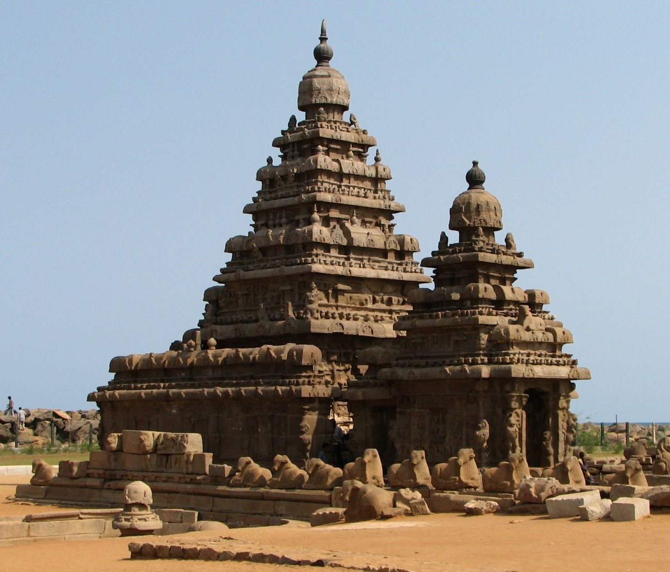
Mahabalipuram, also called Mamallapuram and traditionally nicknamed the Seven Pagodas, is a temple complex in India built under the Pallavas, a South Indian ruling dynasty. Its history includes the eighth-century Shore Temple and a broader role as a religious center. The nickname reflects a tradition that six temples once stood beside the surviving Shore Temple, but archaeological evidence has not confirmed an exact total of seven.
Pallava foundations and traditions
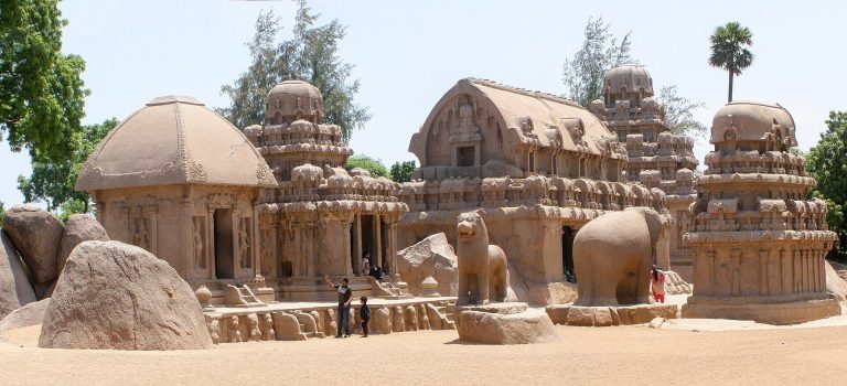
Rock-cut temple building began under Mahendravarman I about 30 years before the foundation or major expansion associated with Narasimhavarman I around 630. Whether this phase marked the first settlement at Mahabalipuram remains uncertain. Both kings commissioned temples, including rathas, monolithic temples carved from single stone blocks. Work on these temple types appears to have ended around 640. Narasimhavarman II commissioned the Shore Temple in the eighth century.
Hindu tradition credits the city’s foundation to Bali, also known as Mahabali, a legendary king and grandson of Prahlada. Another local legend says that Indra, a Hindu deity associated with storms and rain, submerged the city in a great storm, leaving only the Shore Temple above water. Fishermen were said to have seen other temples shining beneath the waves.
Early European accounts and interpretations
Marco Polo was among the early European visitors associated with Mahabalipuram, and a Catalan map dated 1275 marks the site. Before European visitors began arriving in southern India, many of the smaller monuments had become partly or wholly covered by sand. European residents and their families helped uncover them, and English antiquarians, including Colin Mackenzie, were conducting archaeological work by the late eighteenth century.
John Goldingham visited in 1798, noting sculptures, statues, and inscriptions and copying many inscriptions by hand. He interpreted many of their signs as picture symbols, while Benjamin Guy Babington recognized some as Telugu letters. Mark William Carr published Goldingham’s account in 1869. Robert Southey’s 1810 poem The Curse of Kehama helped circulate the Seven Pagodas legend in Europe and described more than one pagoda as visible. In 1914, J. W. Coombes recorded a European theory that copper temple domes reflected sunlight and served as landmarks for ships. D. R. Fyson’s 1931 visitor’s book repeated the tradition and proposed that Narasimhavarman I had founded or greatly enlarged the city around 630.
Underwater surveys and archaeological discoveries
In 1993, historian N. S. Ramaswami challenged the idea of a sunken city offshore, arguing that little contemporary evidence supported the Seven Pagodas tradition. Underwater investigations in 2002 followed reports from fishermen who said they had seen ruins beneath the sea. The National Institute of Oceanography of India and the United Kingdom’s Scientific Exploration Society surveyed the area. Archaeologists identified submerged walls as parts of several temples and assigned them broadly to the Pallava period, around the time of Mahendravarman I and Narasimhavarman I.
The Indian Ocean tsunami of 26 December 2004 changed parts of the coastline and stripped away accumulated sand and sediment, exposing previously buried remains. In April 2005, the Archaeological Survey of India and the Indian Navy used sonar, which maps underwater features with sound waves, to investigate offshore structures. Later surveys traced the walls of two submerged temples. Together with the earlier investigations, these discoveries support the existence of a larger temple complex, but do not establish that it contained precisely seven temples.
Excavations near a large inscribed stone revealed a Pallava-period temple built over the foundations of an older temple from the Sangam period, an early phase of Tamil history and literature, approximately 2,000 years ago. Archaeologists consider that a tsunami destroyed the older building between the Sangam and Pallava periods. They also consider a later tsunami, in the thirteenth century, responsible for destroying Pallava temples at the site.
Remains
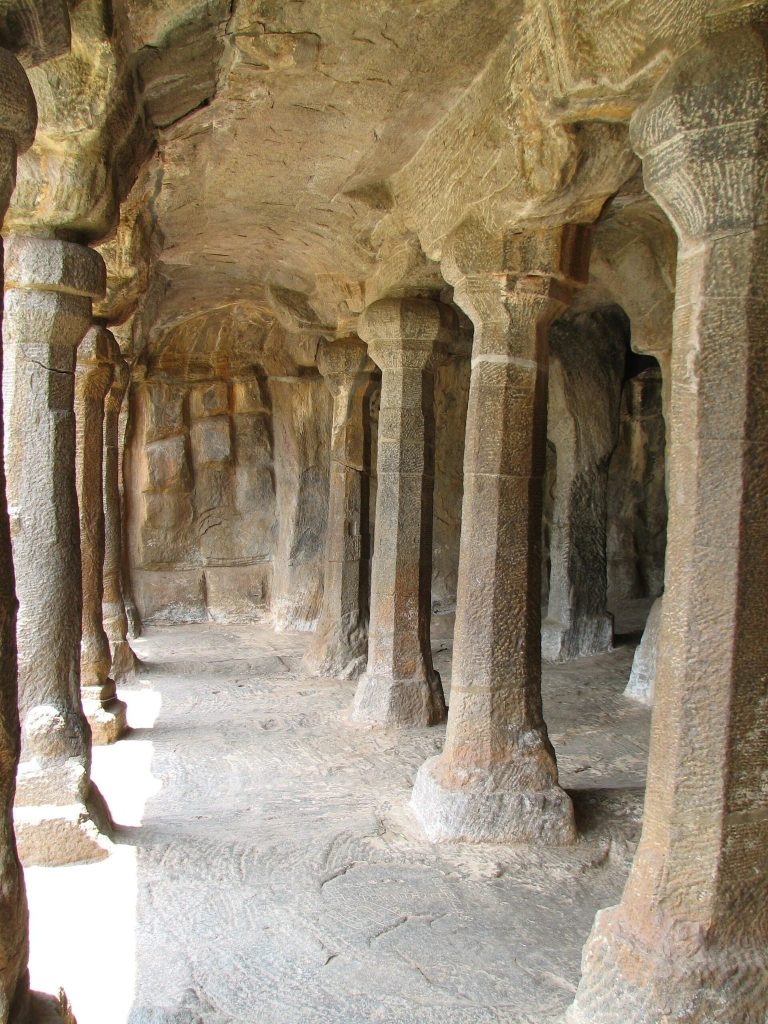
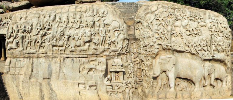
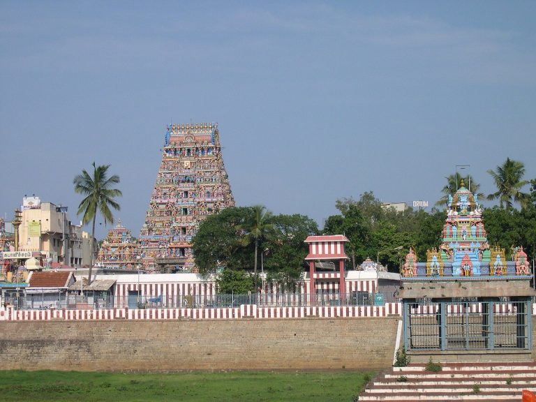
The complex includes the Shore Temple, smaller and free-standing temples, rock-cut shrines, rathas, and outdoor sculpture groups. Rock-cut shrines were carved into rocky hillsides rather than necessarily formed in natural caves. Nine rathas survive, and about 40 monuments, including two open-air low-relief carvings, were visible in 1993. A Pallava-era painting is the only known contemporary depiction of the complex’s former arrangement. The placement of submerged structures in later sonar surveys closely matched the painting in relation to the Shore Temple and other visible buildings.
Visible buildings and sculpture
Shore Temple and free-standing temples
The Shore Temple and other surviving buildings have a pagoda-like form. Fyson interpreted this architecture as reflecting the influence of stupas, Buddhist mound-shaped monuments. The site also includes smaller free-standing temples as part of its varied group of buildings.
Rathas and rock-cut shrines
Each ratha is a temple carved from a single stone mass. Fyson proposed that Mahabalipuram had a monastery and that ascetics’ quarters may have been housed among the rathas. His suggestion drew on small rooms within the structures and archaeological evidence he associated with monastic use.
Outdoor sculpture
Outdoor sculptural groups form another part of the site’s remains. Two of the monuments visible in 1993 were open-air carvings made in low relief.
Submerged architecture
Walls and temple layout
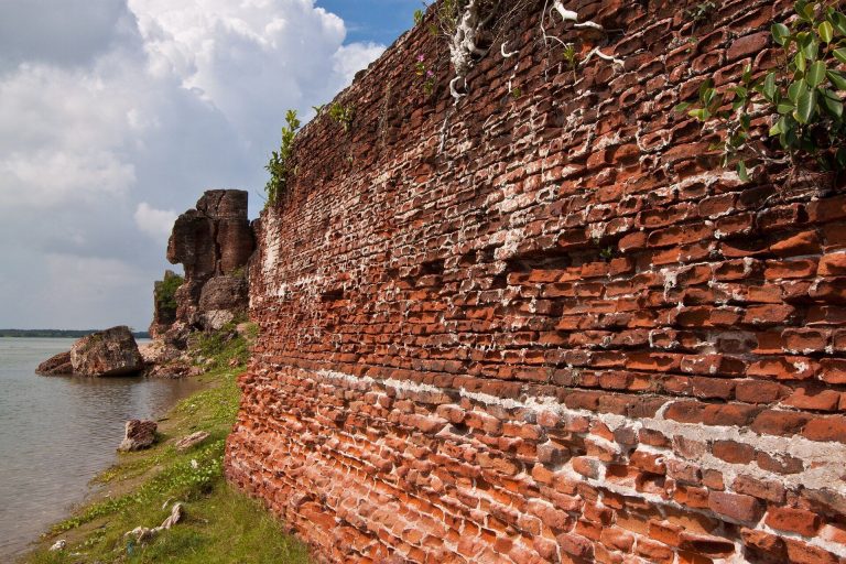
The 2002 survey found wall remains beneath 5 to 8 metres of water and sediment, 500 to 700 metres offshore. After the 2004 tsunami, a long, straight line of large stones briefly emerged from the sea before being covered again. Sonar work in 2005 identified it as a wall about 1.8 metres high and 70 metres long. The survey also identified remains of two submerged temples and part of a cave temple within about 500 metres of shore. Sonar mapping traced the inner and outer walls of two temples, while building ruins found as far as about one kilometre offshore may belong to the same complex.
Submerged sanctuary and carved slabs
One submerged temple complex measures approximately 25 by 28 metres. It includes a square sanctuary 2.6 metres on each side, surrounding space, and an enclosure. Its collapsed tower and finial, the ornament at the top of a building, resemble those of the Shore Temple. Black-stone slabs in the sanctuary bear markings that include a bird-like figure, a bow and arrow, and intersecting triangles arranged in a butterfly-like shape.
Excavated temple and shoreline remains
Earlier temple foundations and fired-clay structure
Excavation revealed the brick foundations of a Sangam-period temple beneath a later Pallava temple. The Pallava building used large stone slabs and stood over the earlier temple’s foundations. A small brick structure on the beach, once covered by sand, also dates to the Sangam period. A well-like structure made of fired clay appears to predate the Pallava period.
Inscribed stone and excavated objects
A large stone exposed by waves carries an inscription dated AD 935. It records that Krishna III, a Rashtrakuta king, gave gold to keep a temple lamp burning continuously. Excavations nearby recovered coins, pottery fragments, small figures made of lime, and brass lamps.
Sculpture and marine deposits
A large sandstone lion, dated by archaeologists to the seventh century, was exposed on the beach after the tsunami. The waves also uncovered other statues and small structures. Layers of shells and other marine debris in the excavated area provide physical evidence cited in support of tsunami destruction at the site.