Giechburg: A Medieval Castle and Renaissance Palace in Germany


Site at a Glance
- Rating
- 4.7
- Popularity
- Medium
- Country
- Germany
- Primary era
- Early Modern
- External website
- Open
- Eras represented
- Medieval, Early Modern
- Civilizations
- Holy Roman Empire
- Site type
- Military
- Remains
- Castle
On this page12 sections
History
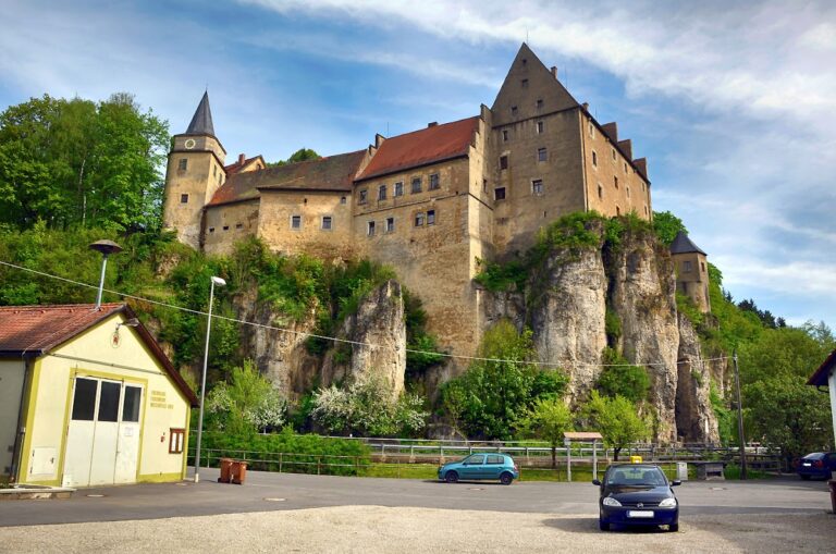
Giechburg is a hilltop castle ruin in Germany, above Scheßlitz in Bavaria. Its settlement history reaches back to the Neolithic period, while a medieval castle was probably built under the counts of Schweinfurt during the tenth-century Hungarian invasions. Later rebuilding transformed the fortress into a Renaissance palace under the Bamberg prince-bishops, who combined ecclesiastical authority with territorial rule.
Prehistoric and Medieval Origins
Settlement activity intensified during the Celtic period, from about 500 BC to the beginning of the Christian era. The prehistoric fortifications were probably used continuously during the Migration Period, a time of major population movements in Europe. The medieval castle occupied the western third of the plateau, which was separated from the rest by a deep neck ditch. Earlier defenses remained in use into the twelfth century, and Giechburg later helped connect the royal estates at Hallstadt and Königsfeld on the Franconian Jura.
Giechburg first appears in written evidence in 1125, in a donation charter issued by Bishop Otto I of Bamberg. Wilhelm of Lützelburg, the second husband of Margravine Mechthilde of Meissen, witnessed the charter as a free man of Giech. Mechthilde’s daughter Adela of Beichlingen married Count Reginboto of Wertheim, who adopted the title Count of Giechburg after acquiring the estate through the marriage.
In 1137, Adela and Reginboto’s only child, Chuniza, brought the Giech inheritance into the Andechs family through her marriage to Count Poppo I of Andechs. Their marriage was dissolved in 1142 because of close kinship, and Chuniza left her inheritance to the Bamberg diocese. Poppo nevertheless used armed action to force the enfeoffment of the entire estate. After the death of Duke Otto II of Andechs-Merania in 1248, a lengthy succession dispute transferred Giechburg and its surrounding territory, broadly corresponding to the eastern part of the present Bamberg district, to the related counts of Truhendingen.
Bamberg Rule and Military Conflicts
The counts of Truhendingen retained Giechburg until 1390. That year, Bishop Lamprecht of Brunn bought the heavily indebted fief for a large sum and restored it to the Bamberg bishopric. The Bamberg bishops then strengthened the neglected castle in two main building phases, from 1421 to 1430 and from 1431 to 1459. Rounded artillery fortifications were added, and Giechburg came to be regarded as the safest place in the Bamberg bishopric during the Hussite incursions. The Hussites, followers of the Bohemian religious reformer Jan Hus, carried their military campaigns into Franconia during the fifteenth century.
On 2 February 1430, Hussite forces led by Andreas Prokop burned Giechburg, the nearby Gügel, Scheßlitz, and several neighboring settlements. The fire damaged the castle, but its defenses protected the Bamberg cathedral treasury. Bishop Anton von Rotenhan rebuilt the destroyed sections, and the treasury remained at Giechburg beyond the period of the Bamberg Immunities Dispute.
During the German Peasants’ War, peasants captured Giechburg by deception during the night of 16 May 1525. Led by Wolfram Hollfelder, the Scheßlitz town clerk, they looted the castle and set it on fire without destroying its essential substance. Bailiff Christof von Redwitz assessed the damage at 750 gulden and listed seized supplies, livestock, household goods, and weapons. After the revolt was suppressed, its leaders were hanged, while stolen goods and burned buildings had to be replaced through forced labor.
The castle suffered more destruction during the Second Margrave War, a sixteenth-century conflict in which Albrecht II Alcibiades of Brandenburg-Kulmbach sought territorial expansion in Franconia. His troops besieged Giechburg from 22 to 26 April 1553. The castle was surrendered by its lord, Emeran von Redwitz. On 5 May, 300 mounted men looted it, taking flax, grain, hemp, livestock, jewelry, and other goods before setting the buildings on fire.
Renaissance Transformation and Later History
Under Prince-Bishop Johann Philipp von Gebsattel, the ruined castle was rebuilt as a Renaissance palace between 1599 and 1609. The medieval defenses were incorporated into the new complex, although the castle’s military importance had declined. Rosenberg at Kronach and Forchheim took over the region’s modern fortress functions. Giechburg instead became the administrative seat of the Giech territorial district and a base for the prince-bishops’ annual hunting expeditions.
Giechburg remained untouched during the Thirty Years’ War, the major European conflict of 1618 to 1648, even though almost every building in Scheßlitz was destroyed. Once local administrative buildings had been rebuilt in Scheßlitz, the administrative seat moved there. The castle subsequently served as a breeding station for the prince-bishops’ foals. After that operation moved to Peulendorf, it became the office and residence of a forestry official responsible for fire surveillance in the surrounding region. Minimal maintenance then accelerated its decline.
Following the secularization of the Bamberg bishopric in 1802, the properties around Giechburg were sold separately. Demolition measures in 1809 hastened the deterioration. Count Friedrich Karl Herrmann von Giech zu Thurnau bought the castle from the Kingdom of Bavaria in 1819, but its condition did not fundamentally improve. The last Count of Giech sold it in 1932 to Leonhard Schmaus, a postal employee, whose grandson sold it in 1962 to Friedrich Karl Hohmann.
The Friends of Giechburg association was founded in 1967 and initiated the first substantial conservation work. Bamberg district assumed control of the castle in 1971, after which a comprehensive renovation program adapted it as a conference venue and center for cultural events. Giechburg is recognized as a historical and architectural monument within Bavaria’s heritage system. The castle is also associated with the Franconian legend of the Dwarf of Freudeneck.
A traditional claim links Giechburg with Bamberg’s Altenburg through an iron basket supposedly used for fire signals. No corresponding installation is documented at Giechburg, and the basket at Altenburg is considered probably to be a nineteenth-century historicist embellishment. The alleged signaling connection therefore remains unsubstantiated.
Remains
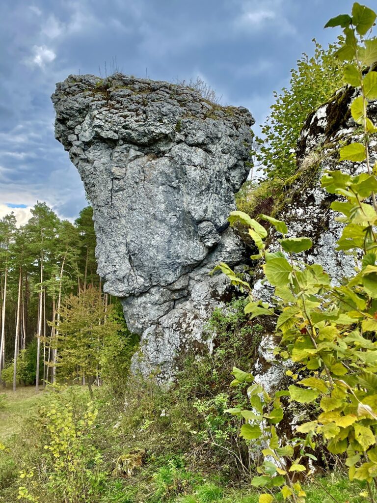
Giechburg occupies the western end of a rocky Jurassic spur at approximately 530 meters above sea level. The plateau contains three visible ditches, and a remnant of the prehistoric rampart survives along its eastern edge. The western defensive works and the later palace occupy the built portions of the plateau, while a small area between them was required by contract to remain free of construction. The summit is formed by resistant Upper Jurassic dolomitic limestone, an erosional remnant of a Jurassic upland that once extended farther west.
Fortifications and Medieval Structures
Eastern Plateau and Keep
The eastern third of the plateau marks the site of a probable Bamberg episcopal counter-castle from the first half of the twelfth century. It probably disappeared during the Andechs succession conflict, although the entire plateau had already been settled during prehistoric and early historic times.
The square keep stands independently in the eastern part of the castle and measures 12.5 by 12.5 meters. It is set diagonally, which reduced the target area presented to medieval catapults and other throwing machines. Small ashlar masonry survives at its base from the high-medieval castle. The tower probably originally had a half-timbered upper structure like the adjacent shield wall, a particularly strong defensive wall.
The keep’s basement contained a barrel vault, and a fireplace for a heated tower chamber survives on an upper floor. Its only high-medieval entrance was on the northeast side. A round-arched ground-level portal and a western entrance were added during Gebsattel’s rebuilding. The western entrance connected the upper floor of the north wing, which contained the prince-bishop’s apartments, to the keep by a covered wooden bridge. The slightly recessed upper story from this period is rectangular and has multiple windows. A slate-covered domed roof formerly capped the tower.
Walls, Ditches, and Gates
Surviving high-medieval elements also include the lower part of the keep, a section of wall beneath the former eastern shield wall, and most of the enceinte, the continuous wall enclosing the fortified site. The Bamberg bishopric extensively supplemented and strengthened the enceinte after acquiring Giechburg in 1390. The original approach entered through the now-demolished Outer Gate at the beginning of the western defensive wall. A surviving window opening indicates the former gatehouse.
Farther west, the Gothic or Middle Gate stands with the former Outer Zwinger, an outer defensive enclosure, in front of it. A former heraldic stone of Bishop Friedrich III of Aufseß was located on the northwest bastion between the two gates. The Middle Gate’s arch bears the arms of Bishops Anton von Rotenhan and Georg I von Schaumberg. Behind it lies the Inner Zwinger, including the former gatekeeper’s passage on the rear of the demolished loophole-equipped wall leading toward the northwest tower.
Above the rusticated portal of the main gate is a sandstone panel carrying the arms of Johann Philipp von Gebsattel. The proposed relocation of the entrance from the east to the west, associated with castle researcher Hellmut Kunstmann, is not supported by the surviving building accounts. The eastern side was already protected by the high shield wall and keep, while the eastern plateau offered no reason to weaken the castle’s security with an entrance at that level.
Renaissance Palace and Surviving Interiors
Palace Wings and Stair Tower
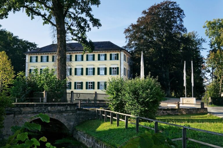
The present core of Giechburg derives principally from Gebsattel’s building work of 1602 to 1609. The south and west wings have been modernized and are used as conference facilities. The long north wing, distinguished by numerous window openings, became a ruin in two stages beginning in the early nineteenth century. A circular ruined stair tower projects from the eastern wall line.
The narrow southern wing formed part of Gebsattel’s three-wing palace. It formerly contained the palace chapel and a partly half-timbered stable building, which has disappeared. Structural instability led to the complete removal of a second upper story at the beginning of the twentieth century. An attribution of the building to Prince-Bishop Marquard Sebastian von Stauffenberg rests on a report written in 1785 by Hofkammerrat von Roppelt, while the surviving administrative building accounts provide no evidence for that attribution or for such a construction project.
Oriel and Well
The best-preserved interior feature is a two-story oriel on the western courtyard side above the cellar entrance. It is crowned by a simple Renaissance ogee gable. Beside it is a well dug after 1390, approximately 40 meters deep. Sculptures, relief carvings, gargoyles, and several coats of arms survive above or near the entrances, although their individual dates and subjects are not specified.
Geological Setting
The lower slopes consist of Lower Jurassic layers, including soft, landslide-prone bluish-gray Amaltheus Clay and the Posidonia Shale formation. Above them, water-retaining Opalinus Clay creates spring horizons where it meets sandstone. Hard iron sandstone of the Middle Jurassic protects the softer layers below it. The geological sequence also exposes a softer fine-grained Kellersandstein layer, a roughly 13-meter interval of weaker material, two narrow sandstone beds, and a shell-bearing limestone bed between about 20 centimeters and 1 meter thick.
The summit’s dolomitic limestone includes formations associated with Ornatenton and the White Malm. These rocks formed approximately 150 million years ago in a tropical shallow sea. Nearby karst features are characteristic of the Franconian Jura, while the spur itself is an erosional remnant separated from the main upland by the wearing away of surrounding Jurassic strata.