Tel Kabri: A Multi-Period Archaeological Tell in Israel
Site at a Glance
- Rating
- 3.9
- Popularity
- Very Low
- Country
- Israel
- Primary era
- Bronze Age
- External website
- Open
- Eras represented
- Stone Age, Bronze Age, Iron Age, Classical, Early Modern
- Civilizations
- Achaemenid, Ancient Greek, Canaanite, Ottoman, Phoenician
- Site type
- City
On this page12 sections
History
Tel Kabri is a multi-period archaeological tell in Israel’s Western Upper Galilee, occupied from the Pottery Neolithic period through later historical phases. Its earliest settlement was established by the Yarmoukian culture, an early settled community of the southern Levant, and the site later became a major centre of the Wadi Raba culture during the early Chalcolithic period. Springs around the tell supported settlement and continued to provide water into modern times.
Early settlements and the rise of the city
A substantial Early Bronze Age town occupied Tel Kabri before its destruction during the regional collapse at the end of that period. The settlement was rebuilt during Middle Bronze Age I, when Kabri was among the earliest Levantine cities to restore its fortifications after the collapse. During the transition from Middle Bronze Age I to II, a major restructuring programme transformed the settlement into a fortified Syrian-style city-state. Parts of the earlier town were levelled, private houses gave way to palatial and defensive construction, and nearby settlements including Achziv and Avdon were developed.
During the Middle Bronze Age, Kabri became the capital of a major polity in the Upper Galilee. It may have controlled territory extending from Mount Carmel to the Sulam range, including as many as 31 subordinate sites and approximately 30,000 subjects. The city maintained trade and exchanged ideas with neighbouring regions, including Cyprus and the Aegean. Its palatial occupation extended across Middle Bronze Age I, IIA, and IIB. The earliest palace is now dated approximately to Middle Bronze Age I, possibly the eighteenth century BCE, while the later palace belonged to Middle Bronze Age IIB. The palace complex remained in use for approximately three centuries, longer than any other palace known in ancient Israel.
Destruction and later reoccupation
The Canaanite palace was destroyed in a major seismic event around 1700 BCE and was probably abandoned because of earthquake damage. The precise sequence of destruction and abandonment remains linked to changing interpretations of the Middle Bronze Age phases.
Tel Kabri was reoccupied during the Iron Age. A citadel was established on the site, apparently by Greek mercenaries serving the Phoenician city-state of Tyre, and a Phoenician settlement known as Rehov developed around it. The town was fortified with a casemate wall, a defensive structure built with internal compartments or parallel wall lines. The Phoenician settlement was destroyed by the armies of the Neo-Babylonian king Nebuchadnezzar II around 585 BCE. Nebuchadnezzar’s reign saw Babylonian power expand across the Levant during the sixth century BCE. Rehov was rebuilt during the Persian period, although habitation on the main tell later ended. In the early Hellenistic period, parts of the Iron Age citadel were reused for burials.
During the Hellenistic period, the springs became closely associated with Akko. Aqueducts carried water from Kabri to the city, including one constructed during the Hellenistic period and later Ottoman systems. A Jewish settlement called Kabrita was established east of the tell during the Early Roman period, and later settlements occupied the same general area. Two Ottoman-period villages also stood on the tell itself. These villages, together with al-Kabri, were depopulated during the 1948 Arab-Israeli War.
Investigation and preservation
After 1948, the tell became part of the grounds of Kibbutz Kabri and was partly converted to agricultural use. Farming, erosion, and a British Mandate-period road damaged upper archaeological layers. Investigation resumed after Neolithic artefacts were discovered in 1956. Excavations and surveys followed in 1957–1958, 1961, 1969, 1975–1976, 1986–1993, 1999, 2004, and from 2005 onward through the Tel Kabri Archaeological Project. Principal excavators and project directors included Moshe Prausnitz, Aharon Kempinski, Wolf-Dietrich Niemeier, Assaf Yasur-Landau, Eric H. Cline, and Andrew Koh.
A trench cut by the national water company in 1961 exposed Bronze Age architecture, palace floors, and part of the Middle Bronze Age rampart. Kempinski’s expedition from 1986 to 1993 uncovered major palace remains and an Iron Age Phoenician citadel. The later international project expanded the known palace and identified an earlier palace beneath it. Geophysical surveys in 2003 showed that the palace was larger than previously believed, and excavations from 2005 onward confirmed and extended that interpretation.
Conservation became especially important after a protective geotextile bonded to the painted plaster floor of Hall 611 in 1993. Removing it without destroying the floor proved impossible, so the 2005 season included extensive conservation work. The 2006 field season was disrupted by the Lebanon War, when rocket attacks, restricted access to stored pottery, and postponed aerial photography affected the project. Research later continued through excavation seasons and intervening periods of analysis.
The original Canaanite name of the site is unknown. It was called Rehov during the Iron Age, although proposed identifications with Rehov mentioned in Egyptian and biblical sources remain unproven. The modern name was assigned by Israeli excavators after Kibbutz Kabri, whose name derives from the former Palestinian village of al-Kabri. The tell itself was located at the former villages of al-Tell and al-Nahr, rather than at al-Kabri. Because no later monumental city was built over the Middle Bronze Age settlement, the Canaanite city can be investigated extensively, offering evidence for administration, taxation, agriculture, and social life.
Remains
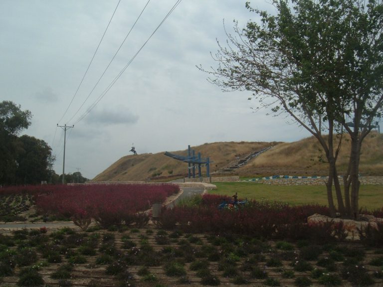
Tel Kabri is a tell, an artificial mound formed by accumulated buildings, debris, and soil from successive settlements. The original Neolithic ground surface lies approximately 5.5 metres below the present surface. The site occupies the eastern end of the Western Galilee coastal plain, less than 5 kilometres from the Mediterranean coast. The Ga’aton River lies to the south, while four springs, Ein Shefa, Ein Giah, Ein Tzuf, and Ein ha-Shayara, define an important part of its physical setting. The settlement’s materials include mudbrick, stone, plaster, and mortar. Excavation areas A, B, C, D, E, F, and T together expose remains from different periods and parts of the tell.
Fortifications and settlement areas
The Middle Bronze Age city was enclosed by a broad glacis, a sloping or extended artificial earthwork used for defence. Approximately 50 metres wide, it had a stone core covered with mudbrick and stone and added about 25 hectares to the fortified area. Excavations also revealed substantial internal and outer stone construction. Area C crossed the northern rampart and was later expanded to examine internal fortifications. Area T exposed a well-preserved section of city wall, while Area C also produced a large family tomb in 1988.
Domestic and industrial areas included houses, courtyards, possible workshops, and an oven. Some Middle Bronze Age buildings were arranged around open courts, and one complex was rebuilt through several phases. Burials occurred throughout the settlement. They included masonry chambers with multiple interments, child burials placed in vessels beneath house floors, ceramic grave goods, jewellery, Egyptian scarabs, and other burial objects. Area A produced Neolithic cist tombs, round and rectangular dwellings, stone vessels, flint artefacts, and early Chalcolithic remains. Area B contained domestic structures, Middle Bronze Age pottery, and tombs with bronze objects, including a duck-billed axe.
Middle Bronze Age palace complex
Palace halls and painted decoration
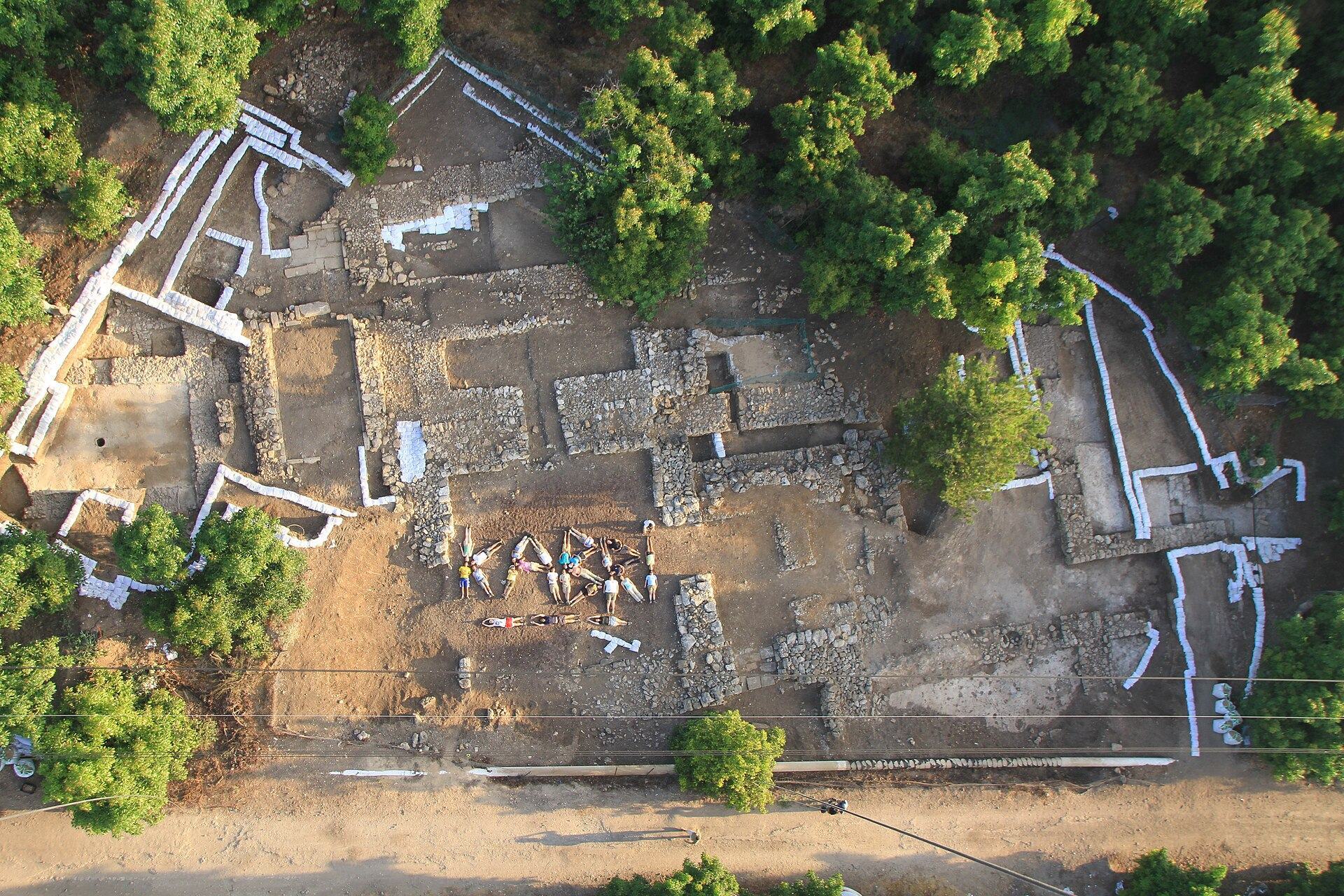
The Middle Bronze Age palace covered approximately 6,000–6,100 square metres and passed through several construction and renovation phases. An earlier Middle Bronze Age IIA palace lay beneath the later Middle Bronze Age IIB palace. Area D-North revealed a large structure that preceded the later complex, while Area D-West East was opened to connect earlier excavations and investigate rooms around a palace courtyard.
Ceremonial Hall 611 measured approximately 10 by 10 metres. Its plaster floor carried Minoan-style decoration associated with Bronze Age Crete and the Aegean. The design included a pattern resembling stone paving, red dividing lines, squares approximately 40 centimetres wide, and surviving plant motifs. More than 2,000 painted-plaster fragments have been recovered from the palace, including at least four paintings or groups of fragments. These are regarded as the only known Minoan-style paintings discovered in Israel. A small red or brown fragment from Areas D-West and D-South may depict a hilltop landscape.
Throne-room complex
Area D-West contains a palace throne-room complex whose walls were lined on their inner faces with orthostats, upright stone slabs used as architectural facings. Six slabs were recorded on the eastern wall and eight on the western wall, ranging from 40 to 150 centimetres in length. Most had rectangular dowel holes approximately 4 by 4 centimetres and 8 centimetres deep, while their upper surfaces also contained square holes. The beach-rock slabs were covered with white plaster.
The preserved eastern wall was approximately 1.1 metres thick and 6 metres long. The western wall was approximately 1.0–1.3 metres thick and 6.8 metres long. A back room behind the orthostat structure was built from large plastered stones and contained three storage jars. Painted fragments from Areas D-West and D-South show that parts of the palace had at least two sets of Aegean-style wall paintings and decorated floors.
Palatial wine cellar
A storage room discovered in Area D-West in 2013 was identified as a palatial wine cellar. It contained 40 large ceramic jars with a combined capacity of approximately 2,000 litres and traces of wine dating to around 1700 BCE. The cellar is regarded as the oldest and largest known palatial wine cellar in the Ancient Near East.
Upper Terrace and courtyard building
Building 3079, also called the Upper Terrace or Courtyard Building, stood on the palace’s southern terrace in Area D-South 1. Its fieldstone foundations sometimes exceed 1 metre in thickness, while the upper courses were built from mudbrick. Several narrow rooms surrounded an open courtyard with a compact crushed-limestone floor. The rooms retained patches of plaster and packed-earth surfaces, although erosion and later disturbance have left the plan incomplete.
The building had at least two phases. The earlier phase, DS IIIb, established the foundation walls and initial layout, whose exact function remains uncertain. The later phase, DS IIIa, added wall segments, strengthened earlier foundations, and improved the floors. The structure may have belonged to the palace’s administrative or service sector, but its precise function is not established. Area D-South 2 contained another large structure with a so-called zigzag wall, along with the possibility of a lower courtyard and a further monumental building that has not yet been excavated.
Iron Age and later remains
The Iron Age citadel occupied a high point in the southwestern part of the tell, although only its northwestern corner has been excavated. It may originally have measured approximately 90 by 60 metres and contains several construction phases. The Phoenician settlement included a casemate wall, Iron Age pottery, a Phoenician seal impression, and remains dating broadly from the tenth through the sixth centuries BCE. Area E produced Iron Age settlement material.
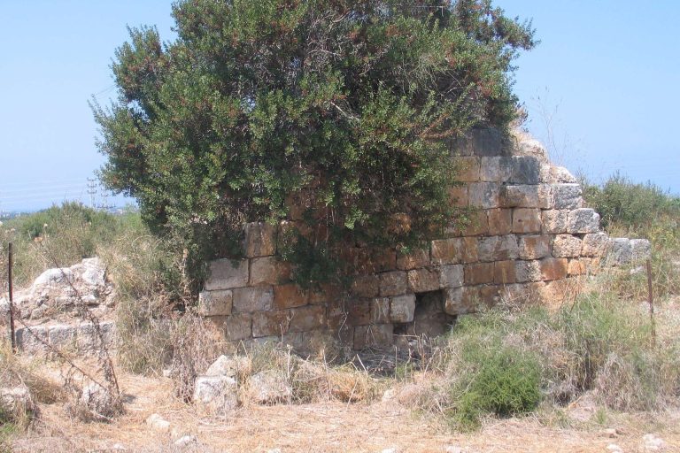
Hellenistic remains include an aqueduct, burials dated to the second century BCE, and a Phoenician seal. The springs and aqueduct installations formed part of the water-supply system connecting Kabri with Akko. Sections of the later Ottoman aqueduct remain standing. Two Ottoman-period villages occupied parts of the tell, while the eastern settlement area preserves remains associated with the later village of al-Kabri. The old Nahariyya–Ma’alot road cuts across the archaeological site, and Area F was separated from Area D by this road.