Skmaqn–Port-la-Joye–Fort Amherst: A French and British Colonial Fortification Site
Site at a Glance
- Rating
- 4.5
- Popularity
- Low
- Country
- Canada
- Primary era
- Early Modern
- External website
- Open
- Eras represented
- Early Modern
- Civilizations
- British
- Site type
- Military
- Remains
- Fort
On this page10 sections
History
Skmaqn–Port-la-Joye–Fort Amherst is a 90.75-hectare historic site at Rocky Point on the southwestern side of Charlottetown Harbour in Canada. French military personnel from Fortress Louisbourg founded Port-la-Joye in 1720, creating a colonial settlement and military outpost that became the administrative centre and port of entry for Isle Saint-Jean, the French colonial name for present-day Prince Edward Island.
French settlement and administration
Michel Haché-Gallant led the settlement effort and brought Acadian settlers from Louisbourg in his sloop. Acadians, French-speaking settlers and their descendants in the Maritime region, established farms around Port-la-Joye during the French periods of 1720–1745 and 1746–1758. The site served as the seat of government and the principal administrative centre of Isle Saint-Jean, as well as an important French outpost in the struggle with Britain for control of North America.
A small French force from Louisbourg occupied the post, but poor morale, infrequent relief, and inadequate winter quarters weakened the garrison. After Louisbourg capitulated in 1745, a New England force landed at Port-la-Joye. The 20-man French garrison under Joseph de Pont Duvivier fled, and the attackers burned the settlement. Duvivier and his soldiers were pursued up the Northeast River until Acadian and Mi’kmaq reinforcements forced the attackers back. Nine New Englanders were killed, wounded, or captured, while six Acadians were taken hostage.
Conflict and renewed French control
In 1746, about 200 British soldiers and two Royal Navy ships occupied Port-la-Joye. Jean-Baptiste Nicolas Roch de Ramezay sent Joseph-Michel Legardeur de Croisille et de Montesson with more than 500 men, including 200 Mi’kmaq, to attack the position. In July, near Port-la-Joye on the Northeast River, Montesson’s force killed or imprisoned 34 New England irregulars, and French control of Isle Saint-Jean was restored.
French forces then built a star-shaped fortification at Port-la-Joye in 1748–1749. Its projecting angles and recessed sections followed principles associated with Sébastien Le Prestre de Vauban, the French military engineer whose systematic designs influenced European fortification construction.
British occupation and the Acadian deportation
After Louisbourg fell in 1758, British forces again took control of Isle Saint-Jean and Port-la-Joye. Lord Rollo arrived in late August with four ships and about 500 soldiers. His force encountered approximately 3,000–5,000 Acadians and rounded up about 3,000 for deportation to France. Around 700 deportees drowned during the voyage, an estimated 900 died of disease in North America, and approximately 1,600 avoided deportation by hiding in the island’s western forests.
The British replaced the French fortification with a stockade fort immediately to the east, toward the water. William Spry supervised its construction and reported it complete on October 10, 1758. Named Fort Amherst after General Jeffery Amherst, the post housed 190 soldiers of the 28th Regiment of Foot, a British infantry regiment also known as the Old Braggs.
A mutiny broke out in the garrison in 1762. Its principal participants faced courts-martial at Louisbourg, with punishments that included demotion, hundreds of lashes with the cat o’ nine tails, and one execution. The Treaty of Paris in 1763 ended the Seven Years’ War, the global conflict that included the British-French struggle for colonies in North America, and the garrison was subsequently reduced.
Survey, abandonment, and later preservation
Samuel Holland arrived at Fort Amherst in 1764 to survey British possessions in the region. He considered the fort unsuitable as a residence and built a dwelling about 1.5 kilometres south at Observation Cove, now Holland Cove. Working with Thomas Wright, engineers, volunteers, and soldiers from Fort Amherst, Holland surveyed Isle Saint-Jean and divided it into three counties, 15 parishes, 67 townships, three royalties, and various town sites.
Holland selected the site of present-day Charlottetown as the island’s colonial capital. Charles Morris surveyed the town site in 1768 with assistance from Fort Amherst soldiers, and King George III designated Charlottetown the capital that year. The garrison moved there in 1770, after which Fort Amherst was abandoned as both a settlement and a fortification.
The fort’s palisade and buildings were demolished during the 1770s. By 1779, the ditch and earthworks remained. During the American Revolutionary War, Massachusetts-based privateers attacked Charlottetown in 1775, affecting the colonial capital rather than the abandoned fort directly.
After abandonment, the property became part of Township Lot 65. Walter Patterson, the first governor of St. John’s Island, acquired the land containing the fortification in 1773 and built a farmhouse there with his wife, Hester Warren. They called it Warren Farm. Patterson’s removal from office in 1786 and the nullification of his land title in 1796 were followed by successive private ownership and farming.
The federal government purchased the property for preservation in 1959, after the site had been designated a National Historic Site on May 27, 1958, on the advice of the Historic Sites and Monuments Board. A visitor centre opened in 1973 to interpret the early history of Isle Saint-Jean and Acadian life before the deportations.
The site was renamed Skmaqn–Port-la-Joye–Fort Amherst on February 16, 2018. The added Mi’kmaq term means “the waiting place” and is thought to refer to annual meetings held there between Mi’kmaq and French leaders from 1725 to 1758 to renew their relationship and military alliance. The Fort Amherst name had become controversial because Jeffery Amherst supported plans to distribute smallpox-infected blankets to First Nations people. Mi’kmaq spiritual leader John Joe Sark and historian Daniel N. Paul called for a change, and Parks Canada reviewed the issue before the renaming.
Remains
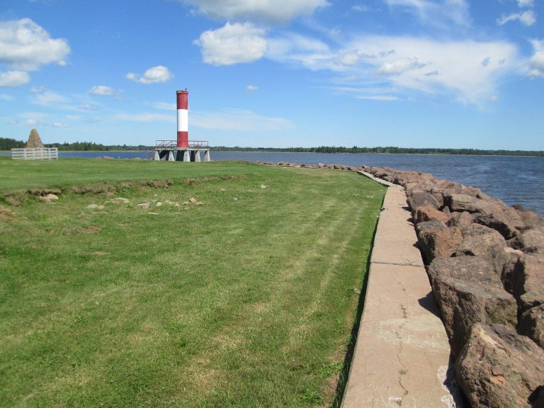
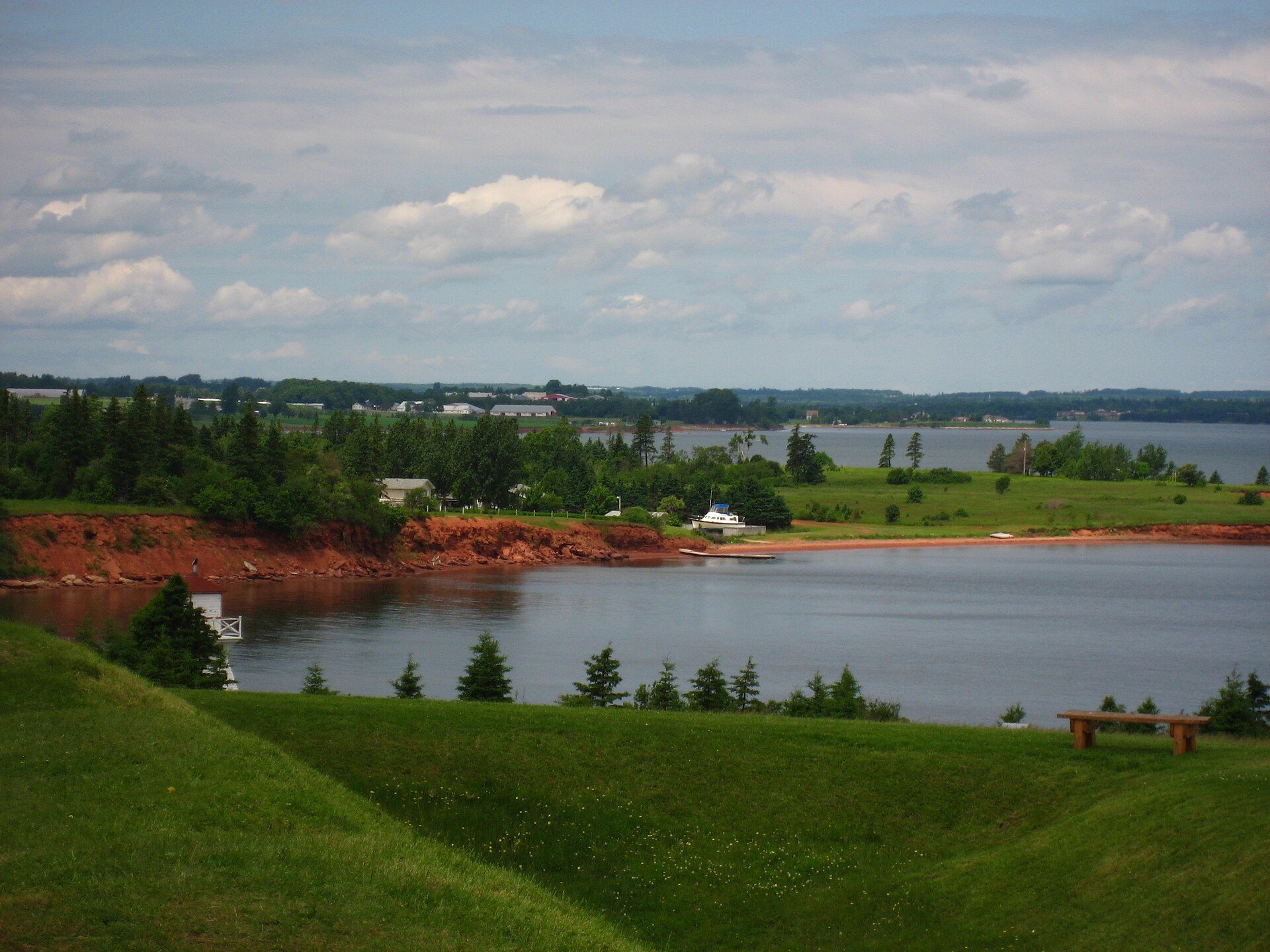
The site occupies the Warren Cove area on the southwestern side of Charlottetown Harbour, in Rocky Point opposite present-day Charlottetown. Its physical layout brings together the former French settlement and fortification area, the later British fort immediately to the east toward the water, and the surrounding land where Acadian farms were established.
Fortifications
French fortification
The French fortification built in 1748–1749 had a star-shaped plan influenced by Vauban’s principles. Its angular arrangement formed the military centre of the renewed French post at Port-la-Joye during the final decade of French control.
British Fort Amherst
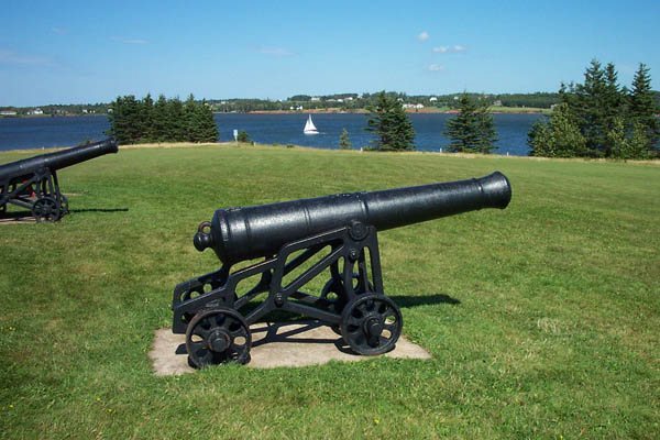
The later British fort was a small stockade enclosure surrounded by a dry ditch, a defensive trench without water, and entered across a drawbridge. Its 2.5-metre-high palisade, a wall of upright posts, stood on a porous sandstone foundation. Eighteen cannon were mounted around the fort, with four at each corner and one midway along two of the walls.
Within the enclosure were the commanding officer’s headquarters, officers’ quarters, soldiers’ barracks, a bakehouse, forge, storehouse, and prison. The palisade and buildings were gone by 1779, while the ditch and earthworks survived as the principal physical remains of the fortification.
Settlement landscape and interpretation
The southwestern part of the harbour area contained the French settlement, while Acadian farms occupied the surrounding land. The visitor centre, opened in 1973, interprets this early settlement landscape, the military history of Port-la-Joye and Fort Amherst, and Acadian life before the deportations.