Cihuatán: A Pre-Columbian Urban and Ceremonial Centre in El Salvador
Site at a Glance
- Rating
- 4.7
- Popularity
- Low
- Country
- El Salvador
- Primary era
- Medieval
- External website
- Open
- Eras represented
- Medieval
- Civilizations
- Maya
- Site type
- City
On this page22 sections
History
Cihuatán is a major pre-Columbian urban and archaeological site near Aguilares in El Salvador, established during the Early Postclassic period around AD 900–950. Its builders created a large city combining local Maya traditions with influences from central Mexico and other parts of Mesoamerica, the cultural region extending from central Mexico through much of Central America. The city occupied approximately 298 hectares and probably dominated much of central and western El Salvador before its destruction around AD 1150–1200.
Foundation and regional development
Cihuatán emerged after the decline or abandonment of major Late Classic centres such as San Andrés. Its foundation has been interpreted as part of the political reorganization and changing trade networks that followed the end of the Classic period. The date of its first construction remains uncertain. Some archaeological dating places the earliest work on the Western Ceremonial Centre as early as the eighth or early ninth century, while the city’s main establishment is generally placed around AD 900–950.
The Early Postclassic was a period marked by political realignment, long-distance exchange, increased militarization, and new artistic and religious forms. Cihuatán’s elevated and defensible setting, together with similar locations chosen for related settlements, suggests that regional instability influenced the organization of the new political landscape. The city may have served as the centre of a territory whose original name is unknown.
Population, culture, and political connections
The ordinary population appears to have been locally Maya, perhaps descended from communities associated with earlier sites such as San Andrés and Joya de Cerén. The ruling elite probably had Nahua origins and strong connections with central Mexico, although their precise ethnic identity remains uncertain. The contrast between the central Mexican character of some monumental buildings and the more Maya-oriented organization of residential areas has helped archaeologists distinguish the local population from the elite.
Cihuatán’s architecture and material culture connected it with Veracruz, Puebla, the Gulf coast, the Maya highlands of Guatemala, Nicaragua, and Costa Rica. Its cultural tradition is known as the Guazapa or Cihuatán phase. Local pottery included Banderas Polychrome, a three-colour tradition named for its recurring banner motif, alongside imported Tohil Plumbate from southwestern Guatemala and Nicoya Polychrome from Nicaragua and Costa Rica. Local versions of central Mexican ceramic traditions also circulated at the site.
Related settlements extended around Lake Güija, through the Zapotitán, Acelhuate, and Lempa valleys, around Guazapa Volcano, and along the coast. Several may have been subordinate communities or suburbs of Cihuatán. Five satellite settlements, El Tempate, Entrecañales, Las Pampas, San Francisco Zacatonal, and Carranza, were identified beyond the principal city, although urban growth, farming, and sand extraction have partly or wholly destroyed them.
Destruction and abandonment
Cihuatán ended in a rapid conflagration, probably caused by an armed conflict around AD 1150–1200. Buildings were burned and the settlement was abandoned rather than rebuilt. The Acelhuate Valley remained sparsely inhabited for several decades afterward. Burned deposits, possessions left behind, numerous spear points, and human remains indicate a violent destruction. The final attack probably took place during the dry season, perhaps in January or February. Bones found near the palace may belong to one or two victims, although their interpretation remains uncertain.
The city’s occupation lasted until approximately AD 1150–1200. Radiocarbon evidence from burned roofing and wall material at structure Q-40 most likely falls between AD 1160 and 1220, with a central result around AD 1170, corresponding to the period of destruction.
Rediscovery and archaeological protection
The name Cihuatán was recorded by the traveller Simeón Habel in the mid-1860s, when the ruins lay within the municipality of Guazapa. Samuel Lothrop produced the first known plan in 1925, and Antonio E. Sol directed the first official excavations in 1929. The site museum and the plaza of the Western Ceremonial Centre later took Sol’s name.
The ruins originally formed part of Hacienda San Diego. After the estate was divided, the Salvadoran government purchased 10.5 hectares from José María Peralta in 1953, including the Western Ceremonial Centre, and acquired the remaining land of the archaeological park from Peralta’s daughters in 1994. Investigations expanded from the 1970s onward. Mapping by Karen Olsen Bruhns and Charles Cecil in 1975 and 1977 recorded more than 1,060 structural features north, south, and east of the monumental centre, while more than 900 structures had been mapped across approximately 63 hectares by 1980.
The archaeological park is co-administered by El Salvador’s Ministry of Culture and the National Archaeology Foundation of El Salvador. Cihuatán and other pre-Columbian sites received protected National Archaeological Monument status under Legislative Decree No. 508 of May 6, 1976.
Remains
Cihuatán lies mainly on Cihuatan Hill near Guazapa Volcano, between the Acelhuate River to the east and the Izcanal ravine to the west. The settlement extends south and northwest toward San Dieguito Hill, across elevations ranging from approximately 265 to 325 metres above sea level. The archaeological park covers about 71.8 to 75 hectares and includes the monumental centre and a substantial residential area. The monumental centre contains approximately 167 structures and is divided into the Western Terrace, the Western Ceremonial Centre, and the Eastern Ceremonial Centre.
Western Terrace and enclosure
Western Terrace
The Western Terrace is a levelled strip approximately 450 metres long from north to south and about 50 metres wide, except at its northern end. Small platforms border the zone, which may have served partly as the city’s principal marketplace. Structures P-15 through P-22 stand on the terrace, with P-32 through P-35 farther south. Most are low rectangular platforms between about 0.8 and 1.5 metres high and probably supported buildings made from perishable materials.
Several platforms had ceremonial roles. P-20, a small square structure near the Western Ballcourt, has a western stairway with balustrades. A broken incense burner on its steps reflects the abrupt destruction of the city. P-22, at the northern edge of the terrace, is a square ceremonial platform about 6 metres wide and 1 metre high. Finds from its western stairway included fragments of incense burners, obsidian blades and waste flakes, quartz and quartzite knives, and red flint pebbles.
Domestic and small ritual platforms
P-16 is a long, low platform near the northwestern corner of the Western Ceremonial Centre wall. Household refuse indicates a domestic function, while an obsidian-working area at its southern end appears to have specialized in tools for woodworking and may also have been connected with the production of maize beer. P-32, P-33, and P-34 represent low domestic features, retaining stones, and a small platform. P-35 is larger and may have supported a small religious building; erosion has given it a rounded form.
Enclosing wall and entrance features
The Western Ceremonial Centre occupied a levelled high point of Cihuatan Hill within an enclosure of about 8 hectares. Its wall defined a sacred precinct that included Plaza Sol and also retained fill used to level the western side of the centre. Southern, western, northern, and short eastern segments survive under the designations P-46, P-47, P-48, P-49, and P-43. The remaining wall height ranges from less than 1 metre to about 2 metres at the northwestern corner.
The northern wall is stepped and built from rough stone set in earthen mortar. Drainage channels follow parts of the northern and western walls, using both natural stone and large ceramic pipes joined by interlocking fittings. Two original southern entrances consisted of a carefully constructed opening and a broad stairway leading toward the high southwestern wall and platform P-23. A further entrance may have stood beside the Western Ballcourt. P-23 may have functioned as a guardhouse and produced feline representations, probably jaguars or pumas, together with two incense burners.
Western Ceremonial Centre
Northern Ballcourt and associated buildings
The Northern Ballcourt is defined chiefly by structures P-3 and P-4, whose walls extended around the court. It had a paved floor, exterior spectator terraces, interior benches, and sloping surfaces designed to make a rubber ball rebound upward. Tuff faced both the inner and outer walls. Structure P-5 forms the southern entrance and has stairways on both its southern and northern sides. Its andesite walls and stairs were faced with volcanic tuff slabs or pale volcanic blocks.
A square temazcal, or heated sweat bath used for bodily, therapeutic, and sometimes ritual purposes, was attached to P-5. Structure P-5-1 measured approximately 5.2 metres per side and contained a ceramic tube and an andesite drain. It may have been used to treat injuries suffered by ballplayers, making it an unusual example of a sweat bath attached to a ballcourt. P-5-2 contained more than twenty ceramic feline sculptures and became known as the Temple of the Idols. A smaller room, P-5-3, probably served as a changing and storage area for players.
Structures P-1 and P-2
Structures P-1 and P-2 lie west of the Northern Ballcourt, outside the enclosure. Both had western stairways, entrance columns, and walls made with bahareque, a framework of wood or reeds coated with earth or clay. They may have been associated with the cult of Xipe Totec, a deity connected especially with renewal and warfare. P-1 had a rectangular plan, a pumice-paved summit, and drainage channels. P-2 had a distinctive T-shaped plan, floors made from pale volcanic blocks, and a central stone bench or probable altar. Burning and a broken incense burner indicate sudden abandonment.
Western Ballcourt
The Western Ballcourt is bounded by P-13 and P-14, the latter divided into P-14-1 and P-14-2. It extends through the enclosure wall toward the Western Terrace and includes a drain at the northern end of P-14-1. Unlike the Northern Ballcourt, its bounding structures had no exterior spectator terraces, their cores lacked tuff facing, and the court had no paved floor. P-14-2 was separated from P-14-1 by a narrow passage and was built over an earlier platform.
Buried wall segments and retaining walls beneath the court fill show that earlier construction was dismantled or covered during the ballcourt’s construction. The court was probably still unfinished when the city was destroyed.
Principal pyramid and Plaza Sol
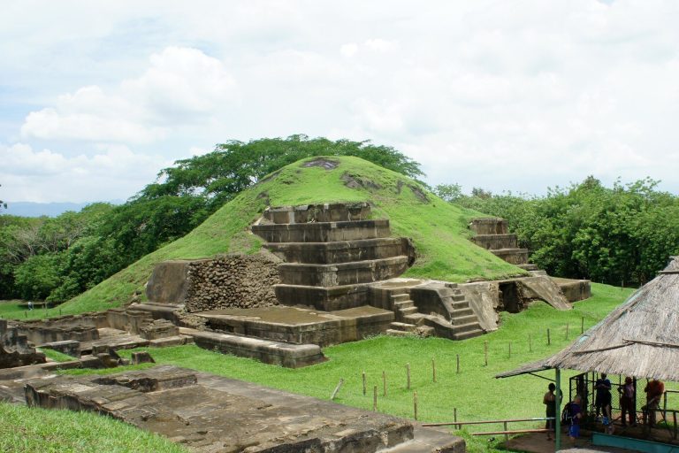
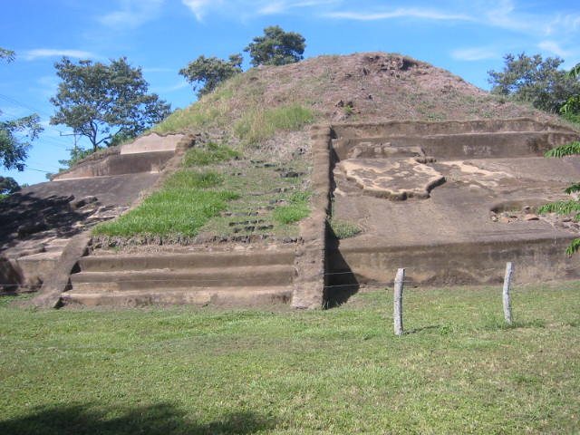
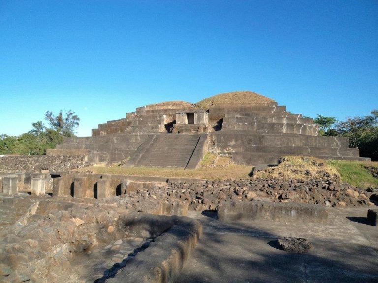
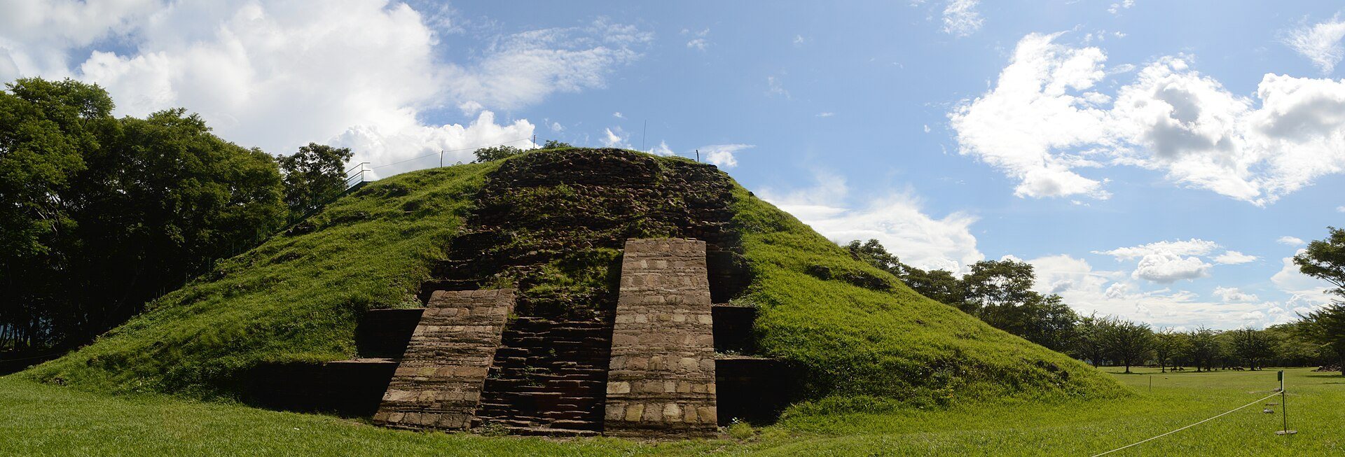
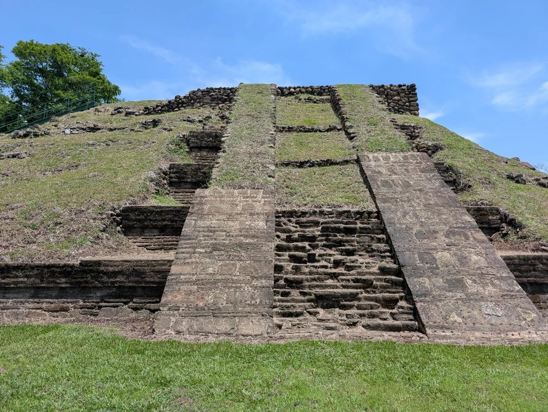
Plaza Sol is the higher of two levels within the Western Ceremonial Centre. It is bounded by the eastern high terrace, the Western Ballcourt area, the principal pyramid, and other terraces and walls. Pyramid P-7 is square, approximately 45 metres wide at its base and about 12 metres high. Six stepped terraces of rough stone and clay-earth mortar rise along its inward-sloping faces, which were faced with tuff. Stairways ascend from the western, northern, and southern sides.
A probable T-shaped temple stood on the summit. Its tamped-earth or adobe walls were partly painted red and probably carried a thick thatched roof. Burned earth and red-painted plaster indicate that the temple burned at the end of the city’s occupation. A circular talpetate stone recovered during conservation work in 2015 bears a ring-and-central-dot design associated with Xipe Totec, suggesting that the summit temple may have been dedicated to that deity.
Southeastern Patios and circular temple
P-41, known as the Southeastern Patios, lies southeast of P-7 and may have been an elite residence, perhaps for priests serving the pyramid temple. It contained finely paved tuff floors, stairs, drains, rooms with red-painted plaster, patios, and interior platforms.
P-28 is a circular andesite platform probably dedicated to Ehécatl, the wind-associated aspect of Quetzalcoatl, the feathered-serpent deity. Its slightly irregular base is about 8.9 metres in diameter and 34 to 40 centimetres high. The platform was unfinished at the time of destruction. Finds included fragments of vessels shaped like Tláloc, a central Mexican rain deity, part of a feline sculpture, burned bone, and two large bifacial points made from obsidian and silicate.
Eastern Ceremonial Centre
Acropolis and palace Q-1
The Eastern Ceremonial Centre contains the acropolis, a raised precinct for elite, ceremonial, and political buildings. It includes the ruler’s palace, or tecpán, together with structures that may have served as ceremonial buildings and noble residences. Plaza Gálvez lies between the Eastern and Western Ceremonial Centres. The acropolis includes palace Q-1, terraces Q-2, the Great Hall, possible subsidiary palaces, pyramids, elongated structures, and a religious plaza.
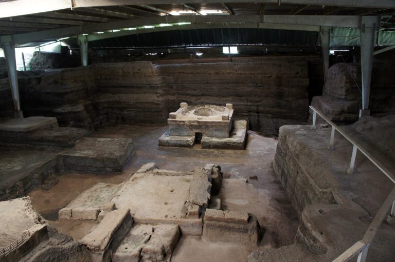
The Great Hall forms the ground floor of Q-1. It is a rectangular space about 8 by 36 metres, with stone-based walls that supported high adobe or earthen walls. Its entrance required a sharp turn to the left, perhaps to provide privacy or defence. The floor combined pale volcanic blocks, pumice, and talpetate slabs. Possible wooden columns, two drains, and the collapsed remains of a flat roof indicate a substantial structure.
Large hollow ceramic merlons, about 40 to 45 centimetres high, decorated the roof edge, while broad talpuja discs probably adorned the upper exterior walls. Ceramics from the hall included painted cups and bowls, red vessels, Banderas Polychrome vessels, and Achiotal Red vessels likely used for drinks. A Banderas Polychrome chalice and a censer beneath the collapsed northern roof point to feasting and ceremonial activity. A young adult mandible and a poorly preserved humerus at the entrance may represent one or two victims of the conflict that destroyed the city.
Upper palace spaces
The third palace level contained a central courtyard, a large ceremonial chamber, and a southeastern room that may have been used by palace women. The large chamber included five eroded earthen columns and an impluvium, a lowered area designed to collect and drain rainwater.
Religious structures Q-14 and Q-40
Q-14, formerly called O-4, is a rectangular religious structure about 8 by 4.5 metres and no more than 1.5 metres high. Nearby deposits contained wheeled dog figurines, large ceremonial incense burners, Tláloc-shaped bottles, seated jaguar effigies, and a cylindrical whistle or flute. A burial beneath the western stairway contained a young woman, a dog, and 70 miniature cups. A serious injury to the woman’s right temple led to a possible interpretation as ritual sacrifice, although that conclusion remains uncertain.
Q-40 is a T-shaped platform northwest of the acropolis, with a long western stairway. Burned roofing and wall material from the structure produced a radiocarbon date most likely between AD 1160 and 1220, linking its destruction to the final burning of the city.
Residential neighbourhoods
Approximately seven residential neighbourhoods surrounded the monumental centre. Their houses formed irregular groups around small patios or rows of structures on terraces, with the arrangement probably shaped by topography and kinship organization. Auxiliary buildings served as storerooms and kitchens. Domestic areas also supported cooking, weaving, obsidian working, ritual activity, and the production of alcoholic beverages.
Most houses stood on low platforms averaging about 18 centimetres high. Their walls were generally no more than 1 metre tall and used stone, adobe, or bahareque. Steep thatched roofs probably covered the buildings. The Plazuela Group and the NW1–NW3 group included houses, patios, storage facilities, and evidence for spinning, cooking, obsidian working, and food storage. In the NW1–NW3 group, the final fire left plates, tools, vessels, and other objects on the floors.
The San Dieguito Hill area contained 146 structural features, including domestic buildings and the ceremonial T-shaped structure 12-1. A nearby clay or bahareque furnace probably served metalworking and may have been associated with Xipe Totec. Mapping south of the monumental centre recorded retaining walls, erosion-control dams, low rectangular mounds, house platforms, pavements, and a possible T-shaped temple. Long low mounds designated SS-44 through SS-47 may have formed another ballcourt.
Construction and material remains
Most structures used cores or retaining walls made from rough stones gathered on Cihuatan Hill. Builders filled these frameworks with earth, compacted soil or mud, and large stones. Stairways commonly had broad balustrades, and some displayed the sloping faces and vertical panels of talud-tablero architecture, an arrangement associated especially with central Mexican monumental buildings. Surfaces were finished with volcanic tuff slabs, pale volcanic blocks, or pumice set in earthen mortar. Some elite surfaces and the principal pyramid received plaster made from burned seashells, with traces of red paint surviving on parts of the coating.
Platform tops were paved with rough andesitic basalt, pumice cobbles, or occasional stone slabs. Burned bahareque and earthen floors show that many platforms carried perishable superstructures. Excavated ceramics include utilitarian wares, Banderas Polychrome, Achiotal Red, Las Lajas Ceremonial vessels, Tohil Plumbate, Nicoya Polychrome, and local forms influenced by Veracruz and Puebla traditions. Ritual objects include spiked and biconical incense burners, Tláloc-shaped bottles, feline effigies, wheeled dogs, anthropomorphic figurines, clay boxes, and representations linked with Xipe Totec and Quetzalcoatl.
Banderas Polychrome vessels often bear black, white, and grey banner designs alongside shields, spears, throwing sticks, flags, skulls, bones, eagles carrying maguey spines, feathered serpents, and possible deities associated with trade and espionage. Together with imported pottery, obsidian tools, burned structures, and ritual imagery, these remains reflect the mixture of local Maya practices and wider central Mexican and Mesoamerican connections that characterized Cihuatán.