Joya de Cerén: A Classic-Period Maya Agricultural Settlement in El Salvador
Site at a Glance
- Rating
- 4.5
- Popularity
- Medium
- Country
- El Salvador
- Primary era
- Medieval
- External website
- Open
- Eras represented
- Classical, Medieval
- Civilizations
- Maya
- Site type
- Domestic
- Remains
- House
On this page15 sections
History
Joya de Cerén is a Classic-period Maya archaeological settlement in the Zapotitán Valley of western El Salvador, near the Sucio River. Established during the fifth or sixth century AD, it was an agricultural village whose inhabitants were probably tributary to San Andrés, the regional center then emerging in the valley. The settlement belongs to the Xocco phase, dated to approximately AD 400–600, and the Payu phase, dated to approximately AD 600–900.
Foundation and Maya regional connections
The village was founded shortly after the Tierra Blanca Joven eruption of Lake Ilopango. At that time, San Andrés was becoming the principal regional center, while the Zapotitán Valley was influenced by Copán. Joya de Cerén shares domestic and spatial characteristics with Copán, linking its buildings and community organization to wider patterns of Classic-period Maya life. The village population at the time of abandonment has been estimated at approximately 200 people.
Joya de Cerén supported an agricultural economy based on guava, agave, cacao, beans, maize, and manioc. The site provides the earliest known archaeological evidence of manioc cultivation in the New World. Residents produced agave fiber, grinding tools, pottery, and other goods locally. They also obtained obsidian and chert cutting tools, jade from the north, and decorated pottery probably distributed through elite-managed markets associated with Copán. Surplus goods moved between households and nearby communities through horizontal exchange.
The eruption and abandonment
Around AD 660, an eruption from Loma Caldera, less than 1 kilometer away, destroyed the village. The eruption affected approximately 5 square kilometers and buried the settlement beneath several rapid layers of ash and pyroclastic debris, which reached roughly 4–10 meters in thickness. The deposits were laid down at temperatures estimated between 100 and 500 °C.
Archaeological evidence indicates that the inhabitants escaped before the burial. Food had already been served, but sleeping mats had not yet been placed on household benches. Cooking fires had gone out, pots had been removed from hearths, and agricultural tools and other implements had been stored near domestic buildings. Mature maize, seasonal plants, guava and other moisture-sensitive trees indicate that the eruption occurred during the rainy season, probably in August or September. The eruptive activity may have lasted several days or several weeks, although its duration remains uncertain.
Cracks in the settlement’s relatively earthquake-resistant wattle-and-daub walls and adobe columns have led scholars to propose that an earthquake of approximately magnitude 4.0 preceded the eruption. Volcanic steam emissions may also have warned the community, but the precise warning is uncertain. The ashfall then protected the village’s architecture, tools, pottery, food remains, cultivated plants, and other materials in positions that preserve activities taking place at the moment of evacuation.
Rediscovery and archaeological interpretation
By the beginning of the twentieth century, the site lay within San Andrés hacienda, one of the largest estates in the Zapotitán Valley. In the mid-twentieth century, the portion containing Joya de Cerén was sold to the government for an early agrarian-reform project. The settlement was discovered in 1976, when a bulldozer was leveling land for government agricultural silos.
Payson D. Sheets of the University of Colorado Boulder led major investigations from 1978 to 1980. Excavation was interrupted by the Salvadoran Civil War, resumed in the late 1980s, and continued through 1996. Archaeological research has continued since then. The discovery revealed an unusually well-preserved Maya farming village and offered detailed evidence for the lives of non-elite agricultural households. Its preservation beneath volcanic ash has led to the informal description “Pompeii of the Americas.”
Joya de Cerén became a National Monument of El Salvador in 1989 and was inscribed on the UNESCO World Heritage List in 1993 under criteria (iii) and (iv). The listing recognizes its evidence for a vanished cultural tradition and its value as an example of an important stage in architectural and technological history. In 2018, work outside the excavated complex, in an area disturbed by a tractor, uncovered a burial pit and human remains. Associated finds included an obsidian blade, human footprints, cultivation furrows, and organic and skeletal material possibly dating to the Late Classic period, approximately AD 600–900.
Remains
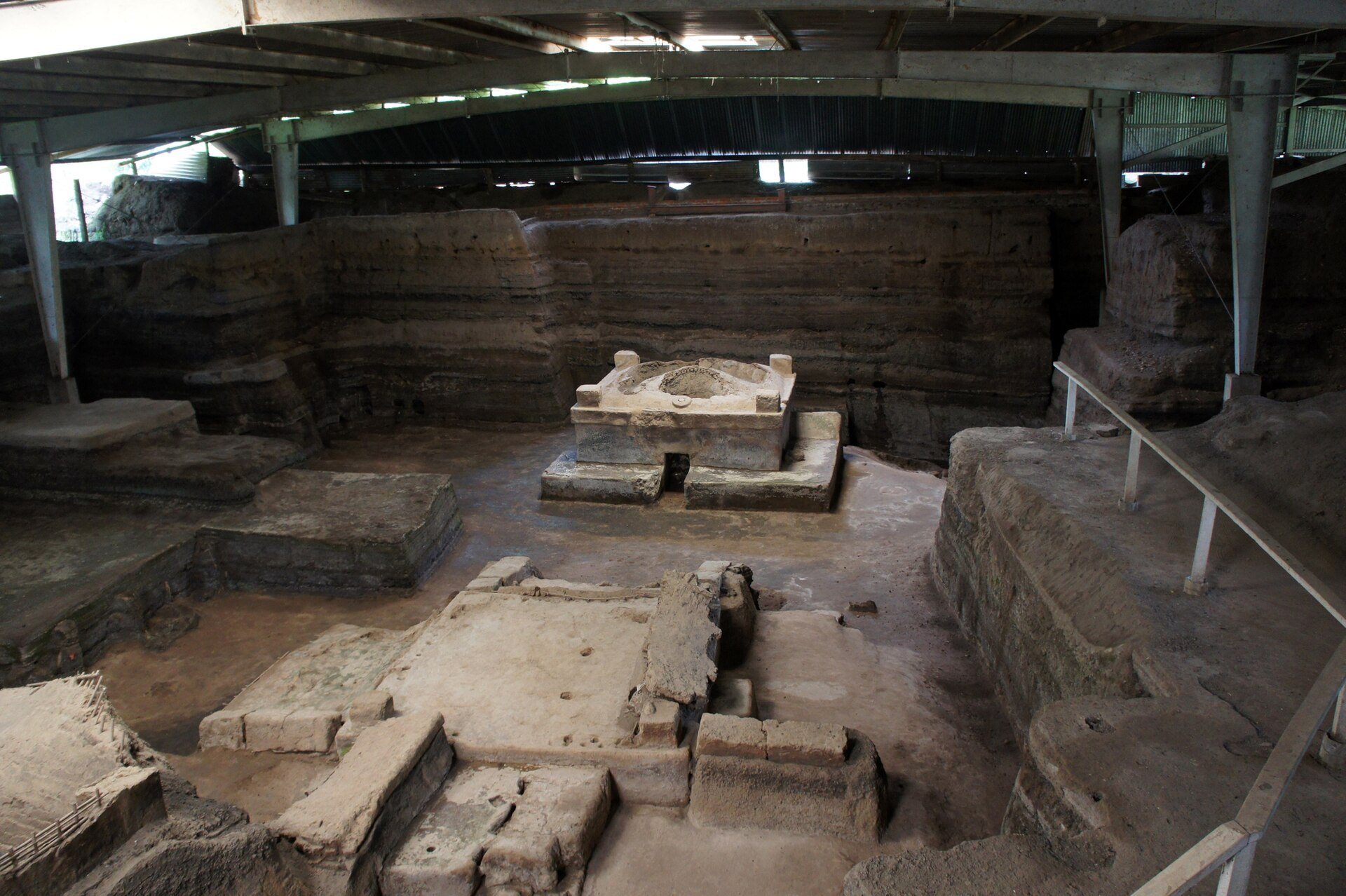
Joya de Cerén lies at approximately 450 meters above sea level beside the Sucio River. The known archaeological area covers about 50,000 square meters, although the full boundaries remain under investigation. Survey has identified 18 structures, while approximately 70 buildings have been uncovered across the broader excavated and investigated settlement. The remains include four domestic complexes, specialized buildings, cultivated areas, fruit trees, kitchen gardens, refuse pits, and other activity spaces.
Settlement layout and construction
The excavated remains are grouped into four archaeological areas. Area 1 contains Structures 1, 6, 10, 11, and 12; Area 2 contains Structures 2, 7, and 9; Area 3 contains Structure 3; and Area 4 contains Structure 4. Most structures and cultivated areas are oriented approximately 30 degrees east of north, apparently following the direction of the Sucio River. Orientation, platform height, floor plan, artifacts, construction methods, altars, caches, and burials help distinguish ceremonial buildings from domestic ones.
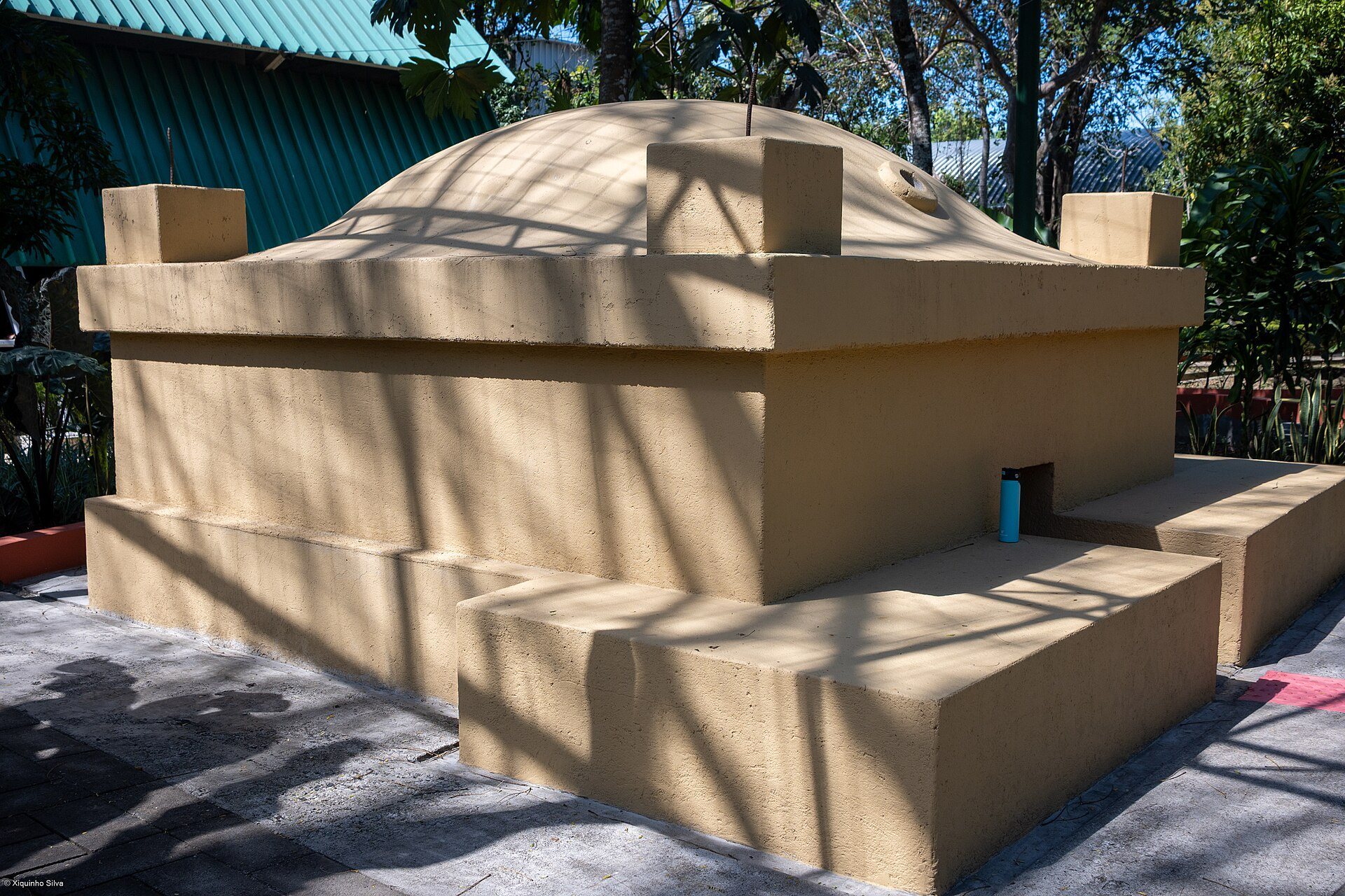
Most buildings used a standardized earthen construction method. Builders excavated through the earlier Ilopango ash to the pre-eruption ground surface, then formed a low mound from earth mixed with grass. The mound extended slightly beyond the building and helped drain rainwater, with its edges corresponding to the roof’s drip line. A rectangular platform of clay mixed with grass was built over it and fired to harden the surface. The platforms had vertical sides, angular corners, and opposing walls that varied by less than five percent in separation.
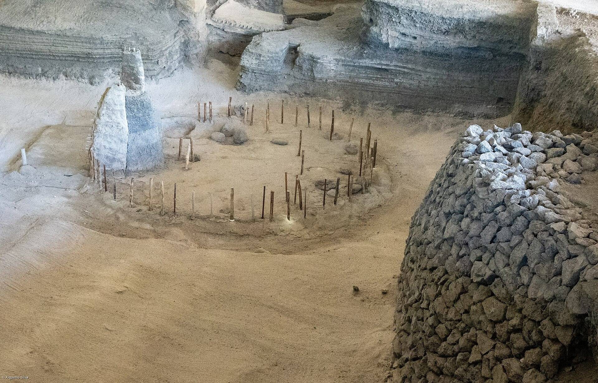
Each platform had solid adobe columns about 1.5 meters high at its four corners. Vertical rods, set about 15 centimeters apart along the east, south, and west walls, were tied to horizontal rods and roof beams with agave cord. Wet clay mixed with grass was pressed over this framework to create smooth reinforced earthen walls about 1.5 meters high and 15 centimeters thick. This wattle-and-daub method used a rod framework covered with clay and plant material. Thatched roofs rested on the wall framework, leaving space above the walls for air circulation.
Domestic complexes
Dwelling and household spaces
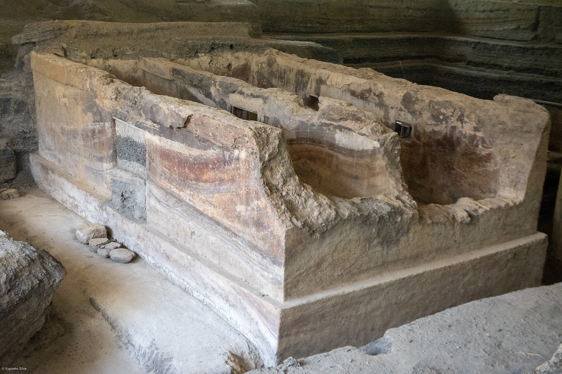
A typical domestic complex contained a dwelling, kitchen, and storehouse. Dwellings such as Structures 1 and 2 generally had a room with a large clay bench used for eating and other household activities, and at night as a family bed. Sleeping mats were stored in the roof beams during the day. Domestic Complex 1, made up of Structures 1, 5, 6, and 11, was excavated completely. Complexes 2 and 4 were excavated partially, while Complex 3 remained unexcavated.
Storehouses
Storehouses such as Structures 4, 6, and 7 generally had square plans and stood immediately south of the main dwelling. Structure 6 preserved evidence of a tethered duck. Mice were found in the roofs of storehouse buildings, where they were caught in the volcanic burial. Household plots could also contain cultivated areas, sometimes enclosed by wooden fences.
Kitchens and workshops
Kitchens such as Structure 11 were usually circular. Their grass walls improved ventilation, while roofs about one-third as thick as those on other structures probably allowed smoke to escape. Structure 11 and other kitchens contained blades, grinding stones, pottery vessels with traces of beans, cacao, and chilies, clay plates, spears, and other implements. Structure 1, also known as Domestic Structure 1, was fully excavated. Its kitchen may have produced masa and supplied metates, flat grinding stones used with handheld stones to process maize and other foods, for activities in Structures 10 and 12.
Each domestic unit is estimated to have stored approximately 70 vessels for cooking and serving food and drink, particularly in kitchen and refuse areas. A fourth specialized building could form part of a domestic complex. Structure 5 has been interpreted as a workshop, while Structure 9 may have been a temazcal, a traditional Mesoamerican sweat bath or steam-bath structure.
Community and religious buildings
Structure 10
Structure 10 is a multi-room building with numerous corridors. It is interpreted as a religious or community building that may have hosted communal festivals and religious activities. Its northern corridor was used for food preparation, while its eastern corridor probably served for storage. Decorated vessels, a red-painted deer image, and a twine headdress were found inside. The headdress has been interpreted in connection with fertility and harvest rituals. Vessels containing achiote seeds were associated with ceremonial objects, suggesting that the eruption may have interrupted a ceremony.
Structure 12
Structure 12 stands approximately 5 meters from Structure 10 and is interpreted as the residence or workplace of a shaman or another religious leader. A doorway and two lattice windows directed and restricted movement through the building. A niche in an earthen bench contained ceramic figurines, shell fragments, beans, and animal antlers associated with female symbolism. These objects have been interpreted as part of a possible supernatural or divinatory toolkit, while the rear rooms and a window in the western room may have been used for spiritual activities.
Structure 3
Structure 3 is the largest building at Joya de Cerén. It may have served special occasions and dispute resolution, and it was connected by a plaza to Structure 13. The broader excavated areas also include milpas, cultivated fields traditionally associated with maize-based farming, kitchen gardens, fruit trees, and refuse pits. Household 1 was associated with Structures 1, 5–6, 10–12, and 17; Household 2 with Structures 2, 7, 9, 13, and 18; and the areas linked to Households 3 and 4 included Structures 3, 4, 8, and 14–16.
Preserved archaeological evidence
Rapid volcanic burial protected household architecture and objects in their working positions, allowing the settlement to preserve a detailed picture of agricultural and domestic life. Food remains, cultivated plants, pottery, tools, storage facilities, and building arrangements show how households combined farming, craft production, food preparation, exchange, and ritual activity within a compact village landscape.