Popham Colony: England’s 1607 Settlement at the Kennebec River
Site at a Glance
- Rating
- 4.3
- Popularity
- Very Low
- Country
- United States
- Primary era
- Early Modern
- External website
- Open
- Eras represented
- Early Modern
- Civilizations
- English
- Site type
- Military
- Remains
- Fort
On this page12 sections
History
Popham Colony was a short-lived English settlement founded in 1607 at Sabino Head near the mouth of the Kennebec River in present-day Phippsburg, Maine, United States. Established by the Plymouth Company during England’s early colonial period in North America, it was also called the Sagadahoc Colony after the historical name for the Kennebec region. The settlement was named for Sir John Popham, its principal financial patron, and was abandoned after about fourteen months.
Foundation and First Settlement
The colony was created through the Plymouth Company, the northern division of the Virginia Company. King James I chartered the Virginia Company in 1606, authorizing private investment in English colonization. The Plymouth Company received a royal grant covering the North American coast between 38 and 45 degrees north latitude, while the London Company received the coast between 34 and 41 degrees. The London Company later founded Jamestown farther south.
An initial Plymouth Company expedition aboard the Richard was captured by the Spanish near Florida in November 1606. A second expedition, carrying about 120 male colonists and boys, left Plymouth on May 31, 1607, aboard the Gift of God and the Mary and John. The settlers hoped to obtain precious metals, spices, and furs. They also intended to test whether local timber could support English shipbuilding.
George Popham, a relative of Sir John Popham, became president of the colony and captain of the Gift of God. Raleigh Gilbert, the son of Sir Humphrey Gilbert, served as admiral and second in command aboard the Mary and John. The expedition included the Reverend Richard Seymour, nine council members, soldiers, artisans, farmers, traders, and other gentlemen. Sir Ferdinando Gorges, the military governor of Plymouth, was another important supporter.
The colonists reached Pemaquid in August 1607, bringing Skidwarres, a Native man captured by George Weymouth in 1605. The Gift of God reached the mouth of the Kennebec, then called the Sagadahoc River, on August 13, followed by the Mary and John three days later. Popham and Gilbert organized journeys up the river and westward across Casco Bay, making contact with the Abenaki, an Indigenous people of the northeastern woodlands whose languages belong to the Algonquian family. The colony did not establish lasting cooperation with the Abenaki.
Hardship and Abandonment
The late-summer arrival left too little time to grow sufficient food. Inadequate provisions led about half the settlers to return to England aboard the Gift of God in December 1607. They nearly starved during the voyage and sold their cargo in the Azores. Those who stayed faced a severe winter, during which the Kennebec River froze.
A fire damaged part of the settlement. Historical accounts connect the incident with the storehouse and its provisions, while excavation indicates that other buildings burned. George Popham died on February 5, 1608, and is the only colonist known to have died at the settlement. The Abenaki reportedly claimed that eleven colonists had been killed and the settlement burned. Raleigh Gilbert then became president at the age of 25.
The colony’s financial position weakened after news of Sir John Popham’s death reached the settlement in May 1608. When the Mary and John returned in September, it brought news that Gilbert’s elder brother John had died. Gilbert inherited the title and estate of Compton Castle in Devon and chose to return to England. With no replacement leader available, the remaining colonists dissolved the settlement and departed aboard the Mary and John and the Virginia.
The failure resulted from several pressures, including the loss of financial backing, the lack of a successor to Gilbert, the harsh winter, and hostility from Indigenous people and the French. Sir Francis Popham, son of Sir John Popham, later made unsuccessful efforts to reestablish the colony.
Later History and Archaeology
Jean de Biencourt and Father Pierre Biard visited the abandoned settlement in 1611. Samuel Maverick saw it in 1624 and reported that vegetation had overgrown the area, although garden herbs could still be seen. During the eighteenth century, the land was divided into farms and several houses were built there.
During the American Civil War, the Union army constructed Fort Popham about 500 metres east of the colony, at the mouth of Atkins Bay. The United States Army built Fort Baldwin on Sabino Head just west of the site in 1905, and parts of the former colony area were later used for transport and storage. Maine acquired part of the property in 1924. Fort Baldwin was reactivated during the Second World War and later returned to the state.
The colony’s precise location was forgotten until a plan of Fort St. George was found in the Spanish General Archives at Simancas in 1888. Pedro de Zúñiga, the Spanish ambassador in London, had obtained the plan through espionage and passed it to King Philip III of Spain in 1608. Archaeological work beginning in 1994 confirmed the location at Sabino Head and demonstrated the accuracy of the plan. Excavation campaigns continued until 2013. The site is listed on the National Register of Historic Places, with part of the area within Fort Baldwin State Historic Site and other portions remaining privately owned.
Remains
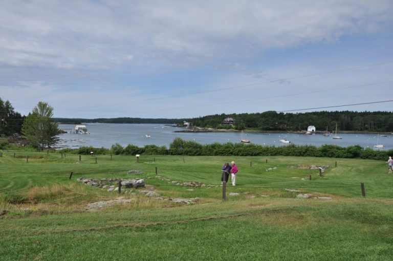
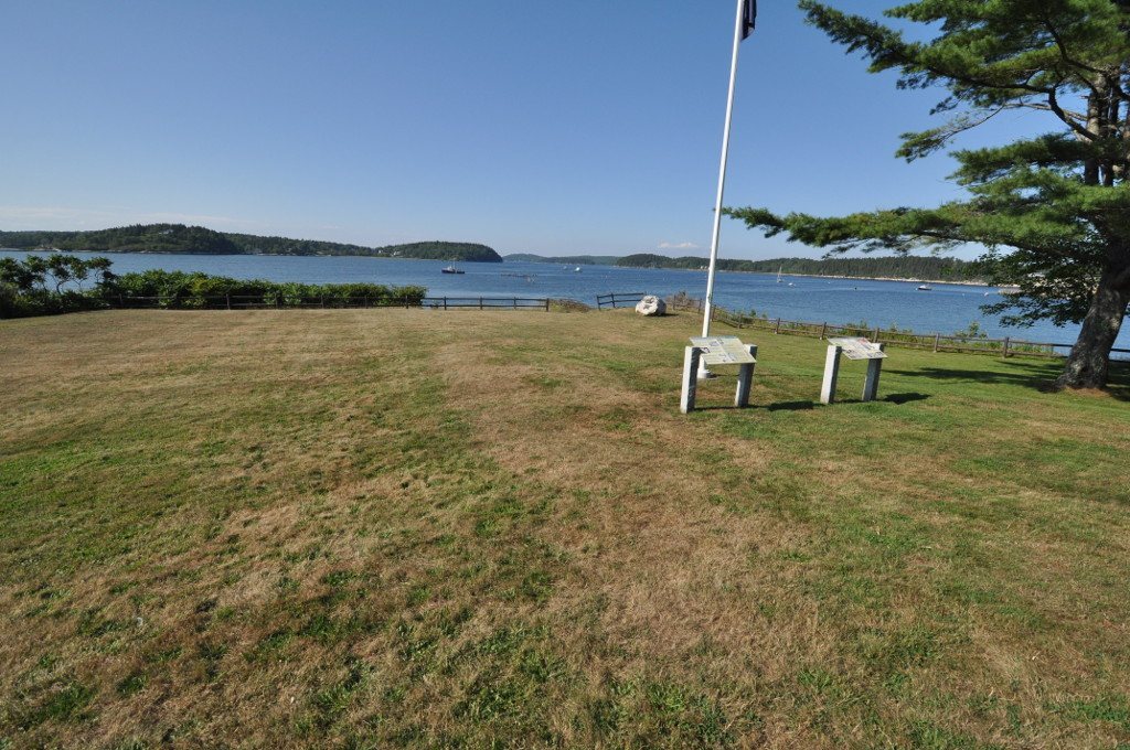
The settlement occupied a headland at Sabino Head near the Kennebec River. Its principal defensive work was Fort St. George, a large star-shaped fortification named for England’s patron saint. A plan drawn by colonist John Hunt on October 8, 1607, shows ditches and ramparts enclosing 18 buildings. The plan also marks nine guns, ranging from a demi-culverin to a falcon, both types of cannon used in the early modern period. Because construction had only recently begun when Hunt made the drawing, the complete layout shown on paper may not have been finished.
Fort St. George
Admiral’s House
Hunt’s plan identifies the admiral’s house among the buildings inside the fort. Excavations begun by Jeffrey Brain of the Peabody Essex Museum in 1997 uncovered its remains. The excavated structures matched the arrangement and approximate dimensions shown on Hunt’s plan, supporting the plan’s value as a representation of the settlement’s constructed layout.
Storehouse and Liquor Store
The storehouse was another building identified on the plan and recovered through excavation. A separate building used for storing liquor was also uncovered. Together, these structures reflect the colony’s dependence on centralized provisions and imported supplies during its brief occupation. Excavation revealed burned building remains, although the precise structure affected by the fire described in historical accounts remains disputed.
Chapel, Guardhouse, and Defenses
The plan marks a chapel, a guardhouse, and other buildings within the fort. Parts of the fort, probably including the chapel and graveyard, lie on privately owned land. The southern portion extends beneath a public road. Shallow ditches correspond to the defensive trenches drawn by Hunt, while the site’s natural topography appears to have contributed substantially to its defenses.
Shipbuilding and Ironworking
Virginia
The colonists built a 30-ton pinnace named Virginia, also called Virginia of Sagadahoc. A pinnace was a relatively small sailing vessel suitable for coastal exploration, transport, and ocean voyages. Built at the colony, the ship was the first English ocean-going vessel constructed in the Americas. It was initially intended for local exploration and to demonstrate the shipbuilding potential of the region, then refitted for the colonists’ return to England.
The Virginia later crossed the Atlantic during Sir Christopher Newport’s nine-vessel Third Supply mission to Jamestown in 1609. It survived a powerful three-day storm, probably a hurricane, that wrecked the mission’s flagship, the Sea Venture, in Bermuda. The vessel made at least one further Atlantic crossing under Captain James Davis.
Ironworking Area
Excavation also revealed evidence of iron smelting, probably using locally available bog iron. Bog iron is iron-bearing material formed in wetlands and used as an ore. The activity may represent the earliest iron smelting in what is now the United States, linking the settlement’s physical remains with its effort to assess and exploit local resources.