Naranjo: A Maya Royal City in Guatemala
Site at a Glance
- Rating
- 4.9
- Popularity
- Very Low
- Country
- Guatemala
- Primary era
- Classical
- External website
- Open
- Eras represented
- Classical
- Civilizations
- Maya
- Site type
- City
On this page18 sections
History
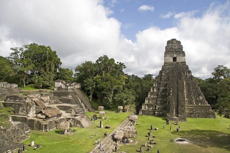
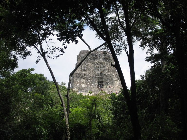
Naranjo is a Pre-Columbian Maya city in Melchor de Mencos, Guatemala, within the Yaxha-Nakum-Naranjo National Park. Settlement began about 500 BC, with the city’s foundation dated to around 300 BC, during the Preclassic period. Known as Wak Kab’nal, interpreted as “Place of the Six Lands,” it also bore the dynastic emblem name Sa’aal, interpreted as “the place where maize gruel abounds.” Its rulers were styled the Holy Lords of Sa’aal.
Preclassic foundations
During the Late Preclassic period, four smaller administrative and ritual centers developed within about 5 kilometers of Naranjo. La Traktorada, Kanahau, Las Trancas, and Chunwitz eventually became part of a single urban agglomeration associated with the formation of the Sa’aal state. Naranjo’s earliest political development remains incompletely understood, although texts preserve a mythic foundation attributed to the city’s patron deity.
The settlement expanded across a landscape of low natural hills and seasonal wetlands between the Mopan and Holmul river systems. Its early rulers built major elevated complexes, including the Western and Central Acropolises and several Triadic complexes. A Triadic complex was a Maya arrangement centered on a large pyramid or temple with two subsidiary structures. These early building programs established the ceremonial and political framework later developed during the Classic period.
Classic-period capital
During the Classic period, which generally extended from approximately AD 250 to 900, Naranjo became the capital of the Sa’aal kingdom. It was one of the major states of the eastern Maya region and took part in political relationships and conflicts involving Tikal, Calakmul, and Caracol. Its principal periods of florescence are placed in the 550s to 610s and in the years 700 to 730.
In AD 546, Naranjo came under the control of Calakmul, a powerful Maya urban state. Calakmul’s ruler Tuun Kab Hix appointed Ah Wosaaj Chan K’inich as Naranjo’s ruler, apparently to deprive Tikal of an ally. In July AD 559, Ah Wosaaj ordered the paving of a road, an undertaking commemorated on Altar 2.
Caracol attacked Naranjo twice in AD 626 and again in AD 631. Calakmul later restored its authority over the city. Under K’ahk’ Xiiw Chan Chaahk, Naranjo defeated Caracol in a conflict described in the inscriptions as a “Star War,” but Caracol recovered and eliminated that ruler by about AD 680.
Lady Six Sky and dynastic revival
In AD 682, Calakmul sent Wak Chanil Ajaw, conventionally known as Lady Six Sky, to reestablish the Naranjo dynasty. She was the daughter of B’alaj Chan K’awiil, ruler of Dos Pilas, and acted as Naranjo’s ruler, or possibly as regent. She was not formally proclaimed queen. Her arrival is recorded on Stela 24, which was found in front of Structure C-7.
Lady Six Sky’s son K’ak’ Tiliw Chan Chaak became ruler in AD 693 at the age of five. Their relationship is recorded on Stela 46. Between AD 693 and 698, Naranjo carried out at least eight attacks, probably under Lady Six Sky’s authority. These campaigns included victories over Tikal in AD 695 and Ucanal in AD 698. K’ak’ Tiliw Chan Chaak began another campaign in AD 706, which included the defeat of Yaxha in AD 710.
Lady Six Sky died in AD 741 and appears on Stelae 3, 18, 24, 29, and 31. Naranjo was defeated by Tikal in AD 744. Its ruler Yax Mayuy Chan Chaak was captured and was probably sacrificed during Tikal’s victory celebrations. Later rulers included Itzamnaaj K’awiil, who fought against Yaxha and, according to Altar 2, repaved the road first established by Ah Wosaaj in AD 790.
Decline and later history
Naranjo’s last known monument dates to AD 820, while the last recorded political reference to Wak Kab’nal dates to AD 842. The city remained inhabited into the Early Postclassic period, with estimates extending occupation to approximately AD 900 to 950. Its final abandonment is associated with political turmoil and severe drought around AD 810. Rainfall deficits depleted reservoirs, reduced agricultural production in seasonal wetlands, and contributed to the abandonment of royal compounds.
Naranjo’s later history was also shaped by extensive looting. By the 1920s, many ancient sculptures had disappeared, and during the 1960s looters broke large sculptures into fragments to remove them from the country. From 1997 to 2001, looters controlled the site. A large tractor cut was also made into the northeastern basal platform of the Central Acropolis during timber extraction in the 1960s, apparently in search of major sculpture.
Teoberto Maler mapped and photographed Naranjo in 1905 after being sent by the Peabody Museum of Harvard University. He excavated the hieroglyphic stairway of Structure B-18 in 1908. Alfred Maudslay and Thomas Gann had earlier documented surviving structures and monuments, while Sylvanus G. Morley and Oliver Ricketson conducted further investigations during the 1910s.
In 1972 and 1973, Guatemala’s Department of Prehispanic Monuments removed 19 stelae to protect them from looters. Archaeological work led by Vilma Fialko from 2002 to 2004 assessed the damage and identified approximately 270 looting tunnels and trenches. Guatemala’s Ministry of Culture and Sport began conservation work in 2002, and research and restoration continued until the project was halted in 2006. Naranjo was included in the World Monuments Watch in 2006, while a 2008 conservation initiative supported restoration of the temple with the hieroglyphic stairway. The site was placed on UNESCO’s tentative World Heritage list in 2022.
Naranjo’s political reach is also being examined beyond its monumental center. In 2013, a building at nearby Holmul, dating to approximately AD 600, was found with a well-preserved stucco frieze. An inscription beneath it states that Aj Wosal of Naranjo commissioned the construction when Naranjo was subordinate to the Kaanul dynasty of Dzibanche and Calakmul. Investigations at Xunantunich likewise suggest that the site may have belonged to Naranjo’s realm.
Remains
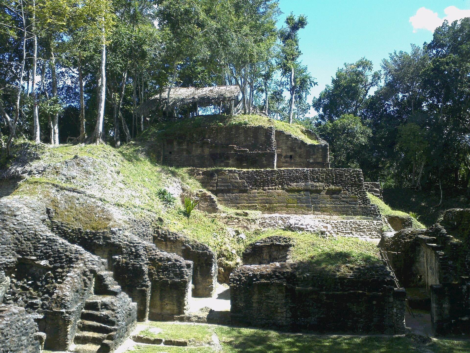
Naranjo lies on an elevated karstic plateau between the floodplains of the Mopan and Holmul drainage basins, about 50 kilometers east of Tikal and roughly 10 kilometers west of the Belizean border. The mapped settlement extends at least 8 square kilometers, while a broader survey covers approximately 90 square kilometers. The monumental or urban center occupies about 2 to 2.25 square kilometers. One survey recorded 389 buildings in the central area, with more than 900 additional buildings in the surrounding settlement. A broader inventory identifies more than 300 architectural groups containing at least 1,800 buildings arranged in residential neighborhoods.
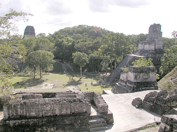
The urban center was organized around north-south and east-west axes and divided into six principal groups. Seven low natural hills shaped the layout. The ceremonial road running east to west began near the principal urban reservoir, passed the Central Acropolis and the Triadic Acropolis platform B-5, skirted the E-Group, and continued toward Pyramid C-9. The north-south axis followed the North Road through the Central Plaza and extended south from Building B-24.
Acropolises and Triadic complexes
Triadic Acropolis C-9
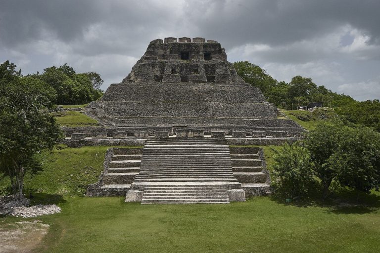
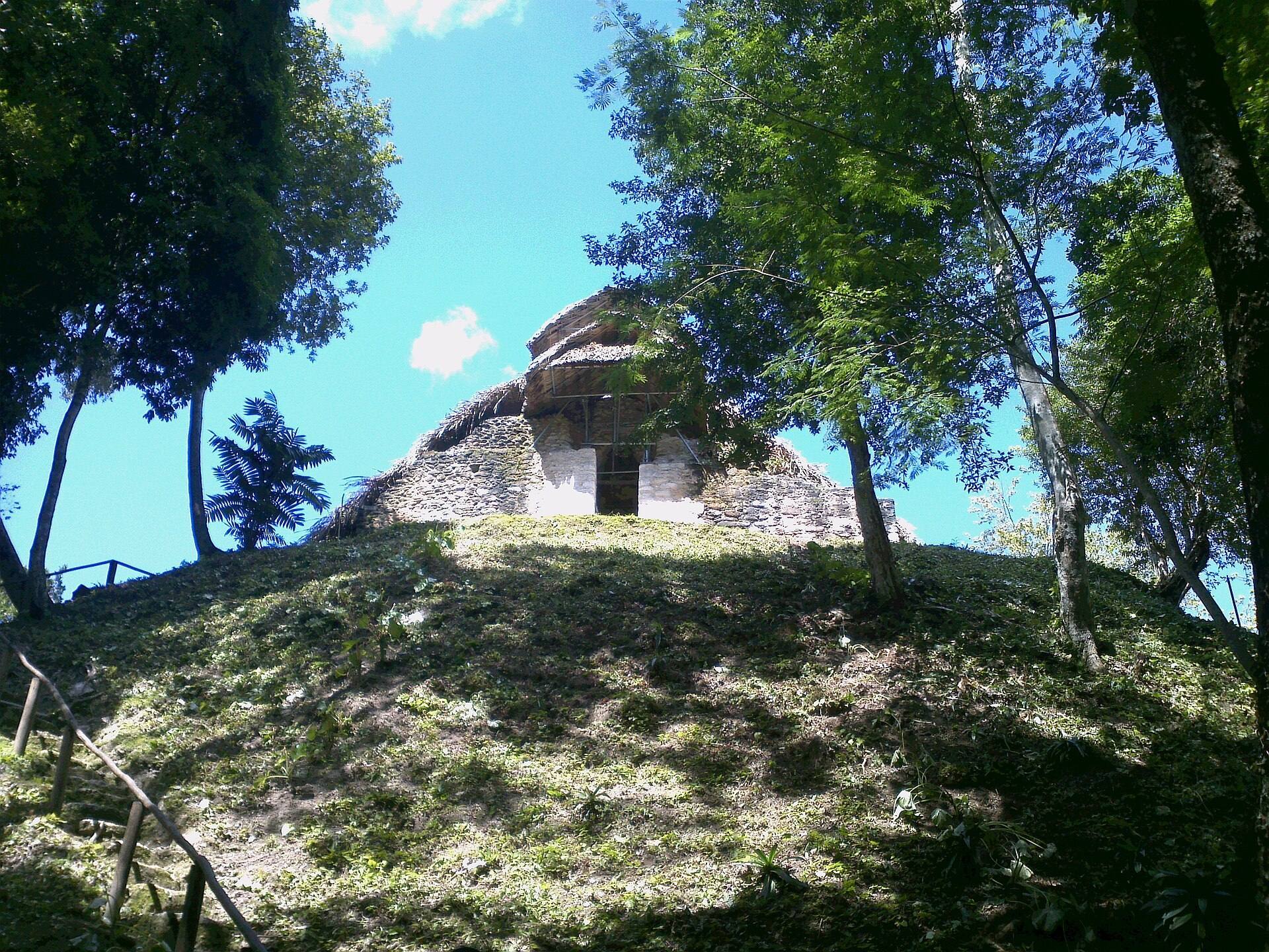
Triadic Acropolis C-9 is the largest of Naranjo’s Triadic complexes and occupies the summit of a natural hill containing a cave. Its main pyramid and associated structures formed an architectural setting interpreted in relation to the Maya concept of a sacred mountain, in which a high place, pyramid, or cave could represent a spiritually important mountain or place of emergence. Other Preclassic Triadic complexes stood on the Western and Central Acropolises and at D-1, B-5, C-3, and C-10.
Building D-1 and Building B-19
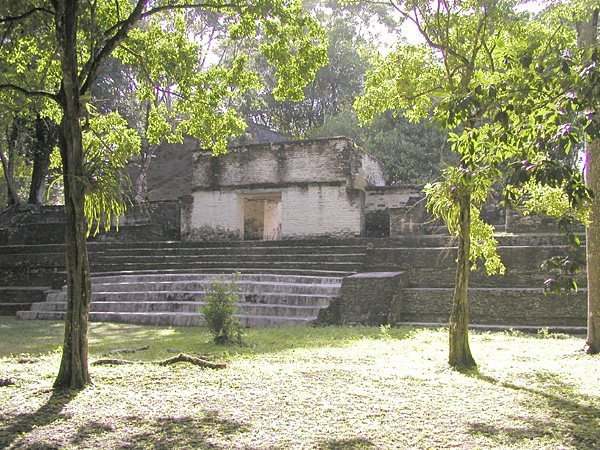
Building D-1 is the earliest identified major building at Naranjo. Beneath Building B-19, north of the Central Plaza, a vaulted palace dates to the decline of the Preclassic period. It is considered one of the early examples of this architectural form in the southern Maya lowlands.
Central Acropolis palace
The Central Acropolis contains the large palace complex identified as the royal palace. It stands beside the E-Group and the Pyramid of the Hieroglyphic Stairway. The acropolis occupies approximately 490 square meters and rises about 40 meters above the plaza supporting its basal platform. Five courts, including three major and two minor courts, are bounded by nine palaces containing multiple rooms. The development of the complex focused on central Building B-15.
Palace B-15
Palace B-15 consists of a four-terraced pyramidal basal platform rising about 30 meters above the surrounding courts. Each terrace contains longitudinal and transverse vaulted rooms. Looting tunnels exposed rooms on the south facade at the first, second, and third levels, on the west facade at the third level, and on the north side.
East Court
The East Court is the largest court in the palace complex, measuring approximately 40 by 27 meters. Palaces B-14, B-15, B-16, and B-17 surround it. Its form suggests that it may have accommodated public activities during the seventh century. Palaces B-14 and B-16 contained broad rooms with wide openings and central benches.
South and North Courts
The South Court was the most restricted and private part of the palace complex and could be reached only from the East Court. The ruler’s most private apartments may have stood around it. Its southern sector connected with several quadrangles that may have housed servants or specialized craft workshops. Six looting tunnels and trenches damaged the facades and substructures of B-15, B-16, and B-45.
A vaulted passage through Building B-14A connected the South Court with the East Court. The North Court adjoined the Main Causeway and may have supported ritual or ceremonial activities. A low L-shaped platform at its northwest corner may have allowed the ruler and his family to watch processions on the causeway.
E-Group and astronomical architecture
Pyramid B-18
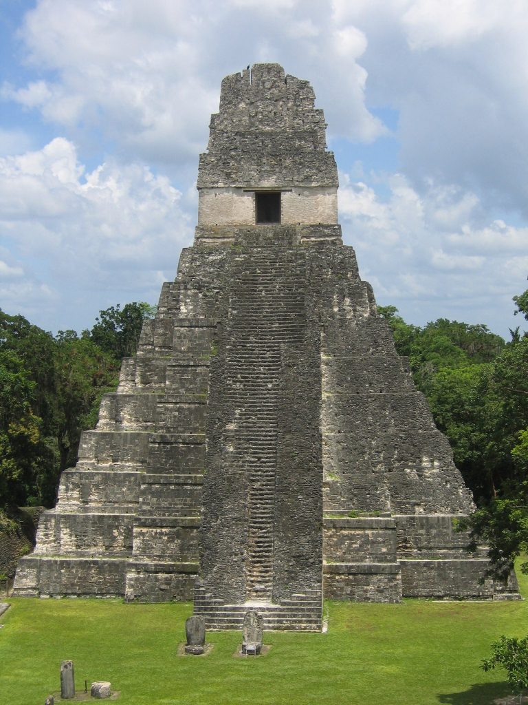
The E-Group included the radial Pyramid B-18, also called the Pyramid of the Hieroglyphic Stairway. Its earliest form dates to the end of the Preclassic period, during the Chikanel ceramic horizon. Four stairways descend toward the cardinal directions and lead to a temple on the summit. From the pyramid, observers could monitor the sun’s movement and identify solstices and equinoxes in relation to the opposing eastern platform B-20. The form and position of B-18 were associated with public ceremonies held at the equinoxes.
A hieroglyphic stairway was added to B-18 during the seventh century and is believed to have been brought from Caracol. Maler excavated it in 1908, and portions are now held by the British Museum in London.
Eastern platform B-20
Eastern platform B-20 formed the opposing element of the E-Group. Its relationship with Pyramid B-18 provided the setting for observing the sun’s position during the annual cycle and for ceremonies associated with the equinoxes.
Stelae and inscriptions
During a Preclassic crisis, Naranjo developed the practice of placing stelae at the bases of temple stairways, including those of Pyramids C-9 and C-10. A stela is a freestanding stone monument that may carry images, dates, and hieroglyphic texts. Forty-nine stelae are recorded at the site, including 38 carved monuments and 11 plain ones.
The monuments include one stela commemorating the completion of a five-year cycle and three associated with ten-year cycles. Their imagery falls into military, dynastic, and ritual groups, with military scenes predominating. Most belong to a Late Classic style and are regarded as less accomplished than monuments produced during the height of Maya Classic-period sculpture.
Naranjo’s inscriptions follow two principal formats. Some begin and end with the date of construction and narrate events between the preceding and current monuments, as on Stela 30, erected in November AD 714. Others cover events from the earliest to the latest occurrence described, as on Stelae 3, 18, 24, and 29. Stelae 25 and 38 contain calendrical and ceremonial material, while Stelae 23 and 35 describe warfare. Stela 45 and Altar 2, a broader and lower stone monument used for historical or calendrical inscriptions, provide important evidence for previously unknown rulers.
Water management and agricultural landscape
Because the central area lacked direct access to a perennial river, the city depended on modified seasonal wetlands, artificial reservoirs, and plastered masonry cisterns for its water supply. These systems stored monsoon runoff for the dry season. A chultun, a plastered underground or partly underground Maya cistern, was also used in the elevated hills, alongside caches and artificial caves.
Seasonal wetlands around Naranjo buffered floods and produced fertile soils for intensive agriculture. Excavations in plazas and nearby depressions have identified thick deposits of fine clay and silt associated with soil erosion during urban expansion and terrace construction. Together, the reservoirs, cisterns, wetlands, and terraces formed the physical infrastructure that supported the city’s large population and monumental center.