Moral Reforma: A Maya River-Port and Regional Center in Tabasco
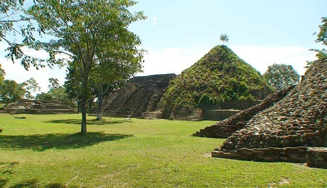
Site at a Glance
- Rating
- 4.7
- Popularity
- Low
- Country
- Mexico
- Primary era
- Medieval
- Eras represented
- Medieval
- Civilizations
- Maya
- Site type
- City
On this page12 sections
History
Moral Reforma is a Maya archaeological site in Balancán Municipality, Tabasco, Mexico, occupied from approximately 300 BC until about AD 1000 and built in the Río Bec architectural tradition during the Late Classic period. Located on the floodplain of the San Pedro Mártir River near its confluence with the Usumacinta, it belonged to the network of cities in the Usumacinta basin and connected political, agricultural, and commercial interests across the region.
From village to river center
Moral Reforma began as a village settlement and developed into a regional center that controlled river traffic, farming, and the movement of goods between the Guatemalan Petén and communities on the Gulf of Mexico. Its position beside an important waterway also made it strategically contested by larger Maya powers. The city maintained political and economic connections with Palenque, Calakmul, Piedras Negras, Tikal, Yaxchilán, Toniná, and San Claudio.
The settlement flourished especially between about AD 600 and 750, when major building activity took place. At first, Calakmul, Palenque, and Piedras Negras each influenced its affairs. Moral Reforma formed an alliance with Calakmul in AD 662 and with Palenque in AD 690. Between approximately AD 675 and 690, it depended on Calakmul while also coming strongly under Palenque’s influence. As Calakmul weakened, Palenque extended its power across eastern Tabasco. Around AD 750, Moral Reforma became the center of a small independent regional province.
Muwaan Jol and changing alliances
Stela 4, an upright carved stone monument with Maya writing and ruler imagery, provides an account of the ruler Muwaan Jol, whose name means “Hawk Skull.” He was born in the mid-650s and took power as a child in AD 661. A second accession ceremony took place under the supervision of Yuknoom Ch’een II of Calakmul on April 5, AD 662. A third ceremony followed under Kan B’ahlam II of Palenque on July 4, AD 690. The ceremonies reflect successive dependence on the two major political centers.
The same monument records victories by Muwaan Jol in AD 687 and probably AD 689. Captives shown on the stela may have been taken during these campaigns. By the time of Stela 1, dated AD 756, the influence of the dominant regional powers had weakened, but local warfare continued. The monument shows a ruler or subordinate allied with Moral Reforma striking prisoners and refers to conflicts with neighboring centers.
Names, exploration, and conservation
The ancient name of the city is unknown. Its emblem glyph, a dynastic or political sign identifying a Maya polity, is illegible on Stela 1. Teobert Maler made the first recorded mention of the site in 1907 during an expedition from Tenosique toward the Usumacinta, identifying it as “La Reforma II” after hearing local reports of large earthen mounds. E. Wyllys Andrews studied the site in 1937 and found Stela 1. Raúl Pavón Abreu investigated it in 1945 and reported Stelae 2 and 3, while César Lizardi Ramos inspected it in 1959 and reported Stelae 4 and 5. By then, several monuments had been moved to municipal museums without records of their original positions.
The name “Moral” was used by Andrews, “Morales” by Pavón Abreu, and “Moral Reforma” was adopted by Daniel Juárez of Mexico’s National Institute of Anthropology and History in 1993. Other recorded forms include Reforma, Balancán-Morales, and the Ruins of Acalán. From 1992 to 2012, the National Institute of Anthropology and History conducted excavation, restoration, and conservation, concentrating on Groups 1 and 2. This work cleared structures buried under earth and vegetation and exposed major buildings, including Building 14, the ball court, and the E1 and E2 pyramids. The archaeological zone opened to the public in October 2009 and is administered by the institute.
Remains
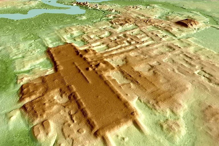
The archaeological zone covers approximately 87 hectares and includes at least 30 mounds, some of which probably conceal substantial pyramids. Its principal area is organized around large plazas enclosed by elongated, high structures. The central building group contains seven medium-sized buildings and several smaller structures. Limestone and river stone were used throughout the site, especially roughly worked cobbles gathered from the San Pedro Mártir River, and the masonry was generally coated with painted lime plaster, or stucco.
Architectural groups
The site’s architecture belongs to the Río Bec tradition, a regional Maya style known for monumental buildings with tall tower-like forms and paired or elaborate temple fronts. The arrangement of plazas, pyramids, palaces, and ceremonial buildings shows a substantial urban center whose major construction belongs chiefly to the Late Classic period.
Group 1
Group 1 is arranged around a rectangular or elongated court. Three pyramids of different heights stand within the group, together with a ball court, two palace-like buildings containing interior courtyards, and plain and inscribed stelae and altars. The ball court was designed for the Mesoamerican ball game, a ritual and political activity played with a heavy rubber ball.
Group 2
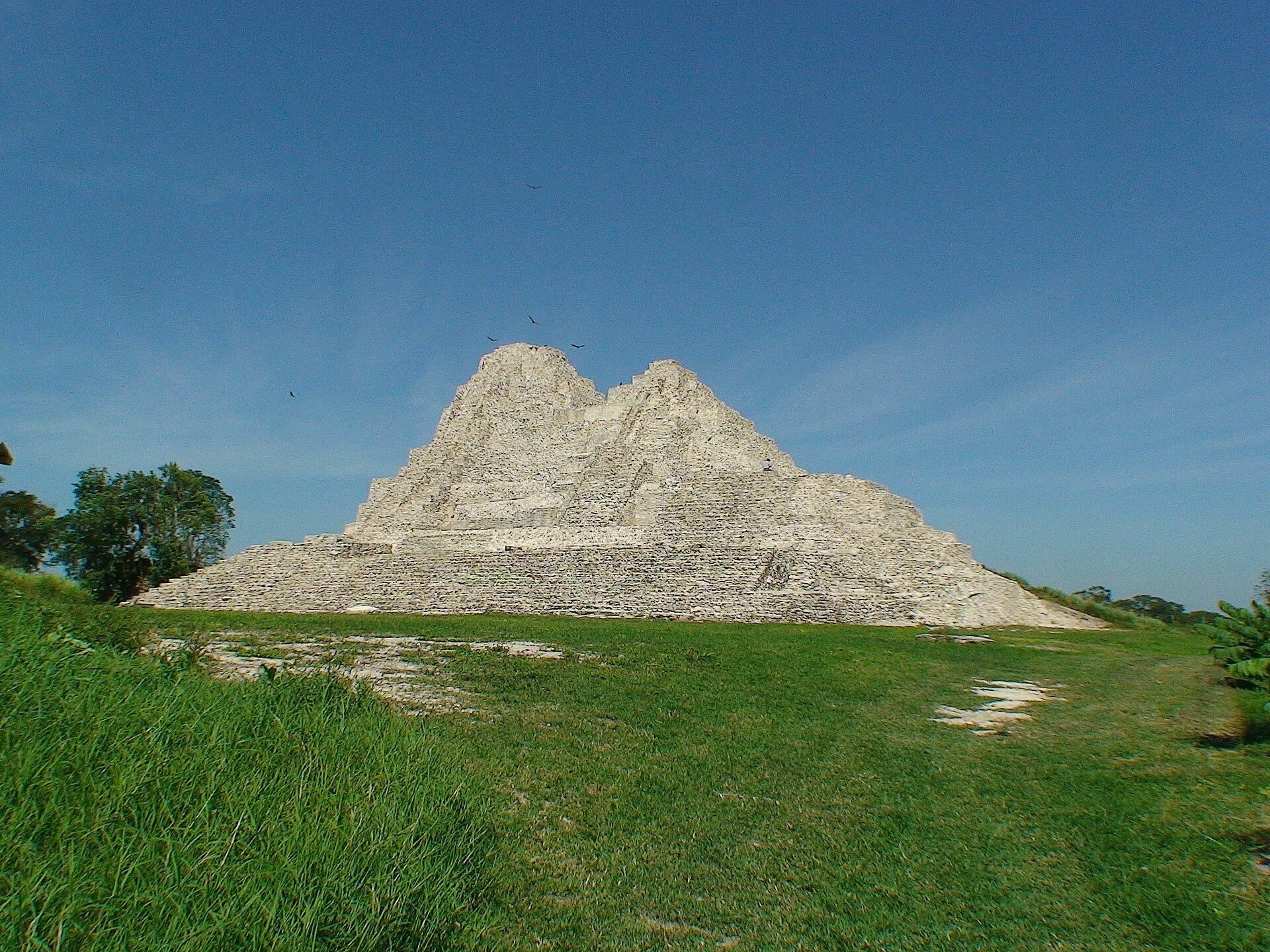
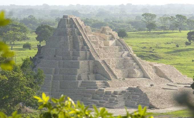
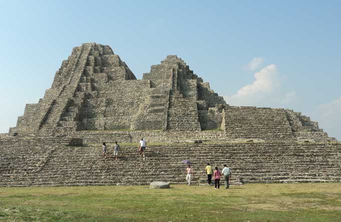
Group 2 contains two connected pyramids with a combined height of approximately 27 meters. The northern pyramid is higher and is reached by a narrow staircase. The slightly lower southern pyramid has a platform on its southern side and a broad stairway leading upward. Together, the structures rank among the highest known pyramid buildings in Tabasco.
Eastern Plaza and Building 14
The eastern plaza, or Plaza Oriente, is dominated by Building 2 and the paired pyramid of Building 14. These structures served ceremonial purposes. Building 14 rises about 27 meters above a base platform measuring approximately 50 by 70 meters. Only small remains survive from the buildings that once stood on the pyramid summits.
Monuments and archaeological finds
Stelae and altars
Four altars, six stelae, and more than 50 other archaeological pieces have been recovered from Moral Reforma. The stelae are limestone monuments carved with Maya glyphs, dates, ruler images, and scenes involving captives. Stela 2 carries a Long Count date corresponding to AD 711. The Long Count measured elapsed days from a mythical starting point and provided a way to express dates in inscriptions. Stela 3 bears a date corresponding to AD 735, Stela 4 one corresponding to AD 656, and the surviving inscription on Stela 5 includes a date corresponding to AD 633.
Stela 1 shows a richly dressed ruler with two captives at his feet on one side. On the other, a figure grips a prisoner by the hair and raises an axe. Parts of the inscriptions and the city’s emblem glyph are illegible. Stela 4 portrays Muwaan Jol holding a ceremonial object with two prostrate captives before him. Its style has been considered similar to that of Palenque, possibly reflecting the participation of Palenque specialists.
Objects from Building 2
Excavation in the second level of the Building 2 complex uncovered six greenish masks and a limestone sculpture representing a warrior-like figure. The sculpture retains bracelet-like elements on its forearms and has a fixed torso with articulated hands and legs that could move. It was interpreted as an offering to the gods. Recovered objects from the site are exhibited at the Dr. José Gómez Panaco Museum in Balancán de Domínguez and the Carlos Pellicer Cámara Regional Museum of Anthropology in Villahermosa.