Dur-Sharrukin: Sargon II’s Neo-Assyrian Royal City in Iraq
Site at a Glance
- Rating
- 4
- Popularity
- Low
- Country
- Iraq
- Primary era
- Iron Age
- Eras represented
- Iron Age
- Civilizations
- Assyrian
- Site type
- City
On this page19 sections
History
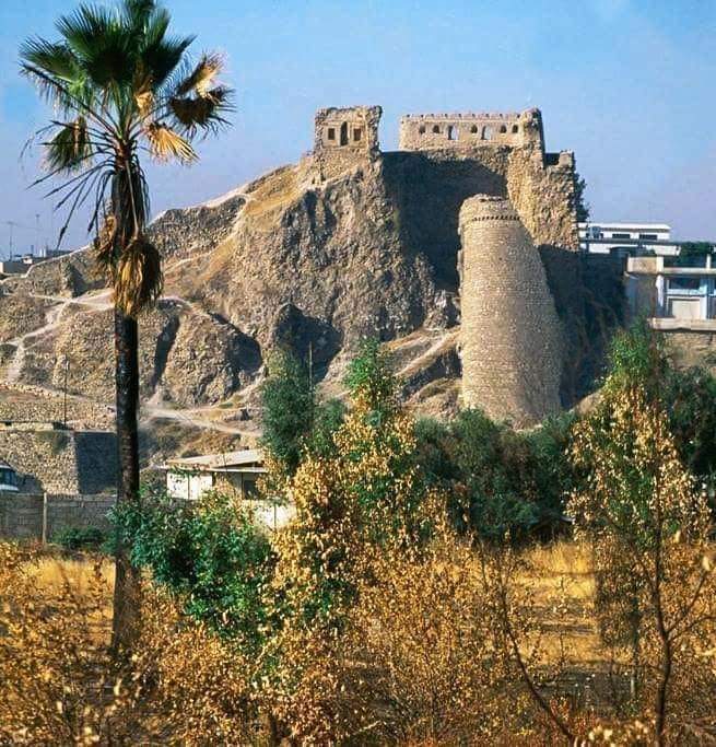
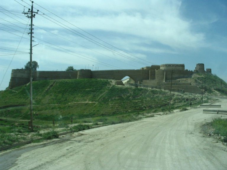
Dur-Sharrukin is a planned Neo-Assyrian royal city at Khorsabad in northern Iraq, founded by Sargon II between about 717 and 706 BC. Named “Fortress of Sargon,” it was built as a new capital on an almost undeveloped site near the village of Magganubba, about 15 kilometers northeast of Mosul. The Neo-Assyrian Empire, the powerful Assyrian state that dominated much of Mesopotamia and neighboring regions from the ninth to the seventh centuries BC, supplied the resources for this ambitious project.
Foundation and construction
Sargon II presented the decision to establish Dur-Sharrukin as divinely inspired. Political considerations may also have influenced the choice, including a desire to distance the royal center from Assur and Kalhu after revolts early in his reign. The new city became the center of a province formed partly from territory that had previously belonged to the province of Nineveh.
Construction began with a religious ceremony in May or June 717 BC and continued for roughly a decade. The city was inaugurated in 707 and 706 BC, although work continued into early 705 BC. Sargon supervised the project closely and received regular reports on its progress. About 110 letters associated with the construction later came to light in the palace at Nineveh. Unlike royal inscriptions, which presented the project in idealized terms, these letters describe delays in obtaining materials, housing workers, plants for the gardens, and transporting monumental sculptures.
The building program drew on the resources of the entire empire. Imperial funds, provincial supplies, loans from dignitaries, deported laborers, corvée workers, contracted specialists, and Assyrian supervisors were involved. Provincial governors were assigned sections of the walls and buildings, while the royal treasurer Tab-shar-Assur supervised the distribution of materials. Clay and straw for bricks came from the surrounding area, reeds arrived from neighboring provinces, timber was sent as tribute along the Tigris, and stone came from Assyrian quarries.
The city replaced the village of Magganubba rather than expanding an existing urban center. Its inhabitants were displaced after receiving compensation for their land. Some accepted money and bronze, while those who rejected payment received replacement fields. A major earthquake interrupted the final stage of construction, although its damage at Dur-Sharrukin appears to have been limited.
Foundation inscriptions placed in an alabaster box described the construction of the city, offered blessings for the king and the settlement, and threatened curses against anyone who violated the foundations. Related texts appeared on sculptures of winged human-headed bulls. The recorded perimeter of the city, 16,283 large Assyrian cubits, was associated in the foundation inscription with the numerical value of Sargon’s name.
Abandonment and later Assyrian history
Sargon II died soon after the completion of the city while campaigning in Tabal in western Anatolia. His body was not recovered, so he could not receive burial according to customary rites. His son and successor, Sennacherib, abandoned Dur-Sharrukin at the beginning of his reign and transferred the capital and its administration to Nineveh, about 20 kilometers to the south. Most of the population probably moved there as well.
Dur-Sharrukin therefore served as a capital for only a short time and later became a relatively minor provincial center. Its population was probably never large, which helps explain the small quantity of ordinary domestic objects found at the site. The city was probably abandoned around the fall of the Assyrian Empire in 612 BC, although texts from the later seventh century continued to refer to its province, including legal documents from the reign of Ashurbanipal.
Rediscovery and archaeological investigation
In the thirteenth century, the geographer Yaqut al-Rumi placed the “ruins of Saroun” near Khorsabad. The name may preserve a distorted form of the ancient city’s name. Nineteenth-century explorers initially sought Nineveh rather than Dur-Sharrukin. Paul-Émile Botta began excavating at Khorsabad in 1843 after abandoning his unsuccessful search at Kuyunjik. With French support and the artist Eugène Flandin, he excavated the palace terrace and uncovered carved gypsum orthostats, large upright slabs used to line or decorate walls. More extensive work began in October 1844.
Botta left Mosul in July 1845, but excavation continued intermittently. Austen Henry Layard took part in later investigations, and in 1852 Victor Place resumed French work after becoming French consul at Mosul. Assisted by the architect and draftsman Félix Thomas and the photographer Gabriel Tranchand, Place continued in the palace and investigated other parts of the city, including Gate 3 and Building G, until 1855.
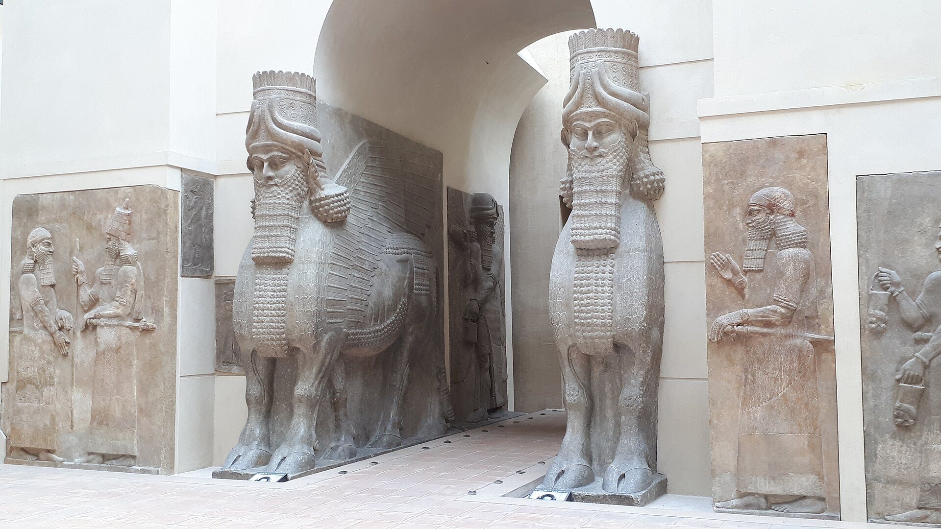
In May 1855, a convoy carrying antiquities was attacked near Al-Qurnah on the Tigris. Most of its 235 crates sank, and only 28 reached the Louvre. Later recovery efforts, including a Japanese expedition in 1971 and 1972, achieved little. The surviving sculptures are displayed in the Louvre’s Khorsabad Court.
American excavations by the Oriental Institute of Chicago resumed in 1929 under Edward Chiera and continued under Gordon Loud through 1935, with Hamilton Darby participating in the later seasons. These campaigns reassessed earlier French interpretations, identified the throne room, clarified the city plan, and investigated Gate 7, the small palaces, Building Z, the palace temples, and the arsenal area. An Iraqi Department of Antiquities team led by Fuad Safar excavated the site in 1957 and uncovered an isolated temple dedicated to the Sibitti.
French investigations resumed in 2019 under P. Butterlin. Magnetic surveys and soundings in 2022 and 2023 showed that the lower city contained many more buildings than previously believed. A winged bull was uncovered in October 2023. The site was reportedly plundered and damaged by the Islamic State in March 2015 during the destruction of pre-Islamic sites. Fighting between the Islamic State and the Peshmerga affected the area in 2016. Defensive works constructed by the Peshmerga were later demolished when the Islamic State retook the area in 2018. Dur-Sharrukin is consequently severely damaged and inaccessible.
Remains
Dur-Sharrukin formed a nearly square planned city of about 300 hectares. Its enclosure measured approximately 1,750 to 1,760 meters by 1,635 to 1,650 meters, with unequal opposite sides. A massive quadrangular wall of large cut limestone blocks faced with mudbrick enclosed the settlement. It was about 14 meters thick and may originally have reached approximately 12 meters in height. Towers and bastions projected several meters from the wall.
Fortifications and the lower city
Seven gates were in use, although eight were planned and one was incorporated into the royal palace. The gates and the inner and outer walls bore ceremonial names invoking protective deities. Gates near the palace were associated with Enlil, Ninlil, Anu, and Ishtar, while other gates invoked Ea, Belet-ilani, Shamash, and Adad.
Channels crossed the city. One ran through the northern half, another entered from the east, and a northern channel appears to have reached a central depression that may have been an artificial basin or garden area. Magnetic surveys have identified streets, monumental buildings, and large elite residences in the lower city, although the complete urban grid remains uncertain.
Gate 3
Gate 3, possibly the Gate of Shamash, measured approximately 67 by 49 meters. Three open courts were entered through vaulted doorways, and the structure was decorated with winged human-headed bulls and reliefs of genies. Its arrangement suggests use by pedestrians.
Gate 7
Gate 7 was simpler than Gate 3 and lacked relief decoration. Its unfinished condition forms part of the evidence for the incomplete state of some portions of the city when construction ended.
Lower-city buildings
The lower city has been only partly excavated. French investigations examined Building G, while American excavations partially exposed Building Z. Iraqi excavations uncovered an isolated temple dedicated to the Sibitti near the acropolis. Magnetic surveys in 2022 and 2023 confirmed numerous large buildings and Neo-Assyrian residences with interior courtyards and reception rooms.
Acropolis and royal palace
The northwestern part of Dur-Sharrukin contained an inner-walled acropolis with the royal palace, temples, a ziggurat, and residences for senior officials. The complex stood on an artificial terrace of more than 10 hectares that rose about 12 meters and crossed the city wall, projecting beyond it. A southeastern ramp led to a monumental triple portal and then to Court XV, which measured approximately 103 by 91 meters.
Palace without Rival
Sargon’s royal palace was ceremonially called the “Palace without Rival.” Its official sector, or babanu, accommodated administration, ceremonies, storage, kitchens, receptions, and possibly workshops and stables. The private sector, or bitanu, contained the royal apartments and at least part of the harem.
Three monumental doorways led southwest from the Court of Honor to the throne room, Room VII. The rectangular room measured about 10 by 47 meters and contained a decorated platform approximately 4 by 4.6 meters and 1 meter high, probably intended for the royal throne.
Court I included a partly excavated isolated building measuring about 60 by 29 meters, with a columned entrance. It may have been a residential or convivial building, perhaps situated within a garden. It has sometimes been identified as the bit hilani mentioned by Sargon II, but the eight columns supported by colossal bronze lions described in the inscription were not found there.
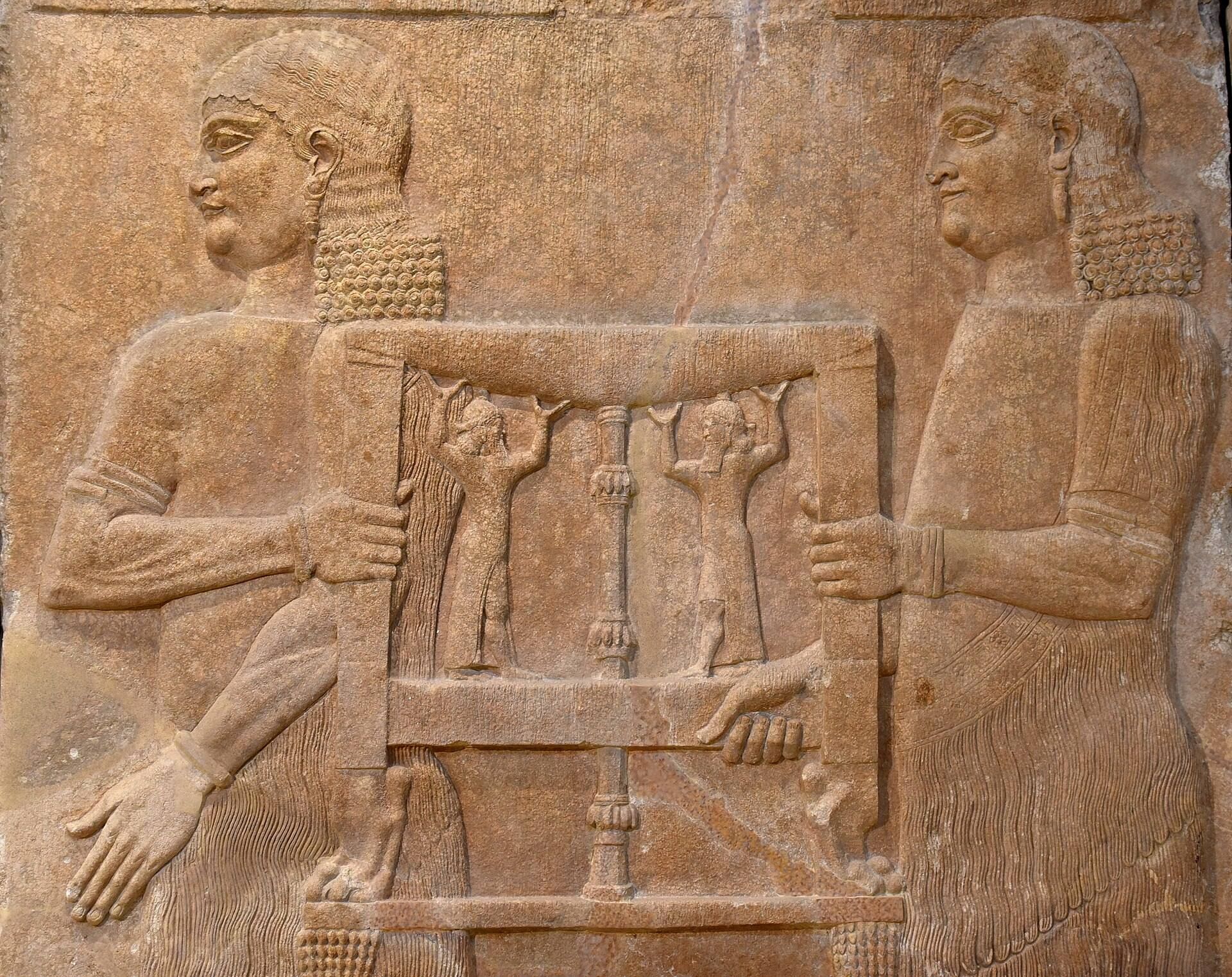
The palace combined sculpture, wall painting, colored glazed bricks, stone inscriptions, and furnishings made from wood, ivory, and other valuable materials. Its relief program presented warfare, tribute, royal ritual, court life, hunting, banquets, and the transport of timber. These scenes expressed the religious and political ideology of Sargon II and the authority of the Assyrian Empire.
Winged human-headed bulls
Pairs of monumental winged human-headed bulls guarded doorways and entrances. In Assyrian texts they were called shedu, lamassu, or aladlammu. These protective figures, commonly shown as winged bulls or lions with human heads, stood symmetrically beside passageways and helped support door vaults.
Each bull was carved from a single block of stone and transported from quarries near the upper Tigris. Their height ranges from approximately 3.5 to 5.8 meters, and their width is about 1.3 meters. Some weighed as much as 40 tons, while at least one sculpture was lost in the river during transport. Accompanying reliefs showed winged genies, bird-headed genies, heroes mastering lions, stylized trees, and the ruler with dignitaries.
Palace reliefs were carved on gypsum-alabaster orthostats and originally painted. Their subjects included military campaigns, tribute, royal ceremonies, court activities, hunting, banquets, and the movement of timber. A winged bull from Gate 6, excavated in 1992, was rediscovered during recent investigations after looters removed its head. Iraqi authorities recovered the head and transferred it to the Iraq Museum in Baghdad. Another massive bull uncovered in 2023 had been described in the nineteenth century and partly excavated in the 1990s before being reburied for protection.
Temples and sacred buildings
The southern side of the palace terrace contained six sanctuaries arranged around three courtyards. Court XXVII gave access to the sanctuaries of Sin, Shamash, Adad, Ninurta, and Ea, while Court XXXI led to the sanctuary of Ningal. Sin was the moon god, Shamash was associated with the sun, justice, and divination, Adad with storms, Ningal with the moon god’s cult, and Ninurta with royal and martial power.
Ziggurat
A ziggurat stood west of the temple complex. A ziggurat was a monumental stepped temple tower built in ancient Mesopotamian cities. Victor Place measured its square base at approximately 43 meters per side and reconstructed a helical elevation with stages about 6 meters high, colored white, black, red, and blue. Place identified it as an observatory, but that interpretation and parts of his reconstruction have been criticized.
Temple of Nabû
The temple of Nabû, designated Building H, stood south of the palace terrace on a platform about 5 meters high. It measured approximately 132 by 85 meters and contained 45 rooms. Nabû was associated especially with wisdom, writing, and scholarly knowledge.
The temple included a paved cella, the principal sacred room, with a podium and niche for the cult statue. An adjoining room probably served as the cella of Tashmetu, and other rooms may have formed a library.
Official residences and military quarter
The lower part of the artificial acropolis was enclosed by an inner wall surrounding an area of approximately 650 by 300 meters. It contained four small palaces, designated Buildings J, K, L, and M, together with the temple of Nabû.
Small palaces
Palace L was the largest of the small palaces. An inscription identifies it as the residence of the vizier Sîn-aha-usur, Sargon II’s brother. Palace K measured approximately 140 by 110 meters, although its occupant is unknown.
Palace F and the arsenal area
Palace F occupied the southeastern part of the city, crossed the city wall, and stood on an elevated terrace. It was probably an ekal masharti, an Assyrian palace of review associated with a military arsenal or administrative complex. The southeastern military quarter covered approximately 272,000 square meters, while Palace F extended over more than 58,000 square meters. This complex was protected by its own inner wall and formed a separate elevated group from the northwestern acropolis.
Gardens and parks
Gardens and parks were associated with the royal palace, including hunting grounds and gardens modeled on the Amanus Mountains of northern Syria. Administrative records mention the transport of young quince, almond, apple, and medlar trees. These planned plantings formed part of the wider palace landscape alongside the channels and possible central basin.