Shiloh: An Ancient Israelite City and Sanctuary
Site at a Glance
- Rating
- 4.7
- Popularity
- Medium
- Country
- Israel
- Primary era
- Medieval
- External website
- Open
- Eras represented
- Bronze Age, Iron Age, Classical, Medieval
- Civilizations
- Abbasid, Byzantine, Canaanite, Crusader, Israelite, Kingdom of Jerusalem
- Site type
- City
On this page14 sections
History
Shiloh is an ancient Israelite city and sanctuary at Shiloh in Israel, associated with the pre-monarchic period and with an occupation sequence extending back to the Middle Bronze Age. Located in the hill country of Ephraim, south of Samaria, it became a major religious center before Jerusalem rose to prominence under King David.
Bronze Age and Israelite Shiloh
The site was occupied from approximately 1750 BCE and preserves remains of Canaanite settlements from the Middle and Late Bronze Ages. According to the Hebrew Bible, the Tabernacle, or Tent of Meeting, was established at Shiloh after the Israelite settlement of Canaan. The portable sanctuary was associated with the Ark of the Covenant before the construction of the First Temple in Jerusalem. Joshua, traditionally regarded as Moses’ successor, and Eleazar, the high priest, are said to have distributed tribal territories and Levitical cities from Shiloh.
During the pre-monarchic period, Shiloh was associated with pilgrimage, major feasts, sacrifices, and an annual festival involving dances among the vineyards. The sanctuary was administered by Eli and his sons, Hophni and Phinehas. Hannah dedicated her son Samuel there, and the biblical account presents Samuel’s prophetic career as beginning at the sanctuary. Shiloh may also have functioned as the de facto capital of the Israelite tribes during this period.
The Ark was taken from Shiloh to the battle camp at Eben-Ezer and captured by the Philistines at Aphek. Eli is said to have died after hearing of the Ark’s capture. A destruction of Shiloh by the Philistines has been proposed in connection with these events, although the precise historical interpretation remains debated. Archaeological and radiocarbon evidence places a major destruction at the site in the second half of the eleventh century BCE, approximately 1050 to 1000 BCE. One interpretation connects this destruction with the Philistine victory and the loss of the Ark, while another sees it as a factor that may have contributed to the later establishment of the Israelite monarchy.
Later Israelite and Imperial Periods
Settlement continued after the major destruction, probably with a reduced Israelite population, until the Assyrian conquest of the Kingdom of Israel in 722 BCE. The prophet Ahijah was later known as “the Shilonite,” linking him with the place. The tell was densely resettled during the Persian period, and a Jewish settlement continued until the Bar Kokhba Revolt.
Occupation and reuse continued through the Roman, Byzantine, early Muslim, and Crusader periods. Byzantine Shiloh supported Christian pilgrimage and settlement, with at least two churches associated with the site and later investigations identifying three basilicas in the wider excavated area. The churches were destroyed during the Arab conquest, after which architectural elements were incorporated into Muslim buildings. A structure known as the Mosque of the Sixty was probably built during the ninth or tenth centuries. Its later history may include the conversion of an earlier synagogue into a mosque, although that interpretation remains uncertain.
Rediscovery and Archaeological Investigation
Medieval Jewish, Christian, and Muslim travelers continued to associate the site with Shiloh, although some accounts placed it at Nabi Samwil, which was identified with Samuel’s tomb. Jerome, Eusebius, the sixth-century Madaba Map, a pilgrimage account from approximately 1210, and the fourteenth-century writer Ishtori Haparchi all referred to Shiloh. Edward Robinson identified the site with Khirbet Seilun in 1838, using the nearby spring of Ein Seilun and the local place-name as part of his reasoning.
Early investigations were followed by excavations by Hans Kjær’s Danish expedition between 1926 and 1932. The work ended after Kjær died of dysentery, and the excavators built two structures over exposed fifth- and sixth-century churches. Israeli excavations followed under Ze’ev Yeivin in the early 1970s and Israel Finkelstein from 1981 to 1984. Further work began in 2010 under the Archaeological Staff Officer of the Civil Administration and Ariel University, with later seasons from 2017 conducted by Associates for Biblical Research under archaeological supervision.
Excavations and surveys have established a sequence from the Middle Bronze Age through the Iron Age, Persian, Roman, Byzantine, early Muslim, and Crusader periods. Finkelstein’s excavations identified eight archaeological strata extending from Middle Bronze II to the Byzantine period. The site was subject to a military expropriation order in 1978. Shiloh’s identification with the biblical sanctuary rests on its location, biblical geographical descriptions, and substantial Iron Age remains.
Remains
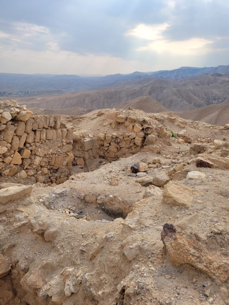
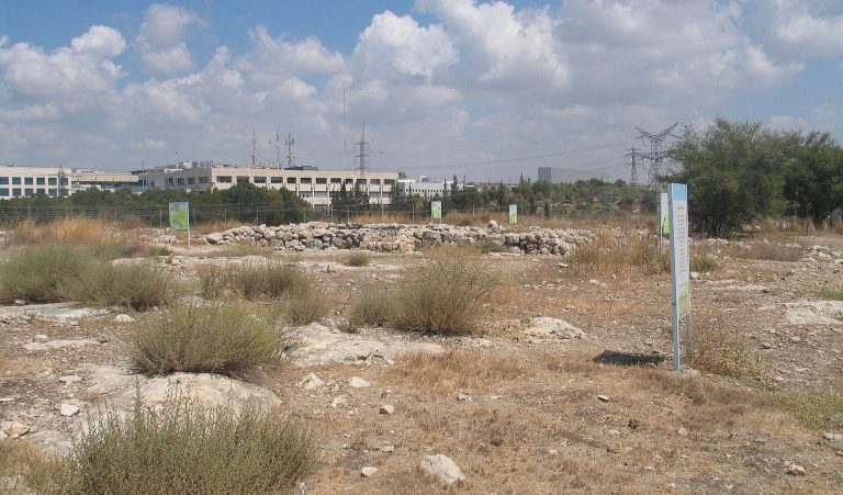
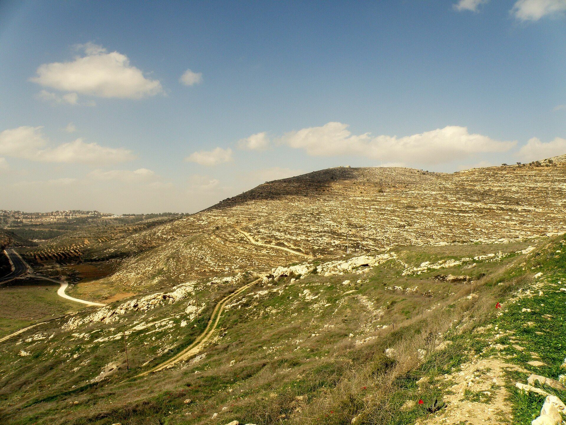
Shiloh occupies a tell, an artificial mound formed by successive settlements, covering approximately 80 dunams and rising to about 715 metres above sea level. The hill stands east of the Shiloh stream and northwest of the Shiloh Valley, surrounded by higher ground in an amphitheater-like formation. Remains range from fortified Bronze Age construction and Iron Age religious and domestic features to churches, water installations, mosaics, and reused architectural elements from the Byzantine and early Muslim periods.
Bronze Age and Iron Age Remains
Fortifications and Early Settlement
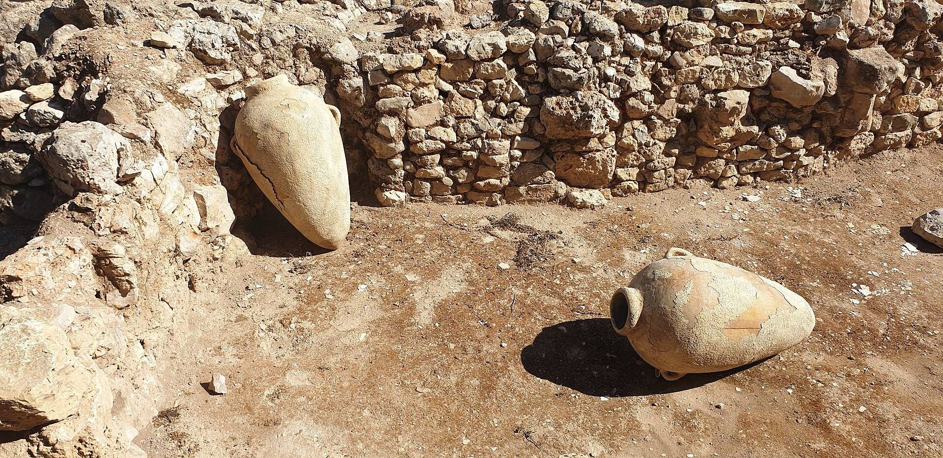
The Bronze Age settlement included a walled Canaanite community, a shrine or sanctuary, and substantial defensive works. A massive wall attributed to Middle Bronze III survives to approximately 7.3 metres high and up to 5.5 metres wide, with an extensive glacis, a sloping defensive earthwork built against a fortification. Excavated layers preserve Middle Bronze, Late Bronze, and later Iron Age phases. Three ancient storage jars found near the presumed location of the Tabernacle came from an early Middle Bronze Age layer beneath Late Bronze and Iron Age deposits and were initially interpreted as containers for agricultural produce.
Iron Age Buildings and Ritual Features
Near the summit of the tell stands the remains of a large two-storey public building supported by pillars. Storage jars with collared rims and cultic objects were found in association with it, suggesting that it formed part of a religious complex. More than 20 Iron Age silos were also uncovered, including one containing carbonized wheat.
Area B, a large building in the northern part of the tell, belongs mainly to Iron Age IIA. Its relatively massive walls enclosed a floor, a bench built against one wall, cooking pots, cooking installations, bowls, and cooking knives. The bench has been interpreted as a feature characteristic of a cultic building. A nearby pit contained deliberate sealing layers, bowls, cooking pots, cauldrons, arrowheads, and Iron Age IIA jars. The excavators proposed that it may have been used to bury sacred cult vessels, although this remains a hypothesis.
Pottery found outside the settlement wall and dated to before approximately 1000 BCE has been interpreted as the remains of animal sacrifices deposited beyond the wall after ritual use and later buried. Rock-cut ritual features, water installations, house walls, a rectangular reservoir measuring approximately 10 by 15 metres, and a rock-cut burial chamber add to the physical evidence for the settlement’s varied activities. Coins found in May 2012 bear an inscription meaning “year … for the redemption of Jerusalem” and have been tentatively attributed to the First Jewish-Roman War.
Byzantine Churches
Churches on and near the Tell
The churches associated with Byzantine Shiloh preserve a range of plans, mosaics, inscriptions, and reused architectural elements. The basilica closer to the tell measured approximately 18 by 15.10 metres and had a central nave, two side aisles, and a western vestibule. Its mosaic pavement contained geometric and vegetal designs. Another basilica excavated in the late 1920s measured approximately 40 metres in length and 14.10 metres in width, with an adjoining southern room about 6.40 metres wide. It had three naves, twelve column bases, and two preserved Corinthian capitals, whose foliage decoration is characteristic of that architectural form.
A further church south of and adjacent to the tell was probably built between approximately 380 and 420 CE. Its mosaic pavement combined geometric designs, a cross, vegetal motifs, and three Greek inscriptions. These included a dedication of a bench, a greeting to the inhabitants of Shiloh, and a general wish for good fortune. Another mosaic inscription referred to the bishop of Shiloh and the regional bishop. The inscription is now displayed at the Good Samaritan Museum, with a copy shown at the Shiloh archaeological presentation.
Church Identified as the Crusader Church
The church commonly identified as the Crusader church measured approximately 11.70 by 25 metres. Its plan is partly obscured because later construction incorporated its remains. The building had an apse, the curved end of a church, a raised platform above the main hall, and rooms to the north and west. A narthex, or entrance hall, and an atrium, an open court, have been proposed at the front.
Mosaic pavements decorated the church. The apse pavement carried vine leaves and grape clusters, while the main hall used geometric designs. In the northern chamber, identified as a prothesis used to prepare Eucharistic offerings, two deer stood beside a pomegranate tree, with a fish behind each deer. A five-line Greek inscription naming two brothers, Porphyrius and Jacob, was set within a frame.
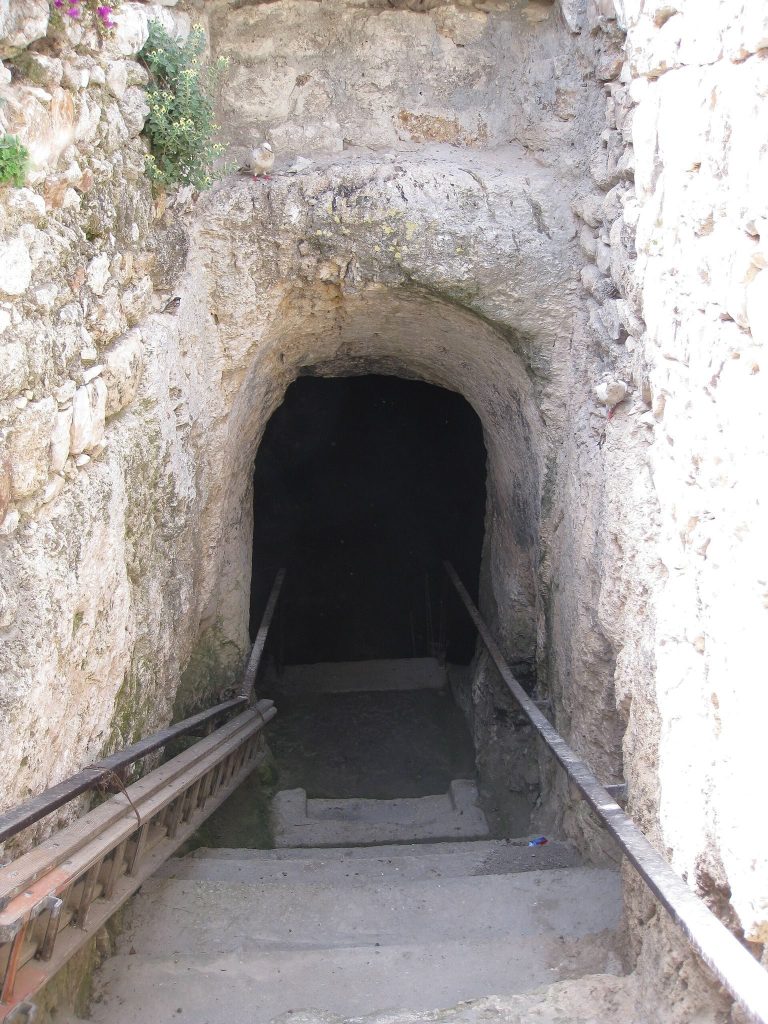
North of the church atrium, a cistern was connected by a pipe to a water source farther north. Several small rooms stood nearby, including one cut into the rock and used for burial. A church beneath the later structure known as Weli Yetaim had drainage problems in its western section. A higher floor and a new mosaic pavement were installed, and excavation later exposed the earlier floor.
Early Muslim and Later Structures
Mosque of the Sixty
The Mosque of the Sixty is a square structure with sides measuring approximately 8.75 metres. Its columns and capitals were taken from a Byzantine basilica, and medieval Arab lamps were found inside. A small niche in the southern wall served as a mihrab, the niche indicating the direction of prayer, during the building’s final phase. Its orientation toward Jerusalem rather than Mecca has led to the proposal that the structure may earlier have been a synagogue, although the interpretation remains uncertain.
Jami al-Arba’in and Agricultural Features
Jami al-Arba’in is a large ancient building with sloping lower walls, column fragments, and a carved stone slab approximately two metres long. The slab may have served as an architectural cornice over an opening and bears leaf, wreath, and other carved designs. Nearby remains include mosaics, pottery, animal remains, weapons, storage installations, and water systems dating from the Bronze Age through the early Muslim period.
Two winepresses found during salvage excavations in 2014 were used from the Late Byzantine period into the early Muslim period, providing evidence for continued settlement and agricultural activity. A Byzantine mosaic floor carries a Greek inscription identifying the place as the village of Shiloh. Together with other inscriptions, architectural elements, and mosaic pavements, it reflects the Christian and ecclesiastical character of the settlement during the Byzantine period.