Fewkes Group Archaeological Site: A Late Mississippian Mound Complex in Tennessee
Site at a Glance
- Rating
- 4.5
- Popularity
- Very Low
- Country
- United States
- Primary era
- Medieval
- External website
- Open
- Eras represented
- Medieval
- Civilizations
- Unclassified
- Site type
- City
On this page14 sections
History
Fewkes Group Archaeological Site is a late Mississippian culture mound complex and village in Brentwood, Tennessee, United States, developed roughly between AD 1050 and 1475 on the western bank of the Little Harpeth River. Mississippian culture comprised complex Indigenous societies that flourished across the southeastern and central United States, often building platform mounds, plazas, and civic or ceremonial structures. The Fewkes settlement occupied approximately 15 acres and was used by two distinct groups whose burial customs provide evidence of change during its history.
Settlement and Abandonment
The first community built the mounds, lived in circular houses, and generally placed its dead in tightly flexed positions within stone-box graves. These graves could be hexagonal, octagonal, circular, or nearly round. Toward the end of the occupation, a second group arrived and buried its dead fully extended on their backs in rectangular stone-box graves. The contrast between the two practices reflects a change in the community’s mortuary traditions.
The village was abandoned around AD 1450, although the wider site chronology extends to about AD 1475. The reason for the departure is unknown. Large quantities of broken pottery on house floors may indicate that the settlement was left hurriedly. The abandonment forms part of the proposed “Vacant Quarter” pattern, which describes the late prehistoric depopulation of portions of the Ohio, Mississippi, Tennessee, and Cumberland River valleys.
Excavation and Modern History
The landowner partially excavated the site in 1895. Archaeologist William E. Myer directed a larger excavation in October 1920, and the results appeared in the Bureau of American Ethnology’s Forty-First Annual Report. The Bureau was a United States federal research institution within the Smithsonian Institution devoted to studying and documenting Indigenous peoples and cultures. Many artifacts recovered from Fewkes are now held by the Smithsonian Institution.
The site takes its name from J. Walter Fewkes, an American archaeologist and ethnologist who served as Chief of the Bureau of American Ethnology in 1920. He visited the settlement and recognized its archaeological potential. Fewkes Group Archaeological Site lies within Primm Historic Park, on the grounds of Boiling Spring Academy, a historic schoolhouse established in 1830. It was added to the National Register of Historic Places on April 21, 1980.
A Tennessee Department of Transportation road-construction project in 1998 removed the remains of at least 21 individuals and associated funerary objects. By April 23, 2010, efforts were underway to reinter the culturally unidentifiable remains. As of 2010, the Tennessee Department of Environment and Conservation’s Division of Archaeology had been unable to identify modern tribal descendants of the site’s inhabitants.
Remains
The complex is organized around a level town plaza with five earthen mounds. Four mounds occupy opposing sides of the plaza, while the smaller Mound No. 5 stands on the riverbank north of Mound No. 1 and outside the town center. Boiling Spring Academy now stands between Mounds No. 1 and 5. Houses and burial areas extended around the mound group, creating a settlement that combined civic, ceremonial, domestic, and mortuary spaces.
Plaza Mounds
Mound No. 1
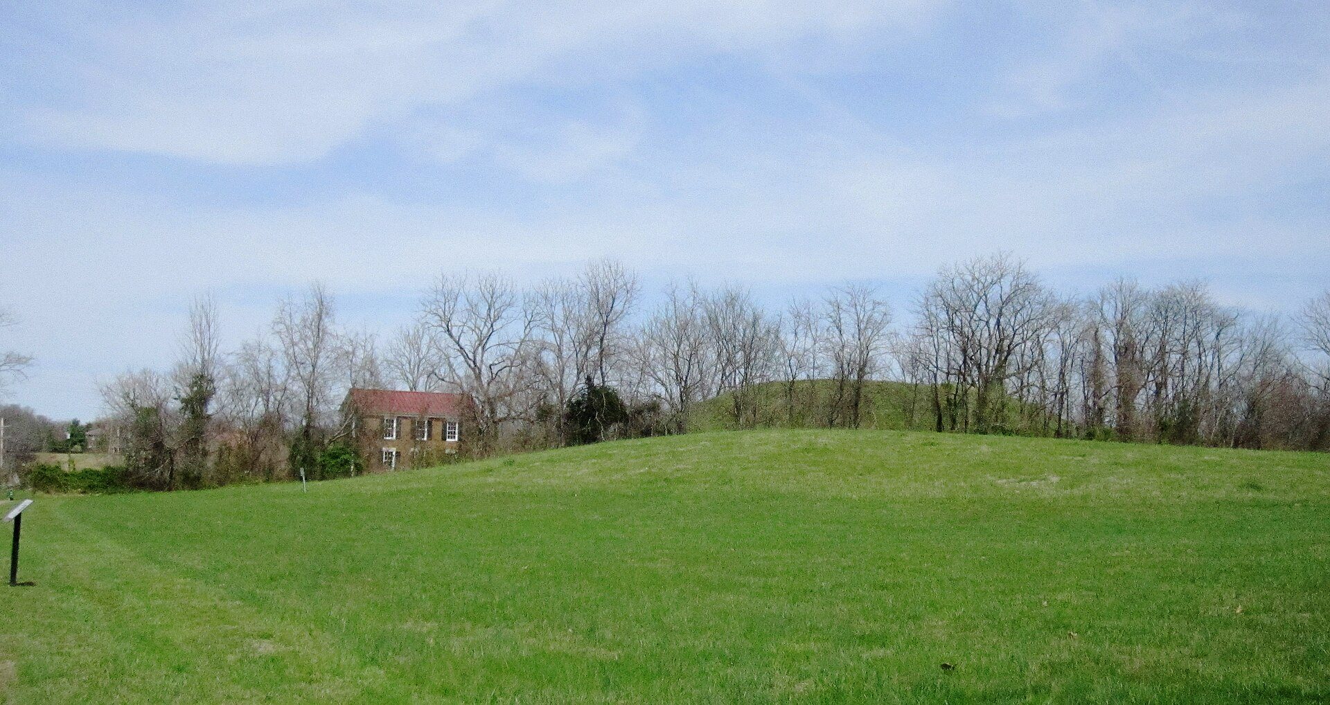
Mound No. 1 stands on the northern side of the plaza and is the largest mound in the complex. It is a platform mound, an earthen mound with a level summit intended to support a civic, ceremonial, or elite structure. The mound measures about 185 by 160 feet, or 56 by 49 meters, and rises approximately 25 feet, or 7.6 meters. It was not excavated during Myer’s 1920 work because of insufficient funding. Myer regarded it as ceremonial and considered it a possible location for a chief’s residence.
Mound No. 2
Mound No. 2 occupies the western side of the plaza. It measures approximately 235 by 160 feet, or 72 by 49 meters, and reached about 7.5 feet, or 2.3 meters, in height when excavated. Less than one-fifth of the mound was investigated, so the total number of structures built there cannot be determined.
The mound was raised in four stages. Its original ground surface contained a fire bed, ashes, and broken animal bones, indicating an earlier structure. That building was demolished before an earthen mound approximately 3 feet, or 0.91 meters, high was constructed over it. Later levels contained buildings with packed floors made from stone slabs, along with a small deposit of maize and maize meal, fire beds, shell-tempered pottery, arrowheads, deer-bone objects, a metate, and a muller. A metate is a stone grinding surface, while a muller is the stone tool used with it to process materials.
Sacred Image House
The southwestern part of Mound No. 2 contained the remains of a structure Myer called the Sacred Image House. Its contents included a sacred idol, a shrine, and evidence of fire ceremonies. These remains connect the building with ritual activity carried out within the mound complex.
House of Mysteries
The later mound surface held a two-room building known as the House of Mysteries, probably an important civic structure used for sacred rites and town gatherings. Its floor consisted of “black, glossy earth.” Woven cane matting formed the walls and arched roof, and clay plaster covered the interior and exterior surfaces in the wattle-and-daub technique. This method uses woven branches, reeds, or cane as a framework coated with a plaster-like mixture of clay or earth.
The building’s altar included an oval bowl of fired red clay filled with white, powdery ashes. Its fire was kept burning, and the structure was eventually destroyed by fire. Cultivation lasting at least 85 years damaged evidence for the final construction stage, although postholes show that a building had stood there. Later rectangular stone-box burials were also placed near the surface.
Mound No. 3
Mound No. 3 is a low oval burial mound at the southwestern corner of the plaza. It measures approximately 100 by 110 feet, or 30 by 34 meters, and is about 3 feet, or 0.91 meters, high. Its edges slope gradually into the surrounding soil. The mound probably originally contained 10 to 15 graves, but looting and plowing destroyed all except two.
The surviving graves were built from limestone slabs and contained tightly flexed burials. One octagonal grave held five large shell beads and a clay pot. The other, a hexagonal grave, contained a small effigy burial vase and a mussel shell probably used as a spoon. Looters had disturbed both graves.
Mound No. 4
Mound No. 4 lies east of the plaza. It is a low, oblong feature approximately 200 by 180 feet, or 61 by 55 meters, and about 4 feet, or 1.2 meters, high. Myer considered it a natural knoll partly shaped when soil was removed for Mound No. 1. Erosion and cultivation affected evidence for possible structures.
Mound No. 5
Mound No. 5 is an oval feature approximately 32 feet, or 9.8 meters, across and 3.5 feet, or 1.1 meters, high. It stands about 300 feet, or 91 meters, north of Boiling Spring Academy and overlooks the Little Harpeth River. Its soil contained broken animal bones, pottery fragments, a trace of a fire pit, and two bone tools.
Houses and Domestic Features
About a dozen house circles were identified around the outer edges of the mound group, especially between Mounds No. 1 and 5. The most important houses adjoined the northeastern side of Mound No. 1. Other saucer-shaped domestic depressions occurred north of Mound No. 1 and west of Mounds No. 2 and 3.
The houses appear to have used cane matting and plastered walls like the ceremonial buildings. Finds from and around them included bear teeth, arrowheads, broken animal bones, traces of plastered walls, stone disks, and a store of yellow ochre probably used as body paint.
One circular domestic depression had a nearly smooth, hard-packed floor and a central upright stone-slab fire basin. Part of the basin had been cut away to accommodate the upright slab of a child’s grave. The approximately 12-year-old child was buried against the slab, with the head resting within the bowl. Ashes remained in the bowl and around the back and top of the head, although the bones were not burned. Two additional children’s stone-box graves were found in or below the floor.
Burial Areas and Funerary Objects
A stone-box cemetery lay near the mound complex. Approximately 100 feet, or 30 meters, southeast of Mound No. 3, a woman had been buried loosely flexed on her right side without grave goods. Nearby, a burial consisted of a pile of bones without grave goods or a stone-box coffin. Other later burials across the site contained conch shells, pottery, spearheads, deer-bone playing dice, and a black-stone female statuette.
Funerary objects removed during the 1998 road-construction excavation included ceramic ear plugs, effigy jars, projectile points, a drilled dog tooth, and a bone awl. Together with the graves and burial practices, these objects provide evidence for the ceremonial and mortuary activities carried out within the settlement.