Thala: An Ancient City and Roman Municipium in Tunisia
Site at a Glance
- Rating
- 4.8
- Popularity
- Very Low
- Country
- Tunisia
- Primary era
- Medieval
- Eras represented
- Classical, Medieval
- Civilizations
- Byzantine, Numidian, Roman
- Site type
- City
On this page11 sections
History
Thala is an ancient city in modern Thala, Tunisia, developed under Massylian and Roman rule on the Dorsal at about 1,000 metres above sea level. The city lies approximately 53 kilometres from Sicca Veneria and 20 kilometres from Ammaedara. Its long history includes connections with the Massylian kingdom, Roman administration, late antique Christianity, and Byzantine military organization.
Massylian and Roman Thala
Thala was associated with the Massylian, or eastern Numidian, kingdom and with the rulers Massinissa, Micipsa, and Jugurtha. In 108 BC, the Roman commander Quintus Caecilius Metellus Numidicus captured the city after a siege during the Roman campaign against Jugurtha.
Under the emperor Tiberius, who ruled from AD 14 to 37, a road was established between Ammaedara and Tacape. The route redirected movement away from the territories of Berber tribes, but tensions with Roman rule continued. Tacfarinas led a revolt in North Africa during Tiberius’s reign, and after its defeat the region came under Roman control.
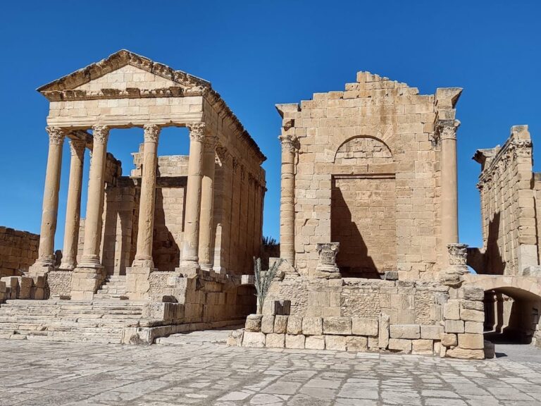
Thala contained sanctuaries dedicated to several Punic and Roman North African deities. These included Tanit, a major Punic goddess; Caelestis, a Roman North African goddess associated with Punic religious traditions; Pluto, the Roman god of the underworld; and Saturn, an important Roman deity.
The city became a municipium, a Roman town with a defined form of civic status and local administration, sometime between the late second and the third century. In 209 and 210, it formed a fortified element dependent on Ammaedara.
Christian and Byzantine periods
Christianity is not evidenced at Thala before the fifth century. Urbanus, identified as a Donatist, was connected with the Conference of Carthage in 411. Donatism was a Christian movement that formed a distinct church in North Africa and disputed the legitimacy of clergy who had compromised during persecution. Another bishop, Faustinianus, is known from an inscription.
During the fifth and sixth centuries, Christian buildings occupied spaces connected with earlier religious structures. One church stood over a temple dedicated to Saturn, while another church excavated in 1898 contained elements from a Saturnian sanctuary. A second Byzantine church south of the city was identified during the nineteenth century, surveyed, and later published in 1913. It passed through at least two architectural phases, including a substantial reduction in size.
Under Justinian, the Byzantine emperor from AD 527 to 565, Thala became part of the regional military organization established across the area. Fortifications around the city belonged to this later defensive landscape.
Modern settlement and archaeological work
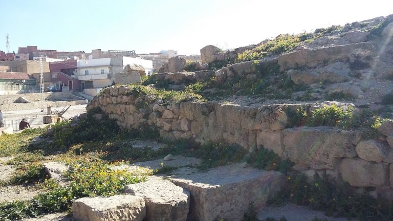
The modern city was built over much of the ancient settlement, and this urban continuity has left relatively few ancient structures visible. Excavation of the Christian building took place during the 1960s and again during the 1990s. The southern Byzantine church was investigated through architectural surveying and the study of its mosaics, while the ancient funerary and fortification remains preserve further evidence of Thala’s development.
Remains
Burial and civic remains
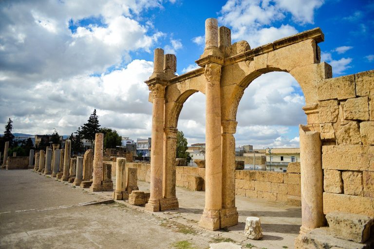
The surviving remains extend from funerary monuments outside the town to Roman and late antique structures within the modern district. The ancient buildings use several forms of masonry, including large ashlar blocks, rubble construction, and the North African technique called opus africanum, in which upright stones are linked by horizontal blocks and the spaces between them are filled with smaller masonry.
Megalithic and Roman burials
Megalithic burials survive outside the town. Within a modern district, a Roman necropolis and a Roman mausoleum preserve evidence of the city’s funerary landscape. The mausoleum is largely concealed by later construction. It measures approximately 3.30 by 4.20 metres, has walls about 0.50 metres thick, and originally rose through two storeys.
Paved square and fifth-century church
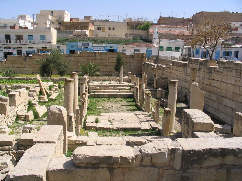
Part of a paved square survives and may have belonged to the forum, the principal public square of a Roman town. A fifth-century church is associated with this area and may have reused either the forum or a temple courtyard. The church measures approximately 25 by 13 metres and was entered from the side.
Inside, the nave and aisles were divided by reused pagan funerary stones. Some walls incorporated large ashlar blocks, while others were built in rubble masonry. Openings were altered during the building’s history. The principal congregational area, known as the quadratum populi, had three naves or six bays, with a semicircular apse and two sacristies. The church contained two choirs or apses, one used for liturgy and the other dedicated to saints or martyrs.
Excavation showed that the church occupied the space of a temple dedicated to Saturn. Finds from the area included a betyl, a sacred stone associated with cult worship, architectural remains, and stelae. A circular altar table naming Saints Lawrence, Sixtus, and Hippolytus was also found. Dating to the fifth or sixth century, it may indicate that relics were kept there. Its position within the church has been identified. The table is now preserved in the Archaeological Museum of Sbeitla, together with fragments of a ciborium, a canopy or architectural cover placed over a Christian altar. Several tombs were also recovered.
Byzantine churches and defenses
Southern Byzantine church
The Byzantine church south of the city preserves evidence of two building phases. In its first phase, it measured approximately 29 by 13.80 metres and used opus africanum. Its nave and aisles contained mosaics, including a dedication naming Zanccarius. The quadratum populi had three naves and nine bays, with a semicircular apse and two sacristies.
The later phase reduced the building to approximately 12.70 by 10.60 metres while retaining part of the earlier walls. Its principal congregational area measured 9.60 by 9.60 metres and contained three naves and four bays. The apse was polygonal. Mosaics from the church include a dedication, a funerary inscription, and Christian symbols, and are now held in the Bardo National Museum.
Fortified remains
Fortified Byzantine remains survive around the city, particularly north of the modern town along the road to Ammaedara. They form part of the defensive organization associated with Thala during the Byzantine period.