Preah Vihear Temple: A Khmer Mountain Sanctuary in Cambodia
Site at a Glance
- Rating
- 4.6
- Popularity
- Medium
- Country
- Cambodia
- Primary era
- Medieval
- External website
- Open
- Eras represented
- Medieval
- Civilizations
- Khmer
- Site type
- Religious
- Remains
- Temple
On this page17 sections
History
Preah Vihear Temple is an ancient Khmer Hindu sanctuary on Poy Tadi in the Dangrek Mountains of Cambodia. Its first foundation was traditionally begun in the early ninth century, during the reign of Jayavarman II, while the earliest surviving architectural elements belong to the early tenth-century Koh Ker period. Dedicated to Shiva, especially as Shikharesvara, or “Lord of the Mountain Peak,” and Bhadresvara, the temple occupied a mountaintop setting associated with divine protection and royal worship.
Foundation and Royal Development
A later inscription, K.583, connects the foundation of the Shikharesvara cult with Prince Indrayudha, son of Jayavarman II. According to the inscription, he brought a linga, the symbolic representation of Shiva that served as the central sacred image in Shaiva temples, from Lingapura at Wat Phu and installed it at Preah Vihear. The site was not a royal residence or an ordinary settlement. Its principal purpose was to preserve and worship the powerful linga, which was believed to protect Cambodia and bring prosperity.
The sanctuary expanded through the work of successive Khmer rulers. It is associated with Indrayudha, Yasovarman I, Rajendravarman II, Suryavarman I, Udayadityavarman II, Harshavarman II, Jayavarman VI, and Suryavarman II. Yasovarman I is linked with the central temple, while elements of the late tenth-century Banteay Srei style were incorporated into the developing complex. Most of the surviving buildings were constructed or enlarged under Suryavarman I and Suryavarman II.
Suryavarman I is associated with the long buildings near the sanctuary, the surrounding enclosure, and Gopura III, a monumental gateway through a temple enclosure. Inscriptions also connect him with the installation or joint veneration of Bhadresvara alongside Shikharesvara. During his reign, the Brahmin Tapasvindra-pandita maintained an ashram at the site and cared for the linga. A royal decree required personnel connected with the sanctuary to swear loyalty to the deity and protect the temple, its servants, and nearby inhabitants.
Ritual Administration and Later Khmer Phases
Jayavarman VI is associated with repairs to parts of the temple and with two libraries in the outer court. Under Suryavarman II, the royal guru and Brahmin Divakarapandita became a major patron and administrator. Inscription K.383 describes his service under several Khmer kings, his organization of offerings and ritual sacrifices, and his responsibility for repairs and improvements at temples, including Preah Vihear.
At Preah Vihear, Divakarapandita is associated with offerings to Shikharesvara, including a golden image of dancing Shiva. He also oversaw the annual restoration or redecoration of towers, courts, and the principal entrance. Suryavarman II is linked with the ceremonial approach, naga and lion features, the inauguration of the temple, and its designation as a place of royal worship. Ascetics, Brahmins, and other religious personnel lived or worked at the sanctuary to maintain its cult.
As Hindu influence in the region declined, the temple was adapted for Buddhist worship. Its religious history therefore reflects a change in practice while preserving the importance of the sacred mountain setting and the temple buildings.
Frontier Dispute and International Adjudication
In the modern period, Preah Vihear became the focus of a sovereignty dispute between Thailand and Cambodia. A 1904 Franco-Siamese agreement provided for a frontier generally following the watershed of the Dangrek range. A map prepared after surveys in 1907 and published in 1908 placed the temple on the Cambodian side. Cambodia relied on this map, while Thailand argued that the treaty’s watershed principle placed most of the temple in Thailand.
After French troops withdrew from Cambodia in 1954, Thai forces occupied the temple. Cambodia protested and brought the dispute before the International Court of Justice in 1959. The case concerned the legal effect of the frontier map and Thailand’s subsequent conduct, rather than the cultural succession of the Khmer Empire.
On 15 June 1962, the International Court of Justice ruled by nine votes to three that Preah Vihear belonged to Cambodia and ordered Thailand to withdraw its military or police forces stationed at the temple. By seven votes to five, the Court also required Thailand to return antiquities removed from the temple or its ruins since 1954. It held that, although the map was not itself the formal work of the Mixed Commission, both parties had accepted it and the frontier shown there had acquired binding force.
Thailand subsequently agreed to hand the site over to Cambodia. In January 1963, Cambodia formally took possession in a ceremony attended by about 1,000 people. Prince Norodom Sihanouk climbed to the temple, made offerings to Buddhist monks, and announced a conciliatory policy under which Thai visitors could visit without visas and Thailand could retain antiquities it had removed.
War, Heritage Protection, and Continuing Tensions
During the Cambodian Civil War, which began in 1970, the temple’s position on a cliff made it militarily defensible. Forces loyal to the Lon Nol government held it after communist forces had taken the surrounding plain. Khmer Rouge forces captured the temple on 22 May 1975 after repeated attempts and artillery bombardment. The defenders crossed into Thailand and surrendered to Thai authorities.
After Vietnam invaded Cambodia in December 1978, Khmer Rouge forces retreated toward the border. Vietnamese forces reportedly attacked Khmer Rouge troops sheltering at the temple in January, although no damage to the temple was reported. Guerrilla warfare during the 1980s and 1990s disrupted access. The temple briefly opened to the public in 1992, was reoccupied by Khmer Rouge fighters in 1993, and became the site of negotiations in December 1998 that led several hundred Khmer Rouge soldiers to surrender to the Phnom Penh government.
Cambodia completed an access road up the cliff in 2003, improving approach from the Cambodian side after decades of warfare and difficult terrain. On 7 July 2008, UNESCO inscribed the Temple of Preah Vihear on the World Heritage List under cultural criterion (i), which recognizes a masterpiece of human creative genius. The listing recognized the temple’s outstanding universal value and intensified the Cambodian-Thai dispute over adjoining land.
Military clashes occurred in October 2008 and February 2011. In April 2009, 66 stones at the temple were allegedly damaged by cross-border gunfire. A UNESCO mission later indicated that damage during the 2011 fighting resulted from fire by both Cambodian and Thai forces, although responsibility for particular damage remained contested. In June 2011, a UNESCO World Heritage meeting accepted Cambodia’s management proposal, while Thailand withdrew from the meeting and rejected its decisions. The following month, the International Court of Justice ordered both countries to withdraw military forces from a provisional demilitarized zone around the temple without prejudging the final frontier.
On 11 November 2013, the International Court of Justice ruled that the land adjoining the temple to the east and west belonged to Cambodia and that any remaining Thai security forces in that area had to withdraw. During the 2025 Cambodia-Thailand border conflict, Cambodia’s Ministry of Culture and Fine Arts stated that Thai attacks had caused substantial damage affecting 562 sections of the complex. The Thai government stated that its attacks targeted Cambodian military assets within the temple.
Remains
Preah Vihear extends for about 800 metres along a north-south axis on Poy Tadi, with the sanctuary at the southern and highest end. The complex rises from the northern plain toward the summit, reaching approximately 120 metres above the northern end. It stands at about 525 metres above the Cambodian plain and approximately 625 metres above sea level. The Cambodian side of the cliff is steep, while the slope toward Thailand is gentler. The unusual northward orientation differs from the east-facing rectangular plan more common among Khmer temples.
The Processional Ascent
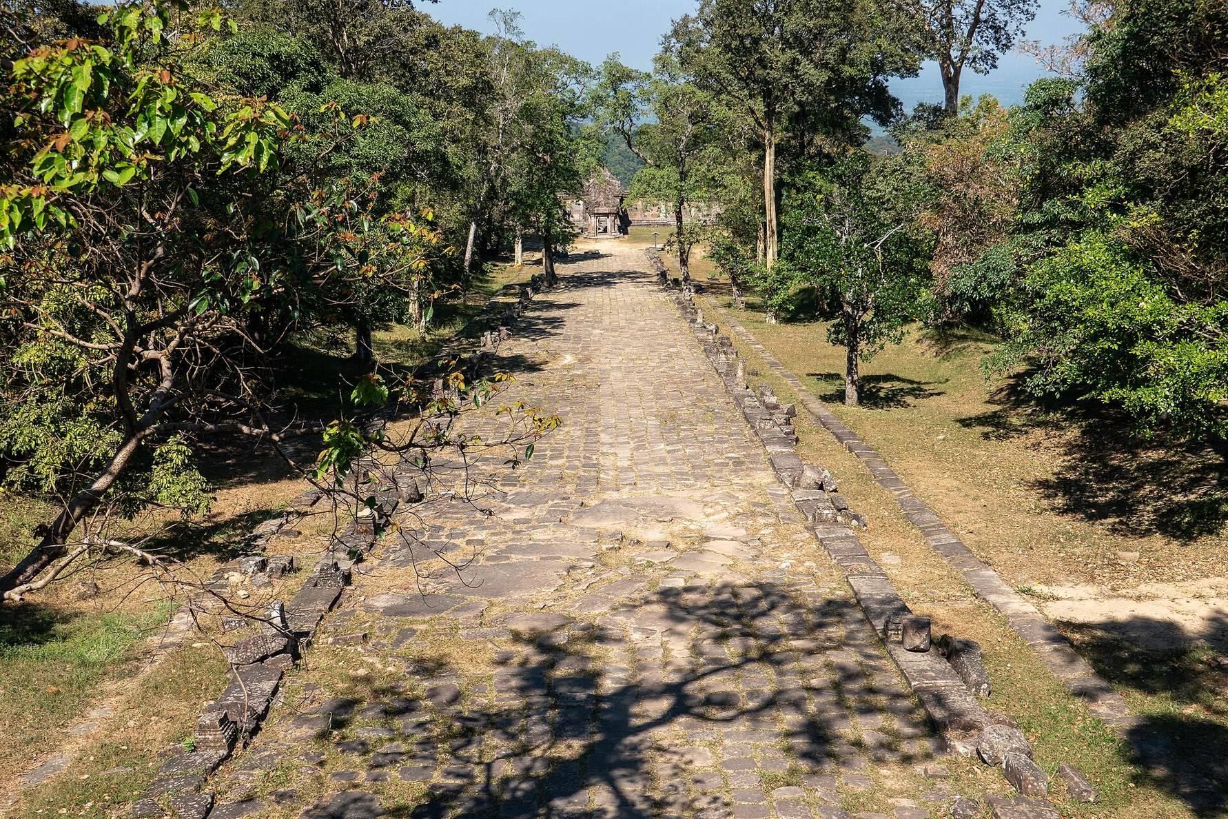
The approach is arranged as a rising sequence of stairways, terraces, courtyards, and five gopuras. They are numbered outward from the sanctuary, so Gopura V is encountered first. Each gateway is reached by steps and marks a change in elevation. Its walls screen the next part of the route, preventing the whole complex from being seen from one point. This arrangement creates a symbolic ascent toward Mount Meru, the sacred mountain of Hindu cosmology.
Northern Stairway and Naga Bridge
The northern stairway contains about 160 to 163 steps. It is approximately 8 metres wide and 78.5 to 78.8 metres long, with many steps cut directly into the rock. The final section narrows to about 4 metres and was formerly bordered by terraces and rows of lion sculptures. Only a few of the original lions survive. A second ancient stairway rises from the eastern side of the mountain and has been repaired in places with wooden replacement steps. The route from the plain to the sanctuary extends approximately 804 metres.
A naga bridge or balustrade connects the northern stairway with Gopura V. The structure is about 7 metres wide and 31.8 metres long and was accompanied by seven-headed serpent sculpture. Larger naga figures also flank sections of the approach.
Gopura V
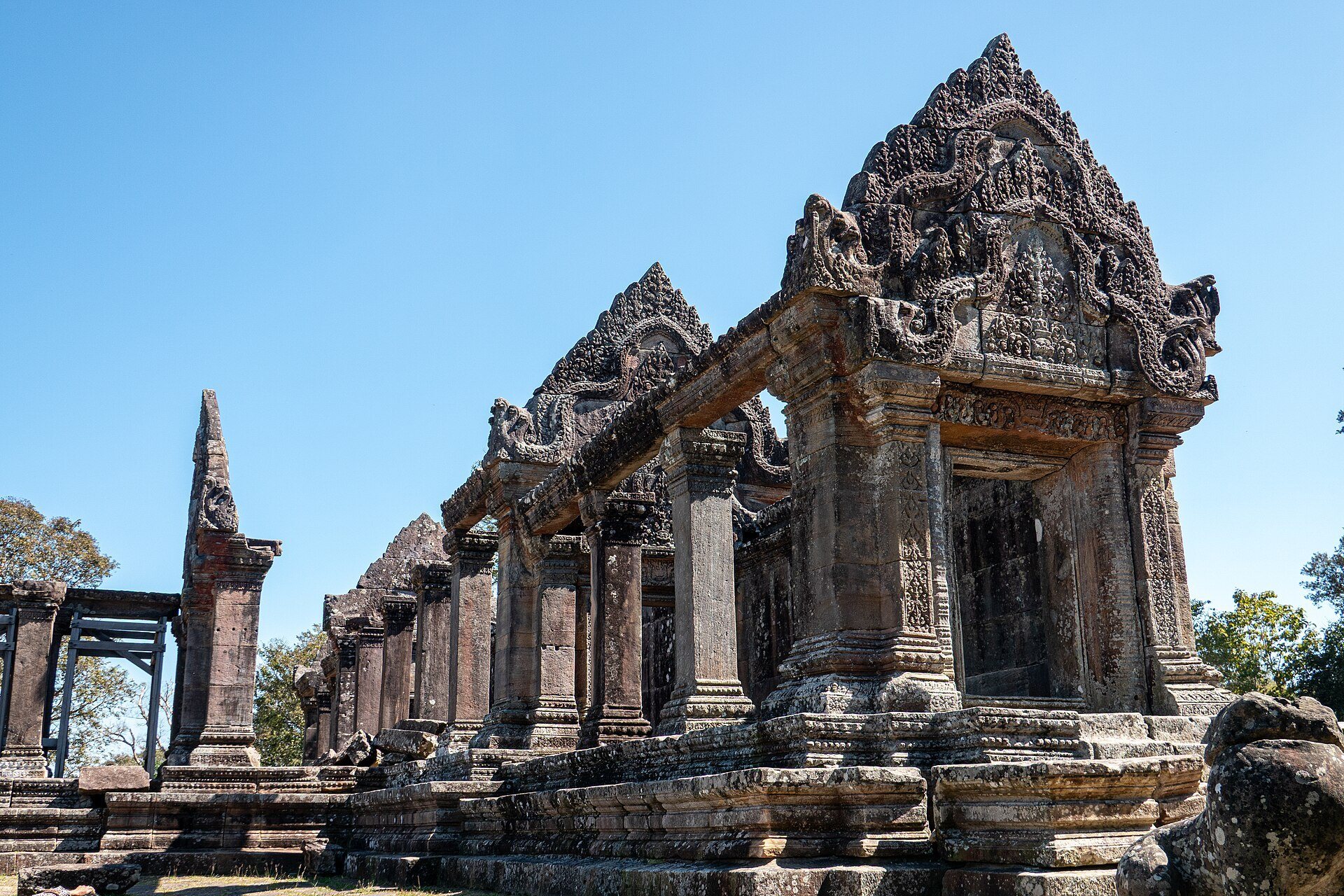
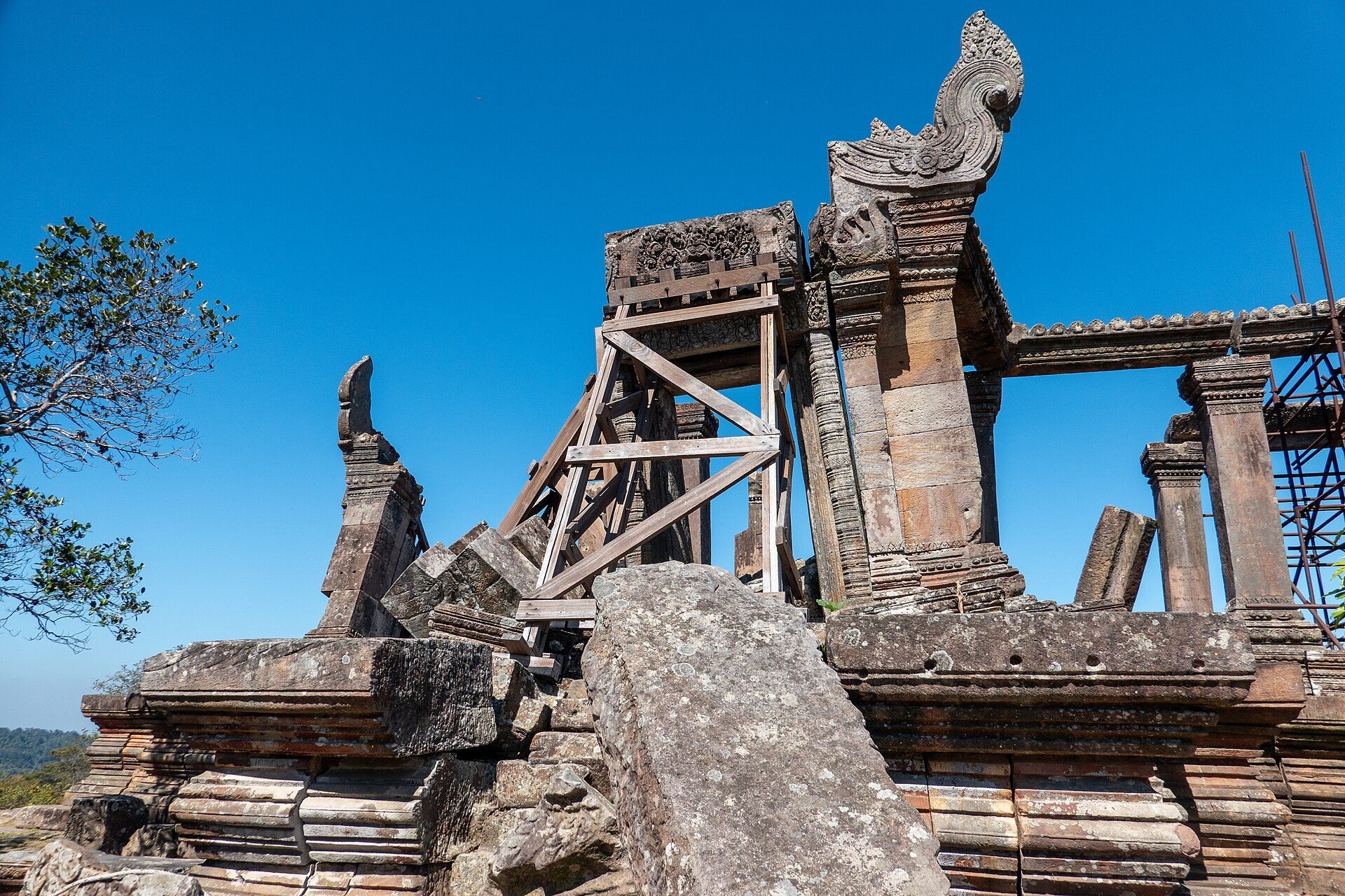
Gopura V is a relatively small rectangular gateway raised on a high stone platform. Doorways open on all four sides, each reached by a stairway. The southern doorway is the best preserved, while the other entrances are ruined. Its tiled roof has collapsed, although some large supporting columns, approximately 3.5 metres long, remain. The structure belongs to the Koh Ker style and retains traces of former red decoration.
A large reservoir lies to the left of the processional route between Gopuras V and IV. It measures approximately 16.8 by 37.8 metres and has stepped sides.
Gopura IV and the Reservoirs
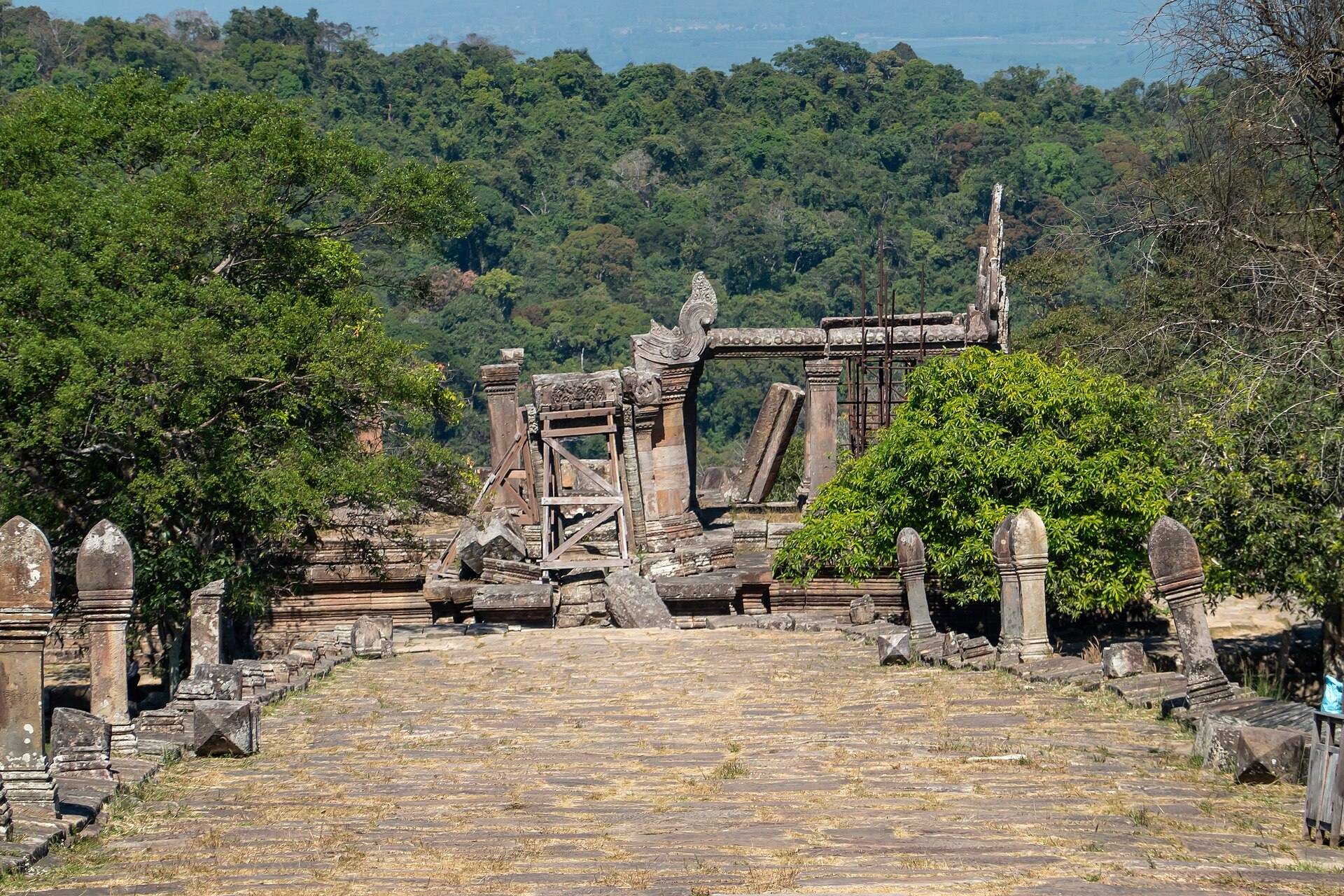
Gopura IV is reached by an avenue approximately 10 metres wide and 275 metres long. The avenue is flanked by 134 boundary posts, 67 on each side, generally about 2 metres high and shaped as lotus buds. A four-stage stairway, about 3.5 metres wide and containing 37 steps, leads to the gateway and is flanked by lion sculptures.
Associated with the Khleang and Baphuon periods, Gopura IV has a more enclosed plan than Gopura V. Its central walls screen the interior from view. Reliefs on its pediments and lintels depict Hindu deities and myths, including the Churning of the Sea of Milk and Vishnu reclining on the serpent Ananta. The southern outer pediment is regarded as one of the complex’s major masterpieces.
A stepped reservoir near Gopura IV measures approximately 18.3 by 36.8 metres. About 50 metres east of the avenue between Gopuras IV and III is a smaller square reservoir paved with stone. Each side measures about 9.4 metres and has twelve steps, each approximately 20 to 25 centimetres high. A nearby square brick base measures about 6 metres on each side and may have supported a statue or a small structure made from perishable material, suggesting ritual use. A stone lion-head water spout once reported on the southern side of the smaller reservoir is no longer at the site, and its location is unknown.
Central Courts and Galleries
Gopura III and the Hermitage Galleries
Gopura III is the largest of the five gateways. An avenue approximately 11 metres wide and 148 metres long leads to it, accompanied by 80 boundary posts and a stairway of about 29 steps. The gateway extends east-west across a raised platform and is flanked by long halls or galleries.
The eastern and western galleries are associated with the Virashrama hermitage, probably used by royal teachers or high-ranking people who came to worship Shikharesvara. Inscriptions connect these structures with the reign of Suryavarman I. Additional southern galleries were known as the royal palace or royal residence, although the complex was not a normal royal dwelling. A small isolated structure on the eastern part of the platform is partly covered by a fig tree and may predate the other gateways. Another isolated sandstone structure lies northeast of Gopura III.
Gopura II and the Libraries
Gopura II is more severely ruined than the other major gateways. It provides a broad route into the central court and toward the sanctuary. Its eastern and western galleries had enclosed outer walls and interior columns that supported the roof. The columns are now damaged or lost.
Two libraries stand in the outer court near Gopura II. These rectangular structures measure approximately 6.5 by 11 metres and occupy the eastern and western sides of the court.
Gopura I
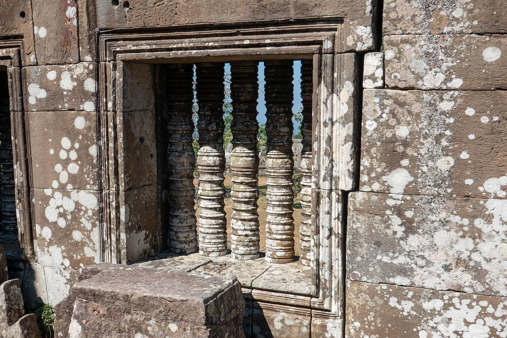
Gopura I forms part of the final section of the ascent. It is a rectangular structure with surrounding galleries approximately 25 metres long and 5.5 metres wide. External entrances open on the eastern and western sides. The gateway has 42 open windows and six false windows on the southern side. Two additional structures east and west of the gateway may have been added later, although their precise purpose is uncertain.
The Sanctuary and Construction
Central Sanctuary and Mandapa
The central sanctuary is the principal sacred structure and was probably the location of the Shikharesvara linga. The surviving building measures approximately 35 by 45 metres. It was surrounded by roofed galleries or an enclosure made largely of sandstone. Some corners are closed, while the eastern and western galleries contain entrances. A southern section was partly enclosed with brick, including reused bricks from an earlier structure.
A mandapa, or pillared hall, stands north of the sanctuary. Its architectural decoration is finely carved, and the northern entrance pediment depicts Shiva dancing on the head of an elephant. The scene is associated with the destruction of evil and the restoration of good. The route between Gopuras III and II is accompanied by boundary posts and seven-headed naga balustrades. Courts, galleries, colonnades, and the sanctuary provided spaces for ceremonies and rituals around the linga shrine.
Materials and Inscriptions
The temple was built mainly from locally available grey and yellow sandstone. Some blocks in the principal tower weigh at least five tonnes and contain lifting holes. Wood supported many roofs, which were covered with terracotta tiles. Brick was used for corbelled arches because it could be bonded with mortar and was more compact than large stone slabs.
Four principal inscriptions are associated with the temple. K.380, on both sides of the southern doorway of Gopura IV, was written in Sanskrit and Old Khmer probably between 1038 and 1049. It names Sukarman, a recorder and keeper of royal archives, and refers to an oath of allegiance to Shikharesvara. K.381, carved on the southern doorjamb of the eastern palace portico at Gopura III, is dated to 1024 and concerns Tapasvindra-pandita and a hermitage associated with offerings to the deity.
K.382 was carved on a pillar formerly located in front of the sanctuary. Dated to 1047, it refers to Suryavarman I and was later transferred to the Bangkok National Museum. K.383, probably written between 1119 and 1121, was engraved on a stele found inside the mandapa. It records Divakarapandita’s service under several Khmer kings, his offerings to Shikharesvara, repairs at temples, and payments to temple workers. At Preah Vihear, it mentions a probable golden image of dancing Shiva, a gold dais decorated with precious stones, bronze floor plates, precious-metal wall plates, and annual redecoration of towers, courts, and the main entrance.
Reliefs and architectural decoration combine Koh Ker, Banteay Srei, Khleang, and Baphuon elements. Hindu scenes include the Churning of the Sea of Milk, Vishnu reclining on Ananta, and Shiva in a dancing form. The sanctuary and galleries have suffered deterioration: the tiled roof of Gopura V has disappeared, several doors and structural elements have collapsed, and only a few original lions remain along the main stairway. Some inscriptions and architectural pieces have also been removed from their original locations. The 2011 fighting caused contested damage, with a UNESCO assessment attributing destruction to gunfire by both sides. The UNESCO World Heritage property covers approximately 154.7 hectares, with a buffer zone of about 2,642.5 hectares.