Cumberland Street Archaeological Site: Evidence of Sydney’s Convict and Working-Class Neighbourhood
Site at a Glance
- Rating
- 4.4
- Popularity
- Very Low
- Country
- Australia
- Primary era
- Modern
- External website
- Open
- Eras represented
- Early Modern, Modern
- Civilizations
- British
- Site type
- Domestic
On this page12 sections
History
Cumberland Street Archaeological Site is an archaeological site in The Rocks, Sydney, Australia, between Cumberland and Gloucester Streets. It preserves evidence of European occupation from about 1788 to the early twentieth century, including the development of a convict and ex-convict neighbourhood during the first decades of the colony.
Early colonial occupation
The site occupies parts of two early Sydney town blocks, Sections 74 and 75. The Cadigal people were associated with Sydney Cove and The Rocks before and during the arrival of European settlers. The First Fleet established the British settlement at Sydney Cove in 1788, and the Second Fleet later brought more convicts and settlers to the colony.
European occupants were living on the site by about 1795, when George Legg and Ann Armsden were recorded there. Armsden and Legg, a First Fleet arrival, lived in a large stone house across a lane from the premises of George Cribb. The Byrne family followed in 1805. These early residents formed part of a community in which convict and free people lived and worked alongside one another.
Businesses and community life
George Cribb, a convict transported on the Admiral Gambier in 1808, ran a butchery and hotel at the corner of Gloucester Street and Cribbs Lane. His premises occupied more than half the site between 1811 and 1829, and he remained there until the later 1820s. Cribbs Lane retained his name, while Carahers Lane commemorated Owen Caraher, who made candles and soap in Gloucester Street during the 1860s.
The neighbourhood became increasingly crowded as convict, ex-convict, and free families occupied the area. Daniel King, a free settler who arrived in 1817 and married a convict woman, was among its residents. Land in Section 74 was sold in 1827 and subdivided in 1834. Further grants in Section 75 followed between 1835 and 1840.
By 1889, approximately 33 houses, shops, and hotels stood within the site. Small tenements, bakeries, hotels, and brothels formed a densely occupied residential and working environment. Families sometimes remained for several generations, and people whose spouses worked at sea could return to their parents’ homes during their absence.
Thomas and James Share operated a bakery from the 1830s, later taken over by Robert Berry. Because many private houses had no ovens, residents used Berry’s ovens to prepare Sunday meals. The site was part of a wider Rocks community later associated with poverty, overcrowding, crime, and violence, as well as strong social networks.
Clearance and later uses
After the plague outbreak of 1900, the government resumed The Rocks area and became landlord of about 900 properties, including the whole site. Houses, shops, and hotels were demolished between 1902 and 1915. This clearance ended the site’s residential history and formed part of the Darling Harbour resumptions undertaken in response to the outbreak.
The cleared land was subsequently used for industrial, transport, and public-utility purposes. Norton Griffiths operated machinery and joinery works there in 1917, followed by the City Railway Workshops in 1918. A Department of Repatriation vocational training trade school occupied the site from 1921 to 1924, motor garages operated from 1925 to 1931, and a Department of Road Transport and Tramways bus depot used it from 1951 to 1972. The property was then used for storage until 1994. A concrete pavement slab laid for the bus depot covered much of the area.
Excavation and conservation
The property has been held by the Sydney Cove Redevelopment Authority and its successor, the Sydney Harbour Foreshore Authority, since 1972. A full-scale archaeological excavation took place in 1994, followed by smaller University of Sydney Summer School excavations in 2005 and 2006. These investigations brought the former residential community back into view through its buildings, deposits, and artefacts.
Youth Hostels Australia was selected for the redevelopment, and the Sydney Harbour YHA and Big Dig Archaeology Education Centre were constructed between September 2008 and October 2009. The new building was placed above the archaeology while the remains were retained and interpreted. The site was added to the New South Wales State Heritage Register on 17 December 2010 as the Cumberland Street Archaeological Site, also known as the Big Dig Site, Sydney YHA, and Big Dig Education Centre.
The archaeological evidence supports research into colonial settlement, convict and working-class communities, women’s lives, living standards, industrialisation, social class, and the changing role of government in Sydney. Public participation in the 1994 excavation and the later in-situ conservation, meaning preservation in the original location, also shaped the site’s interpretation. Unexcavated areas retain potential for further research.
Remains
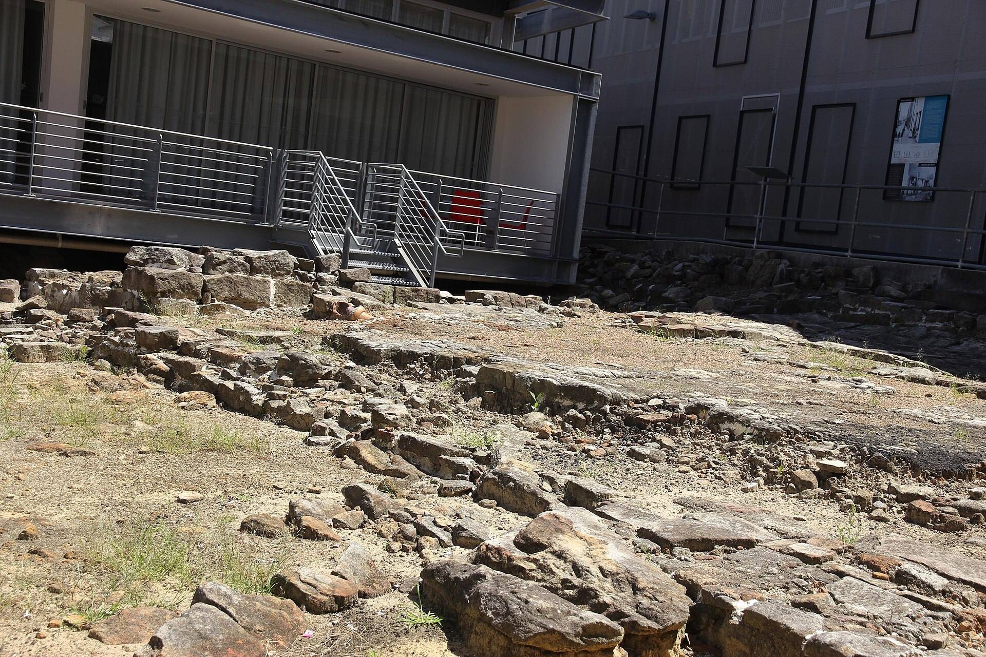
The archaeological site lies on the western side of Sydney Cove, between Cumberland and Gloucester Streets. Excavation revealed a densely occupied nineteenth-century neighbourhood containing substantial masonry remains, timber-building traces, lanes, service features, and deposits associated with domestic, commercial, and industrial activity.
Buildings and laneways
Building remains
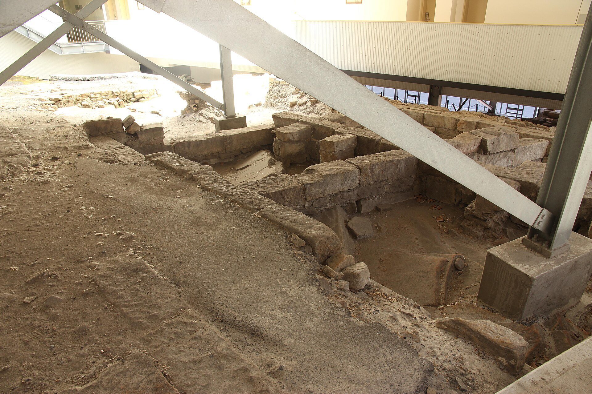
Masonry remains from at least 46 buildings survive, including houses, shops, hotels, and other structures. Post holes and more temporary timber-building traces add evidence of structures whose physical remains were less substantial. The earliest houses incorporated or cut into sandstone outcrops. The remains of eight terraces built during the 1840s and 1850s and demolished around 1905 survive in their entirety.
Cribbs and Carahers Lanes
Cribbs Lane and Carahers Lane are the site’s two major historic laneways. They were reconstructed as routes through the later hostel and archaeological site, allowing the former pattern of buildings and lanes to be read across the surviving remains. Ancillary paths and other landscape features also form part of the archaeological layout.
Water, sanitation, and deposits
Stone-lined cesspits, which collected human waste before modern sewerage, survive alongside tanks or wells cut into the living sandstone. These features and associated deposits relate to the site’s domestic, commercial, and industrial uses. Some exposed wells and cesspits were lined with Bidum, a protective geotextile material, and backfilled to stabilise them.
The 1994 excavation covered approximately 70 percent of the archaeological resource and removed about 1,500 separate contexts, including pavements, rubble, demolition deposits, and accumulated occupation layers. Samples were retained for future analysis. Approximately 60 percent of the pre-1830 resource survives, while several partly excavated or unexcavated areas remain generally intact.
Artefacts and material evidence
Approximately 750,000 individual artefacts were recovered during excavation and are stored off-site. Together with the surviving deposits, they provide evidence of material culture, consumption, work, and living conditions among the site’s former inhabitants. One fragment of porcelain made after 1790 had been expertly flaked by Aboriginal people, presumably for use as a tool.
Integrated archaeological conservation
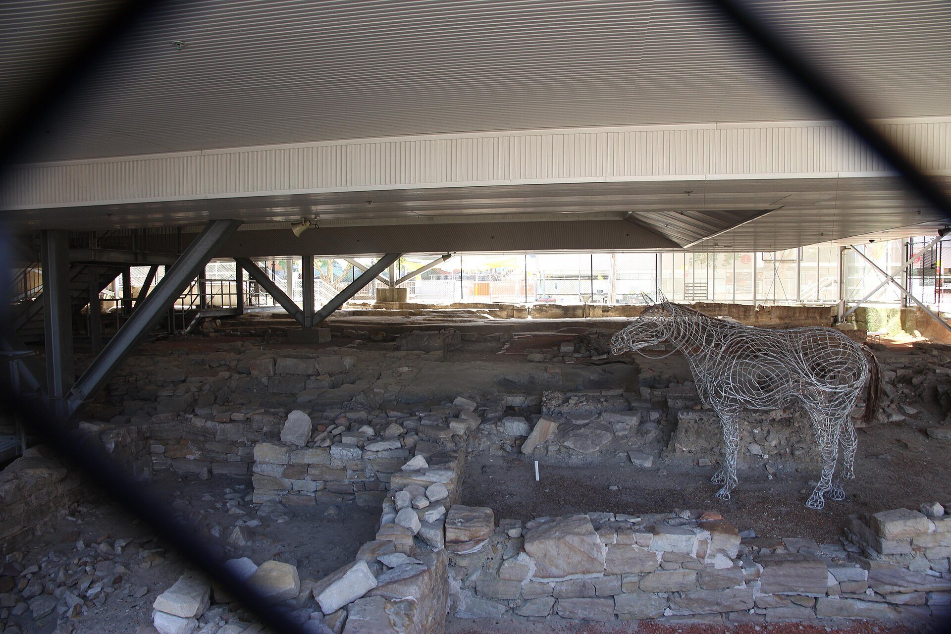
The present Sydney Harbour YHA is a lightweight building raised above the archaeology on structural-steel trusses and a small number of pillars. More than 85 percent of the archaeological site remains visible at ground level, while the building’s physical impact is concentrated in about 52 metres of selected areas. Gravel, pebbles, and other materials were added in some locations for stabilisation and interpretation.
Open voids in the hostel provide views into the excavated remains, while the reconstructed lanes form routes and view corridors through the building. The Big Dig Archaeology Education Centre is integrated into the redevelopment and interprets the excavation and former neighbourhood through displays and other interpretative works. The archaeological remains remain in situ beneath and around the building.