Fort Boykin: A Historic Military Earthwork on the James River
Site at a Glance
- Rating
- 4.6
- Popularity
- Low
- Country
- United States
- Primary era
- Modern
- External website
- Open
- Eras represented
- Early Modern, Modern
- Civilizations
- English
- Site type
- Military
- Remains
- Fort
On this page13 sections
History
Fort Boykin is a historic military earthwork at Smithfield in Isle of Wight County, Virginia, United States, built by English colonists in 1623. Its position above the James River supported the defense of the Virginia colony and later made it part of successive defensive systems during the American Revolution, the War of 1812, and the American Civil War.
Colonial foundation
Fort Boykin’s history began after the Indian Attack of 1622, which killed 347 people in the Virginia colony, including 52 in Warrosquyoake Shire, the early colonial name for the area later called Isle of Wight County. The colony also feared attacks by Spanish marauders. On May 21, 1623, the Governor’s Council ordered Captain Roger Smith to build a fort on the Worrosquoyacke shore opposite Tindall Shoals.
The new installation was first called “The Castle.” It was also known as Roger Smith’s Fort and the Fort at Warraskoyack. The fort remained active during Bacon’s Rebellion, the 1676 to 1677 uprising led by Nathaniel Bacon against Virginia’s colonial government under Governor William Berkeley. Its use at that time is recorded in the journal of the ship Young Prince.
Revolutionary and early national defenses
During the American Revolutionary War, the earlier fort was enlarged and refortified. It was renamed Fort Boykin after Major Francis M. Boykin, a local Continental Army officer and owner of the property. The Continental Army was the revolutionary army created by the American colonies, commanded by George Washington. The installation was also called the Fort at the Rocks, after the adjacent Rocks plantation.
After the British surrender in 1781, the fort was abandoned. It was probably reworked during the War of 1812, when the British warship HMS Plantagenet remained offshore in the James River for several months. British troops attempting to land at the Rocks plantation wharf were driven back by men stationed at the fort. After the war, the site again deteriorated.
Civil War occupation
The Confederate Army returned Fort Boykin to military use during the American Civil War and doubled its size. Between June 1861 and May 1862, Confederate forces cleared, refurbished, and refortified the position as part of a defensive line intended to prevent a Union advance toward Richmond.
In August 1861, Robert E. Lee ordered Colonel Andrew Talcott, Virginia’s state engineer, to redesign the fort. Lee commanded Virginia’s military forces early in the Civil War before becoming commander of the Confederate Army of Northern Virginia. Construction proceeded under Talcott’s son, Captain T. M. R. Talcott, and Lieutenant W. G. Turpin. Some Confederate records called the position the Day’s Point Battery.
On May 8, 1862, during the Peninsula campaign, a Union offensive that advanced from Fort Monroe toward Richmond, Union Navy vessels fired on Fort Boykin. The fort’s soldiers spiked their guns and withdrew after the Union weapons outranged them. Union marines landed on May 17, destroyed what they could, and blew up the powder magazine.
For the remainder of the Civil War, the Confederate Signal Corps used the site. The corps was the Confederate military’s communications branch and transmitted information through visual and other signaling methods. Its personnel included the poet Sidney Lanier and his brother Clifford Lanier.
Private ownership and preservation
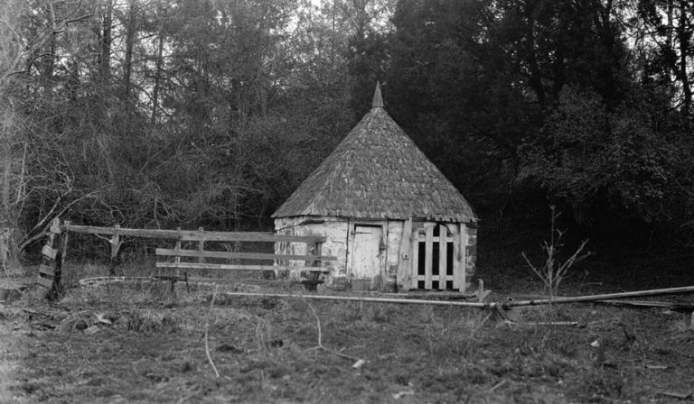
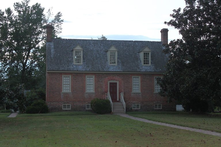
After the Civil War, Fort Boykin ceased to function as a military installation and became overgrown. Herbert and Mary Greer purchased the property in 1908 and built a house within the earthworks. The Jorden family acquired it in 1950. Following the death of the last owner in 1976, the fort was given to the state for public use.
Fort Boykin was placed on the National Register of Historic Places in 1985 because of its archaeological potential. The National Register is the United States’ official list of sites, buildings, structures, districts, and objects recognized for historical or archaeological importance. Isle of Wight County now owns the property, which is maintained as a public park.
Remains
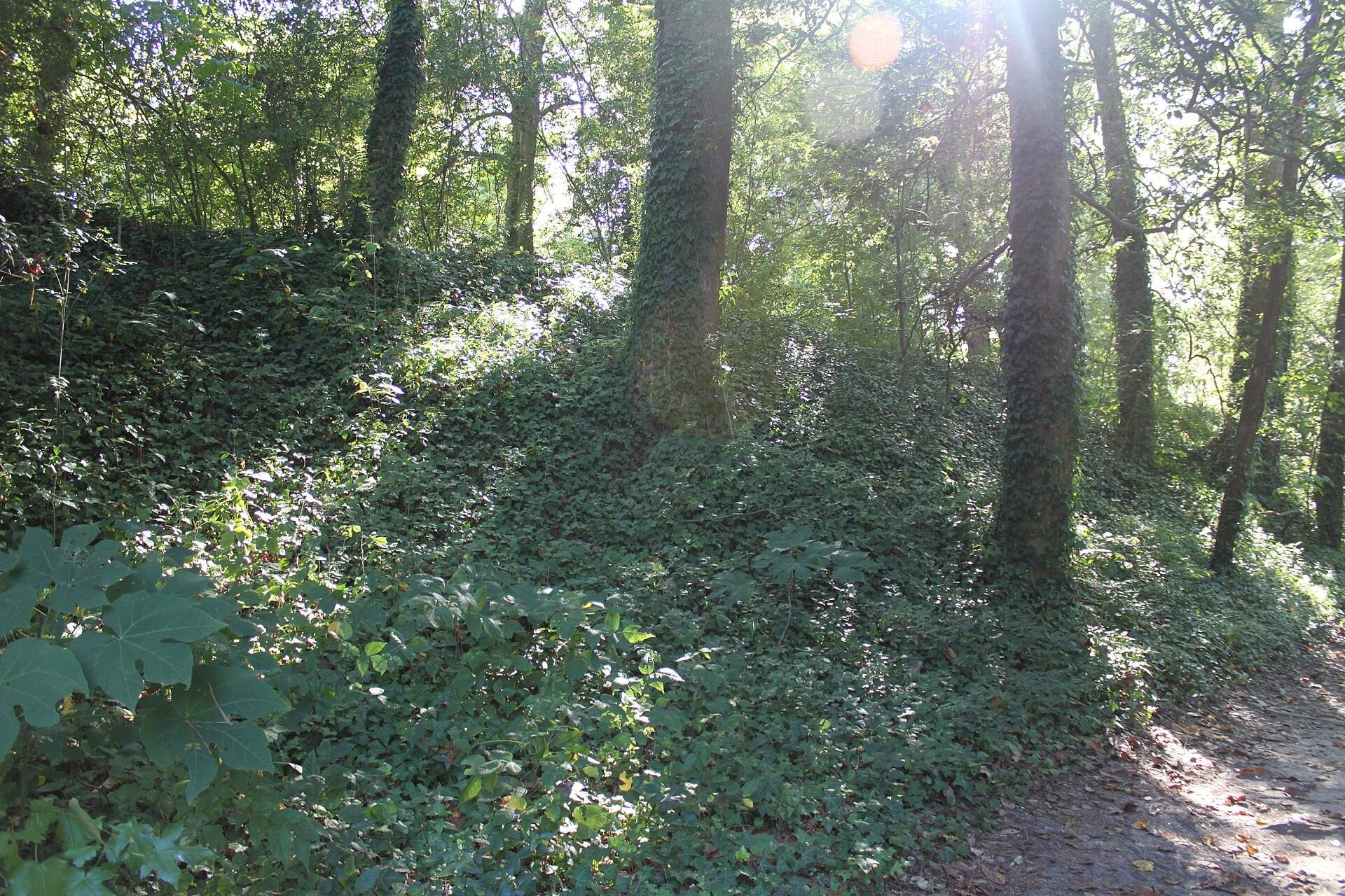
Fort Boykin occupies about 14.4 acres along the James River. Its elevated position and steep river-facing embankment overlook a waterway that served as a major trade route into the Virginia interior. The surviving fortifications are chiefly earthworks, built by cutting and compacting soil into defensive banks and ditches. Most of the preserved fabric belongs to the Civil War period, while the earlier forms survive through the altered earthworks and archaeological remains.
Colonial and Revolutionary earthworks
The 1623 fort
The first fort was a triangular earthenwork enclosed by a ditch and topped with palisade walls, defensive barriers made mainly from upright wooden stakes. Its deep natural ditches, high ground, and steep river embankment contributed to the name “The Castle.” These features established the basic defensive position above the James River.
Revolutionary and War of 1812 alterations
During the American Revolutionary War, surviving sections of the earlier fort were enlarged with new ramparts and gun emplacements. The fort was probably reshaped during the War of 1812 into a five-pointed star, adding a later geometric form to the earlier triangular earthwork.
Civil War fortifications
Expanded earthwork
The Civil War fortification was approximately twice the size of its predecessor. By May 1862, the earthwork contained positions for 14 guns, with 10 mounted. The river-facing arrangement placed its artillery toward the James River, reflecting the fort’s role in the Confederate defensive line.
Artillery and hot-shot furnace
A March 12, 1862 report lists 32-pounder and 42-pounder smoothbore cannon at the fort, all facing the James River. Smoothbore cannon have barrels without internal rifling. The position also contained a hot-shot furnace, an installation used to heat cannonballs so they could ignite combustible targets.
Present condition
The remains are largely intact, although erosion has carried away much of the front wall facing the river. The earthworks preserve the physical evidence of repeated enlargement and rebuilding, with the Civil War configuration forming the dominant surviving layer. The later house built within the earthworks also reflects the property’s transition from military installation to private holding before its preservation for public use.