Sabile Hillfort: A Curonian Stronghold and Livonian Order Site in Latvia
Site at a Glance
- Rating
- 4.8
- Popularity
- Very Low
- Country
- Latvia
- Primary era
- Iron Age
- External website
- Open
- Eras represented
- Iron Age, Medieval, Early Modern
- Civilizations
- Crusader, Livonian Order
- Site type
- Military
- Remains
- Fort
On this page13 sections
History
Sabile hillfort is a fortified Curonian stronghold in Latvia, occupied during the late Iron Age and later connected with the Livonian Order period. It stood in the Vanema region of Courland above the Abava valley, with an associated settlement that developed through the eleventh to thirteenth centuries and again during the fourteenth to sixteenth centuries. Together, the hillfort, settlement, and later castle reflect the transition from a Curonian centre to an Order-controlled administrative and supply site.
Curonian stronghold and settlement
The Curonians were a Baltic people who inhabited western Latvia and nearby areas during the Iron Age and medieval period. Sabile formed one of their fortified centres in Vanema, a historical Curonian district that also appears in the medieval division of territories involving the Livs and the Livonian Order. The hillfort was occupied in the late Iron Age, while the settlement beyond its defenses developed through successive building phases.
Sabile and its settlement first entered written history on 4 April 1253. On that date, the Livonian Order and the Curonians divided Curonian territories and the Vanema district of the Livs, after which the area passed to the Order. The hillfort may have been temporarily unoccupied afterward, although a larger settlement had developed there again by the fourteenth century.
The Livonian Order castle
A separate stone castle was established between the earlier hillfort and the Abava River, about 500 metres southwest of the hillfort. Latvian historians generally place its construction between 1253 and 1260, possibly in connection with Kandava Castle. It was probably complete by 1282, although 1300 has also been proposed. The castle was a compact fortified enclosure, or castell, rather than a large irregular fortress, and probably contained mostly wooden buildings within its walls.
The castle originally served as an independent bailiff’s castle. A bailiff was an Order official who administered a district and its castle. The first recorded bailiff at Sabile was Johannes in 1282, and another bailiff is mentioned in 1301. The castle was later placed under the bailiff of Kandava and continued until the end of the Order’s rule as an auxiliary economic centre, chiefly storing tax grain and other supplies.
Eberhard von Monheim, commander of Kuldīga from 1314 to 1328 and later master of the Livonian Order, was traditionally credited in some Baltic German accounts with building Sabile Castle. He probably rebuilt it instead, since the castle was reconstructed in 1326. Its position near the Abava, a rapid, and a ford placed it beside routes linking the region’s settlements and fortifications.
Settlement, routes, and administration
Viticulture began at Sabile during the fourteenth century. The settlement stood near the route from Kuldīga through Renda and Kandava to Tukums, which formed part of the Riga to Prussia road. It was also near an east to west water and winter route formed by the Venta, Abava, and Slocene rivers. Kandava Castle lay 15 kilometres to the east along the river, Renda’s crossing 21 kilometres to the west, and Talsi Castle 23 kilometres to the north. Five Order castles and one bishop’s castle were associated with the wider water route.
The settlement below the castle was mentioned in 1422 and was already described as a small town. In August 1438, representatives of a Westphalian faction within the Livonian Order met at Sabile Castle with envoys of the Teutonic Order’s grand master to discuss the advancement of the knight Finke to the office of master. In 1462, Sabile served as the administrative centre of the Kandava bailiff’s district, and a garden plot before the castle gate was granted as a fief.
Decline and dismantling
By 1555, Sabile was counted among several Courland castles considered militarily obsolete and too weak to support a garrison for long. Its principal practical use was as a granary and supply store. During the Livonian War, a conflict that brought the political order of medieval Livonia to an end, the former Order master Gotthard Kettler became Duke of Courland and Semigallia under the Polish king Sigismund II Augustus in late 1561. Sabile passed with most Courland castles to the new duchy.
By 1563, the castle walls were in such poor condition that constructing other buildings nearby was considered dangerous. A church was built close to the castle in 1567, probably as part of Gotthard Kettler’s programme of church construction in Courland. It had already collapsed by 1600. Between 1600 and 1604, permission was apparently sought from Duke Friedrich of Courland to demolish the castle ruins and reuse their stones for repairing the church and constructing a stone enclosure wall. The work was carried out, although the exact date of the castle’s dismantling is unknown.
Castle ruins were still described in 1793, and Johann Christoph Brotze’s drawing of 1794 shows low walls. The castle was no longer included in H. F. Wäber’s list of castles from 1804. Sabile suffered heavily during eighteenth-century raids by Polish and Swedish troops, and a major fire completely destroyed the settlement in 1808.
Later investigation and urban change
A synagogue was built on or beside the former castle site in 1890, when Jews made up 73 percent of Sabile’s population. The town’s primary school was built over the castle foundations in 1925 and was later expanded into a secondary school during the Soviet period. The former castle area is now largely built over or incorporated into the later urban fabric, making its exact position difficult to determine.
August Bielenstein first described the hillfort in 1869. Ernests Brastiņš surveyed and measured it in 1923, followed by more extensive archaeological research by Ēvalds Mugurēvičs from 1975 to 1979. The hillfort and its ancient settlement became a state-protected cultural monument of national significance in 1998. Excavations have taken place at the earlier hillfort and its settlement, but not at the former Order castle.
Remains
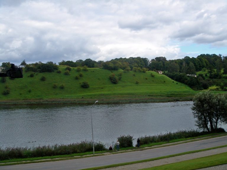
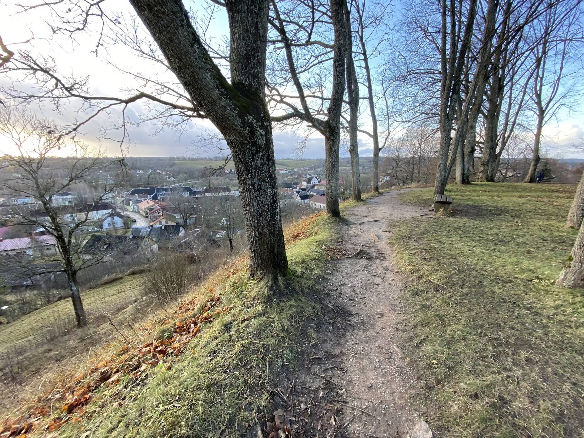
Sabile’s surviving archaeological landscape consists of the naturally defensible hillfort and its associated settlement, together with the largely built-over area of the former Order castle. The hillfort occupies a land tongue on the bank of the Abava valley, between two ravines. The former castle stood on the right bank of the river, on ground about 5 metres above the water, roughly 500 metres southwest of the earlier Curonian centre.
Curonian hillfort and settlement
Hillfort defenses
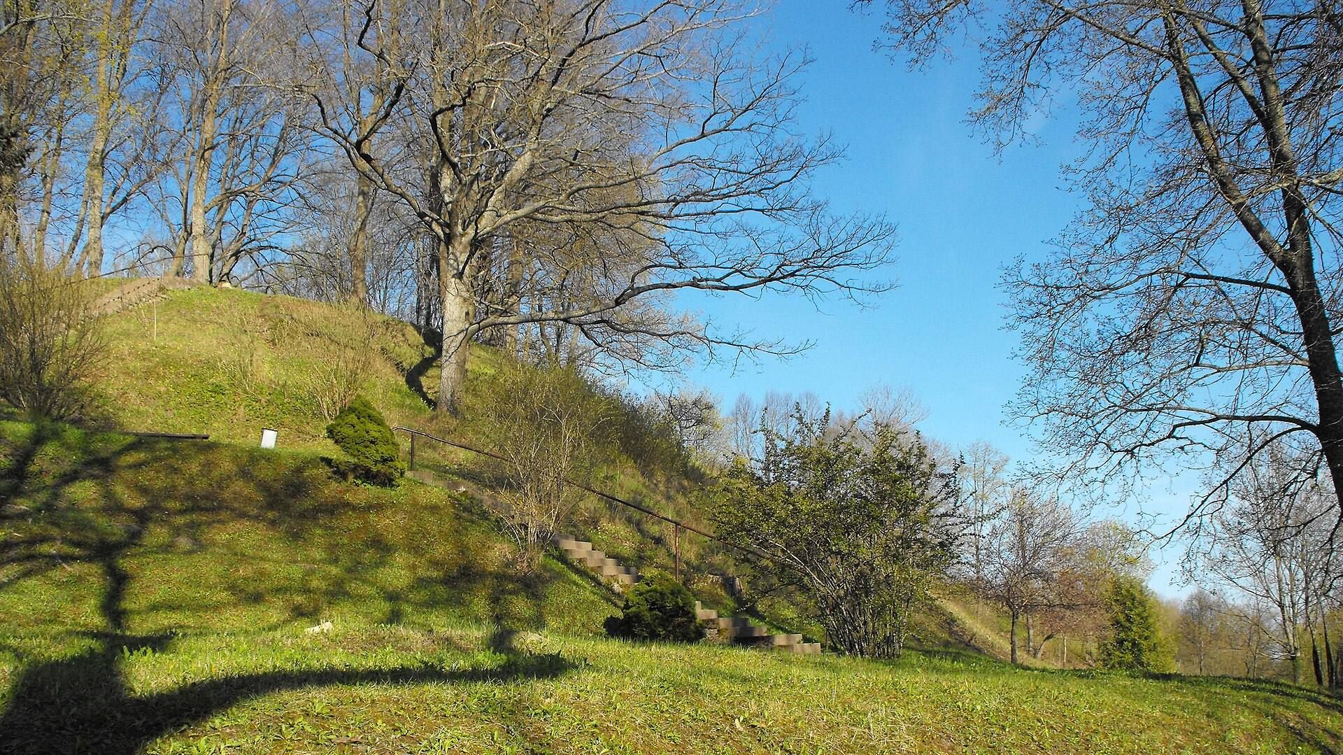
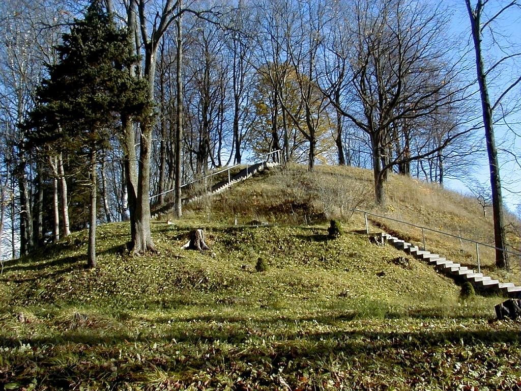
The hillfort rises 25 metres above its surroundings and has a plateau measuring approximately 45 by 60 metres. A terrace about 10 metres wide runs at its foot. A ditch around 3 metres deep and 10 metres wide separated the stronghold from the surrounding fields, while a bank about 5 metres high strengthened the defensive line. The hillfort’s cultural layer, an archaeological deposit formed by successive human occupation, reaches up to 0.5 metres in thickness.
Associated settlement
An associated settlement covered approximately one hectare beyond the ditch. Its cultural layer is also up to 0.5 metres thick and preserves two principal building phases. The earlier phase dates from the eleventh to thirteenth centuries, when the settlement was fortified with a wooden palisade. The later phase belongs to the fourteenth to sixteenth centuries and is connected with the period of Livonian Order authority.
Approximately 500 metres northeast of the Order castle stood the earlier Curonian or Liv settlement’s wooden hillfort. East of it was a plateau separated from the surrounding uplands by a small ravine, containing the palisaded settlement of the eleventh to thirteenth centuries. North of the hillfort rises 74-metre-high Karātavu Hill, also called Upurkalns or Gallows Hill. During the Order period, local tradition associated this hill with the judging and execution of peasants.
Livonian Order castle area
Fortified enclosure
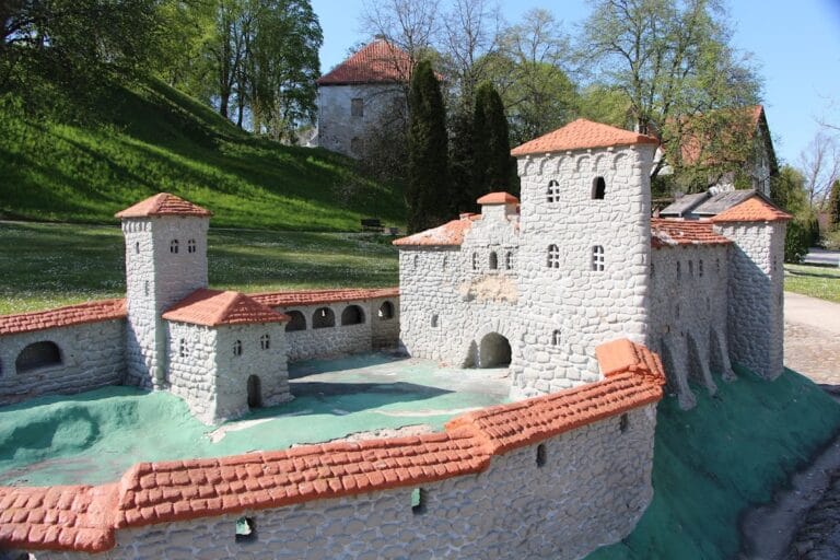
The Order castle was rectangular and nearly square, with its long axis running southeast to northwest in accordance with the river. Its corners were aligned toward the cardinal directions. The wall along the Abava measured approximately 147 metres, while the southeastern side measured about 110 metres. The southeastern edge was protected by a small spring-fed ravine that served as a moat, and ditches were probably made along the northwest and northeast sides.
The castle’s setting supplied additional natural defenses. Springs were plentiful around Sabile, and the sides of the Abava valley rose as much as 55 metres above the river. A rapid and a ford lay on the Abava at Sabile. The former castle area now lies largely beneath or among later urban buildings and open spaces, including the area between the market square, bus station, and school. Much of the site probably extends into the square before the former synagogue, which is now used for art exhibitions.
Surviving associated objects
A bell cast in 1450 for the castle chapel was transferred in 1876 to the bell tower of the present Sabile Lutheran church. It is described as the oldest surviving church bell in Latvia. Part of the present church’s pulpit is dated to 1282 and is described as the oldest surviving piece of church furnishings in Latvia. These objects preserve material links with the medieval religious and institutional landscape associated with Sabile, while the castle itself has largely disappeared from the ground surface.