Hillfort Anduliai: The Site of Medieval Kretinga Castle in Lithuania
Site at a Glance
- Rating
- 4.5
- Popularity
- Very Low
- Country
- Lithuania
- Primary era
- Medieval
- External website
- Open
- Eras represented
- Medieval
- Civilizations
- Unclassified
- Site type
- Military
- Remains
- Castle
On this page8 sections
History
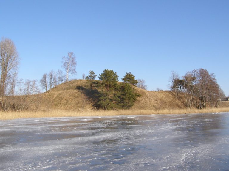
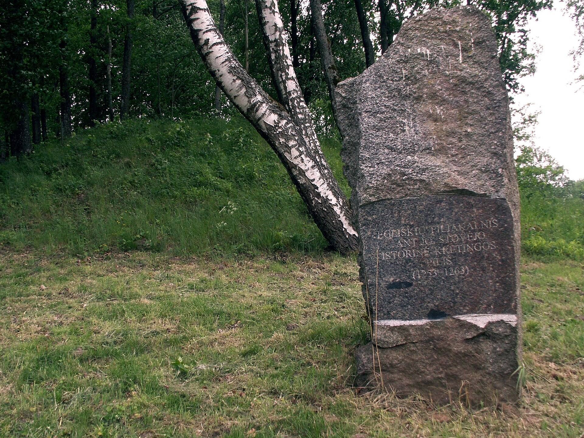
Hillfort Anduliai in Lithuania is a Curonian stronghold identified with Kretinga Castle, which appears in written sources from 1253 to 1263. The site was occupied from the end of the first millennium to 1263 and belonged to the western Baltic Curonians, a people who lived in parts of the eastern Baltic region during the medieval period. Its elevated position, steep slopes, ditches, and ramparts formed the defensive setting of a fortified settlement.
Kretinga Castle and the Curonian Rebellion
After the Crusaders conquered the southern Curonians, the castle and half of its lands were granted in 1253 to the feudal lord Veltūnas and his brothers Reiginas, Saveidis, and Tvertikinis. The remaining half was divided between the Bishop of Courland and the Livonian Order, a Catholic military order involved in the conquest and administration of the eastern Baltic.
The Curonians rebelled after the Battle of Durbe in 1260, a major defeat of the Livonian Order and its allies by forces that included Samogitians and Curonians. In spring 1263, the people of Kretinga defeated Crusader forces attacking them. They captured the commander of Klaipėda Castle and burned him on a pyre as a sacrifice to the gods. Another captured knight was exchanged for Curonians held prisoner by the Germans.
Destruction and Later Identification
During a second campaign, the Crusaders captured the castle through deception. They killed its defenders and inhabitants, including women and children, plundered the settlement, and burned it before returning to Klaipėda. The district of Kretinga, recorded as castellatura Creten, was mentioned for the last time in 1290.
Later, the hillfort lay within the territory of Anduliai village, which disappeared after 1944. This association led archaeological and encyclopedic publications to use the name Anduliai Hillfort. The site is also known as Švedkalnis, Švedų Pylimas, and Piltis. In 1972, local historian Ignas Jablonskis identified it as the Kretinga Castle mentioned in thirteenth-century written sources.
Archaeological Investigation and Protection
Adolfas Tautavičius led a survey for the Institute of History of the Lithuanian Academy of Sciences in 1963. Further surveys followed under Romas Olišauskas in 1982 and Vilnius Morkūnas in 1992. Jablonskis excavated 2.7 square metres in 1965. In 2003, Reda Švelniūtė investigated 20 square metres in the centre and southern part of the plateau, finding a 30-centimetre cultural layer dating to the beginning of the second millennium.
Hillfort Anduliai was declared an archaeological monument of republican significance in 1972. In 1997, the hillfort and forehill were entered in the Register of Cultural Values as an archaeological complex. The site became a cultural monument in 1998 and received state protection in 2005.
Remains
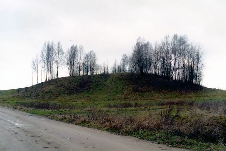
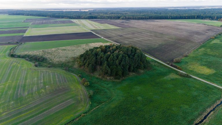
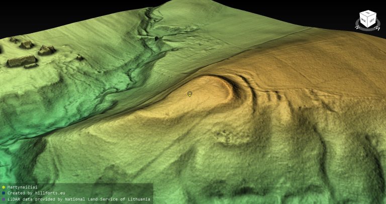
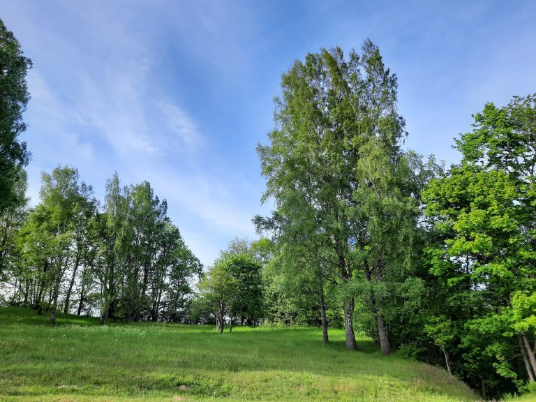
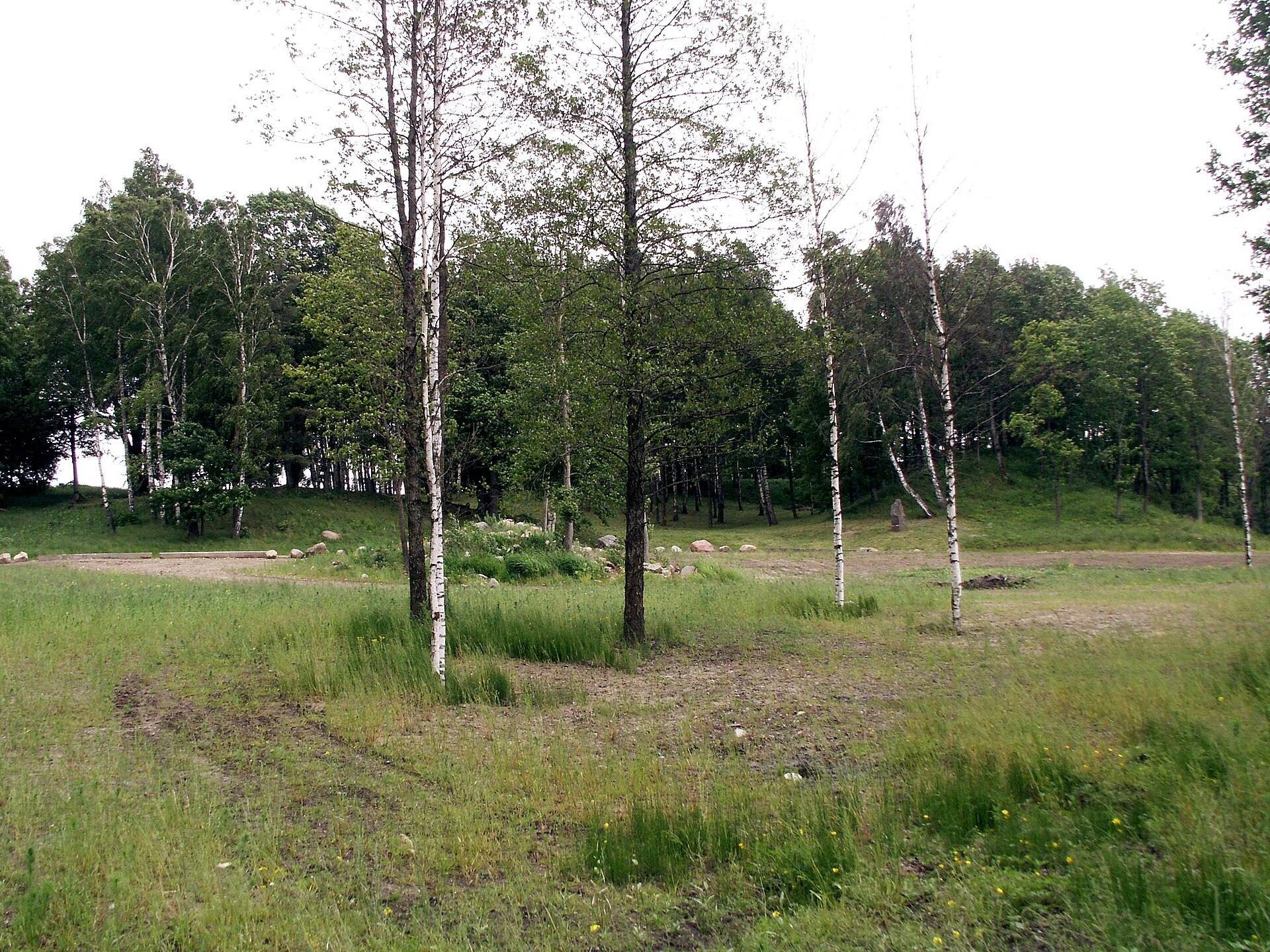
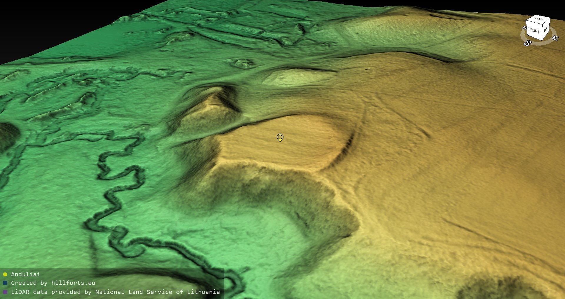
The site occupies a high promontory beside the valleys and hollows of the Danė River and its tributary, the Šaltupis, also called the Kapupis. The southern and western slopes are steep and rise 10 to 12 metres. An oval plateau, measuring 60 by 40 metres, runs along a north-south axis. A semicircular rampart protects its northern and eastern sides.
The Main Hillfort
The rampart is 70 metres long, 1.5 metres high, and 10 metres wide. Archaeological investigation found two layers of burnt material within it. The earlier rampart stood 1.5 metres high and supported a wooden defensive wall. After the wall burned, the rampart was raised to 3.5 metres. The plateau has a heavily damaged, thin cultural layer. Excavated material includes part of a bronze horseshoe brooch, a bronze plate, and undecorated pottery.
Perkūnkalnis
Beyond a ditch 7 metres deep and 40 metres wide, northwest of the main hillfort, lies a separate promontory called Perkūnkalnis, or Perkūno Kalnas. It measures 36 metres in length and 8 metres in width. The promontory was not used as part of the hillfort and has been interpreted as a possible sacred hill, a raised landform associated with pre-Christian ritual activity. In 1944, a large stone with a bowl-shaped depression, known as the Sacrificial Stone, still lay there.
The Cultural Values Register uses a reversed identification for the two landforms. It calls the Perkūnkalnis promontory the hillfort and the principal fortified rise the forehill.
Cemetery
A cemetery dating from the second to the thirteenth century extends east and north of the hillfort, adding a burial area to the settlement’s surviving archaeological landscape.