Kalinjar Fort: A Historic Hill Fortress in India
Site at a Glance
- Rating
- 4.4
- Popularity
- Medium
- Country
- India
- Primary era
- Early Modern
- External website
- Open
- Eras represented
- Classical, Medieval, Early Modern
- Civilizations
- Gupta, Mughal, Rajput
- Site type
- Military
- Remains
- Fort
On this page23 sections
History
Kalinjar Fort is a historic fortified hill settlement in India, at Kalinjar in Uttar Pradesh. Known historically as Kalanjara, it developed over many centuries from a sacred centre into a major political and military stronghold. The hill was associated with pilgrimage traditions, Shiva worship, successive dynasties, and repeated sieges before the fort was decommissioned under British rule.
Early Sacred Traditions
The name Kalanjara has been associated with Sanskrit ideas concerning time and its destruction or subjugation, and later with Shiva as lord of time. In early tradition, Kalinjar was an important pilgrimage centre. The Mahabharata, a major Sanskrit epic containing religious and pilgrimage traditions, associates Kalanjara with sacred pools, the ashram of the sage Agastya, and prāyopaveśa, the ritual practice of fasting to death at the end of life. The epic does not explicitly connect the site with Shiva.
The Harivamsa tells of seven Brahmins who were reborn at Kalanjara as deer. This tradition may be reflected at Mrigadhara, where seven deer are depicted beside rock inscriptions from the Gupta period. The Gupta period, an influential North Indian imperial era conventionally dated here from about the third to fifth centuries, provides an early setting for the religious and artistic development of the site.
By the Gupta period, Kalinjar had become a centre of Shiva worship. Two Gupta-period terracotta seals found at Bhita mention Kalanjara and depict lingas, aniconic representations of Shiva. One seal also mentions Bhadreshvara, possibly referring to the Bhadreshvara Temple at Kalinjar. Later Shaiva texts, including the Skanda Purana and tantric pilgrimage lists, continued to recognize the hill as an important sacred place.
Jain texts also describe Kalinjar as a mountain connected with the previous lives of the ascetic brothers Citta and Sambhuya. A pre-Chandela inscription indicates the presence of a wealthy merchant community at the site, showing that Kalinjar was associated with both religious activity and organized settlement before the Chandela period.
Early Temples and Regional Dynasties
A fragmentary inscription from Chandi Darwaza, probably dating from the eighth or ninth century, says that the Bhadreshvara Temple had been built in the distant past by a king named Udayana. Udayana’s identity remains uncertain. He may have been connected with the Panduvamshi dynasty, or he may have been the legendary king known from the Brihatkatha.
Two ninth-century inscriptions record the construction of a Shiva temple and later pilgrimages to it. This temple has been interpreted as probably referring to the Nilkantha Temple. Its final additions were probably made around the beginning of the thirteenth century during the reign of Paramardi, who left an inscription dated 28 October 1201.
By 836, Kalinjar appears to have been under Gurjara-Pratihara control. The Rashtrakuta king Krishna III captured it in the mid-tenth century, after which it came under the Kalachuris of Tripuri. Before 954, the Chandela ruler Yashovarman took Kalinjar from the Kalachuris.
The Chandela Stronghold
The Chandelas were a medieval Rajput dynasty that ruled much of Bundelkhand and made Kalinjar an important political and military centre. Later dynastic traditions described Kalinjar as the Chandelas’ place of origin, although contemporary inscriptions did not identify it as their capital at the time of Yashovarman’s conquest. By 998, Yashovarman’s successor Dhanga used the title Kalinjaradhipati, meaning lord of Kalinjar, indicating that the settlement had become his capital.
Kalinjar then appeared frequently in Chandela inscriptions and texts. The Chandelas renewed the fortifications and enlarged the complex. During the eleventh and twelfth centuries, substantial building took place amid relative political stability, while Chandela feudatories repeatedly visited the Nilkantha Temple on pilgrimage.
In 1023, Mahmud of Ghazni attacked Kalinjar and received tribute, but he did not capture the fortress. The Persian scholar Al-Biruni later called Kalinjar, together with Gwalior, one of the most famous fortresses in India.
Ghurid Attacks and Chandela Recovery
In 1202 or 1203, the Ghurid general Qutb ud-Din Aibak besieged Kalinjar. Paramardi apparently surrendered and offered tribute. He died during the siege, or, according to one tradition, was assassinated by his prime minister. The garrison surrendered on 27 April 1203. Kalinjar was placed under a Muslim governor, and the site was probably looted while some temples were reportedly destroyed.
Paramardi’s successor, Trailokyavarman, reconquered Kalinjar within a few years and again adopted the title Kalinjaradhipati. In 1233-1234, the Ghurid commander Malik Nusratuddin Taisi failed to capture the fortress but plundered the town below it. Trailokyavarman and his successor Viravarman retained control, and the last Chandela ruler, Hammiravarman, was still identified as Kalinjaradhipati in an inscription dated 1289.
Mughal, Baghela, and Maratha Control
After the Chandelas, Kalinjar came under the Bundela dynasty for an uncertain period. It later passed through the control of the Mughals, the Baghelas of Rewa, the Marathas, and the East India Company. In 1530, the future Mughal emperor Humayun led a campaign against the fort. A rock inscription below the Patalganga tank records his name, titles, and the date 30 March 1530.
By 1545, the Baghela ruler Ram Chand controlled Kalinjar. Sher Shah Suri besieged the fort, and a battle followed between his army and the Baghelas, who were supported by Bundela allies. Sher Shah was mortally wounded when one of his own cannons exploded, but his troops captured the fort. He was temporarily buried on the hillock of Kalinjari east of the fort before being moved to his permanent tomb at Sasaram.
After the death of Sher Shah’s successor Islam Shah in 1554, Ram Chand Baghela reoccupied Kalinjar with Bundela assistance. In 1569, the Mughal emperor Akbar ordered Majnun Khan Qashqal, governor of Manikpur, to recapture the fort. Ram Chand surrendered after the water supply failed, and Kalinjar remained under Mughal rule until the Maratha takeover.
In the early eighteenth century, the Peshwa Bajirao captured Kalinjar after defeating the Mughal general Bangash Khan of Allahabad. A Maratha light-infantry garrison of about 5,000 men was established under several senior commanders, and the fort was used to levy chauth, a revenue payment, on surrounding territories.
Company Rule and the Rebellion of 1857
After the Peshwa’s defeat in the Second Anglo-Maratha War, the Treaty of Surji-Anjangaon transferred Bundelkhand to the East India Company. The Company managed Kalinjar from 1805 to 1806. British troops entered Bundelkhand in 1812 and annexed the fort after prolonged fighting.
During the Indian Rebellion of 1857, the old Bhatt aristocracy recaptured Kalinjar and drove the Bundela forces to Ajaygarh. In 1858, British forces under Major Hugh Rose besieged the fort. The population resisted, and the fighting caused almost 800 British and 3,000 Indian deaths. With assistance from the states of Panna and Rewa, British forces captured Kalinjar on 4 May 1858. The last Bhatt Peshwas surrendered and were sent to Rewa as prisoners.
After the capture, Kalinjar was divided among the Bundelas, the Rewa Solankis, and the Chaubes of Rajaula. The fort was decommissioned, and buildings were demolished to prevent its reuse as a Maratha garrison. Damage from the British period remains visible on the walls and in open areas. Kalinjar is now controlled by the Archaeological Survey of India and is recognized as a monument of national importance.
Remains
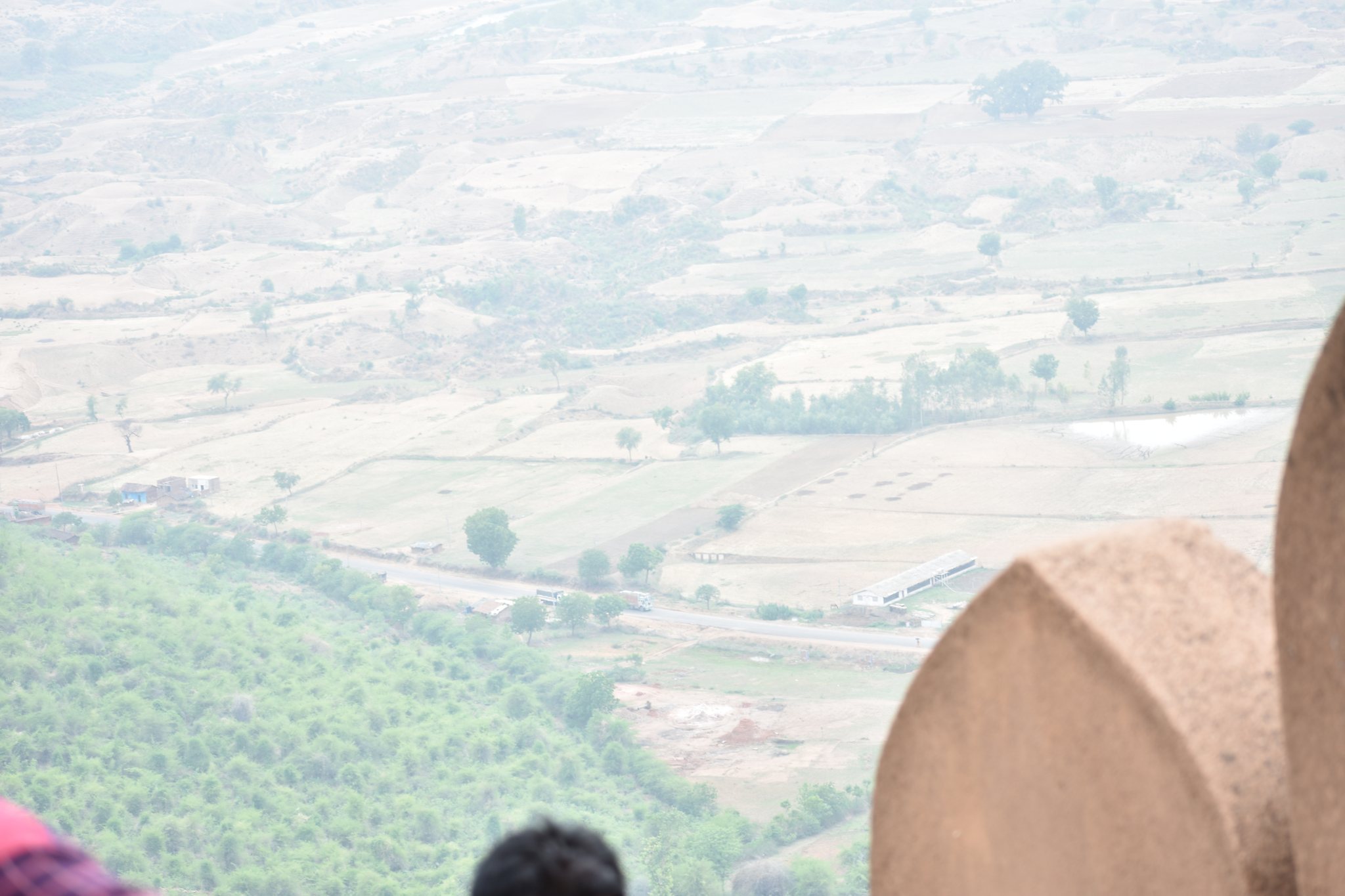
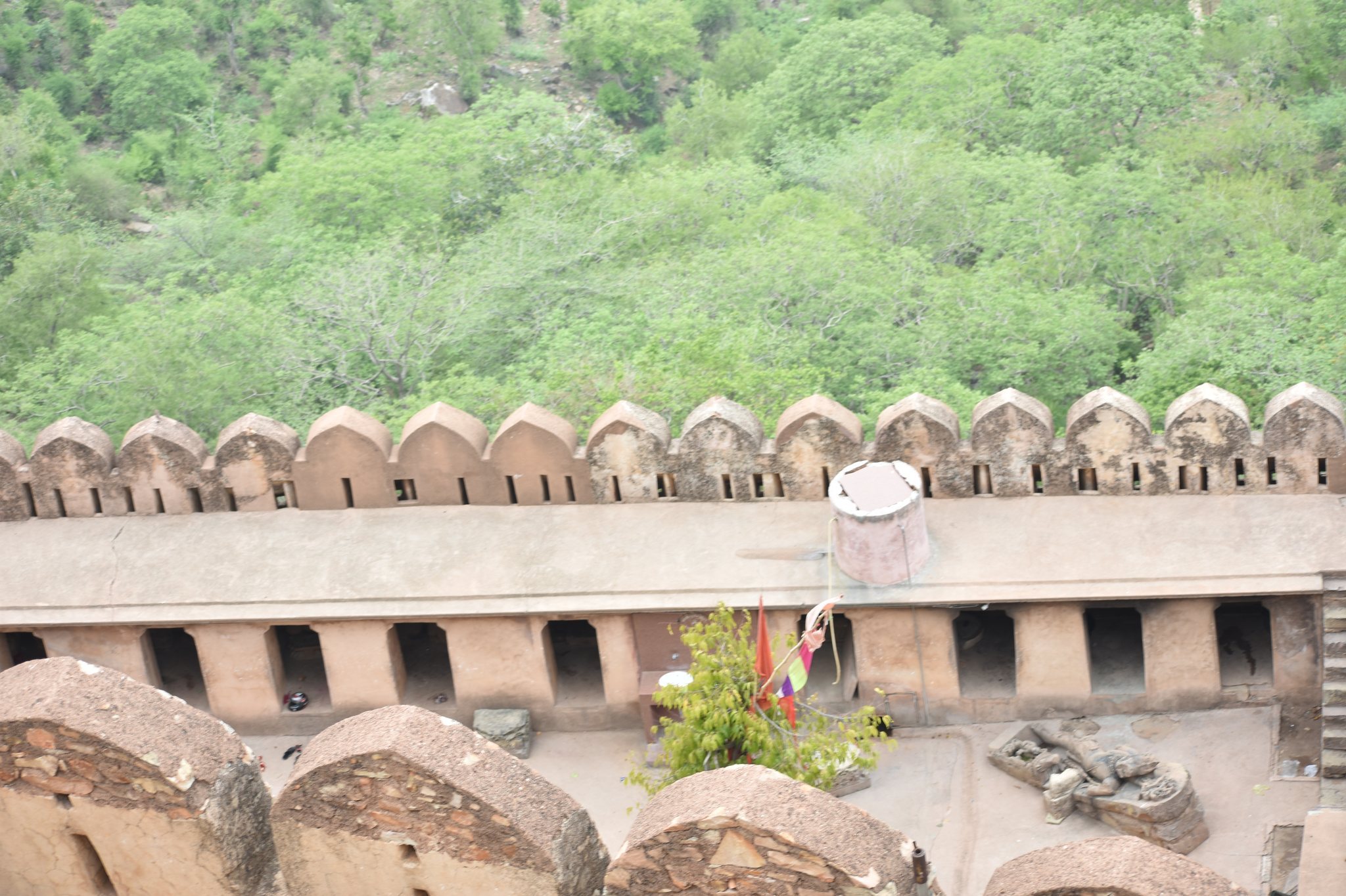
Kalinjar Fort occupies an isolated, flat-topped rocky hill at the northeastern end of the Vindhya Range, overlooking the Bundelkhand plains. The hill rises about 244 metres above the surrounding plain and reaches approximately 400 metres above sea level. The village of Tarahati, also called Kalinjar, lies at the northern foot. The fort is about 1,600 metres long and 800 metres wide, with walls extending for roughly 7.5 kilometres and rising locally to about 30 to 35 metres. Granite and other stone masonry were used for construction and repair. Some wall sections date from the fourteenth to sixteenth centuries and were repaired by the British in the nineteenth century.
Approaches and Gates
Northern Approach
The principal entrance lies on the northern side and is reached through the settlement below the hill. The original approach included several flights of stone steps. Most have disappeared, although the first and later sections survive substantially. Seven principal gates lead up this northern ascent: Alam or Alamgiri Darwaza, Ganesh Darwaza, Chandi or Chauburji Darwaza, Budhabhadra Darwaza, Hanuman Darwaza, Lal Darwaza, and Bara Darwaza. Panna Gate is also identified within the fort.
Alam, Ganesh, and Chandi Gates
Alam Darwaza is reached by the first surviving flight of steps. An inscription at its top dates the gate to 1673, during the reign of Aurangzeb. Ganesh Darwaza takes its name from a coarse image of Ganesha carved on its right side. Chandi Darwaza is a double gatehouse with four towers, which explains its alternative name, Chauburji Darwaza. An adjoining structure was probably a guardhouse.
Upper Gates and Associated Shrines
A branch path from the approach descends towards the Balkhandi Mahadeo shrine through the small, dilapidated Balkhandi Mahadeo Darwaza. Budhabhadra Darwaza follows on the main ascent. Hanuman Darwaza is named after a nearby carving of Hanuman. Its area includes Hanuman Kund, a reservoir, and rock carvings of several deities.
Lal Darwaza is built of red sandstone. To its west lies Bhairon Kund, a reservoir with a colossal rock-cut figure of Bhairava. Bara Darwaza is the final gate on the approach and marks the entrance to the fort proper.
Nilkantha Temple and Rock-Cut Shrines
Nilkantha Temple
The Nilkantha Temple is the most prominent structure within the fort. It occupies a cave beneath an overhanging rock ledge below the ramparts, near the northwestern corner of the hill. A post-and-lintel gateway known as the Parmardi Deva or Paramardideva Darwaza leads to steps descending to the temple.
The temple mandapa, or pillared hall before the shrine, is richly carved but dilapidated. Eight pillars formerly supported its octagonal roof. The cave facade was also elaborately decorated, including figures of the river goddesses Ganga and Yamuna, although much of this decoration is damaged or effaced.
The shrine contains a dark-blue, three-eyed linga about 1.15 metres high. The rock-cut cella lies beneath a cliff from which a small perennial trickle of water emerges. The linga is a face-bearing form worked as a deep wall relief rather than a free-standing object. The mandapa has an octagonal, pillar-supported interior, with disc-shaped capitals, figure-decorated impost blocks, and horizontal architraves. Its lack of a shikhara, or temple superstructure above the sanctum, combined with its tall decorated pillars, has led to an attribution to the late Pratihara period, probably the seventh or eighth century, although other elements may be earlier or later.
Rock-Cut Reservoir and Images
South of the Nilkantha Temple is Svargarohana, a deep rock-cut reservoir. Nearby, in a cliff niche and pool, stands a colossal rock-cut statue of Kala-Bhairava about 7 metres high and 5 metres wide. The eighteen-armed figure holds weapons and offerings including a sword, axe, club, shield, bowl of blood, and sweets. It lacks the trident common in many depictions of Shiva. A smaller statue of Kali, about 1 metre high, stands beside it.
Other rock-cut reliefs depict Parvati, Narayana, Bhairava, and Kali. Some may belong to the Gupta period, while others are attributed to the Chandelas. Together with caves, inscriptions, and temple remains, these images preserve the site’s long history as a centre of religious activity.
Palaces and Water Installations
Bundela Palaces
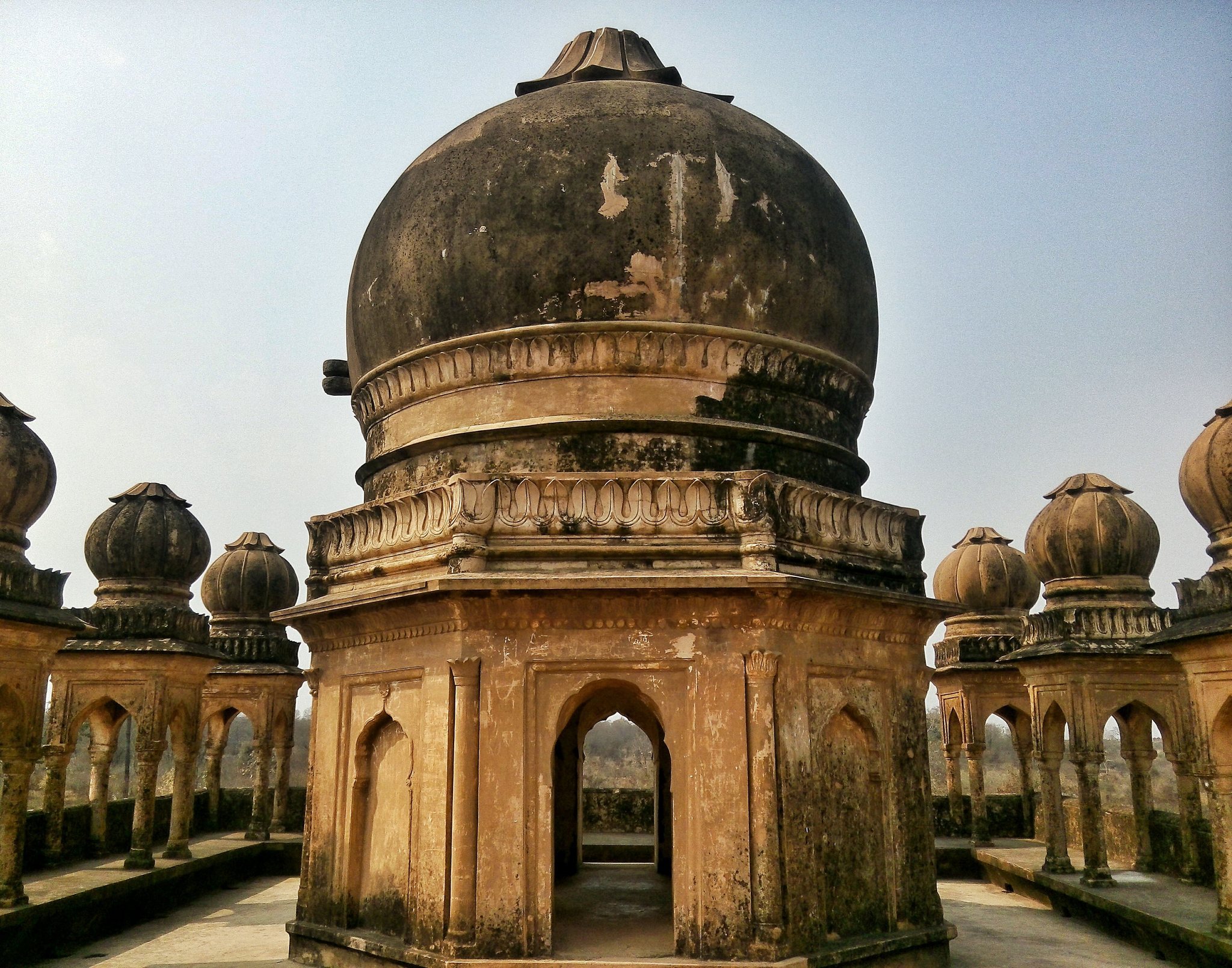
At least three Bundela-period palaces survive: Raja Aman Singh Palace, Rani Mahal, and Rang Mahal. They generally consist of multistorey buildings arranged around square courtyards, with broad projecting eaves, overhanging balconies, and chhatris, domed or cupola-like pavilions, at the four corners.
Raja Aman Singh Palace stands in the southern part of the fort and houses a site museum containing sculptural and other remains found at Kalinjar. The former palace contains fully sculpted figures, including a Varaha figure. Other named palace and residential features include Bhagwan Sej, Sita Sej, and Rani Mahal with the Venkat Bihari Temple.
Rani Mahal stands north of Aman Singh Palace in the central part of the fort and is dilapidated. It is a two-and-a-half-storey rubble-masonry building that was formerly plastered and possibly painted. Its chhatri superstructures show Mughal architectural influence. Rang Mahal lies to the northwest.
Koth Tirth
Adjacent to Raja Aman Singh Palace, Koth Tirth is the largest water body within the fort. The underlying rock was cut into a basin, and steps surround it on all sides. Numerous pilgrim inscriptions are carved into these steps.
Reservoirs and Tanks
Numerous reservoirs, tanks, pools, and cisterns supplied water outside the monsoon season and during sieges. Named water features include Hanuman Kund, Bhairon Kund, Sita Kund, Patal Ganga, Pandu Kund, Budhbhadra Talao, Pani ki Aman Kund, Sanichar Talao, Bijli Talao, Ram Katora Talao, Taliyya Talao, and Bhairon ka Jhirka.
Mosques, Tombs, and Other Structures
Islam Shah Mosque
The Islam Shah Mosque stands north of Koth Tirth in the central part of the fort. It is enclosed by a walled courtyard and is entered through an eastern gate. The mosque has a three-bay-deep liwan, a roofed hall open on one or more sides, to the west. Its flat roof is supported by square pillars. Five blind arches occupy the western rear wall, and the central arch contains an undecorated mihrab, the prayer niche indicating the direction of Mecca.
Qanati Mosque and Tombs
A qanati, or screen, mosque stands at the southwestern corner of Sanichar Talao. The fort also contains a Muslim cemetery with numerous undated graves. Two square tombs with Lodi-style domes stand at the cemetery’s northwestern corner. The larger tomb has a western mihrab and a Persian inscription.
Caves and Service Buildings
Other identified features include Sidh ki Gupha, Koth Tirth, Mrigdhara, and the graveyard. The complex also contains Dak Bungalow I and other service structures, as well as the named gates, shrines, palaces, mosques, tombs, walls, water installations, and archaeological remains that survive across the hill.