Fuerte San Miguel: A Portuguese Military Fortification in Uruguay

Site at a Glance
- Rating
- 4.7
- Popularity
- Medium
- Country
- Uruguay
- Primary era
- Early Modern
- External website
- Open
- Eras represented
- Early Modern
- Civilizations
- Portuguese, Spanish
- Site type
- Military
- Remains
- Fort
On this page12 sections
History
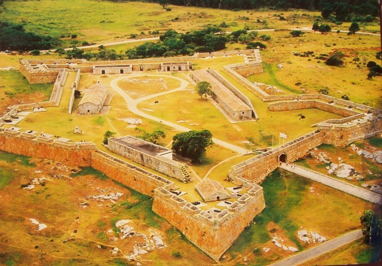
Fuerte San Miguel is a Portuguese military fortification in Uruguay, located at Dieciocho de Julio in Rocha Department. Construction of the present fort began on 17 October 1737, following Portugal’s establishment of a military position in the area, and its later form developed into a star-shaped bastioned fortification associated with the Vauban style, a system using angled bastions and overlapping defensive fire.
Portuguese foundation and expansion
The Portuguese established the fort after abandoning an attempted fortification at Maldonado. Spanish forces may have created an earlier field fortification in 1734, which the Portuguese occupied three years later. The design of the present structure is attributed to Brigadier José da Silva Pais, although other attributions associate the plan with the military architect Manuel Gomes Pereira, who was later replaced by Captain Antonio Teixeira Carvalho.
A Portuguese garrison of 100 men used San Miguel as an observation post for Spanish military movements. Article XVIII of the Treaty of Madrid, the 1750 agreement intended to settle Portuguese and Spanish territorial claims in South America, allowed Portugal to retain and fortify the line of Castillos Grande. The treaty was later annulled by the Treaty of El Pardo in 1761.
War and Spanish control
As the political settlement deteriorated, Gomes Freire de Andrade, governor and captain-general of the Portuguese Captaincy of Rio de Janeiro, ordered Colonel Elói Madureira, governor of the Colony of Rio Grande de São Pedro, to move troops toward the Laguna region. Portugal planned a fortified defensive line south of San Miguel after Pedro de Ceballos, governor of Buenos Aires, conquered Colonia del Sacramento in October 1762. Lieutenant Colonel Tomás Luis Osório arrived with cavalry and troops from Fort Jesus, Mary and Joseph of Rio Pardo.
Construction of the nearby Fortaleza de Santa Teresa began in October 1762. It was intended to block the land route used by Ceballos and become the principal Portuguese stronghold in the area. Ceballos captured San Miguel in April 1763, after which Spanish forces repaired and substantially improved the fort.
In 1775, when a British invasion was considered imminent, the engineer Bernardo Lecocq directed further reinforcement works. The Treaty of San Ildefonso in 1777 revised the territorial arrangements and confirmed Spanish possession of San Miguel. Additional repairs in 1797 strengthened the fort in anticipation of renewed warfare.
Abandonment and reconstruction
Following Uruguay’s independence in 1828, the fort was deactivated and abandoned. It gradually deteriorated into a ruin. By 1891, vegetation covered the structure, cracks had developed, and a mountain palm was growing in one corner.
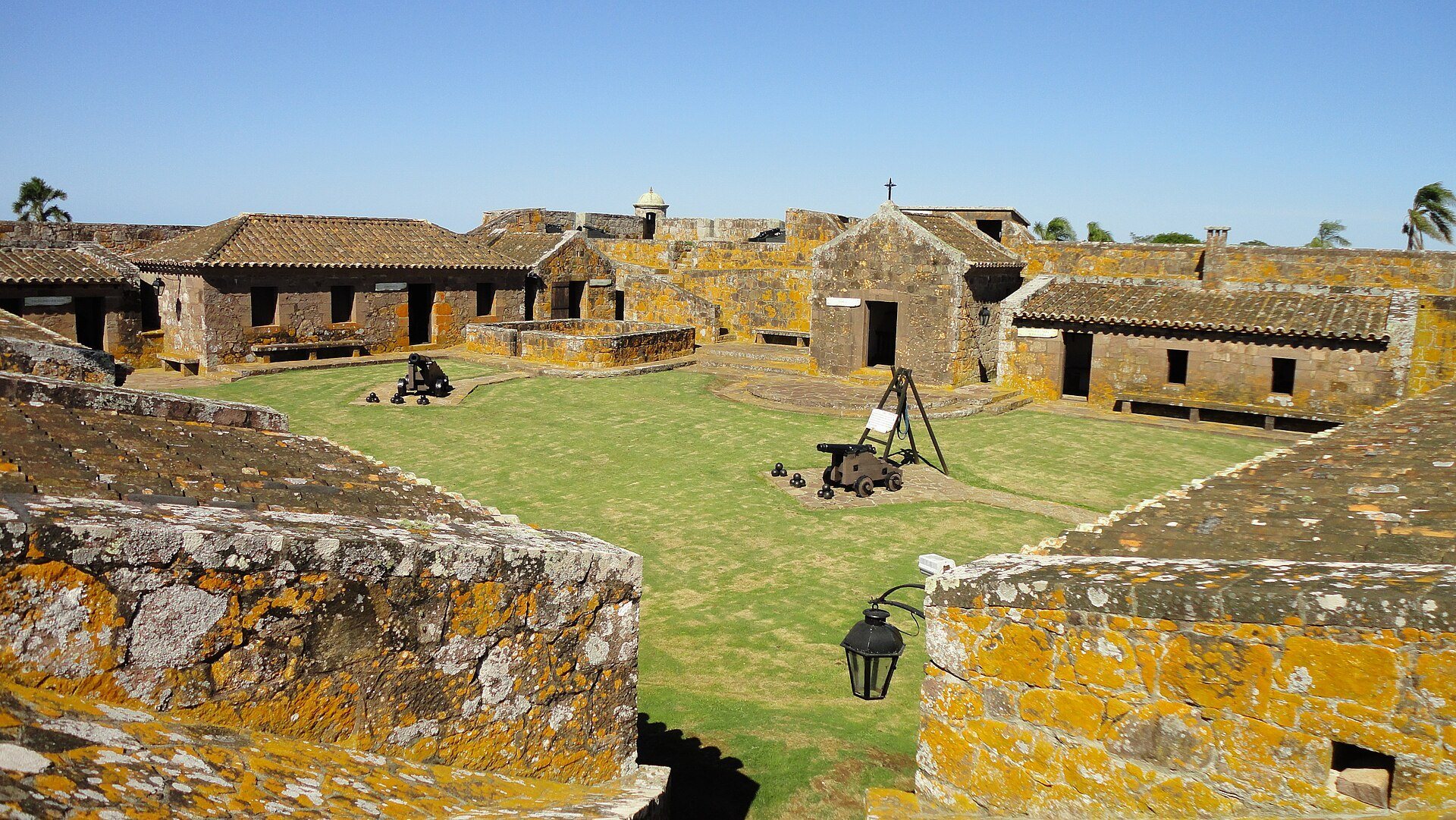
A restoration committee formed by General Alfredo R. Campos, General Alfredo Baldomir, and the historian Horacio Arredondo began operating in 1927. From 1933, the fort was reconstructed according to its original plans and with period techniques. The work included the Command House, Parliament House, chapel, kitchen, and Troop Barracks. Uruguay declared Fuerte San Miguel a National Monument in 1937, after which its recovery was intensified. The Army now administers the fort, which houses a Military History Museum with garrison uniforms, displays on the development of Army uniforms, and watercolors by Emilio Regalía.
Remains
Fortification and defensive works
Walls and bastions
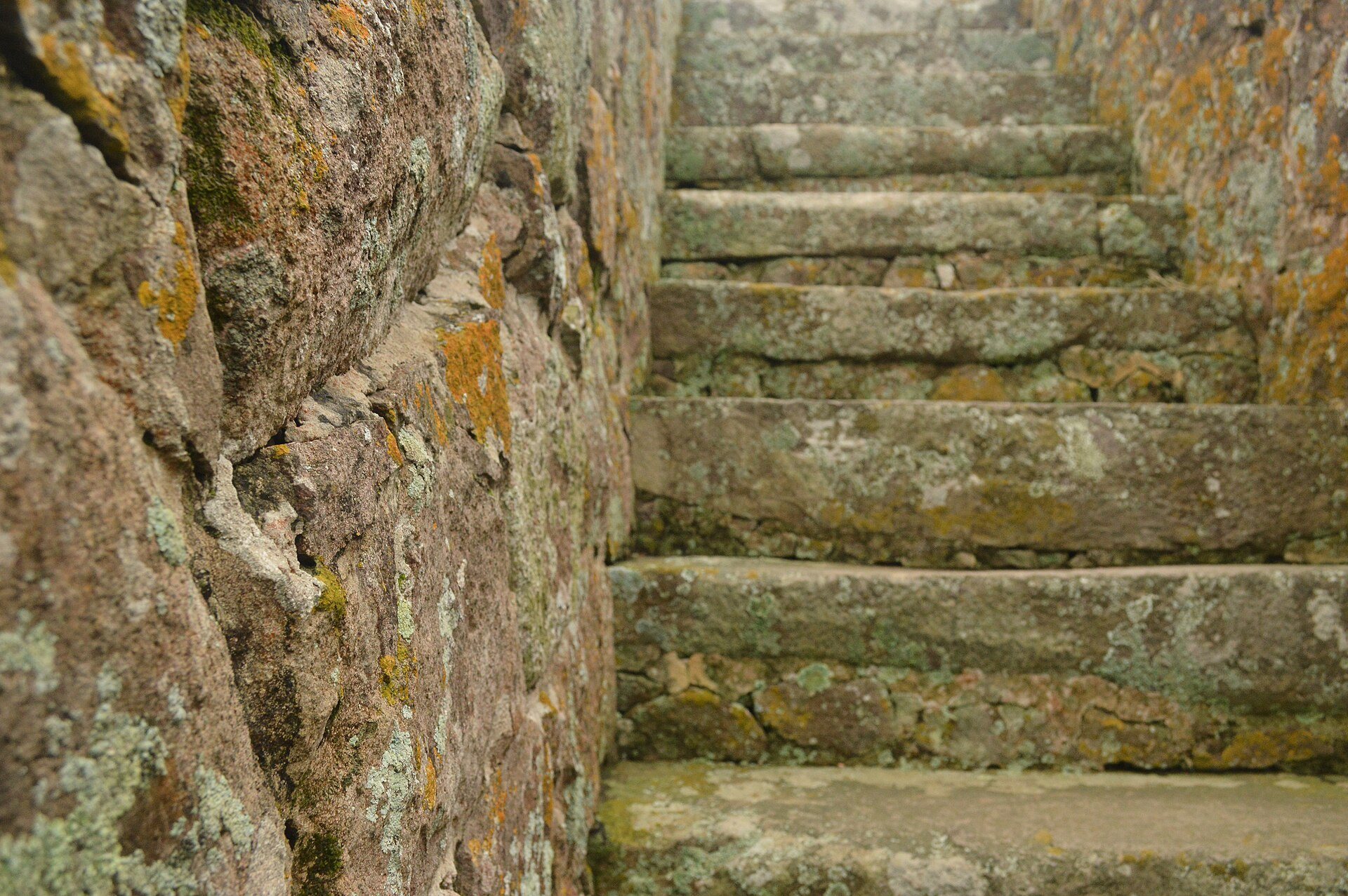
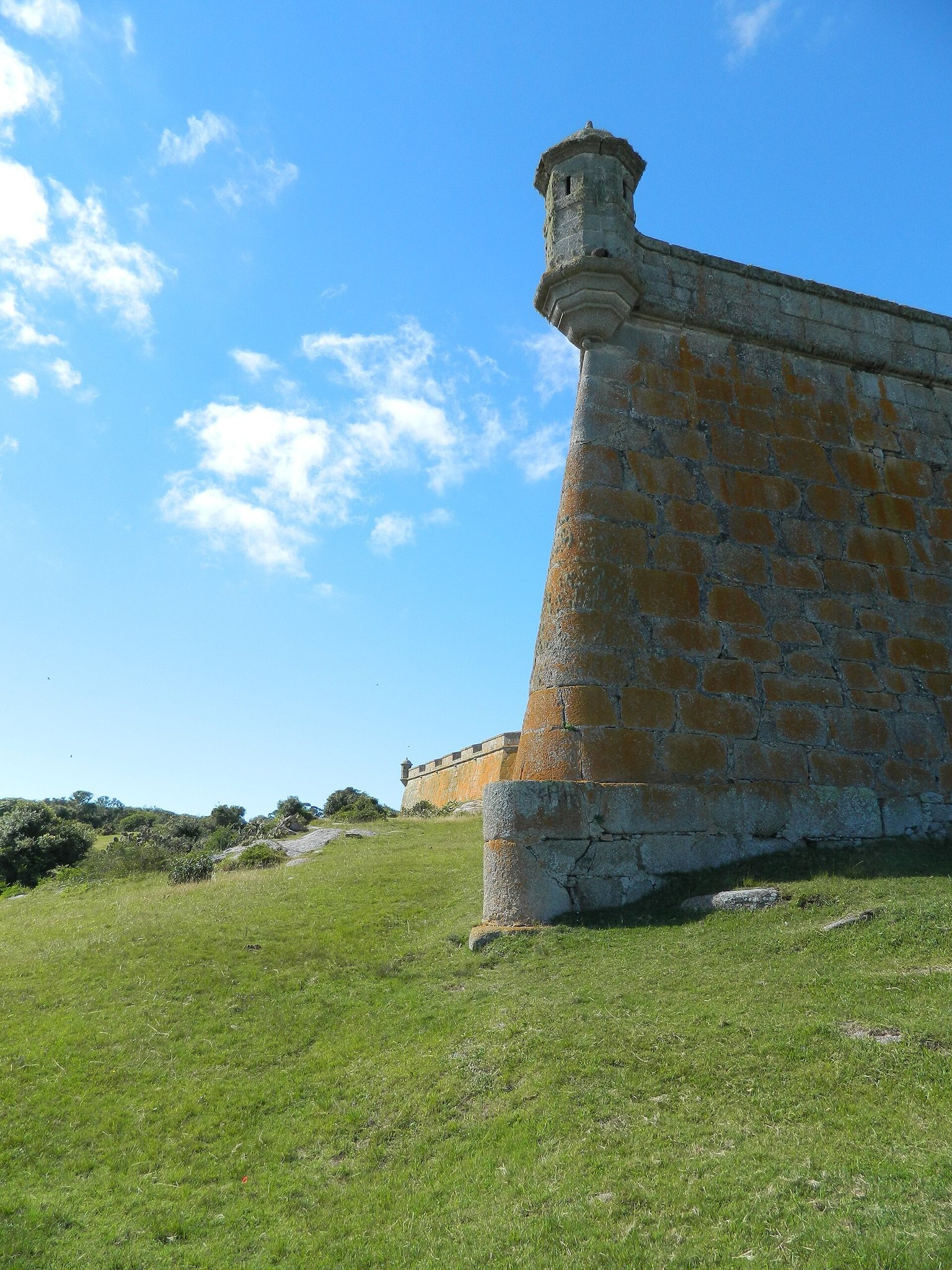
Fuerte San Miguel stands on the summit of the Sierra de San Miguel, about 35 metres above sea level. The fort has an approximately 300-metre perimeter formed by irregular stone masonry. Its characteristic material is pink granite laid unevenly, reflecting the limited availability of suitable local granite and giving the structure a less refined finish than the neighbouring Fortaleza de Santa Teresa.
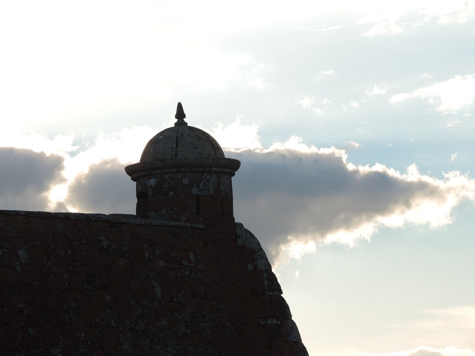
The initial plan was a rectangular stone polygon with two pentagonal bastions at the corners of its shorter sides. By about 1740, it had developed into a star-shaped fort with four pentagonal bastions at the vertices, linked by curtain walls, the defensive walls joining adjacent projections. Watchtowers or sentry structures crown the bastions, while 18 embrasures, openings through which cannon could be fired, are distributed across the upper levels. The fort’s limited dimensions prevented the construction of ramps connecting those levels.
Entrance and inner mound
Entry was made across a drawbridge spanning a flooded moat. A chapel stood on the earthen mound or terrace within the fort, and a deep well was positioned on one side of the mound. These features formed part of the fort’s internal arrangement alongside the reconstructed service buildings.
Outpost and surrounding landscape
Hill outpost
A separate outpost is set into a vegetated slope of the hill. Facing east, it contains a wall with a small window and resembles a natural cave or animal shelter. The fort lies about 6 kilometres south of Laguna Merin and 8 kilometres west of Chuy, with the San Miguel River running at the foot of the hill. Mountains marking the boundary with Brazil are visible in the distance.
Protected area and nearby building
Fuerte San Miguel stands within the San Miguel protected area, where forests and marshland preserve native ecosystems inhabited by monkeys, birds, capybaras, and guazubira, a native deer of the region. In front of the fort, the Hosteria Fortin de San Miguel was built in 1945 in a Spanish colonial style using stone from Cerro Picudo. The building contains 20 rooms and a ballroom for 150 people.
Military History Museum
The museum occupies the fort and preserves historical uniforms associated with its garrison as well as displays tracing the development of Army uniforms. Its collection also includes a series of watercolors by Emilio Regalía, linking the reconstructed military complex with later interpretations of its history.