Fortaleza de Santa Teresa: A Colonial Frontier Fortress in Uruguay
Site at a Glance
- Rating
- 4.7
- Popularity
- Medium
- Country
- Uruguay
- Primary era
- Early Modern
- External website
- Open
- Eras represented
- Early Modern
- Civilizations
- Portuguese, Spanish
- Site type
- Military
- Remains
- Fort
On this page11 sections
History
Fortaleza de Santa Teresa is a former military fortress in Uruguay’s Rocha Department, founded by Portugal and completed under the Spanish Crown between 1765 and 1775 in the early-modern bastioned style of artillery warfare. Built to control the Angostura pass between coastal wetlands and the Atlantic, it formed part of the defensive line associated with the 1750 Treaty of Madrid, which sought to regulate Portuguese and Spanish territorial claims in South America.
Portuguese foundation and Spanish conquest
The fortress’s origins followed the Treaty of El Pardo of 1761, which effectively annulled the earlier agreement and renewed the military contest between Portugal and Spain. Gomes Freire de Andrade, Count of Bobadela, ordered Portuguese forces under Lieutenant Colonel Tomás Luis de Osorio to establish a defensive line south of Fuerte San Miguel. After Spain conquered Colonia del Sacramento in October 1762, Osorio gathered more than 1,000 men in the region and placed about 400 soldiers in the first position.
Work began in 1762 under the Portuguese engineer Gómez de Mello. On 6 October, the foundation stone was laid and the position was dedicated to Saint Teresa, a saint especially venerated by Gomes Freire de Andrade. This first work was a field fortification rather than the masonry fortress that survives today. It consisted of a trench cut into the slope of Castillo Chico and enclosed with upright timber stakes. The timber had been transported about 30 kilometres from the area of Fuerte San Miguel across swamps and streams.
Spanish General Pedro de Cevallos captured the unfinished Portuguese position by capitulation on 19 April 1763. He ordered a second fortification directed toward Portuguese Brazil, designed by the engineer Francisco Rodríguez Cardozo. This phase reused material from the first work and incorporated granite prepared by four Portuguese stonecutters.
Construction of the present fortress
The present fortress developed as a third fortification between 1765 and 1775, following designs by the French engineer Bartolomé Howel. Construction involved the former Jesuit Lucas Marton and Guaraní people. In 1775, the engineer Bernardo Lecocq strengthened the position in anticipation of a British invasion, and additional repairs followed in 1797.
In 1776, Governor Juan José de Vértiz y Salcedo travelled from Buenos Aires to organize the fortress’s defence against a renewed Portuguese threat while awaiting Cevallos and his army. The planned counterattack was abandoned after news of the 1777 Treaty of San Ildefonso, which confirmed Spanish possession of Santa Teresa and Fuerte San Miguel. Cevallos later became Captain General and the first viceroy of the Río de la Plata.
Conflict, abandonment, and restoration
Santa Teresa changed hands repeatedly during the political and military struggles of the early nineteenth century. Revolutionary forces compelled its surrender on 7 May 1811. Portuguese troops later occupied it during an invasion supported by Viceroy Francisco Javier de Elío, withdrew after the 1812 Rademaker-Herrera Treaty, and returned during the Luso-Brazilian invasion of 1816. The fortress was captured during the Argentine-Brazilian War in 1825 and definitively secured for Uruguay in 1828.
With the emergence of the Oriental Republic of Uruguay, Santa Teresa became state property in 1828. A border settlement at the mouth of the Chuy Stream, signed on 15 May 1852, left the fortress and Fuerte San Miguel within Uruguayan territory. During the presidencies of Fructuoso Rivera and Manuel Oribe, from 1830 to 1843, Santa Teresa continued to serve as a frontier lookout. Manuel Oribe’s forces took refuge there during the Guerra Grande, the major mid-nineteenth-century conflict in Uruguay. Afterward, the fortress was abandoned and was reoccupied as a prison in 1895.
Limited resources for preserving historic monuments contributed to the fortress’s decline. Stone was removed, coastal dunes began to cover parts of the structure toward the end of the nineteenth century, and the abandoned buildings were used as shelter by cattle and bats.
In 1921, the historian and archaeologist Horacio Arredondo proposed and developed a restoration plan during the presidency of Baltasar Brum. Approved in 1928, the plan also extended to Fuerte San Miguel and Fortaleza del Cerro in Montevideo. Reconstruction continued from the 1940s onward, after which Santa Teresa became a museum and historic site. It is a National Historic Monument within Santa Teresa National Park, whose creation was intended to protect the fortress.
In August 1977, Uruguay’s armed forces drafted a political plan at a conclave held at Santa Teresa. The plan was later rejected in the country’s 1980 constitutional plebiscite. A different layer of memory surrounds the landscape in a 1930 literary legend by Baltasar Brum, based on an Indigenous tradition. It attributes the formation of Cerro Verde and several nearby coastal points to five sea sirens transformed into landforms, with southern winds sustaining the vegetation of Cerro Verde against advancing dunes.
Remains
Setting and defensive layout
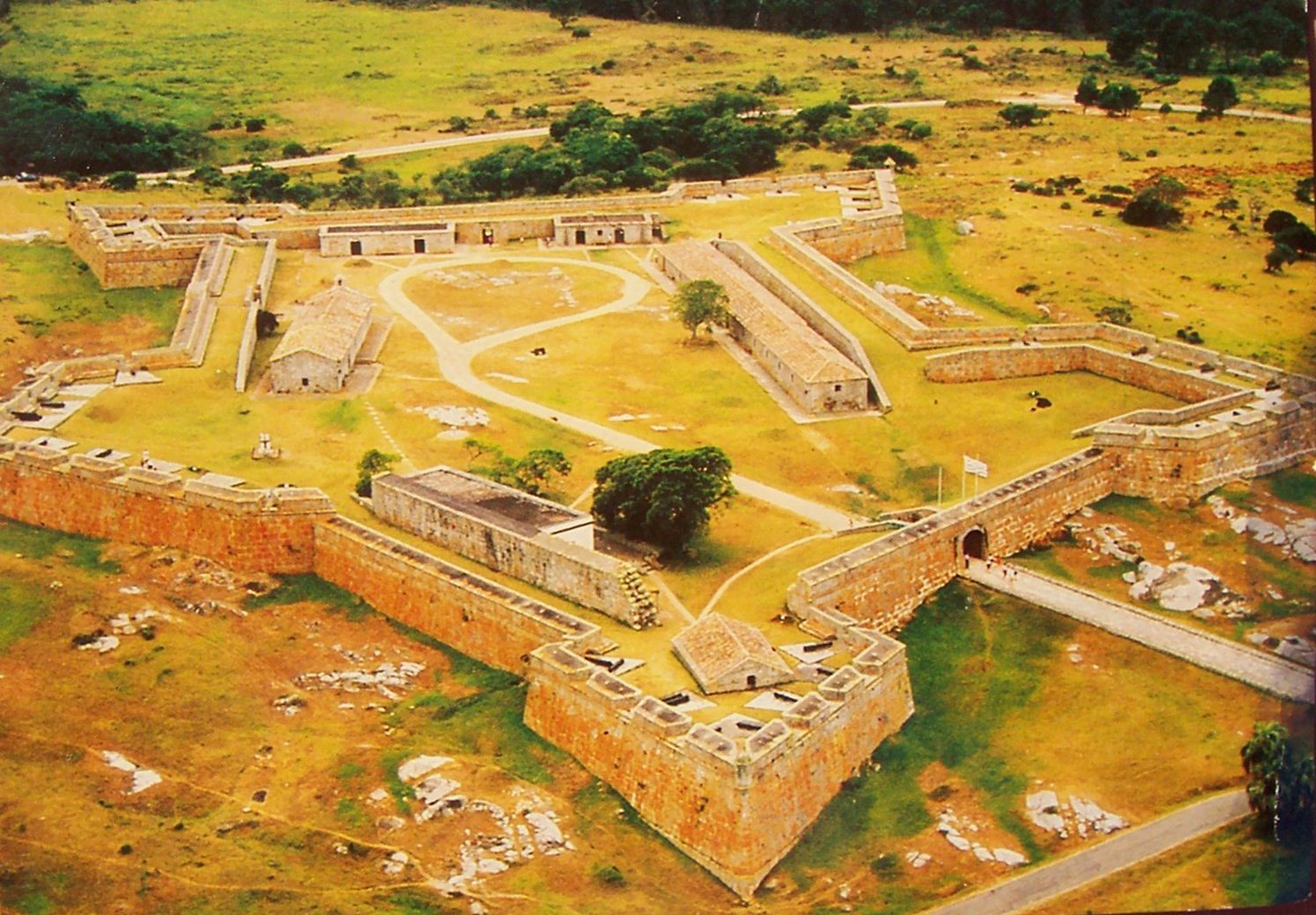
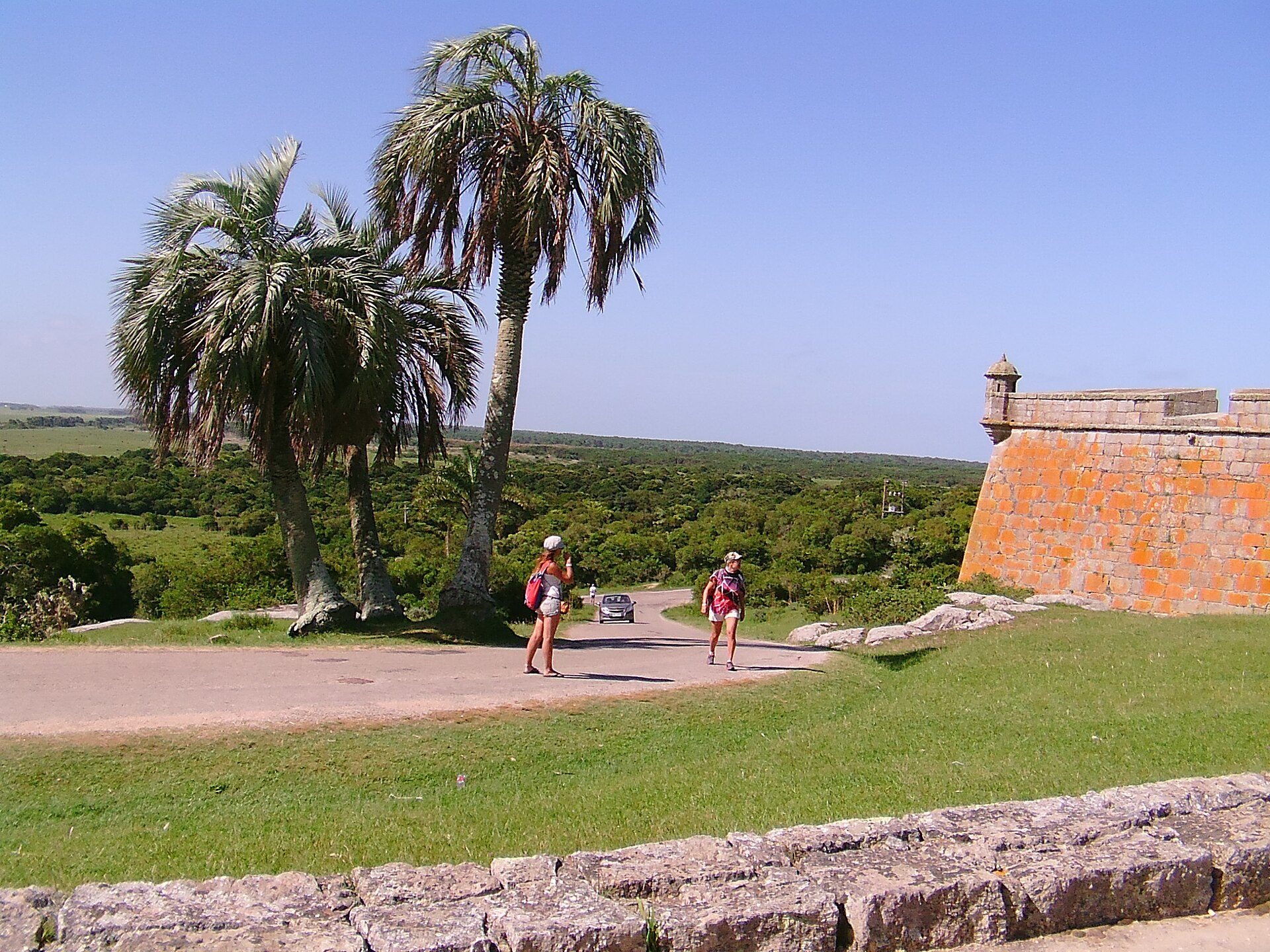
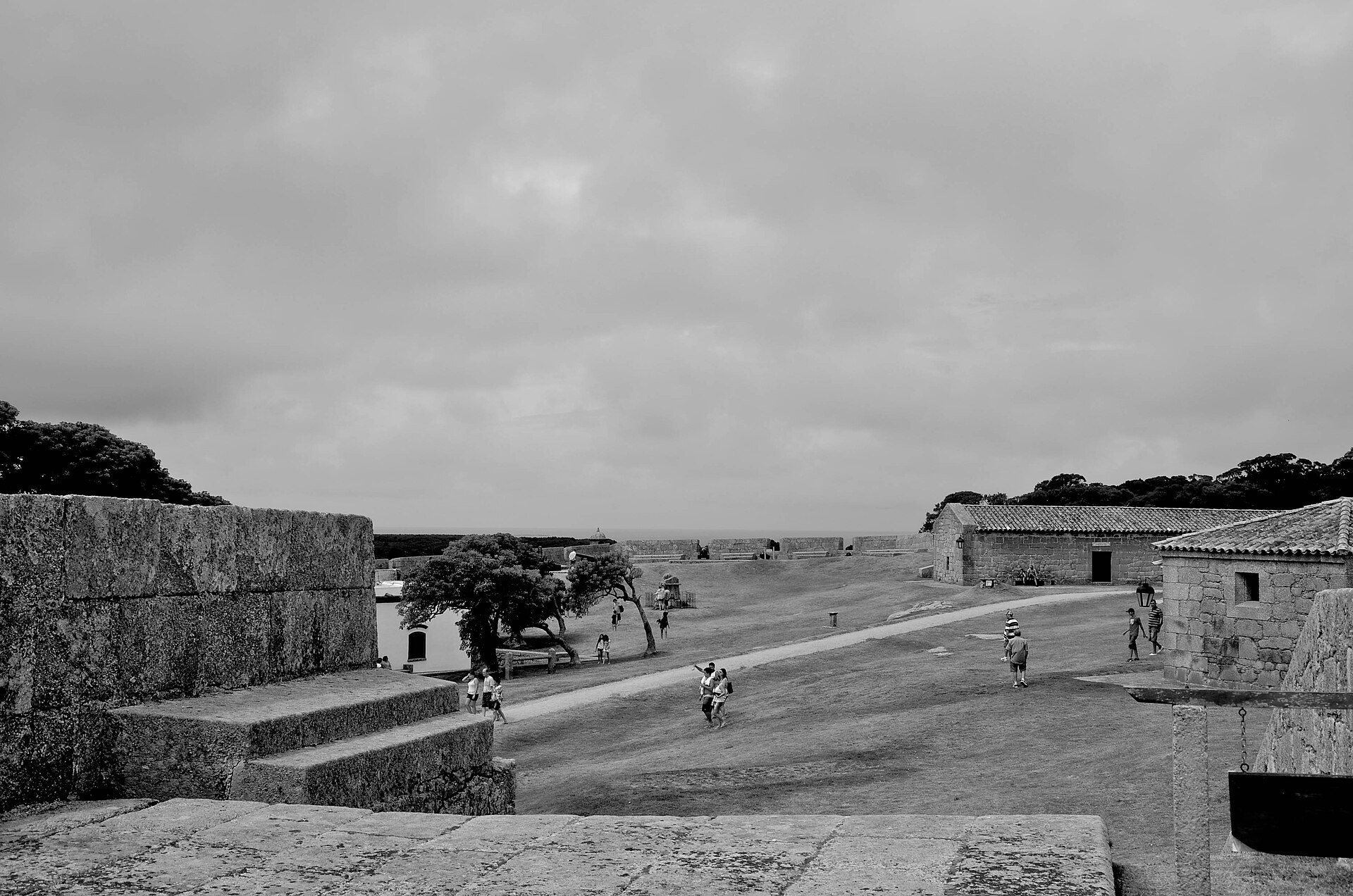
The fortress stands on a rocky elevation about 58 metres above sea level along the Camino de la Angostura, the passage described as linking the wetlands with the sea. Its setting includes coastal dunes, marshes, lakes, and low rocky elevations near the Atlantic coast and Laguna Negra. The surviving structure is an irregular pentagon with five projecting bastions, one at each corner. Its perimeter measures approximately 650 metres, and the fortress occupies about 1,600 square metres.
Bastions and artillery positions
The five bastions contain artillery positions arranged behind parapets, which are protective raised defensive edges, and embrasures, the openings through which weapons were fired. Starting at the main gate and proceeding counterclockwise, they are San Juan, San Carlos, San Luis, San Clemente, and San Martín. The underground powder magazine lies near San Juan, San Carlos could accommodate the largest battery, and a livestock enclosure was located near San Luis.
Walls, ditch, and entrances
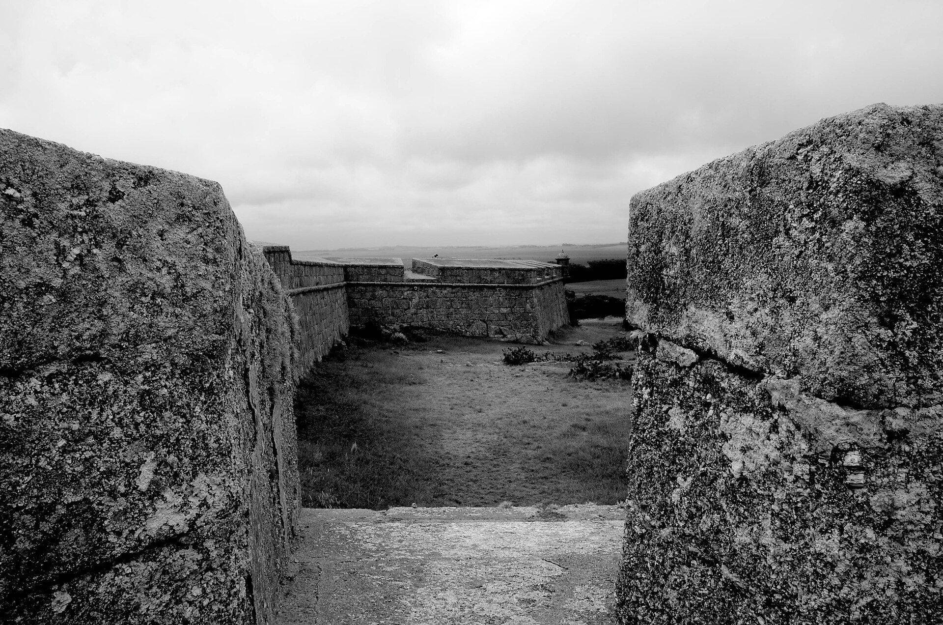
The walls have two stone faces with an earth filling between them. Large, carefully cut granite blocks form the masonry, while the wall system measures approximately 10 to 12 metres thick at the base and about 2 metres at parapet level. In some areas, the solid embankment reaches 7 metres in width, and the exterior walls rise to about 11.5 metres.
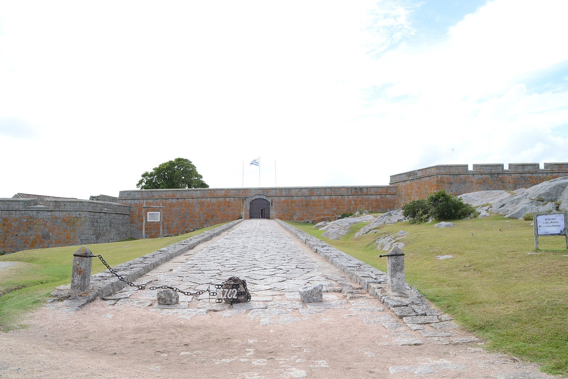
The original defensive system included a ditch protected by parapets, palisades, and earthworks. Besides strengthening the position, the ditch was intended to provide water and block the corridor used by forces travelling between southern Brazil and Maldonado and Montevideo. The principal entrance is a solid, wooden, west-facing arched gate. A smaller concealed relief gate faces south.
Interior buildings and associated features
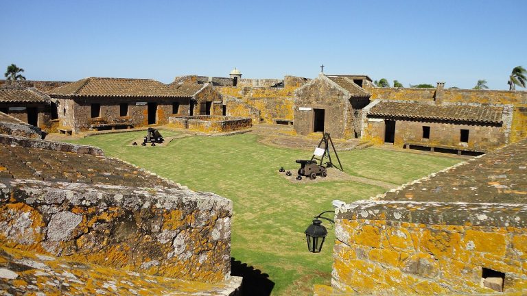
The military design belongs to the bastioned system associated with artillery warfare. Its relatively low, thick walls and projecting artillery platforms were arranged so that the bastions could protect the straight sections between them. The interior could accommodate approximately 300 men. Stone buildings include the flag room and guardroom beside the principal entrance, the main building formerly used as a chapel, two large blocks, the powder magazine, and cells. These colonial interiors were restored, and replacement roofs were installed.
Trench Tunnel and Arca Tunnel tradition
The feature known as the Trench Tunnel is a deep trench with smaller-stone walls running east to west in front of the fortress. A separate underground Arca Tunnel belongs to oral tradition rather than confirmed architectural evidence. Tradition describes at least three rooms connected by passages and a large tunnel extending eastward toward the Atlantic, about 2 kilometres away. Popular belief places a hidden object called the Secret Ark of Father Lucas underground.
Cemetery
A cemetery lies a short distance from the western wall. It was used from the second half of the eighteenth century until after Santa Teresa ceased to function as a military stronghold, and later served the surrounding area. Burials included Spanish soldiers and other garrison personnel, enslaved people, Indigenous people, and Portuguese individuals. Named burials include the Guaraní chiefs and missionaries Agustín Lipopisi and Félix Sayobí, Cecilia Maroñas, and a son of Commander Alagón.
Lucas Marton constructed the small cemetery enclosure with convicts and Guaraní people. Although partly collapsed, it retained its original layout and stones and became the first area selected for restoration. The small crosses are original stone elements. The large stone cross was carved during the fortress restoration by the master mason Juan Buzzalini.