Vindolanda: A Roman Auxiliary Fort in Britain
Site at a Glance
- Rating
- 4.8
- Popularity
- Medium
- Country
- United Kingdom
- Primary era
- Classical
- External website
- Open
- Eras represented
- Classical
- Civilizations
- Roman
- Site type
- Military
- Remains
- Fort
On this page21 sections
History
Vindolanda is a Roman auxiliary fort in the United Kingdom, established beside the Stanegate in northern Britain around AD 85 during the late first-century Roman frontier expansion. An auxiliary fort was a military installation occupied by non-legionary troops, and Vindolanda remained part of the Roman frontier system until the early fifth century. Its fort and associated civilian settlement were repeatedly demolished, rebuilt, relocated, and altered as Roman military priorities changed.
Early forts and changing garrisons
The site may have had a Roman military installation during the campaigns of Gnaeus Julius Agricola, the Roman governor of Britain in the late first century. A recently identified fortification north of the visible fort may belong to the early 70s and could have been a temporary marching camp, although the earliest occupation remains uncertain. The first securely dated fort, known as Period I, was built around AD 85 and was probably occupied by the First Cohort of Tungrians. A cohort was a Roman military unit normally commanded by a prefect.
The cohort’s prefect was probably Julius Verecundus, according to an interpretation of one writing tablet. A troop roster lists 746 men and six centurions, although only 295 men and one centurion were at Vindolanda when the record was made. The remainder were at Corbridge or serving elsewhere. Around AD 92, the fort was rebuilt as a larger timber-and-turf installation. During the 90s, the Tungrian unit was replaced for a time by the Ninth Cohort of Batavians, a mixed infantry and cavalry force of about 1,000 men commanded by officers including Flavius Genialis and Flavius Cerialis.
The third timber fort, occupied approximately from AD 97 to 105, produced most of the writing tablets associated with Cerialis and his household. They include correspondence from his wife, Sulpicia Lepidina, and school exercises belonging to their children. In AD 104, the Batavian cohort was ordered to leave Vindolanda for Trajan’s second campaign in Dacia. The fort was deliberately demolished, valuables were removed, and rubbish and documents were burned. A sudden rainstorm put out the fire, helping to preserve many of the tablets in wet ground.
Expansion before and during Hadrian’s Wall
The First Cohort of Tungrians returned in or after AD 105 and built the large Fourth Timber Fort. A contingent of Vardulli cavalry from northern Spain was also present. Fighting in northern Britain between approximately AD 110 and 118 is indicated by the tombstone of Titus Annius, a Tungrian centurion killed in war, and may have contributed to a reduction in the cohort’s strength.
Vindolanda probably served as an administrative and logistical base during construction of Hadrian’s Wall, the frontier barrier built across northern Britain from approximately AD 122. A large timber building dating from about AD 120 to 130 may have accommodated the emperor Hadrian and his entourage during his visit to Britain in AD 122, although this interpretation is uncertain. The fort was rebuilt in the 120s as the Fifth Timber Fort. Around AD 125 to 128, its garrison moved to the newly built wall fort at Housesteads, and Vindolanda was temporarily abandoned.
After the emperor Antoninus Pius advanced the frontier to the Antonine Wall in AD 140, Vindolanda was reoccupied and gradually rebuilt. When that northern frontier was abandoned around AD 160, Roman forces returned to Hadrian’s Wall. Vindolanda again became strategically important because of its position on the Stanegate, the military road linking Corbridge in the east with Carlisle in the west. The road remained an important military, commercial, and supply route even after another road was built nearer Hadrian’s Wall.
Stone forts and late Roman change
The first stone fort, Period VIa, was probably occupied by the Second Cohort of Nervians by AD 162 or 163. In the early third century, during the emperor Septimius Severus’s campaign in northern Britain, it was replaced by a military complex known as Period VIb. The earlier fort was demolished to make room for as many as 200 circular structures. Their purpose is uncertain. They may have housed irregular troops, local workers, hostages, refugees, or civilians seeking protection.
Around AD 211 to 213, the Severan complex was demolished and replaced by a new stone fort. The Fourth Cohort of Gauls was stationed there by AD 213, and its presence is recorded in dedications to Caracalla and later emperors. The cohort rebuilt the western gate in AD 223 and carried out further construction or repairs under Probus between AD 276 and 282.
The civilian settlement west of the fort was probably abandoned or destroyed around AD 270, although some activity continued at its bathhouse. As the garrison declined, some civilians moved into or settled within the fort. The fort was repaired or rebuilt around AD 300, and further substantial repairs were undertaken in the later fourth century, possibly after Count Theodosius restored Roman control following the Great Conspiracy of AD 367 to 368, a major crisis involving attacks and unrest along the frontiers of Roman Britain.
After Roman rule
The regular military presence probably ended in the early fifth century, when Roman administration withdrew from Britain. Occupation continued for several centuries, with evidence for post-Roman burials, a possible Christian church, and a small group of artefacts dating from the fifth to ninth centuries. Some evidence suggests activity as late as approximately AD 600, while final abandonment is placed broadly in the ninth century.
Vindolanda’s civilian settlement, or vicus, developed beside the fort. It included traders, craftsmen, farmers, families, slaves, and other non-military residents. At its height, the wider community may have contained between 1,500 and 5,000 people. Goods arrived from across the Roman Empire, including Arabian spices, Baltic amber, Mediterranean wine and olive oil, and imported pottery. Soldiers and civilians also produced or repaired vehicles, weapons, leather goods, textiles, pottery, and other necessities using local iron, lead, coal, stone, timber, clay, and water.
Religious life brought together Roman, Celtic, Germanic, and other provincial traditions. Altars and dedications honoured Jupiter, Vulcan, Fortuna, Silvanus, Mercury, Mars, Hercules, the Veteres, mother goddesses, Cocidius, Mogons, Maponus, Satiada, Viturus, and other deities. The Veteres were regional northwestern deities, while Satiada, Viturus, Mogons, and Maponus were local or regional gods known from inscriptions. The local Textoverdi, a community or tribal group, are also known from inscriptions. A small Christian community probably existed by the fourth or fifth century. A possible church in the former headquarters, together with a later Christian dedication and the tombstone of Brigomaglos, may indicate continuing Christian or monastic activity after Roman military rule.
Antiquarian study and excavation
William Camden recorded the ruins in 1586. Christopher Hunter described Bathhouse II as partly roofed in 1702, before extensive stone robbing. Around 1715 or 1716, John Warburton removed an altar dedicated to Fortuna by the centurion Gaius Iulius Raeticus. John Horsley’s publication of 1732 helped establish systematic antiquarian study, and John Wallis recorded a decorated temple and a cemetery in 1765.
The Reverend Anthony Hedley began the first substantial archaeological work in 1814. He exposed the east gate of the late stone fort and investigated other gates, the headquarters, and the northeastern corner. In 1831 he built Chesterholm house to supervise the excavations. Henry McLauchlan produced the first plan of the stone fort in 1858, based largely on visible earthworks.
Eric Birley acquired the Chesterholm estate in 1929. Excavations commissioned by Durham University during the 1930s exposed the fort walls, headquarters, and parts of the vicus, but work stopped in 1939 because of the Second World War. Excavation resumed in 1946, and later work in the 1960s revealed major remains of the third- and fourth-century fort and settlement. The Vindolanda Trust was established in 1970 as a charitable body to administer the site and museum. Regular excavations continued under Robin and Andrew Birley, with later work also involving Barbara Birley.
Campaigns included work on Bathhouse II in 1970 and 1971, the central sector from 1985 to 1989, the western area outside the fort from 2004 to 2006, the granaries in 2008, and large-scale excavations beginning in 2016. About 27 percent of Vindolanda has been excavated. Early forts lie beneath later buildings, sometimes up to six metres below the modern surface, while groundwater, springs, demolition layers, and reused timbers complicate the archaeological sequence. Clay and turf sealed the earliest deposits in oxygen-poor conditions, preserving organic materials that would normally decay. The site and its collections form part of the Hadrian’s Wall World Heritage context.
Remains
Fortifications and timber phases
Vindolanda contains at least nine successive Roman fort phases, beginning with five timber-and-turf forts and continuing through stone forts and later rebuilding. The forts were generally rectangular with rounded corners, although their alignments, dimensions, and internal plans changed. Early construction used wood, turf, clay, wattle, daub, and earth. The first fort covered about 1.4 hectares, while later timber forts expanded to approximately 2.8 hectares and then more than three hectares.
Early timber forts
The First Timber Fort occupied approximately the same area as the visible stone fort but on a slightly different alignment. Its western and southern ditches contained writing tablets, wooden and leather objects, metalwork, a toy sword, a centurion’s helmet crest made from moss fibres, and an iron stylus. The Second Timber Fort was about twice the size of the first and followed the cardinal directions. Its southern rampart was a turf wall about 4.5 metres wide, reinforced with alder boards and oak posts. Its single-entrance south gate stood on unstable ground affected by water drainage.
The surviving western part of the Second Fort’s timber headquarters contained at least fifteen rooms, part of an internal courtyard, and a water tank measuring approximately 10.75 by 3.125 metres and about 1.26 metres deep. A conduit supplied the tank from the north. Hard-packed clay floors were covered by thick layers of bracken, preserving organic and metal objects.
Third Timber Fort
The Third Timber Fort followed the plan of the Second but used better-quality timber. Its headquarters measured at least 50.65 by 31.25 metres, making it one of the largest known headquarters buildings of its type in Britain. It contained nineteen identified rooms, courtyards, corridors, a kitchen, storerooms, workspaces, a forge, and a possible writing office.
A large audience room formed part of the headquarters, while the kitchen contained two bread ovens. A storeroom had a wooden floor made from a reused tabletop. The forge contained coal dust, charcoal, ash, and fragments of bronze, iron, and lead. The south gate was shifted westward from the earlier entrance, and its roadway consisted of clay covered with stone chippings. A wooden water pipe supplied the fort. It was made from bored alder trunks joined by oak boxes, and tree-ring analysis dates the felling of its timber to AD 97.
Fourth and Fifth Timber Forts
The Fourth Timber Fort was the largest at Vindolanda, extending approximately 60 metres farther west than its predecessors. It included a large timber building with a central courtyard, a possible mess for junior officers, barracks, an infirmary, and substantial fortification posts. The possible palatial building had plastered walls, opus signinum floors made from waterproof concrete, and a possible private bath.
Its barracks contained fourteen single-room groups arranged in two rows, with verandahs and larger apartments for centurions. Small shoes suggest the presence of soldiers’ children, wives, or slave-boys. A separate courtyard building, with rooms arranged around it, may have served as an infirmary. The Fifth Timber Fort is less well understood because later stone construction destroyed much of it. A workshop measured approximately 48 by 20 metres and contained flagstone floors, thick alder and oak walls, coal dust, iron slag, a forge, and deep working pits. A second courtyard workshop farther west measured at least 25.7 by 15.7 metres and contained hearths.
Stone fort and military buildings
Walls, gates, and roads
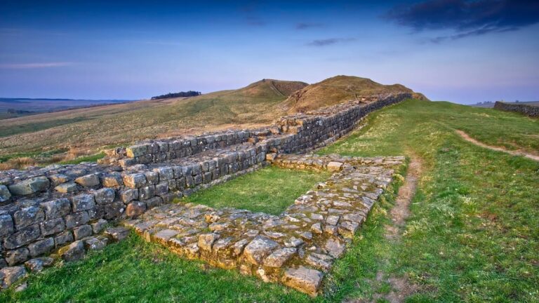
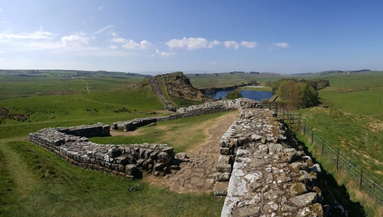
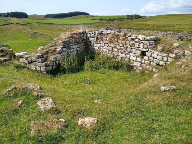
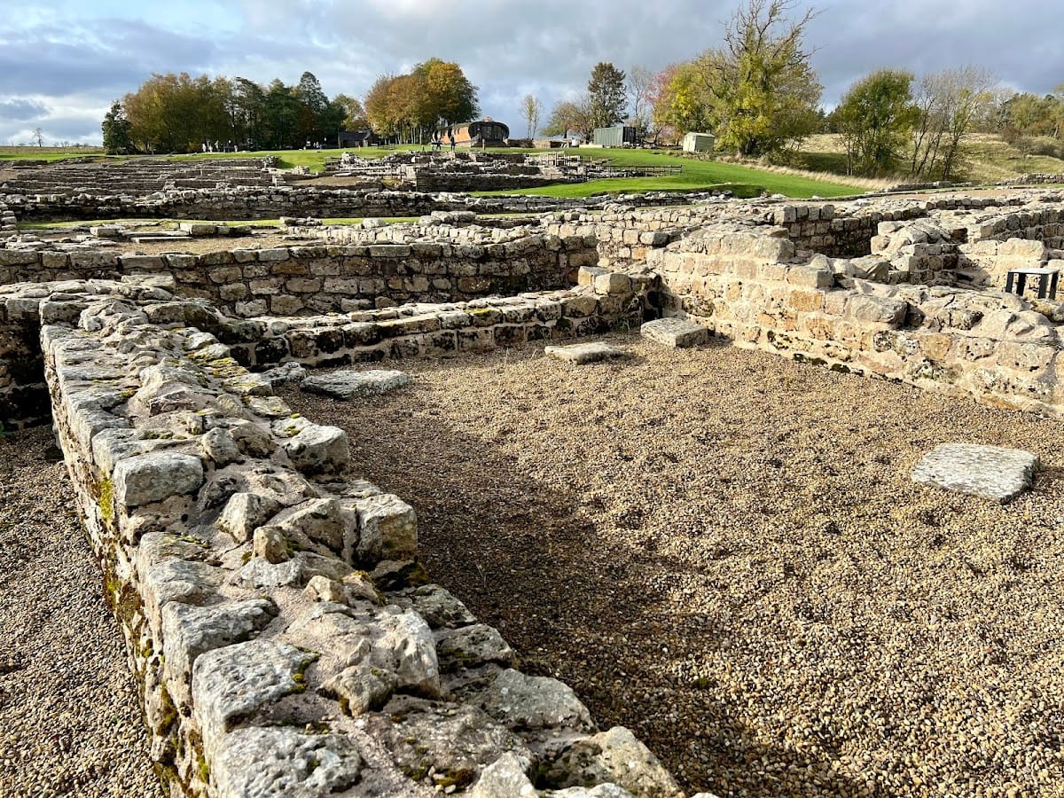
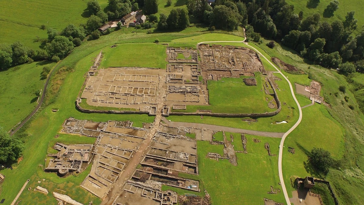
The final stone fort, represented by Periods VII to IX, measured approximately 155 by 93 to 94 metres and covered about 1.4 hectares. It was built from locally obtained sandstone, probably quarried near Barcombe Hill and the Chineley Burn. The visible remains mainly belong to the third and fourth centuries. Its walls had a rubble core faced with dressed sandstone blocks bonded with lime mortar. An earth rampart supported the rear of the wall and served as a walkway, reached by the gravelled Via Sagularis running around the inner perimeter.
Sections of the wall survive to approximately three metres high, and the northeastern corner was preserved to nine courses when exposed in 1972. Drainage channels passed through the wall to remove water from the interior. Four artillery platforms were identified inside the fort, including one at the northwest corner that probably held a ballista covering the north gate. The surrounding ditch was approximately 4.9 to 6.1 metres wide and was later partly reused as a drain and rubbish dump.
The north gate, or Porta Praetoria, was the principal entrance and connected with the Stanegate. Its flanking towers measured about 6.6 by 4.9 metres, projected beyond the wall, and enclosed a passage approximately 3.6 metres wide. The west gate, or Porta Principalis Sinistra, had a passage about 2.9 metres wide and towers built partly from large stone blocks. Its roadway crossed the vicus. The east gate may originally have had flanking towers but apparently led only to a stone stairway rather than an external road. The small south gate had no flanking towers, measured about four metres wide, and was probably blocked during the late period.
Headquarters and commander’s residence
The central headquarters, or Principia, measured approximately 24.8 by 26.6 metres. The visible remains belong mainly to the fourth century and overlie an earlier stone headquarters on a different alignment. The later building contained a forecourt, entrance, covered portico, basilica, tribunal, administrative rooms, armouries, and a central chamber used for the imperial cult and as a shrine for the military standards.
The standards shrine contained a deeply built, stone-lined pit for the garrison’s pay rather than a conventional basement. The headquarters also included a six-metre-deep well, rooms later fitted with underfloor heating, and storerooms with raised floors and ventilation openings. Some administrative rooms were later converted for domestic use, and a fire installation was maintained in the standards shrine during part of its later history.
East of the headquarters stood the commander’s residence, or Praetorium. The visible fourth-century complex was a roughly 650-square-metre peristyle house arranged around a courtyard bordered by columns. It contained eighteen rooms, an eastern bath suite with underfloor heating, a water basin, and a curved-ended room. The complex was substantially altered around AD 300, and a possible church with a curved end was later built in the courtyard. Three altars dedicated by commanders of the Fourth Cohort of Gauls were found in the residence.
Granaries, workshops, and barracks
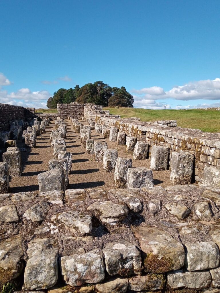
Two stone granaries stood west of the headquarters. Built in the third century, they had raised floors supported by stone air channels that ventilated stored grain. One retained part of its suspended stone floor. Both were converted into residential buildings in the late fourth or early fifth century.
A military workshop stood beside the Via Praetoria. Other workshops in the fort and vicus served metalworking, leatherworking, vehicle repair, pottery production, spinning, and weaving. The barracks included paired blocks with officer accommodation and groups of soldiers sharing rooms. Some rooms measured approximately 35 square metres and contained hearths. Several blocks had six such groups rather than the eight found in many auxiliary barracks. Another excavated barrack may have had two storeys and contained windows, hearths, and comparatively comfortable accommodation.
Shrines, latrines, and water supply
A shrine to Jupiter Dolichenus was excavated near the northwest part of the fort in 2009. Jupiter Dolichenus was a Roman-period form of Jupiter associated with a Syrian religious tradition and commonly regarded as a protector of soldiers. The shrine was probably established around AD 220 by the garrison commander and destroyed around AD 370, possibly during the spread of Christianity. It contained an altar and is one of the rare known internal shrines of this type in an auxiliary fort.
Communal latrines stood in the southeastern and northeastern parts of the fort. One accommodated approximately twelve to fourteen people and another about sixteen. The larger latrine had a rectangular plan, a U-shaped drain, a central stone platform, and an entrance on the north side. A structural failure in its southern wall caused one latrine to collapse before the end of the third century.
An aqueduct brought fresh water from a spring northwest of the fort. A cistern stood in the northeastern corner, while basins, stone channels, wooden channels, wells, and conduits distributed spring and rainwater through the fort and vicus. The main roads, the Via Praetoria and Via Principalis, crossed before the northern entrance of the headquarters.
Civilian settlement and religious buildings
The vicus
The civilian settlement west of the fort existed in at least two principal phases. The first phase included larger stone buildings and may have been enclosed by a substantial clay rampart around a core of approximately 0.81 hectares. The second covered approximately 2.4 to 4 hectares and included shops, taverns, workshops, houses, drainage channels, and Bathhouse II.
The later settlement developed along the north bank of the Doe Sike and beside the road from the west gate. Buildings generally had stone foundations, timber-framed walls, clay hearths, stone-slab roofs, wooden shutters, and limited domestic comfort. The main road had stone-lined drains about five courses high. A large corridor house was later divided into several buildings. During the earlier phase it may have included a butcher’s shop, suggested by a possible sales counter and a branched drain for slaughter waste. A bronze standards fitting was found in its eastern wing.
Several long, narrow houses faced the main road. They averaged approximately 18 by 4.6 metres in the later settlement and sometimes rested on unusually massive stone blocks. Their rooms included hearths, smoke vents, ovens, and, in some cases, curved-ended spaces or small courtyards. One building had a clay-and-stone oven and a raised cooking bench. Another complex, initially identified as an official lodging establishment, or mansio, was probably a residence for senior officials in its early phase and later housed soldiers’ families. It contained a heated bath suite, kitchens, dining rooms, a latrine, servants’ rooms, stables, and courtyards. In the mid-third century, its western wing held a small brewery with two stone vats over hot-air channels.
Bathhouses
Bathhouse I was built around AD 100, probably by the Batavian cohort, about 20 metres south of the later stone fort. Constructed mainly from brick, it included a changing room, sweat room, hot bath, warm bath, cold bath, heated floors supported by stone pillars, furnaces, and a separate latrine. Its complete plan was reconstructed after demolition, and the remains were conserved after excavation in 2000.
Bathhouse II stood about 22 metres from the northwest corner of the stone fort. It passed through three building phases and included a changing room, hot, warm, and cold rooms, two furnaces, a water basin, a latrine measuring approximately 5.2 by 2.7 metres, an entrance hall, and a drainage channel leading north toward Brackies Burn. Its cold room measured about 5.45 by 5 metres, the warm room about 3.8 by 5.5 metres, the hot room about 6.3 by 5.5 metres, and the sweat room about 4.4 by 5 metres. A cold-water basin measured approximately 2.25 by 5 metres.
The heated floors rested on stone pillars and thin stone slabs. Parts of the west wing survived to about two metres high. Bathhouse II was repaired or altered around AD 367 and later partly converted into workshops. A child’s sandal, hairpins, combs, and beads show that civilians also used the baths. Stone robbing caused heavy damage, although early eighteenth-century descriptions indicate that the building then retained substantial roofing and masonry.
Temples and burial grounds
A Romano-British temple stood northwest of the vicus. Its square inner chamber measured approximately 5.1 by 5.1 metres and was surrounded by a covered passage measuring about 10.8 by 10.8 metres. An altar found inside had an illegible inscription. Other sanctuaries stood southwest of the settlement, including a temple with richly decorated columns that was destroyed by stoneworkers after it was recorded in 1765.
Cemeteries lay outside the built area, including burial grounds north and south of the Stanegate and west of the vicus. They contained urns, cremations, tombstones, stone-lined graves, chamber graves, and the foundations of two larger post-Roman mausolea. A possible early Christian church and one of the mausolea are among the later features preserved or presented within the archaeological park.
Artefacts and preserved deposits
Waterlogged, oxygen-poor deposits preserved approximately 500,000 artefacts, including textiles, leather, wood, pottery, glass, metalwork, animal bone, and plant remains. The Vindolanda tablets form the largest known collection of Latin writing from the Roman world. More than 600 named individuals appear in the texts, most of which date from approximately AD 90 to 120. The alder or birch tablets were generally hinged in pairs with leather ties. Addresses were scratched on their outer surfaces, while ink was applied to the inner faces.
The tablets record letters, lists, accounts, military orders, leave requests, supply arrangements, and private correspondence. They were found in buildings, rubbish pits, and fire remains near the south gate and the Third Fort headquarters. Infrared photography made many otherwise illegible texts readable. The collection includes letters from officers’ wives, messages to soldiers, food requisitions, administrative records, and a school exercise on Virgil’s Aeneid.
About 6,000 Roman shoes and other leather objects have been recovered, including tents, saddles, bags, buckets, purses, and an archer’s thumb guard. Three second-century leather tents were excavated. Tent III was made from about fifty sections of goat hide, weighed approximately 45 kilograms when dry, and stood about 1.85 metres high over its wooden frame. Its walls were about 1.1 metres high, with a roof angle of approximately 60 degrees. It was conserved and almost completely restored.
Wooden finds include wagon components, furniture, tent pegs, combs, writing tablets, toy swords, structural timbers, and a carefully made second-century toilet seat. The seat had a keyhole-shaped opening, was found broken in a rubbish pit used around AD 122, and was conserved over approximately eighteen months. Textiles, mostly wool, provide evidence for weaving, including a child’s sock. One tablet records a delivery of 38 pounds of wool, possibly indicating local textile production.
Metal finds include armour, weapons, jewellery, tools, medical instruments, bronze objects, and military equipment. A small bronze horse figure, about eight centimetres high, was found beneath a Vicus I floor and may have been a standards ornament. A gold ring with a carnelian gem inscribed with the words ANIMA MEA, meaning “my soul,” and a gem showing Silvanus were found in the same building. Two Roman leather boxing gloves dating from approximately AD 120 were excavated in 2017. Made as separate hand coverings rather than a matching pair, they were sporting equipment intended to develop fighting skills.
Other finds include a carved sandstone object from 2021 depicting a nude male warrior or deity before a horse or similar animal. Its identification remains uncertain, with Mars and Mercury among the proposed interpretations. A wooden phallus approximately 160 millimetres long, probably about 2,000 years old, was interpreted as a toy or symbolic object.
Human remains include the skeleton of a child aged approximately nine to eleven, buried beneath a barracks floor after AD 213 and before the middle of the third century. The child had grown up in the Mediterranean region. Analyses indicated bound wrists and severe skull injuries, while the child’s sex, social status, and circumstances of death remain uncertain. A separate skull belonged to a native Briton about 1,800 years old and showed injuries from sword blows and evidence of placement on a stake. Its isotopic signature indicates an origin in northwestern Britain, and it may represent the display of a war trophy.
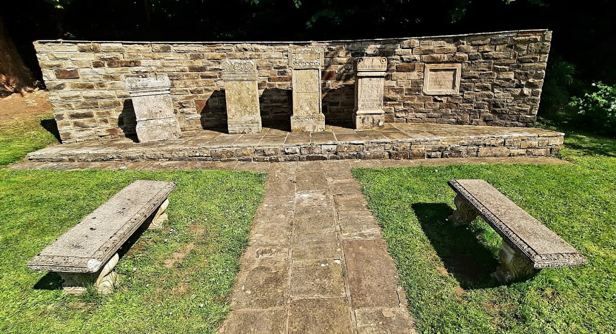
Animal remains include cattle, sheep, pigs, goats, dogs, wild cats, and other fauna. Perforated ox skulls may have been used as targets for weapons practice. A complete dog skeleton was found in a granary of the final stone fort, while deposits of animal bone reflect different phases of food disposal. Forty-seven Latin inscriptions have been found, including altars, votive stones, building stones, centurial stones, tombstones, and other fragments. A fragment of a military diploma belonged to a soldier of the Tungrian cohort.
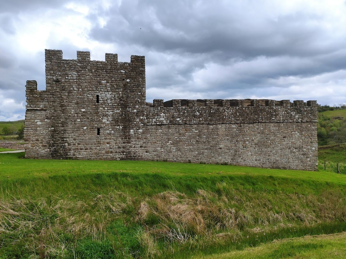
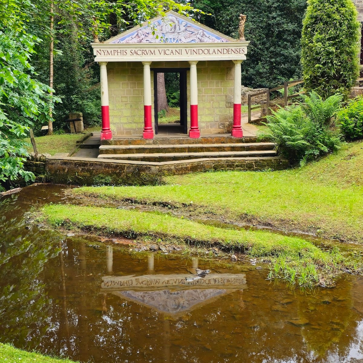
The Chesterholm Museum preserves selected finds from the excavations, including tablets, footwear, armour, jewellery, coins, textiles, pottery, and personal objects. The archaeological park includes the remains of the late stone fort, the vicus, both bathhouses, the headquarters, commander residences, a latrine, the Romano-British temple, the Jupiter Dolichenus shrine, a post-Roman mausoleum, and a possible early Christian church. Reconstructions include a Roman temple, shop, house, a Northumbrian croft, and sections of Hadrian’s Wall in turf and stone. Some reconstructed upper structures, including a watchtower and wall sections, are explicitly speculative.