Shinoridate: A Medieval Fortified Residence in Hakodate, Japan


Site at a Glance
- Rating
- 3.7
- Popularity
- Low
- Country
- Japan
- Primary era
- Medieval
- External website
- Open
- Eras represented
- Medieval, Early Modern
- Civilizations
- Unclassified
- Site type
- Military
- Remains
- Castle
On this page14 sections
History
Shinoridate is a medieval fortified residence in Hakodate, Japan, built by Wajin, the Japanese-speaking settlers and communities who established fortified residences in southern Hokkaido. The site developed from the late fourteenth or early fifteenth century and became the easternmost of the Twelve Garrisons of Southern Hokkaido, a group of fortified settlements established on the Oshima Peninsula from the fourteenth century. A tate was a fortified medieval residence, rather than necessarily a castle with a stone-built keep.
Origins and early phases
The date and founder of Shinoridate remain uncertain. Archaeological investigations place its earliest phase at the end of the fourteenth or the beginning of the fifteenth century. Historical traditions instead connect its establishment with Kobayashi Yoshikage in 1455–1457, or with his grandfather, Kobayashi Shigehiro. Some interpretations extend the origins into the fourteenth century. The site was known by several names, including Shinori no Tate and Shinori no Castle, while its present name comes from the local place-name.
Investigations by the Hakodate City Board of Education between 1983 and 1985 identified three principal phases: the late fourteenth or early fifteenth century, the middle fifteenth century, and the sixteenth century or later. This early phase places the fort at least about half a century before Koshamain’s War, a fifteenth-century conflict between Ainu groups and Wajin communities that grew from tensions over trade and local authority. Shinoridate therefore cannot be explained solely as a fortification built in immediate response to that conflict.
Conflict and abandonment
In 1457, during Koshamain’s War, Ainu forces attacked and temporarily captured Shinoridate. The conflict followed a dispute between a local blacksmith and an Ainu youth concerning the quality and price of a small knife. Kobayashi Yoshikage, then lord of the fort, was killed during the fighting.
Shinoridate fell again on 1 May 1512, during the conflict between the Shoya and Koji brothers. Kobayashi Yoshisada, Yoshikage’s son and lord of the fort, was killed, as was Kobayashi Suekage, lord of the associated branch fort and Kuramae Fort. In 1514, Yoshikage’s grandson, Kobayashi Yoshiharu, transferred to Otate and entered the service of Kakizaki Mitsuhiro. Shinoridate was probably abandoned at that time.
Preservation and historical interpretation
In 1885, the abandoned fort was used as an agricultural practice ground by Shinori Elementary School and was temporarily occupied as land for the Imperial Japanese Army. It later became private property. Local residents began a preservation campaign in 1899, and ownership was transferred through the Uga alumni association. A monument marking the fort site was erected in 1918.
Shinoridate became a National Historic Site on 9 August 1934. The designated area was expanded on 27 April 1977 to include the outer moats and surrounding land, and the Shinoridate Historic Site Preservation Society was established later that year. In 2017, the site was selected for the Continued Top 100 Japanese Castles, a modern heritage designation recognizing selected castle sites in Japan.
A large medieval coin hoard found near Shinoridate in 1968 added evidence about the economic history of the area. Produce from Shinori, including kelp and salmon, was traded along the Hokuriku coast toward Kyoto and Osaka. The hoard may have been commercial savings connected with this regional trade, although interpretations also include ritual and foundation-related deposits.
Remains
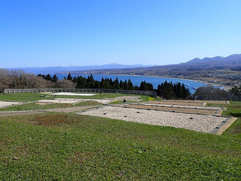
Shinoridate occupies a gently sloping coastal terrace about 140 metres from the shoreline, at an elevation of approximately 17–25 metres. The enclosure overlooks the Tsugaru Strait and the Shimokita Peninsula, with views toward Mount Hakodate. The former Shinori River lies to the west, a ravine or stream extends to the east, and the sea lies to the south. Earthworks use this terrain to form a broadly rectangular fortified residence.
Enclosure and defensive earthworks
Main enclosure
The main enclosure measures approximately 70–80 metres from east to west and 50–65 metres from north to south, covering about 4,100 square metres. Its surrounding embankments vary with the terrain. The northern bank rises about 4–4.5 metres, while the southern bank is about 1–1.5 metres high. The tops of the embankments are approximately 2 metres wide. An entrance structure is identified on the eastern side, and the designated historic-site area covers approximately 19,960.14 square metres.
Moats and entrances
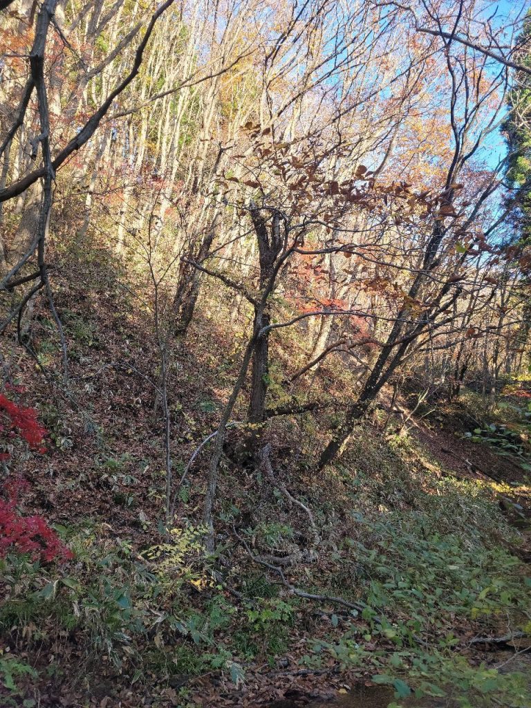
Dry moats, defensive ditches without standing water, protect the northern and western sides. They are approximately 5–10 metres wide and reach depths of up to 3.5 metres. Their V-shaped profile is known as yagen-bori. On the western side, two parallel moats are separated by an embankment about 1.8 metres high, while another embankment reaches about 2.4 metres and the intervening ditch is approximately 2 metres deep. Openings occur on the eastern and western sides, with the western entrance serving as the principal gate.
Two earthen bridges cross the moats, including a particularly well-preserved western bridge. Excavations identified four moat sections, an earthen bridge, two bridge abutments, two gates, and additional embankment remains. Together, these features show how the fort combined constructed defenses with the natural river, ravine, and coastal setting.
Buildings and water supply
Building remains
Excavations revealed seven buildings from the fort’s successive occupation phases. Some were post-built structures, meaning that their supports were set directly into the ground, with intercolumnar spacing of 7 and 6.5 shaku. Others used foundation stones with a 6-shaku unit. The buildings belong broadly to the late fourteenth or early fifteenth century, the middle fifteenth century, and the sixteenth century or later.
Other excavated features include a group of postholes, eight rows of postholes, two ditch-like features, four pit-like features, seven pits, palisade remains, and buildings or installations whose functions are not stated. These remains belong to the changing arrangement of the fortified residence across its identified phases.
Enclosure well
A well in the northeastern part of the enclosure was approximately 5 metres deep. Its construction used a post at each corner, horizontal timbers joining the posts, and boards inserted between them. This square corner-post-and-crossbeam technique formed the well’s sides.
Archaeological finds
Objects from the fort
Material recovered from the fort includes 76 ceramic objects, 22 ancient coins, 18 bronze objects, 279 iron objects, eight stone objects, and wooden objects. The stone group includes an inkstone and sharpening stones. The ceramics include southern Chinese celadon and white porcelain, together with domestic Suzu, Echizen, and Seto wares. Most of the ceramics date from the early fifteenth century, while a small quantity belongs to the middle to later fifteenth century.
Shinori medieval coin hoard
Road-widening work near the mouth of the Shinori River in July 1968 uncovered three large buried jars containing 387,514 coins. The find lay near the fort, approximately 50 centimetres below the ground surface and about 3 metres above sea level. The jars were separated by about 5 metres. Two were reddish-brown Echizen wares, while the third was a grey-glazed jar from the Suzu kilns.
The hoard contains 93 coin types. It includes small quantities of early Japanese coins, late tenth-century Vietnamese coins, late eleventh-century Goryeo coins, and mainly Chinese coins ranging from four-zhu Ban Liang coins minted in 175 BC to Hongwu Tongbao coins minted in 1368. The jars and their contents weighed approximately 1.6 tonnes. Buried during the fourteenth century, before Koshamain’s War, the hoard has been interpreted as commercial capital or savings, a deposit connected with funerary coins, or a ritual foundation deposit.
The 387,514 coins are preserved in the Hakodate City Museum under the name Hokkaido Shinori Medieval Remains Excavated Coins and are designated an Important Cultural Property. Their contents provide material for interpreting the economic connections of the Shinori area alongside the fort’s buildings, defenses, and other excavated remains.