Wulp Castle: A Medieval Hill Castle in Switzerland



Site at a Glance
- Rating
- 4.4
- Popularity
- Low
- Country
- Switzerland
- Primary era
- Medieval
- External website
- Open
- Eras represented
- Medieval
- Civilizations
- Holy Roman Empire
- Site type
- Military
- Remains
- Castle
On this page15 sections
History
Wulp Castle is a medieval hill castle in Küsnacht, Switzerland, whose surviving form dates mainly from the High Middle Ages. It occupied a projecting hill above Lake Zurich and developed through several phases between the eleventh and thirteenth centuries. Its foundation is uncertain, although the Acta Murensia, a twelfth-century chronicle about the foundation of Muri Abbey, mentions Eghart of Küsnacht as possibly owning a castle near the lake around 1095. Whether that reference concerned Wulp cannot be established.
Origins and Lenzburg rule
The earliest medieval stone castle was built along the edge of the hill during the eleventh century. At that time, Küsnacht formed part of an imperial bailiwick, a territory administered on behalf of the Holy Roman Empire by an imperial bailiff or a lord exercising that authority. The area was under the Counts of Lenzburg, and the castle was probably established on their initiative. Its occupants were likely ministerials, dependent service nobles who carried out administrative and military duties for powerful lords and rulers.
Wulp was extensively rebuilt around 1100, probably because the status and requirements of its occupants had increased. The western courtyard was levelled, and the complex acquired more substantial buildings. During the second half of the twelfth century, a representative building was added in the northwest corner. It later burned and was not rebuilt. A blacksmith’s forge in the western courtyard formed part of the castle’s working facilities.
Transfer to the Regensbergs
The political position of the castle changed after the Lenzburg dynasty died out in 1173 and the Zähringer line ended in 1218. Parts of the Küsnacht imperial bailiwick, including the lower right shore of Lake Zurich, passed to the Barons of Regensberg, a prominent noble family with lands and rights around Zurich. Wulp was probably redesigned after this transfer of ownership.
The central residential tower was dismantled, and its stone was reused in new perimeter walls. Large residential buildings were added in the south, while quarters for servants may have been built to the north. This final construction phase was probably abandoned before it was complete, perhaps around 1260. The division of the Regensberg family into two lines may have weakened its resources. Political pressure from Zurich, followed by the sale of Regensberg rights and possessions after 1270, may also have contributed to the castle’s decline.
Siege, abandonment, and later memory
A chronicle from 1432 states that on 25 May 1267 Rudolf of Habsburg and forces from Zurich besieged and captured a castle near Küsnacht during the Regensberg feud. Rudolf was a thirteenth-century king of the Romans whose Habsburg dynasty was becoming a major territorial power in the region. Later chronicles describe the siege and destruction of a castle at Küsnacht, usually identified with Wulp. Archaeological evidence does not conclusively prove that Wulp was violently destroyed in 1267, although a fire in the eastern part may have been connected with the event.
The castle was probably no longer occupied after about 1250 and was abandoned around 1270. It then deteriorated, leaving only limited visible remains by 1895. The tradition of its destruction later inspired an elaborate depiction by Johann Melchior Füssli in 1717. Füssli was a Swiss artist and printmaker known for historical and topographical illustrations. The site’s name appears in written records from around 1460, when the Klingenberg Chronicle called it “Wurp by Küssnacht.” Later forms included “Wulsch” around 1520 and “Wulp” in 1548. The name may derive from an Old High German word associated with turning or a twisted hill, or from the Wulper family, who farmed an estate on the Wulp meadow that may have been connected with the castle.
A 1336 Mülner property register refers to a castle estate at Küsnacht, although this may have meant Wulp or Höchhus Küsnacht. Maps from 1566 also confused Wulp with another possible castle site called Balb. Hans Conrad Gyger’s map of 1667 distinguished the locations correctly, while the existence of a castle at Balb remains uncertain.
Excavation and conservation
Modern archaeological work took place in 1920 to 1923, 1961 to 1962, in 1978, and from 1980 to 1982. Jacques Bruppacher, president of the Küsnacht beautification association, proposed the first campaign, which was carried out largely through volunteer labor. The Küsnacht timber corporation, owner of the hill, authorized the work. The ruins received federal protection in 1923 and were formally opened to the public in 1924.
Later conservation stabilized vulnerable walls and masonry, protecting them from frost, moisture, and root damage. The excavations established at least three medieval building phases and uncovered occupation traces beneath the castle. Finds consisting mainly of household pottery and stove ceramics made before the middle of the thirteenth century support the conclusion that the castle ceased to be inhabited after about 1250.
Remains
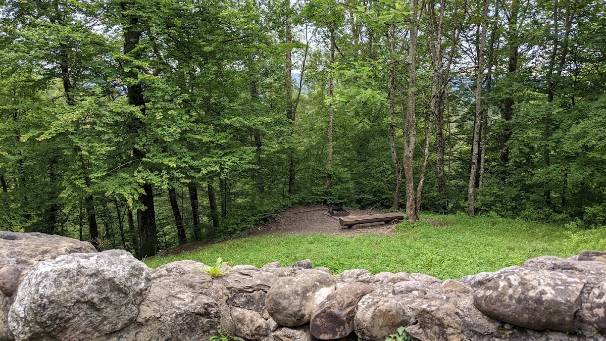
Wulp Castle stands at about 570 metres above sea level on a spur above Küsnacht, beside the Küsnachter Tobel near Lake Zurich. The surviving remains belong to a multi-part hill-castle complex arranged around a hilltop enclosure. The first medieval buildings were set against a perimeter wall that followed the edge of the hill. Later construction levelled parts of the uneven ground with marl rubble and created a more extensive ring wall, while only foundations and short sections of masonry now remain clearly identifiable.
Earlier occupation
The oldest occupation evidence consists of Late Bronze Age pottery fragments from the northwest part of the hill. Roman-period coins and pottery, together with many fragments of hypocaust tubes, suggest that buildings may have stood there during the Roman period. A hypocaust was a system that heated rooms by circulating hot air beneath a raised floor and sometimes through hollow tubes. No structures from these earlier periods survived, but their remains show that the hill was occupied before the medieval castle.
At the southwest corner of the later courtyard, excavators found a partly sunken building measuring about 4 by 6 metres and dating from the seventh or eighth century. An earlier ditch, roughly 1.5 metres wide, also survived. It was later removed and filled with demolition rubble. A wooden palisade is possible, but no remains of one were identified.
Medieval enclosure and central tower
Early perimeter buildings
The earliest medieval complex comprised a few stone buildings leaning against a wall that ran along the hill’s edge. Its precise date is uncertain. During the rebuilding around 1100, the western courtyard was made level with a deposit of marl rubble. A rectangular tower was then positioned at the highest point and became the central feature of the castle.
Rectangular tower
The massive rectangular tower belonged to the phase dated approximately to 1200. Its foundations remain, with walls about 3.2 metres thick in the lowest courses. The tower may have served as a cistern, while its central position also gave it a prominent representative function. In the later redesign, it was dismantled down to its foundations. Stone from the tower, along with material from window and door surrounds, was reused in new perimeter walls.
Ring wall and entrance
The later castle was enclosed by an extensive ring wall, with access through the northern side. The wall was strengthened to about two metres in the northeast and south. A possible entrance to the inner castle lay above the stump of the former rectangular tower. The foundations of the perimeter wall were found about 3.2 metres below the modern surface, within the artificial marl layer used to level the hilltop. Additional wall remains and a thin fire layer lay beneath that deposit.
Residential and working areas
Eastern and southern buildings
A transverse wall divided the enclosure into eastern and western sections. The eastern section was built up with the main residential hall and additional rooms. A large residential building occupied the south, and another building to its north may have provided accommodation for servants. These structures belonged to the later arrangement created after the change from Lenzburg to Regensberg control.
Northwest building
The substantial building in the northwest corner contained stove tiles, indicating that it could be heated by a stove. An ash layer shows that the building burned and was not rebuilt. It stood in the western part of the complex, which otherwise functioned as a largely uninhabited outer ward. A forge for a horseshoe smith was also installed in the western courtyard. A cistern or well was associated with the castle, and rubble from it was cleared during conservation work in 1961 and 1962.
Eastern tower and surviving masonry
An unusual tower was built onto the eastern section of the ring wall. It had an oval or drop-shaped plan with a straight edge designed to deflect attacks. Its date and purpose remain uncertain. Christian Frutiger, an architect from Küsnacht who directed later conservation and archaeological work, proposed that it was rebuilt after the reported destruction of 1267 and attributed the work to the Mülner knights of Zurich. Other architectural observations favor construction after the middle of the thirteenth century. The tower may represent the earliest known Swiss example of a round tower with this type of deflecting edge.
Only the foundations of the tower and small sections of the main perimeter wall can now be clearly identified. Repeated stabilization and conservation have secured the surviving masonry. Excavated pottery and stove-ceramic fragments belong mainly to the period before the middle of the thirteenth century. Their dating supports the interpretation of a castle abandoned in the later thirteenth century, after which its buildings gradually deteriorated.