Wharram Percy: A Deserted Medieval Village in Yorkshire
Site at a Glance
- Popularity
- Very High
- Country
- United Kingdom
- Primary era
- Medieval
- Eras represented
- Medieval, Early Modern
- Civilizations
- Anglo-Saxon, English, Norman
- Site type
- Settlement
- Remains
- Village
On this page12 sections
History
Wharram Percy is a deserted medieval village and former civil parish, a local administrative area, on the western edge of the Yorkshire Wolds in the United Kingdom. Its settlement took shape through a major reorganisation of land and parish boundaries between about 850 and 950, and the village was most active from the 10th to the 12th centuries.
Early activity and village formation
The area appears to have been settled from prehistoric times. Around 50 BCE, people established farm enclosures beside a track running east to west through the valley. In about the 3rd century, Romans enlarged one enclosure into a farmstead that remained in use for roughly 200 years, after which the area appears to have been deserted. Two buildings beside trackways date to about the 6th or 7th century, during the Anglo-Saxon period of early medieval England.
The village’s earliest beginnings are uncertain. Ditches found in a 2002 survey using measurements of the ground’s physical properties contained Middle Saxon material, from a phase of the Anglo-Saxon period, and evidence of a few buildings. One interpretation places a small early village here by the mid-7th century. Another suggests that shepherds used temporary huts in summer and autumn, while the ditches served as sheepfolds for an annual market or fair held around 11 November, the feast day of St Martin.
Between about 850 and 950, land use and parish boundaries were reorganised, establishing the village’s first basic components. The earlier settlements were ploughed over in the process. Whether a landowner directed this change or local people undertook it together is unknown.
The Domesday Book, a survey of landholdings and taxable resources commissioned by William I after the Norman Conquest of England, names the settlement as Warran or Warron in 1086. Wharram may derive from an Old English word for cauldron or an Old Norse word for bend. The Percy ending refers to the aristocratic family that held land in the area during the Middle Ages and appears in the place-name by 1292. Domesday lists Lagmann and Carli as the main landholders and Ketilbjorn as holding a smaller share. Lagmann and Carli may have arranged rebuilding of St Martin’s Church shortly before the Conquest.
Norman rule and Percy lordship
After William I conquered England, his campaign to suppress resistance in the north, known as the Harrying of the North, resulted in the seizure of Wharram’s lands. William granted them to Osbert, sheriff of York and Lincoln, and possibly also to William de Percy, a Norman nobleman. The later lords of Wharram may have descended from William de Percy, or from a tenant who adopted his lord’s name. William de Percy’s descendants became the Percys of Northumberland.
Around 1176, William Percy and Herbert Chamberlain were the two principal local powers. Either or both may have directed developments in the village at that time. In 1254, Henry Chamberlain sold his remaining rights there to Peter Percy, leaving the Percys in sole control. The village prospered under their lordship, with changes to North Manor and the creation of a hunting park associated with this period.
Economic change and depopulation
Wharram faced hardship in the early 14th century. Peter, son of the local lord Robert III, died without a male heir in 1315, leaving his daughter Eustachia and her mother, Isabel. Robert III died in 1321 at the age of 76, and his last surviving son, Henry, died soon afterwards. Scots raided the village in 1322. A valuation the following year found two-thirds of its land uncultivated and several plots unoccupied. In a 1334 tax assessment, Wharram ranked 33rd among 50 local villages and was valued at 18 shillings.
The Black Death, the plague pandemic that reached England in 1348, does not appear to have directly caused Wharram’s eventual abandonment. Population loss did, however, contribute to movement into larger settlements. The plague killed Eustachia’s husband, Walter Heslerton. Their son Walter was too young to inherit, and Eustachia was declared mentally unfit and placed under Crown protection, allowing the Crown to administer the estate for its own benefit. Eustachia died in 1366 and her son the following year. The estate then passed to Henry Percy of a more prominent Percy family, ending the earlier family’s direct involvement. By that time, Wharram’s fortunes had recovered from their earlier decline.
During the Peasants’ Revolt, a major English uprising in 1381, a tax return suggests that more than half the village’s people avoided the poll tax, a levy on individuals. Around the turn of the 15th century, the Percys exchanged their local holdings with the Hylton family. The Hyltons may never have lived at Wharram and were not resident there after 1406.
During the 15th century, changing prices and wages made sheep pasture more profitable than growing cereal crops. Over the following century the Hyltons converted more land to sheep farming and employed fewer agricultural workers; farmers may also have been evicted without a surviving record. In the early 16th century, the last residents were evicted and their homes demolished to make way for additional pasture. Sir William Percy sold Wharram Percy to Matthew Hutton, then dean and later archbishop of York, in 1573.
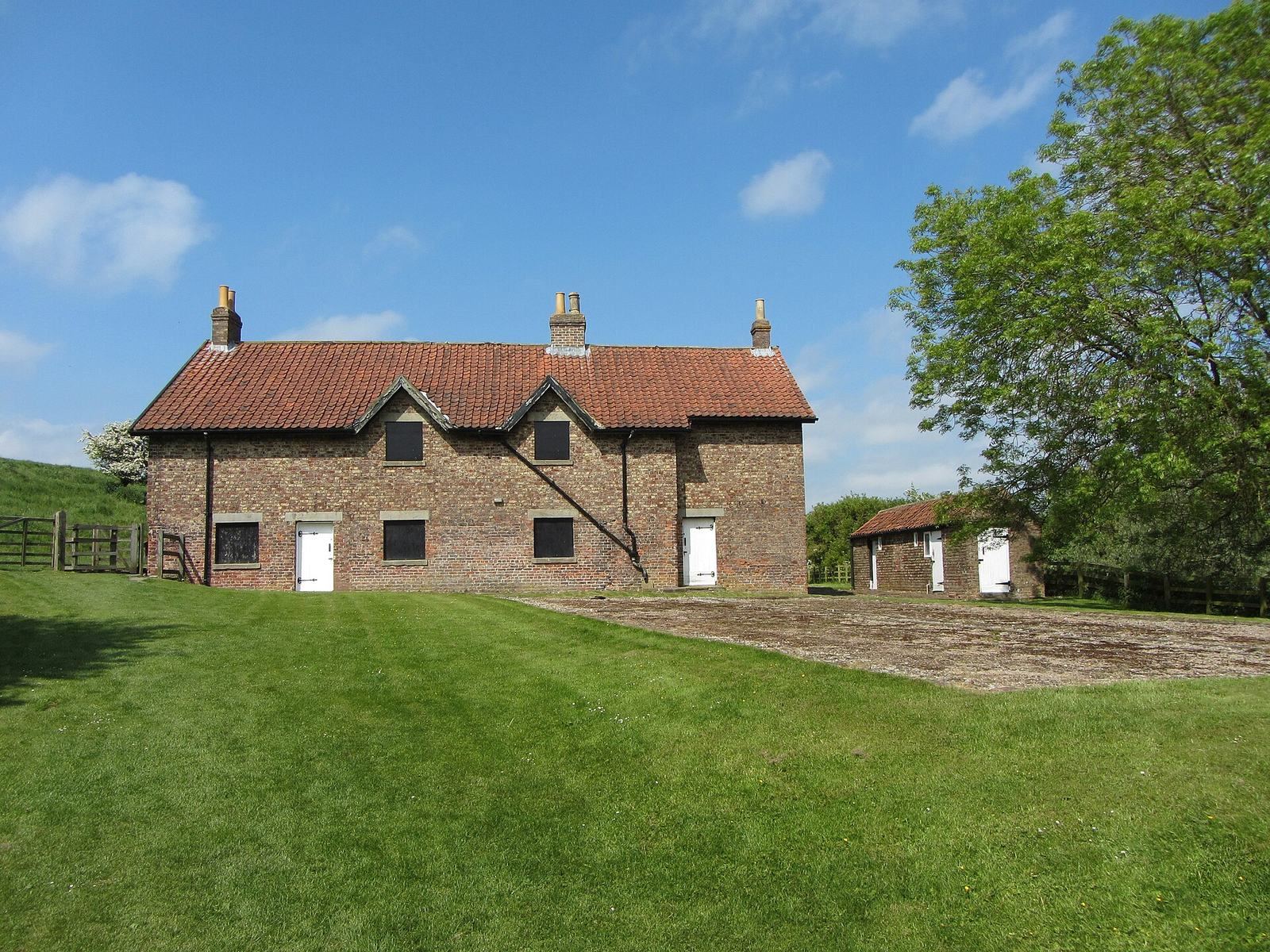
The chief messuage, the estate’s principal residence, was the last continuously inhabited plot. It supported mixed farming and maintained activity in the area until the Huttons sold the land to Sir John Buck of Filey in 1634. References to the chief messuage cease in 1636. The Buck family held the land until Henry Willoughby, 6th Baron Middleton, bought it in 1833, apart from a brief confiscation during the Civil War. By the time of Willoughby’s purchase the estate was occupied by a farm. His heir, Digby, demolished the farmhouse and built a row of cottages.
Parish history and archaeological investigation
Wharram Percy remained an ancient parish after its village was depopulated. It included the townships of Burdale, Raisthorpe, Thixendale and Towthorpe, historical local districts that became separate civil parishes in 1866. In 1935, Wharram Percy parish was abolished and merged with Raisthorpe and Burdale and Wharram-le-Street to form Wharram. Its population was 40 in 1931.
The village earthworks were familiar locally, and house-platform outlines appeared on Yorkshire’s first Ordnance Survey six-inch maps, published in 1854. Interest in deserted villages led historian and archaeologist Maurice Beresford to visit in 1948; J. K. St Joseph took aerial photographs. Excavations began in 1950, and archaeologist John Hurst joined the work in 1952. Archaeologists, historians and botanists investigated the site each summer until 1990, using the work to test methods and train new archaeologists.
After the church tower collapsed in 1959, investigators excavated the church interior. A further investigation and field survey in 2002 identified ditches and evidence of Middle Saxon activity. A 2004 study of human remains from the churchyard considered disease, diet and death, including childhood growth, breastfeeding, osteoporosis and tuberculosis. A 2017 study revisited remains first recovered in the 1960s. Researchers concluded that the marks were not explained by violence inflicted during life and that dental analysis ruled out the possibility that the dead were outsiders. Cannibalism and attempts to prevent the dead from returning as revenants, people believed to rise from the grave, remained possible explanations. Neither was established, though the latter was considered a possible early archaeological example of such a practice.
English Heritage has cared for the site since 1974; it is now in the care of Historic England, while the land remains owned by Lord Middleton of Birdsall.
Remains
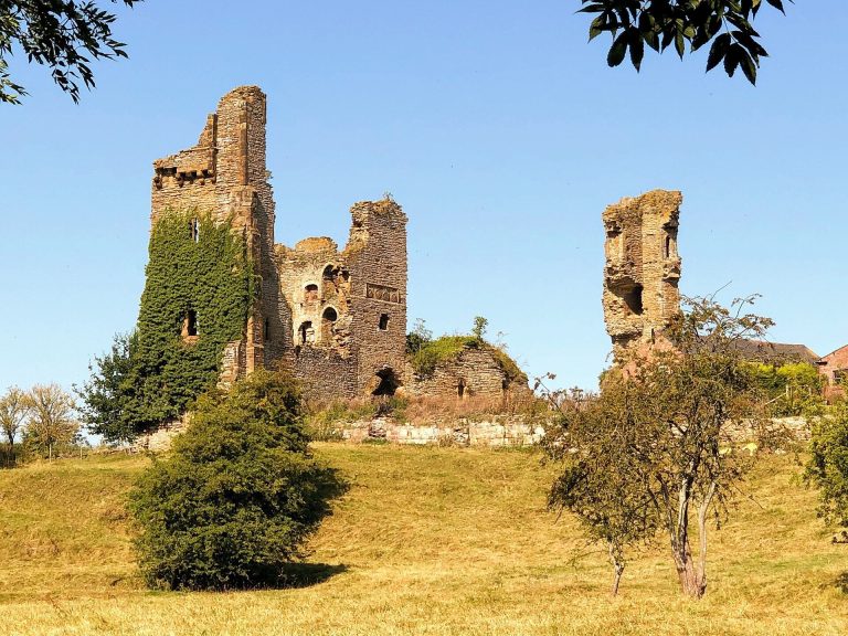
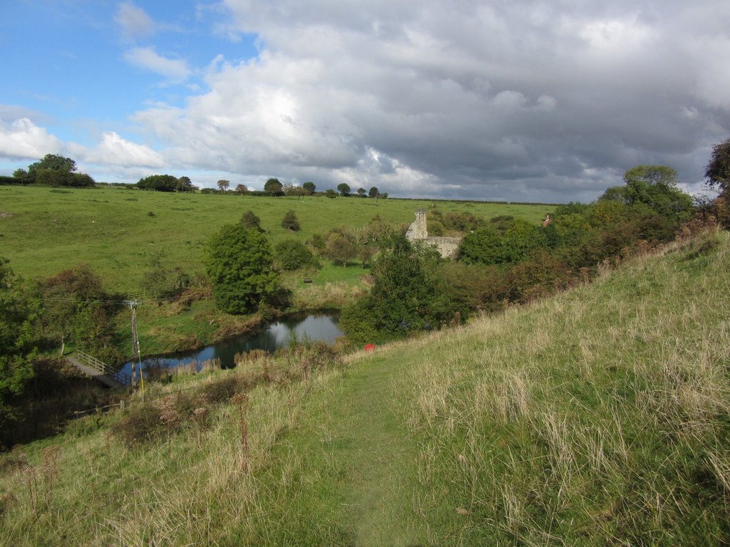
The village plan can be traced in earthworks across surrounding fields, while the ruined church is visible above ground. The surviving evidence includes buried settlement features and successive timber and stone buildings. Wharram Percy lies about 1.6 kilometres south of Wharram-le-Street.
Settlement and archaeological features
Village landscape
Outlines of house platforms and other parts of the settlement appear in the fields. Trackways and enclosures also provide evidence of earlier activity in the valley. The earthworks preserve the layout of a village whose physical remains are spread across the surrounding landscape.
Early settlement traces
Late Iron Age, the final phase of the Iron Age, farm enclosures stood beside the east-west track. One enclosure was enlarged into a Roman farmstead in about the 3rd century. The two Anglo-Saxon buildings dated to about the 6th or 7th century were located along trackways. Ditches identified in the 2002 survey contained Middle Saxon material and evidence of a few buildings.
St Martin’s Church
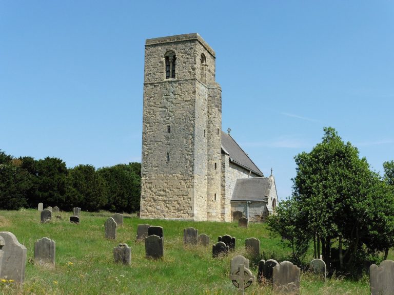
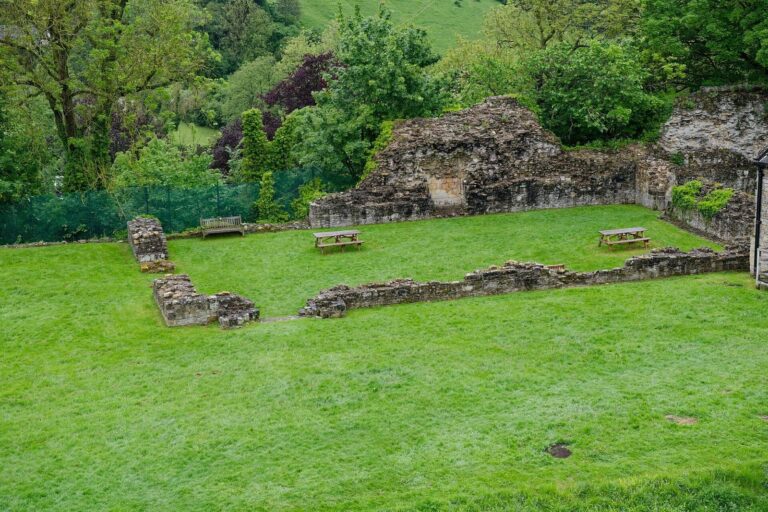
The churchyard contains the remains of St Martin’s Church, which developed through six phases from the early 12th to the early 17th century. Excavation after the tower fell in 1959 revealed an earlier timber building dating to the mid- to late 10th century, followed by a smaller stone church from the mid-11th century. The church remains in a ruined state.
Churchyard human remains
Excavation recovered a substantial group of human skeletal remains from the churchyard. A separate group, first found in the 1960s and examined in 2017, included men, women and children. Some bones had cuts and burn marks, and long bones had fractures. Most cuts were on the neck, head and chest rather than around the joints; the fractures may have been intended to extract marrow. The remains had been placed in a pit near houses.
Manorial and agricultural features
North Manor was altered during the period of Percy control, and a hunting park covering 3.25 hectares was created. Two water mills served the village; both had fallen out of use by 1323.