Vilcabamba: The Inca Capital at Espíritu Pampa
Site at a Glance
- Popularity
- Very High
- Country
- Peru
- Primary era
- Early Modern
- Eras represented
- Medieval, Early Modern
- Civilizations
- Inca, Wari
- Site type
- City
On this page21 sections
History
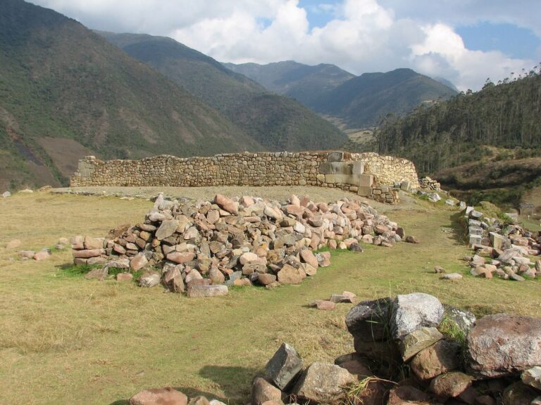
Vilcabamba, the Inca capital now identified with the ruins of Espíritu Pampa, lies in the highland-and-jungle region of southern Peru. It became the refuge of the independent Inca state in 1539, after Spanish conquest had driven the Incas from their former centres. The name also refers to a rugged historical region of about 6,000 square kilometres between the Urubamba and Apurímac rivers, in what is now La Convención Province.
The region runs from the northeastern Andes toward the Amazon Basin, across steeply changing terrain that ranges from glacial peaks and mountain grasslands to cloud forest and rainforest. The mountain route through the Urubamba canyon was the principal Inca approach, while the landscape later made Spanish military campaigns difficult. Vilcabamba the Old, the capital, is distinct from Vilcabamba the New, a Spanish-founded settlement roughly 35 kilometres away to the southwest.
Inca expansion and the Spanish conquest
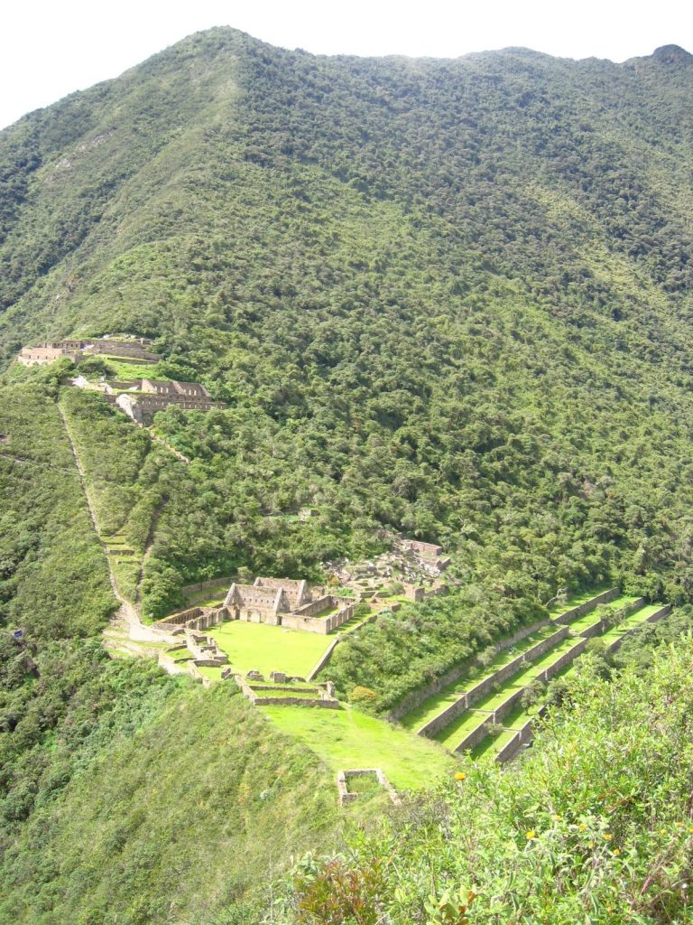
People lived in the region long before the Incas arrived. From about 1450, the Incas controlled parts of it and established major centres at Machu Picchu, Choquequirao, Vitcos, and Vilcabamba. The chronicler Bernabé Cobo attributed the conquest of Viticos and Vilcabamba to Pachacuti, who campaigned there after defeating the Chanka. The Incas repaired a destroyed bridge at Chukichaka, making it an important entrance to the region. The two provinces were later joined. Spaniards treated the land between the Apurímac and Urubamba as rebel territory, although the Incas apparently did not regard all lands toward the Apurímac as part of their own domain.
After the Spanish conquest of Peru, Manco Inca Yupanqui, son of Huayna Capac, was crowned as a ruler dependent on the Spanish. He had expected cooperation that would protect his people, but Spanish abuses and enslavement turned him against his new allies. He besieged Cusco in 1536 but failed to capture it. After considering the positions of Hernando Pizarro and Diego de Almagro as well as his own forces, Manco refused to join Almagro and withdrew to Vitcos. In July 1537, Rodrigo Orgóñez, acting for Almagro, seized and sacked Vitcos, but Manco escaped.
Manco continued the resistance in other parts of Peru. As Spanish forces gained ground, he retreated into the Amazonian forest in 1539 and established his capital at Vilcabamba. An expedition led by Gonzalo Pizarro failed to capture him but seized his wife, Cura Ocllo. Hernando Pizarro later had her killed and executed Indigenous leaders who had been captured after Manco refused to negotiate. Manco sought to revive Inca traditions and recreate a smaller version of the former empire, while his forces continued attacking roads between Lima and Cusco.
Rulers of the independent Inca state
In 1544, seven Spanish fugitives who had supported Almagro’s son killed Manco at Vitcos, hoping to obtain a pardon. His five-year-old son Sairi Túpac succeeded him under regents. Raids on Spanish roads stopped, and the Indigenous population of Vilcabamba became more isolated. In 1557 the Spanish offered Sairi Túpac a pardon and land if he left Vilcabamba and converted to Christianity. He accepted, arrived in Lima on 5 January 1558, and received land, but died at his estate in the Yucay Valley in 1560. He departed without Vilcabamba’s Inca regalia, and his departure may not have ended the state’s independence in practice.
Titu Cusi Yupanqui, another son of Manco, took power after Sairi Túpac, although Inca succession convention favoured his younger brother Túpac Amaru. Under Titu Cusi, raids resumed and people were taken from Spanish-controlled lands to Vilcabamba. Spanish officials also suspected him of involvement in unrest elsewhere, including a planned revolt at Jauja. In negotiations, however, he presented himself as seeking peace.
In 1566 Titu Cusi agreed to a treaty with the Spanish at the Acobamba River. He promised that his son Quispe Titu would marry Beatriz, Sairi Túpac’s daughter, and inherit her lands and an annual income of 3,500 pesos. He also agreed to end raids and admit Christian missionaries and a corregidor, a local Spanish colonial official. The treaty was ratified in 1569. Augustinian friars Marcos García and Diego Ortiz established churches in two settlements near Vitcos. Quispe Titu was baptized in 1567, followed by Titu Cusi and one of his wives the next year. Despite the treaty, Titu Cusi continued to govern independently.
The Spanish campaign and fall of Vilcabamba
Viceroy Francisco de Toledo arrived in Peru in 1569 and regarded the independent Inca state as a threat to Spanish authority. He argued that the Incas had themselves conquered other peoples recently and therefore had no moral claim to inherit Peru. When Titu Cusi fell ill and died at Vitcos in 1571, his secretary Martín Pando and the friar Diego Ortiz were accused of poisoning him and were killed. Túpac Amaru became ruler. Christian churches and symbols were destroyed, and Vilcabamba cut off contact with outsiders.
In July 1571, unaware that Titu Cusi had died, Toledo sent him the ratified treaty. The Dominican prior Gabriel de Oviedo turned back after only one of several Indigenous messengers sent across the Apurímac returned. In March 1572, another envoy, Atilano de Anaya, was detained at the Chukichaka bridge and killed. Inca commanders apparently sought to conceal Titu Cusi’s death and prevent renewed contact with the Spanish. Toledo declared war on 14 April.
The final campaign involved about 250 Spanish soldiers under Martín Hurtado de Arbieto and 2,000 Indigenous allies. After several battles, the force passed through Vitcos and advanced on the Inca fort of Huayna Pukara. Defenders had prepared traps, but the commander Puma Inca changed sides and provided information about the fortifications. The Spanish captured the fort and entered Vilcabamba on 24 June 1572. The city had been emptied, its residents had fled, and Túpac Amaru escaped into the forest. The Incas had destroyed their food supply, apparently hoping to make the Spanish withdraw. Túpac Amaru was later captured and executed in Cusco on 24 September 1572. His death ended the independent Inca state and organized Inca resistance to Spanish rule.
Spanish settlement and rediscovery
After the conquest, Hurtado de Arbieto became governor and founded San Francisco de la Victoria de Vilcabamba, also called Vilcabamba la Nueva, in 1572. The settlement was described as about five kilometres west of Vitcos, near present-day Hoyara. Around 1596 it moved closer to deposits of precious metals. The mines produced little, and the town later lost importance to Santa Ana. Silver mining brought a short period of prosperity, but Spanish interest in the town and region had waned by the early seventeenth century. Hurtado used Indigenous labour for his own purposes, reducing many people to conditions of slavery despite Toledo’s instructions that they be treated carefully.
The Inca ruins became overgrown and were eventually forgotten. The remains of Vitcos came to be called Rosaspata, while the former capital became known as Espíritu Pampa. In 1710 Juan Arias Díaz identified Choquequirao as the Inca capital. Peruvian historian Carlos A. Romero disputed that conclusion in 1909, arguing from sixteenth-century Spanish chronicles for Puquiura. During a 1911 visit, Hiram Bingham correctly identified Rosaspata as Vitcos and reached Espíritu Pampa, but mistakenly identified Machu Picchu as Vilcabamba.
In 1964 Gene Savoy, travelling with Peruvian explorer Antonio Santander Caselli, argued that Espíritu Pampa was the lost capital. The principal ruins lay about 640 metres from the area Bingham had visited. Historian John Hemming supported the identification in 1970 through his analysis of Spanish and Inca accounts. In 1976 Edmundo Guillén, Tony Halik, and Elżbieta Dzikowska compared the ruins with letters written by Spaniards who described the invasion. Gregory Deyermenjian photographed parts of the site in 1981, and architect Vincent Lee recorded archaeological features during the 1980s; Lee’s later work further established the identification.
In the twenty-first century, Vilcabamba became a national archaeological park and systematic excavation began. Work in the 2010s led by Brian Bauer and Miriam Aráoz added evidence about the capital’s final days. In 2010 archaeologist Javier Fonseca Santa Cruz found a looted settlement associated with the Wari culture in coffee fields about a kilometre from the Inca ruins. A Wari-period tomb found at Espíritu Pampa in 2011 also showed that the area was occupied well before it became an Inca capital. The location may have served as a trading centre between lowland and Andean peoples.
Remains
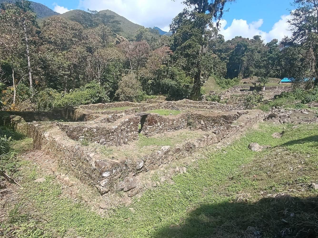
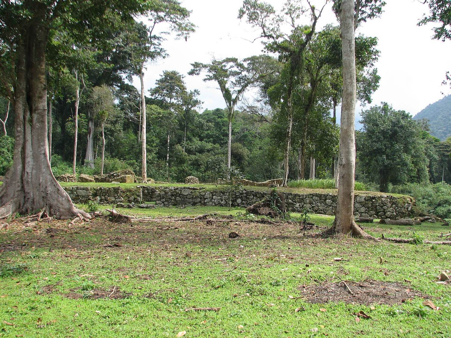
Espíritu Pampa lies near the Chontabamba River, a tributary of the Urubamba, at about 1,458 metres above sea level. Dense vegetation covers much of the site, which may contain several hundred structures. The remains include a central area of rectangular buildings, plazas, platforms, terraces, and canals, with stone foundations for circular buildings becoming more common farther out. The central area covers about 15 hectares.
Inca settlement
Rectangular buildings and circular foundations
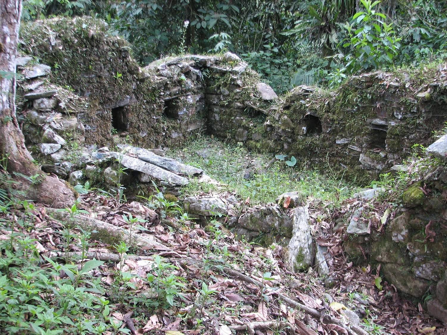
Most of the rectangular buildings were made from river stones, pieces of bluish-grey slate, and white granite. Gravel-and-clay mortar bound the masonry, and the walls were coated with dark red plaster. Jungle conditions contributed to their collapse; the surviving walls rarely stand more than a metre high.
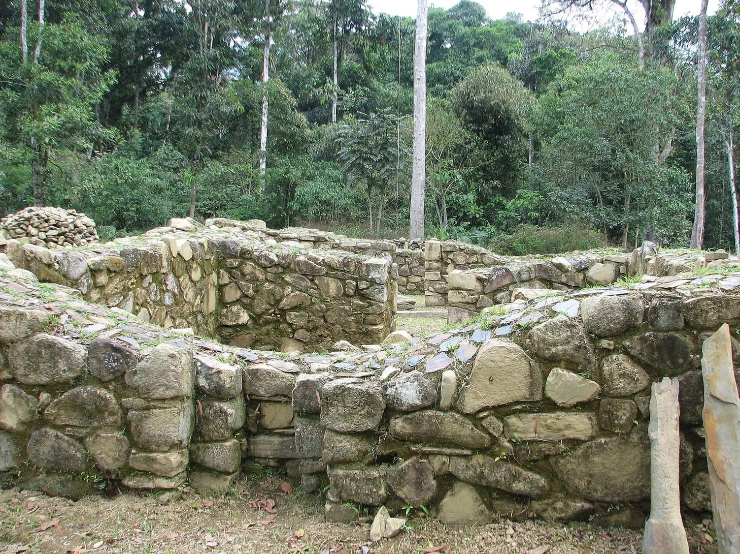
The circular foundations are stone-built, measure about 3 to 9 metres across, and rise as much as 50 centimetres. Each has a single doorway. Their upper portions have not survived, and they may once have supported wooden structures with conical roofs. Their cultural origin is uncertain: they may date to the Inca period and have been built by local Machiguenga people.
Central ceremonial precinct
Main plaza
The main plaza was used for public gatherings and ceremonies. Martín de Murúa described it as large enough for horse races. Trees now cover it and obscure its extent. Pedro Sarmiento de Gamboa may have raised a Spanish flag there in 1572 to mark the transfer of Vilcabamba to the Spanish Crown.
Palace enclosure
On the northeast side of the plaza, four rectangular buildings stand within a large enclosure entered through one gateway. Known as the palace, this is among the few structures at the site built with carefully dressed stone. It may have served as the ruler’s residence.
Public-ceremony building
A long kallanka, a large Inca building for public or ceremonial use, runs along the plaza’s northwest side. It measures about 80 metres by 7.5 metres and has twelve doorways along each long side. It was among the largest buildings in the Inca Empire.
Southwest platform and buildings
A group on the plaza’s southwest side was first identified as an ushnu, a raised platform used in Inca ceremonies. Its plan differs from comparable structures at other Inca cities and more closely resembles the palace across the plaza, though its stonework is less finely finished. Later walls surrounded an original group of four buildings, adding rooms and creating a more complex arrangement.
Southeast complex
A large group of buildings, terraces, and patios occupies the southeast side of the plaza.
Tendi-Pampa
Courtyard complex
About 300 metres southwest of the main plaza, artificial terraces support buildings arranged around an inner courtyard. The structures have windows and wall niches. Local Machiguenga speakers call the ruins Tendi-Pampa. Pottery beneath a burned and collapsed roof supports the possibility that the complex was hurriedly abandoned and burned before the Spanish arrival in 1572. A small amount of ceramic roof tile suggests tiles served as decoration on parts of buildings rather than covering entire roofs. The complex probably had ceremonial and feasting functions.
U-shaped building
A separate U-shaped structure at Tendi-Pampa differs from typical Inca buildings and resembles a Christian chapel. Its clay floor is incised to imitate European tiles. Both its date and purpose remain uncertain. It may be connected with Titu Cusi’s baptism, or it may have held sacred Inca relics or the mummies of rulers.
Wari settlement and burials
Settlement layout
The Wari settlement, about a kilometre from the Inca centre, had a densely built area of D-shaped and rectangular buildings, small plazas, low terraces, and stone-lined channels. The surviving walls rise about 30 centimetres. They were built from two rows of unworked stones set in earth mortar and coated with clay plaster. Some structures were built over older ruined buildings, indicating repeated cycles of occupation and abandonment. Two circular foundations from a later period overlie Wari remains.
Burials
About 40 burials, probably mostly individual, lay beneath building floors. Most occupied cylindrical or conical pits lined with stone. Some pits were capped with one or two large flat stones pierced by a central opening, with a ceramic vessel placed at the bottom. This arrangement may have allowed liquid offerings to be made to the dead. Pottery, metal objects, and stone tools were recovered from the burial area.
Lord of Vilcabamba burial
The Wari-period burial called the Lord of Vilcabamba held the remains of a man estimated to have been 25 to 35 years old. Its shaft was unusually deep, about 1.7 metres, and one metre across. River stones lined the sides beneath a grey-clay coating, and a large slab formed the floor. Two flat stones, set like shutters and pierced by an opening, covered the grave.
The burial contained a large silver chest ornament, a silver face mask, beads, four silver feather ornaments, a ritual bronze axe, a palm-wood staff wrapped in silver, two gold bracelets, silver sequins, and fourteen silver ornamental plates. The chest ornament, bracelets, and plates carry imagery from the southern Andes, including a stylized profile of a predatory feline. The excavated area has yielded the largest single-area collection of Wari metalwork recovered to date. The bronze axe is notable for its tin alloy rather than arsenic; tin sources lay outside Wari territory, within the sphere of influence of the separate Andean culture of Tiwanaku.