Veii: An Etruscan City and Roman Settlement in Italy
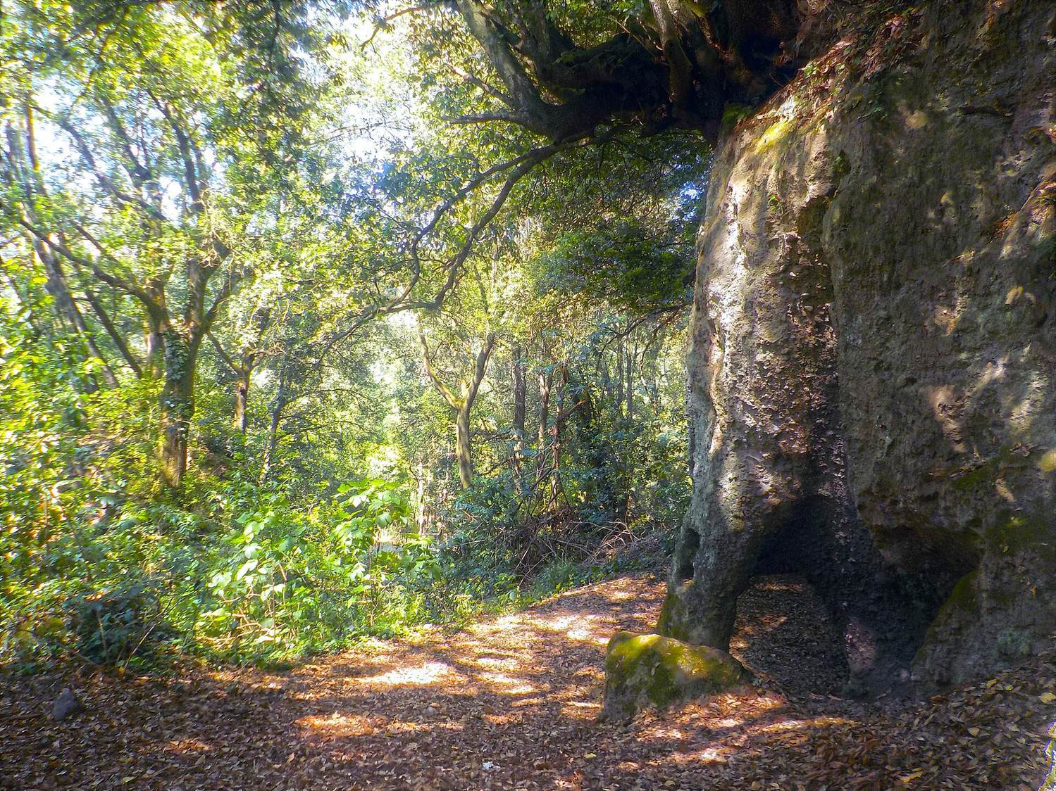
Site at a Glance
- Popularity
- Very High
- Country
- Italy
- Primary era
- Iron Age
- Eras represented
- Iron Age, Classical, Medieval
- Civilizations
- Etruscan, Papal States, Roman
- Site type
- City
On this page34 sections
History
Veii was an ancient Etruscan city at Isola Farnese in the modern municipality of Rome, Italy. Its earliest known occupation dates to the tenth century BC, and it grew into one of central Italy’s major political and cultural centers.
From early settlements to Etruscan city
In the tenth century BC, people lived on the plateau and in smaller settlements nearby. During the ninth century BC, settlement became increasingly concentrated on the plateau. These communities belonged to the Villanovan culture, an early Iron Age culture of central Italy regarded as a formative predecessor of Etruscan civilization.
Veii’s population and settlement density increased in the eighth and seventh centuries BC. Contact with Greek communities brought writing and the potter’s wheel by the eighth century, while Greek pottery found at the site reflects these connections. Trade with Greeks and Phoenicians, farming, salt resources near the Tiber’s mouth, and river transport all contributed to the city’s wealth.
By the middle of the seventh century BC, previously separate settlements had developed into a more unified urban center. Veii became one of central Italy’s major cities and, by the sixth century BC, was among the largest cities in Italy outside the Greek colonies. Its position near the Tiber and routes into the interior also brought it into competition with Rome.
Veii was the southeasternmost member of the Etruscan League, a loose association of twelve independent city-states. Its members shared religious practices and met annually at the sanctuary of Fanum Voltumnae to discuss religious, political, and military matters. During the Roman siege, the other cities failed to organize an effective defense of Veii. Falerii and Capena were reported to have offered support near the end.
Conflict and Roman conquest
Roman tradition describes earlier wars against Veii during the reigns of Rome’s kings Romulus, Tullus Hostilius, and Servius Tullius. After Rome’s monarchy was overthrown in 509 BC, Veii supported the exiled Tarquinius Superbus against Rome at the Battle of Silva Arsia. These accounts belong to traditional narratives rather than securely established contemporary records.
Conflict intensified in the fifth century BC as Rome extended its influence around Fidenae and the Tiber. Roman tradition places the Battle of Cremera in 477 BC, a clash associated with the destruction of the Fabii family’s military force. The numbers given in traditional accounts are uncertain, though a serious encounter is generally accepted. In 438 BC, Veii’s king Lars Tolumnius supported Fidenae’s revolt against Rome. After four Roman envoys were killed there, war followed. Roman accounts say the military tribune Aulus Cornelius Cossus killed Tolumnius in a subsequent battle.
Rome declared war on Veii in 406 BC and besieged the city for ten years. Keeping troops in the field through winter and paying them marked a change in Roman military practice. Veii received little effective assistance from the Etruscan League, and its decision to appoint a king on its own in 403 BC further weakened support from the other cities.
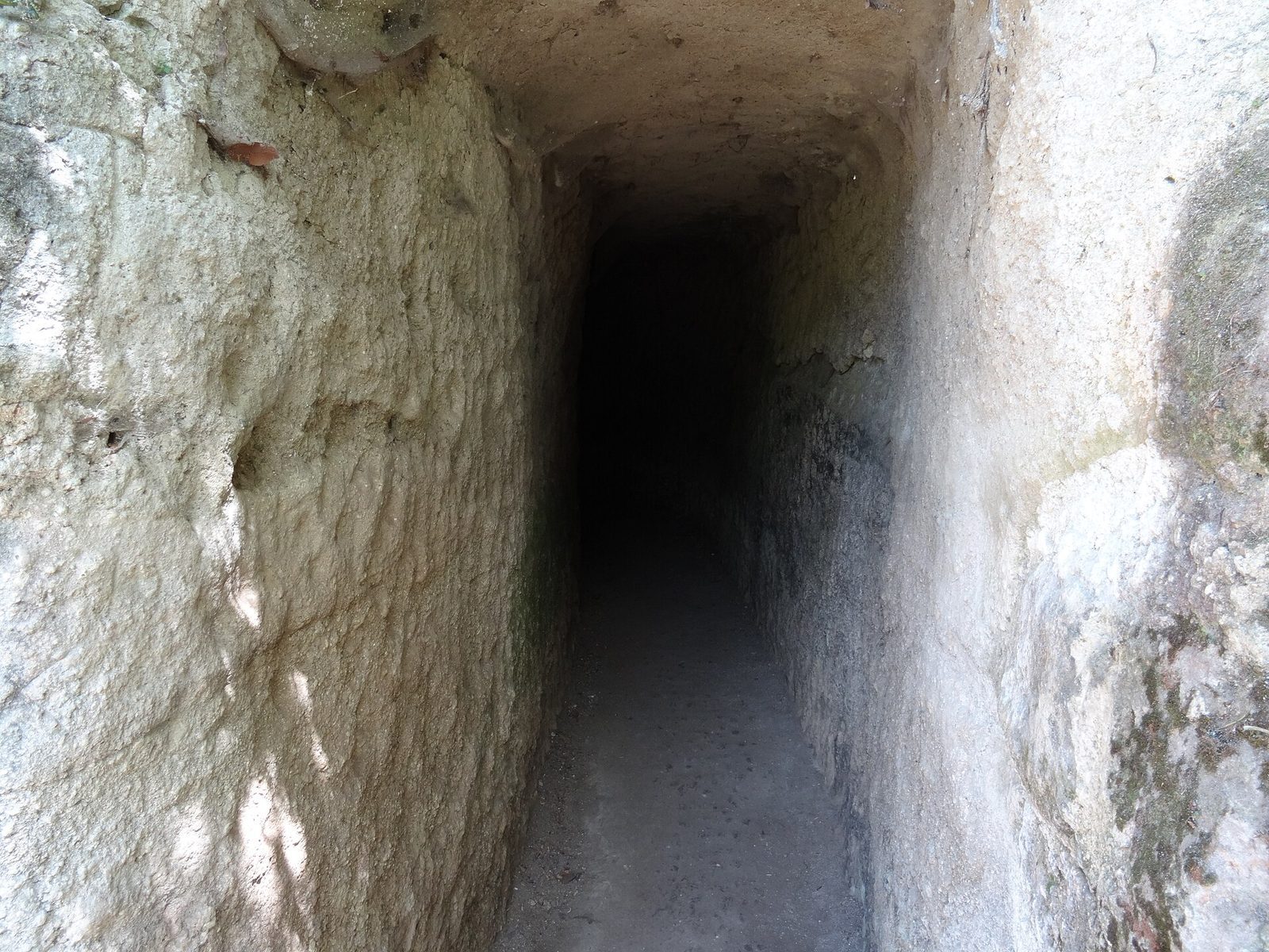
In 396 BC, the Roman general and dictator Marcus Furius Camillus led the final assault. Roman forces reportedly entered through tunnels cut into the soft volcanic rock beneath the city and connected with its drainage system. After Veii fell, it was plundered. Roman accounts describe adult men being killed and women and children enslaved. Camillus removed the cult statue of Juno Regina, or Queen Juno, and dedicated it at a temple on Rome’s Aventine Hill. The conquest greatly expanded Roman territory and brought southern Etruria under Roman control.
Roman settlement and decline
After the conquest, Veii’s territory became Roman public land and was divided into parcels for Roman citizens. Camillus opposed a proposal to move half of Rome’s population to Veii. The proposal was raised again after Gauls sacked Rome in 390 BC, when Roman refugees had taken shelter at Veii. The conquered city remained occupied, but it did not recover its former population or prosperity.
In the middle of the first century BC, Julius Caesar established a Roman colony at Veii. The settlement was drawn into the Perusine War of 41–40 BC, a conflict in Italy between Octavian’s forces and those of Lucius Antonius and Fulvia. Under Augustus, Veii became the municipium Municipium Augustum Veiens. A municipium was a community incorporated into the Roman political system while retaining some local civic organization. The Roman settlement was much smaller than the Etruscan city, and the surrounding district developed as a landscape of farms and villas.
Veii declined in Late Antiquity and had ceased to function as a town by the fourth century AD. Areas of the wider site saw later, limited activity, including early medieval settlement at Piazza d’Armi.
Rediscovery and protection
The antiquarian Raffaello Fabretti helped bring Veii back to attention in the seventeenth century. Investigations followed in 1843 and 1916. From 1954 to 1968, archaeologist John Bryan Ward-Perkins led the South Etruria Survey, systematically recording visible antiquities across Veii’s territory as urban expansion and deep ploughing threatened archaeological remains. Excavations in central areas and at Piazza d’Armi also took place from 1996. In 1997, the Lazio regional authority established Veio Regional Park to protect the area’s natural environment and archaeological landscape.
Remains
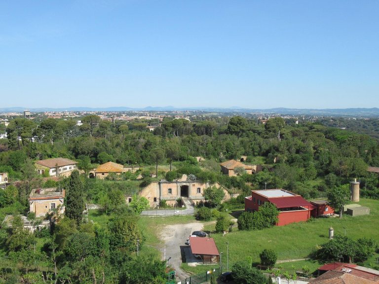
Veii occupied a roughly triangular plateau of about 190 hectares, bounded by the Fosso Piordo to the south and the Fosso Valchetta, identified with the ancient Cremera, to the north. Steep slopes and ravines shaped the city’s defenses and layout. The ancient builders used volcanic tuff, a soft volcanic rock, for walls and other structures.
Plateau, defenses, and streets
City walls and natural boundaries
The city’s tuff-block defenses extended for more than eight kilometres. The walls were over two metres thick at their base, narrowed toward the top, and are estimated to have reached five to eight metres in height. Sections survive. Streams formed part of the defensive boundary in places, while a wall closed the triangular approach to the plateau.
Street network
Streets generally followed the plateau’s terrain and the routes leading into the city. At Piazza d’Armi, a more regular grid of streets was established in the seventh century BC. Roads from the gates linked Veii with Rome, Caere, Tarquinia, Vulci, Nepet, Falerii, Capena, and other neighboring settlements. Their junction served as the center of the Etruscan city and later as the site of the Roman forum, or civic square.
The citadel at Piazza d’Armi
Setting and early settlement
Piazza d’Armi, Veii’s fortified citadel, occupies a steep promontory where the Cremera and Fosso Piordo meet. Cliffs protect it on three sides, and a narrow ravine separates it from the main plateau. The promontory covers about 6.9 hectares. A road crossed the ravine in the Roman period, and evidence also points to an earlier wooden bridge.
Excavations have traced settlement at Piazza d’Armi from the ninth century to the middle of the fifth century BC. The earliest dwellings included circular and oval huts, some with lowered floors, central roof supports, and earthen walls mixed with fragments of tuff. Near the plateau’s center, a burial of a man aged about 25 to 30 was placed beneath successive hut structures. Radiocarbon dating places the burial between 940 and 810 BC. Its unusual position has prompted interpretations of the man as an elite figure or founder, and of the surrounding structures as a shrine connected with a hero or founder. These interpretations remain uncertain.
Monumental buildings and defenses
In the second half of the seventh century BC, quadrangular dwellings arranged along streets meeting at right angles replaced scattered huts. The area later acquired paved streets, public buildings, small temples, and aristocratic houses with baked-clay architectural decoration. Foundations and fragments of a rectangular temple from the early sixth century BC have been found there. The temple may have had a single-room interior and a central support for its main roof beam. A group of mid-sixth-century roof ornaments included a standing human figure and a dog.
A substantial wall enclosed Piazza d’Armi by the first half of the sixth century BC. Its only access point had a double-gated entrance. The defenses were strengthened again from the late sixth to the early fifth century BC, probably as conflict with Rome intensified. The area appears to have been abandoned by the middle of the fifth century BC. A small production installation dates to after the Roman conquest, and the ground was used for agriculture in the late fourth century BC. It was resettled in the early Middle Ages, broadly from the ninth to eleventh centuries AD; defensive works from this phase were once mistaken for Etruscan construction.
Water management and roads
Underground waterworks
Veii’s water system included channels cut below ground through rock for water supply and drainage. Wells, cisterns, channels, and drainage works connected parts of the settlement with inhabited and sacred areas. A broad network of water channels also extended into the territory around Formello.
Ponte Sodo and river channels
Ponte Sodo is an artificial tunnel cut through rock at a bend in the Valchetta. About 70 metres long and roughly three metres wide, it redirected the river to reduce flood danger and made crossing easier near a city gate. Wells cut down from above provided access to water in the tunnel. Other channels linked the Valchetta with the Fosso Piordo, supplied the Portonaccio sanctuary, and drained cultivated valleys north of the city.
Roads and crossings
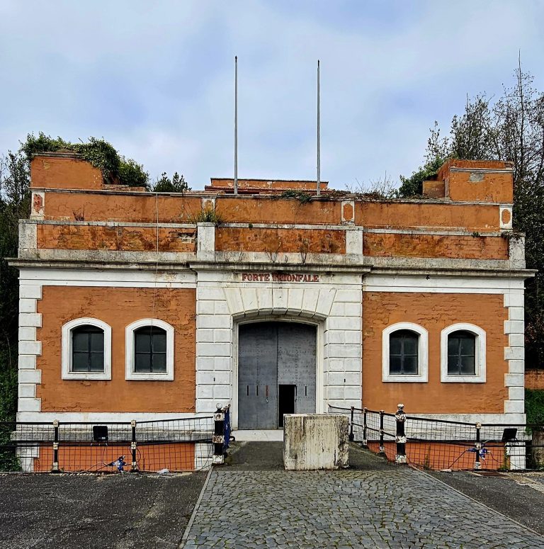
Multiple gates gave access to roads leading from the city. Named routes included the Via Veientana and Via Trionfale toward Rome, as well as roads toward Fidenae, Crustumerium, Capena, Falerii, the Bracciano and Baccano lake districts, Caere, and the Portonaccio sanctuary. A possible northern route above Ponte Sodo may have been used when the Cremera flooded. The short Arco del Pino tunnel, cut through rock, helped the Via Veientana descend into the Cremera valley. A well-preserved stretch of Roman paving survives on the road toward Capena.
Sanctuaries and sculpture
Portonaccio sanctuary
The extra-urban sanctuary of Portonaccio stood beside the Fosso Piordo, near a sulfurous spring and an important road outside the city. Associated with Minerva and probably Apollo, it had origins extending at least to the seventh century BC and became one of Etruria’s major sacred complexes. Its temple to Apollo dates to about 510 BC. The sanctuary’s multicolored architectural decorations in baked clay are now represented in collections at the Villa Giulia in Rome.
Apollo of Veii
The Apollo of Veii was recovered in fragments from a pit for offerings at Portonaccio in 1916. Dated to about 510–500 BC, the 181-centimetre statue is attributed to the Etruscan sculptor Vulca or an artist associated with his workshop. Made of multicolored baked clay, it shows Apollo barefoot in a tunic and cloak, with his left arm reaching forward and his right arm lowered, possibly to hold a bow. The sculpture belonged to a group that included Herakles, the Greek hero identified with Roman Hercules, and was designed to be viewed from the side. The statue is now in Rome’s National Etruscan Museum at Villa Giulia.
Juno temple and inscriptions
A temple of Juno, identified with the Greek goddess Hera, was regarded as Veii’s most honored temple. At Portonaccio, Etruscan dedicatory inscriptions name Aplu, corresponding to Apollo, and Uni, corresponding to Juno.
Roman public buildings and baths
Forum at Macchiagrande-Vignacce
Excavations in the forum area at Macchiagrande-Vignacce began in 1996. They revealed a paved square about 40 by 80 metres, surrounded by a row of columns. A small shrine and other public buildings opened onto the square, with a bath installation behind the shrine. Earlier activity in the area included huts, later replaced by rectangular masonry buildings, and a nearby place of worship with a well. Inscriptions refer to a temple of Mars, a theater, and a building for a Roman association. Eleven large forum columns were removed in the nineteenth century and reused in the portico of Palazzo Wedekind in Rome. A statue of Tiberius and numerous inscriptions were also taken from the area during earlier excavations.
Campetti bathing complex
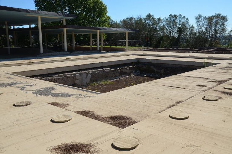
The bathing complex at Campetti covers about 10,000 square metres and was associated with therapeutic waters. Rebuilt in the late first century BC, it had covered rooms and large pools supplied by cisterns, arranged on two levels separated by a terrace. Installations for heating water were added from the late first century AD. Later structures reused material from earlier phases. A private dwelling stood over the ruins, and a lime kiln dates to the early Middle Ages.
Bagni della Regina
A separate bathing complex, the Bagni della Regina, stood beside a hot spring in the Valchetta gorge north of Piazza d’Armi.
Burial grounds and funerary evidence
Necropolises and burial practices
Numerous burial grounds around Veii contain rock-cut chamber tombs and burial mounds. Named areas include Quattro Fontanili, Monte Michele, Vaccareccia, Macchia della Comunità, Monte Campanile, Valle la Fata, Isola Farnese, Casalaccio, Oliveto Grande, Pozzuolo, Riserva del Bagno, Casale del Fosso, Grotta Gramiccia, Quarto di Campetti, and Picazzano. Excavations at Casale del Fosso and Grotta Gramiccia in 1913–1916 revealed about 1,200 tombs. Work at Quattro Fontanili from 1963 to 1976 found about 2,000, some badly damaged by ploughing.
Cremation predominated in the earliest periods, while burial of the body became more common from the ninth century BC and accounted for about 70 percent of recorded burials in the eighth century. Both practices could occur within one family. In a sequence from 550 to 350 BC, cremation was predominant in 550–500 BC, the two rites were more evenly balanced in 500–400 BC, and burial of the body predominated in 400–350 BC. Early cremations used urns placed in pits with grave goods; some male burials had clay covers shaped like helmets. Later graves included larger pits, side niches for offerings, and, in some infant burials, tuff sarcophagi. In the eighth century BC, grave goods became more numerous and elaborate, and terracotta sarcophagi and urns carried scenes from the deceased’s life or images of deities. During periods of war or economic hardship, cremation became more common again and grave goods were less valuable.
Tomb of the Roaring Lions
At Grotta Gramiccia, the Tomb of the Roaring Lions is among the earliest known painted Etruscan tombs, dating broadly to the early seventh century BC. A short corridor leads into a low, square chamber. Its wall paintings are arranged in two bands, with birds above and open-mouthed feline or lion-like creatures below. The burial is thought to have been by cremation. Despite tomb robbery, finds included pottery, brooches, jewelry, a sword, and remains of a decorated two-wheeled war chariot.
Tomb of the Ducks
Found at Riserva del Bagno, the Tomb of the Ducks dates to about 680–670 BC. Its name comes from a painted line of ducks on the chamber wall.
Campana Tomb
The Campana Tomb is a painted chamber tomb at Monte Michele, discovered in 1843 and dated to the late seventh century BC. Its grave goods were recovered alongside the wall paintings.
Monte Michele tombs
Six chamber tombs dating from about 670 BC to the end of the seventh century BC were identified at Monte Michele along the ancient road to Capena. Tomb 5 contained burials of a pair, a child, and a young adult, together with pottery and metal objects, a four-wheeled chariot, and a bronze funerary urn engraved with a face resembling a Gorgon or funerary demon. The grave goods date to about 670–650 BC and are displayed at the Villa Giulia.
Tumuli
The surrounding area has about a dozen known burial mounds. These include the Tumulo della Vaccareccia, explored in 1935 and dated by its grave goods to about 640–630 BC, and two tumuli at Oliveto Grande. Some burial mounds were leveled in modern times to expand cultivated land.
Homes and material culture
Domestic architecture
Early homes on the plateau were generally circular or oval huts, built with timber framing set over shallow trenches and roofs of thatch or woven material. Masonry buildings increasingly replaced huts from the seventh century BC. At Piazza d’Armi, excavations also revealed a two-room hut built over an earlier burial.
Pottery, metalwork, and other finds
Veii’s finds include impasto pottery, hand-shaped from coarse clay containing mica and stone fragments, and bucchero, fine black pottery fired in a low-oxygen atmosphere. Some early bucchero vessels have walls less than two millimetres thick. Excavated vases and bowls show activities such as harvesting, animal husbandry, and metalworking, while funerary ceramics depict victories and social achievements. Greek pottery fragments from the eighth century BC occur across the site.
Bronze objects include horse fittings, weapons, fans, jewelry, and mirrors. Etruscan bronze workers also made embossed chariots, cast figurines, and decorated vessels. Finds from burials include terracotta sarcophagi and urns. Two graves with burials of the body contained early Roman bronze objects resembling coins or weights, placed between the deceased’s hands.