Tell Beydar: The Ancient City of Nabada in Syria
Site at a Glance
- Popularity
- Medium
- Country
- Syria
- Primary era
- Bronze Age
- Eras represented
- Bronze Age, Iron Age
- Civilizations
- Assyrian
- Site type
- City
On this page11 sections
History
Tell Beydar, the archaeological site of ancient Nabada, lies in northeastern Syria. Settled during Early Dynastic I, around 2900–2750 BC, Nabada developed into an independent city-state and later became a provincial center in the kingdom of Nagar.
Early Dynastic development
During phase II, dated to 2750–2560 BC, the settlement covered about 22 hectares. Nabada reached its greatest extent during its Early Dynastic development and had become a medium-sized independent city-state by around 2600–2500 BC. In phase IIIa, dated to 2560–2430 BC, the lower town was abandoned and the occupied area contracted to about seven hectares.
Around 2450 BC, Nabada became a provincial capital in the kingdom centered at Nagar, an ancient kingdom of Upper Mesopotamia. The site’s phase IIIb is dated to 2430–2340 BC. Nabada was administered from Tell Brak, and the city and nearby settlements may also have served as caravan relay stations on routes between Anatolia and southern Mesopotamia.
Akkadian and later occupations
After the Akkadian conquest of the region, Nabada became a minor outpost of the Akkadian Empire, a Mesopotamian empire founded by Sargon of Akkad. Radiocarbon estimates for the transition span 2420–2270 BC, with an uncertainty of about ten years. The site chronology groups the Proto-Imperial, Akkadian, and post-Akkadian phase between 2340 and 2100 BC.
Nabada was depopulated after about 2400 BC for reasons that remain unclear. Around 2350 BC, a different population resettled the site, bringing material culture more like that of Akkad; this occupation was followed by another abandonment. Hurrians, an ancient people of the region, occupied the site around 1400 BC. After another interval, a settlement was established during the Neo-Assyrian period, a later phase of the Assyrian Empire, around 700 BC. The upper mound was occupied again during the Hellenistic period, which followed Alexander the Great’s conquests and the spread of Greek culture, from about 200 BC into approximately the first half of the first century BC. The site was eventually abandoned.
Archaeological investigation
Some excavations took place in the nineteenth century. Antoine Poidebard noted and photographed Tell Beydar during an aerial survey in 1929. From 1992 to 2010, a joint Syrian-European team led by Marc Lebeau and Antoine Suleiman excavated for 17 seasons and also carried out restoration work. The University of Chicago’s Oriental Institute surveyed an area within 12 kilometres of the site in 1997 and 1998, later supplementing the work with satellite imagery. The University of Venice excavated near a city gate on the northeastern slope of the third-millennium inner city. Modern domestic construction has encroached on the archaeological site.
Remains
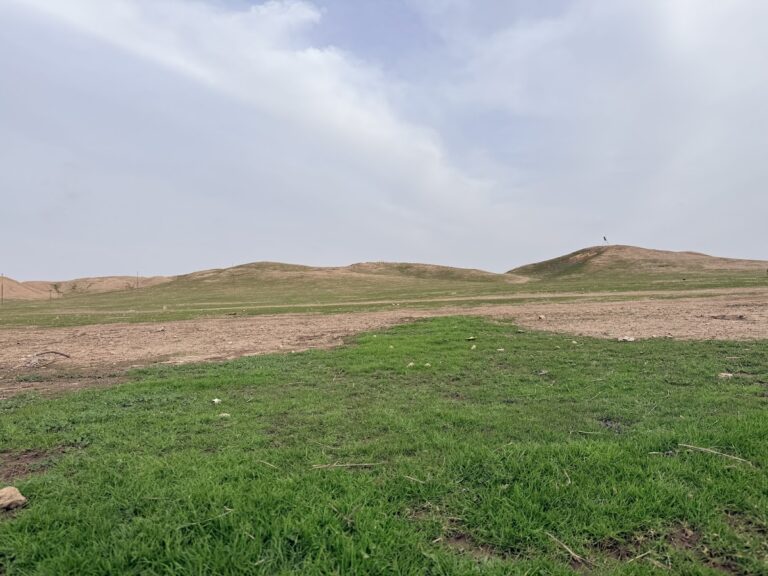
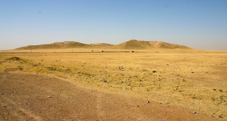
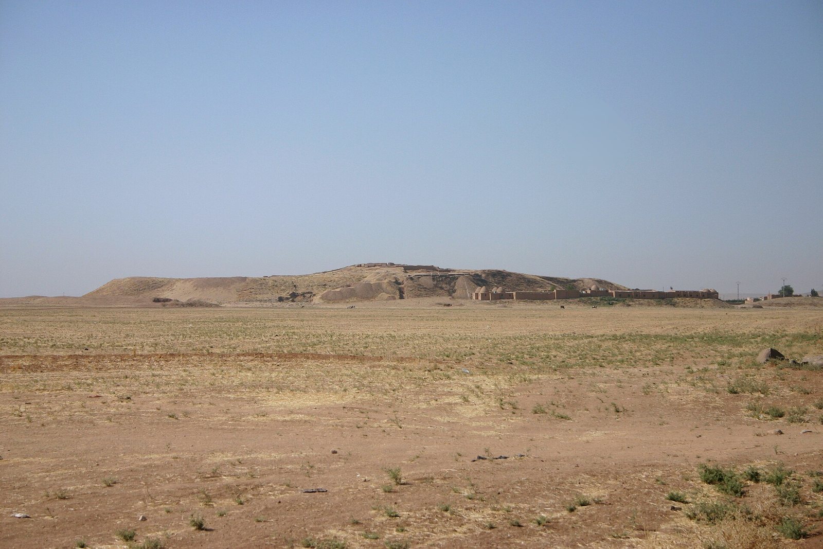
Tell Beydar is a tell, a mound formed by successive layers of occupation and building debris. The central site covers about 22 hectares and rises approximately 27.5 metres above the plain. Its circular central mound covers about seven hectares and is surrounded by the circular lower town known as Beydar I. The outer enclosure covers about 28 hectares. The inner wall is about 300 metres in diameter, while the outer wall is about 600 metres across. The outer wall, around five metres thick, was built on a raised embankment and had gates. Later settlements called Beydar II extended across about 50 hectares at the base of the mound. The Hellenistic settlement occupied its summit, while the small Late Chalcolithic tell of Beydar III lies one kilometre to the south.
Public buildings
Palace
The upper mound contains about 20 metres of occupation remains. On its summit, an Early Dynastic palace of white baked brick measured about 50 by 60 metres and had 50 rooms, plastered walls, and a large central courtyard. Its Early Dynastic IIIb form incorporated surviving parts of an earlier, 18-room Early Dynastic II palace.
Temples
Five large temples, labelled A to E, stood in the city centre and together occupied about 16.5 percent of its area. The deities worshipped in them are uncertain. Šumugan, a Mesopotamian deity associated with wild animals and the steppe, has been proposed as one possibility.
Other buildings
Excavations identified a central area where the principal public buildings were concentrated, along with a royal granary, several agricultural buildings, and houses.
Burials
About 20 tombs were excavated, including some high-status burials. Their grave goods varied with social standing and included weapons, jewelry, and pottery. One burial contained a bronze axe.
Tablets and other finds
Nearly 250 early cuneiform tablets and fragments were recovered. Cuneiform is a writing system made with wedge-shaped impressions in clay. About 220 tablets, found out of their original setting, belong to one archive and date to Early Dynastic III, around the twenty-fourth century BC. They come from the period before Sargon’s rule and roughly a generation before the fall of Ebla. Most are agricultural and administrative records. One lists 100 rams, 185 ewes, three he-goats, and 43 pastured lambs belonging to Lushalim, and names a month for the Sun-god. The texts use a form of Akkadian and include Semitic personal names, as well as some Sumerian. Their writing combines complex signs made with thick and thin strokes with rounded impressions for numbers. More than 1,500 clay sealings, impressions used to secure or authenticate objects and documents, represent 215 designs, many in a style associated with Tell Brak. Small finds include objects made of tin bronze and arsenical bronze. Finds from Tell Beydar are displayed in the Deir ez-Zor Museum.