Tarkhatinsky Megaliths: An Early Bronze Age Stone Complex in Russia
Site at a Glance
- Popularity
- Medium
- Country
- Russia
- Primary era
- Bronze Age
- Eras represented
- Bronze Age
- Civilizations
- Unclassified
- Site type
- Religious
- Remains
- Sanctuary
On this page5 sections
History
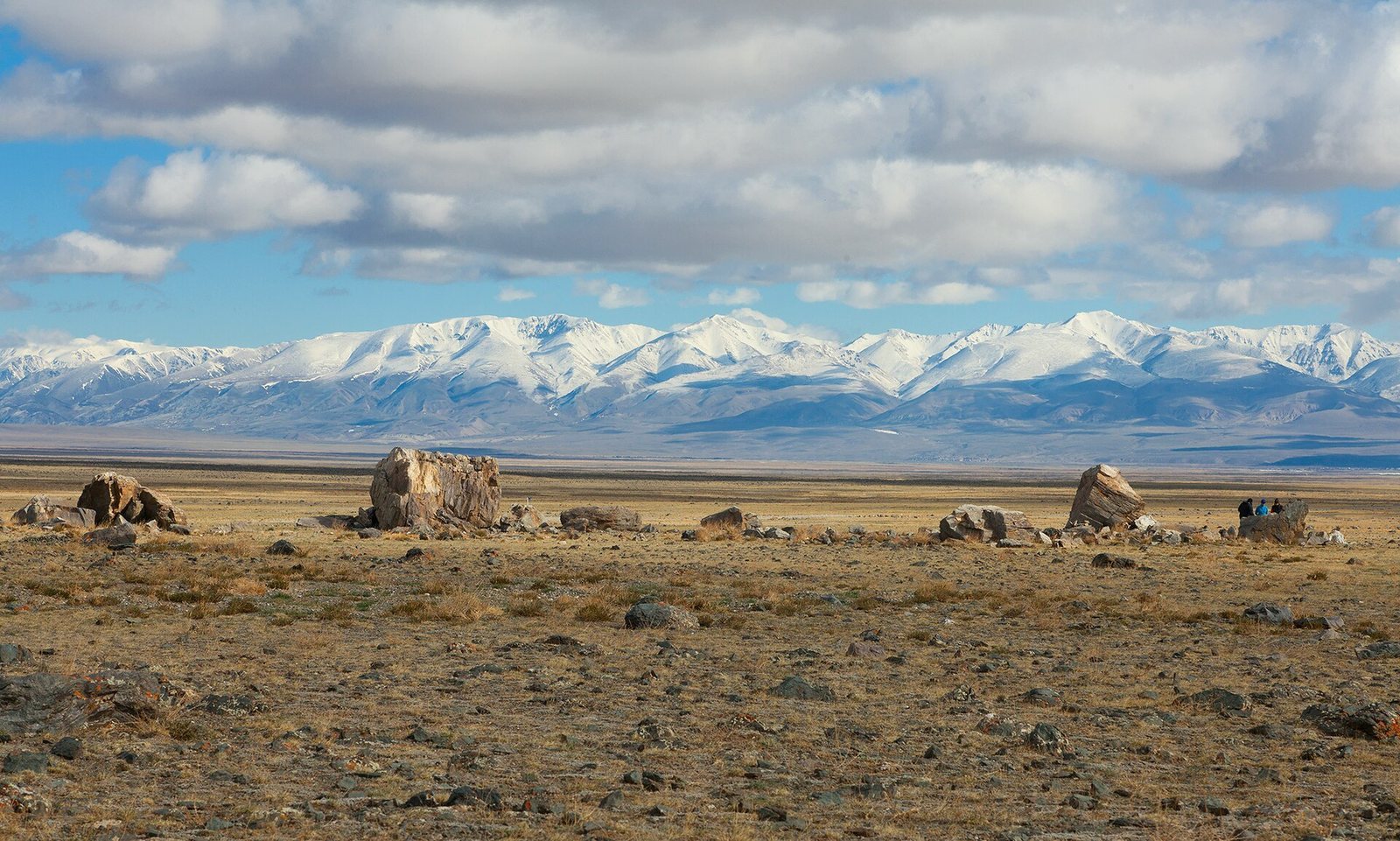
The Tarkhatinsky Megaliths are a complex of large stones in the Chuya Steppe of Russia’s Altai Mountains, about 25 kilometres south of Kosh-Agach. Built between the end of the third millennium BCE and the beginning of the second millennium BCE, they are associated with the Karakol culture, a Bronze Age archaeological culture of the Altai region.
How the stones reached the site remains uncertain. Comparable rock could be quarried about 12 kilometres to the northwest. One proposal is that a glacier brought the stones to the area before people arranged them; another suggests that people transported them, without explaining how. The glacial explanation is considered very unlikely. The question has drawn attention partly because wheeled transport appeared relatively late in the region.
Researcher Vladimir Kubarev found the complex in the 1970s and described it in 1980. A Gorno-Altai State University expedition led by V.I. Soïonov investigated the site in 1994. Expeditions in 1996 and 1997 studied the stones’ magnetic readings and rock composition, and examined the original positions of stones that had been moved. An article reporting on this work appeared in 2000. The Hermitage Museum conducted an expedition from 2003 to 2005, and Novosibirsk State University carried out research in 2009. In 2003 the complex became a cultural heritage property of federal significance. From 2010 to 2012, astronomer E.G. Gienko and Novosibirsk University researcher E.P. Matochkine found further rock carvings and determined the original positions of the principal stones. They interpreted the complex as a sanctuary and solar-observation site intended to function as a solar calendar, marking time through the Sun’s apparent position or seasonal movements.
Remains
Stone circle and setting
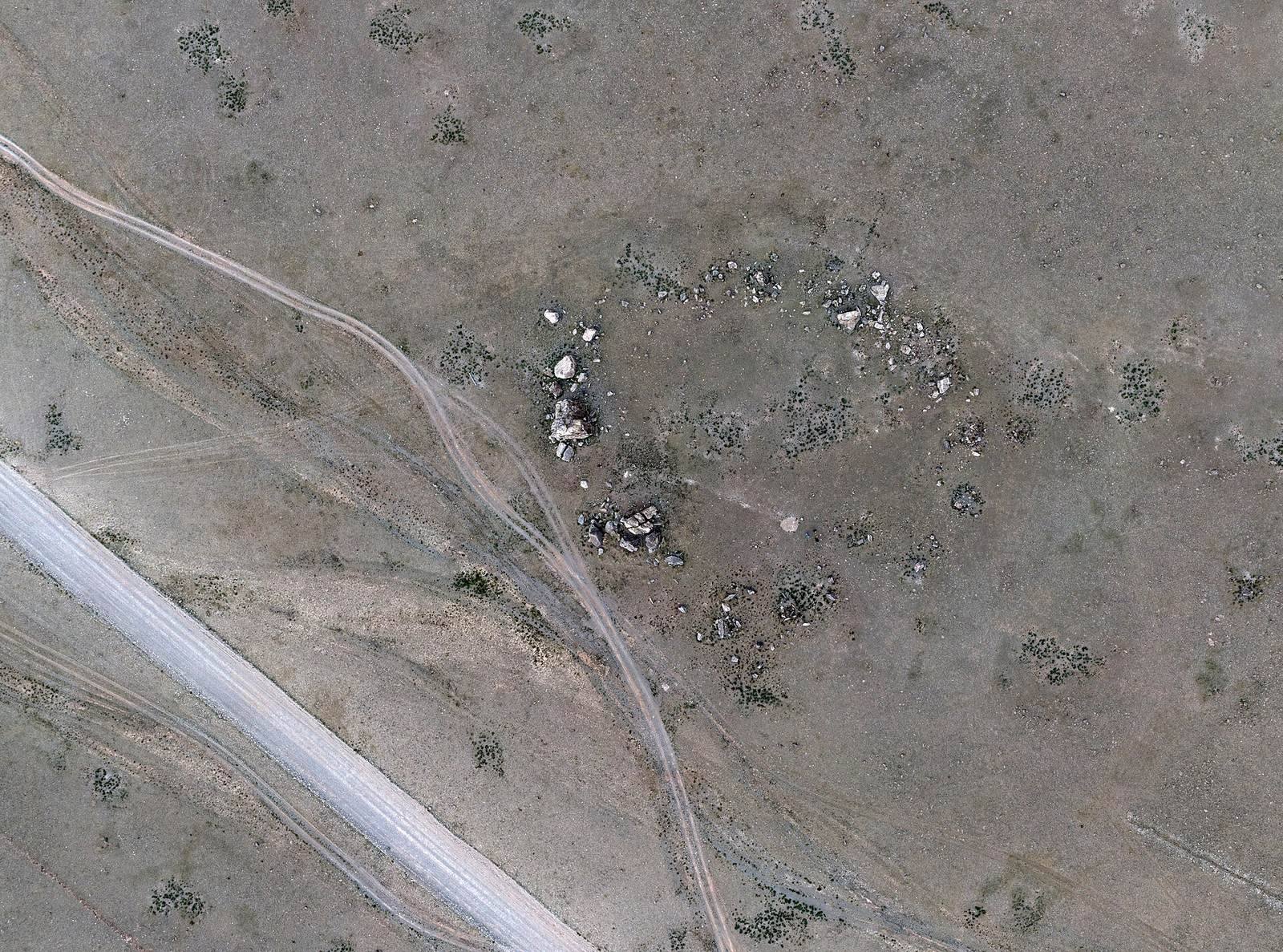
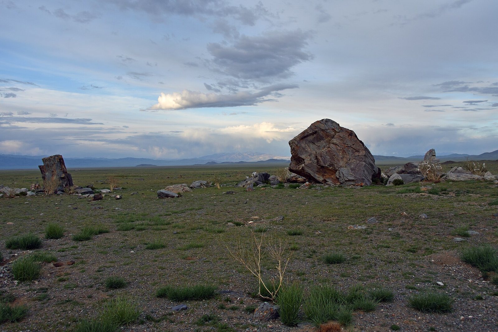
The complex stands on an arid plateau, with the foothills of the Southern Chuya Range to the south. The Tarkhata River, which gives the site its name, lies a few kilometres away. Large blocks form a circle with a circumference of 60 metres. The stones stand between 0.5 and 6 metres apart; the largest measures 6 by 5 by 4 metres, and four rise more than 2 metres above ground. The largest blocks occupy the circle’s northwest, while smaller ones lie to the southeast. Further stone arrangements of different sizes are situated in the southern part of the complex. The layout follows the north-south and east-west directions to within one degree.
Rock carvings
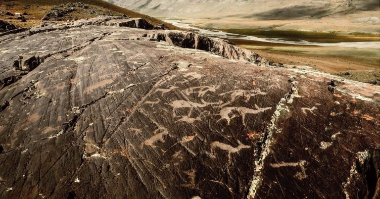
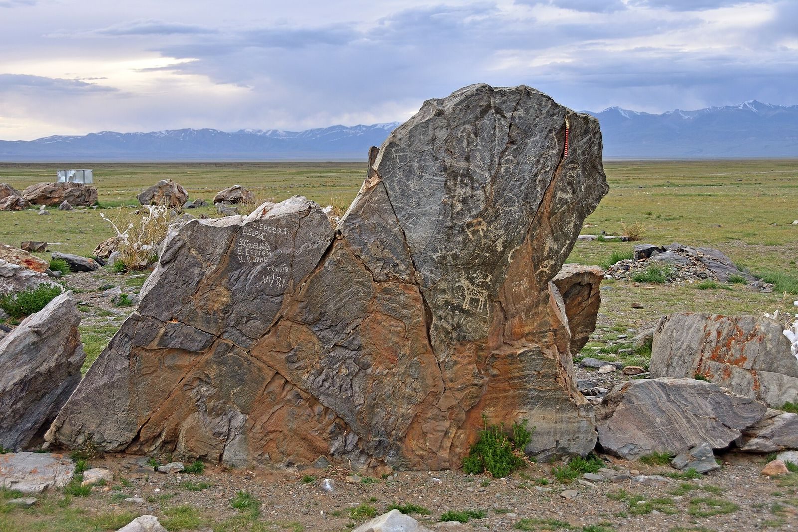
Carvings appear on four stones within the complex. A split stone in the northeast has relatively recent inscriptions and images. A large stone in the northwest bears a figure that is half human and half animal, resembling carvings at Kalbak-Tash. On a 1.5-metre-high stone in the southeast, nearly 30 engravings depict goats and other animals. Another stone south of the circle shows a man pursuing a bull. About 70 metres south of the complex, a separate stone carries four images of human figures; its connection to the main group is uncertain.
Solar alignments and magnetic readings
Calculations indicate that about 4,000 years ago, on days around the summer solstice and shortly before sunset, sunlight passed between the stones and reached the circle’s centre. One stone received full sunlight only at that time of year, a phenomenon that can no longer be observed. At the equinox, a stone has also been observed casting an arrow-shaped shadow. Eight of the 14 largest stones have unusual magnetic readings, some above and others below the normal level. If people in the Bronze Age could recognize magnetism, it may have played a part in rituals at the complex.