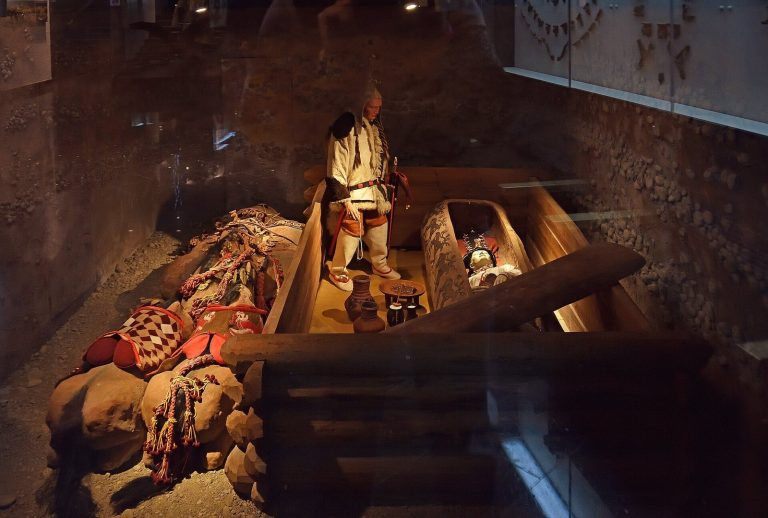
Petroglyphic Complexes of the Mongolian Altai: A Rock-Art Cultural Landscape
Site at a Glance
- Country
- Mongolia
- Primary era
- Stone Age
- Eras represented
- Stone Age, Bronze Age, Iron Age, Medieval
- Civilizations
- Unclassified
- Site type
- Civic
- Remains
- Rock Art
On this page8 sections
History
The Petroglyphic Complexes of the Mongolian Altai are a group of rock-art sites in Bayan-Ölgii Province, Mongolia, with images dating from around 11,000 BCE to the ninth century CE. Their chronology is estimated from changes in imagery and carving techniques rather than radiocarbon dating, so individual images can be difficult to date precisely.
From hunting to herding
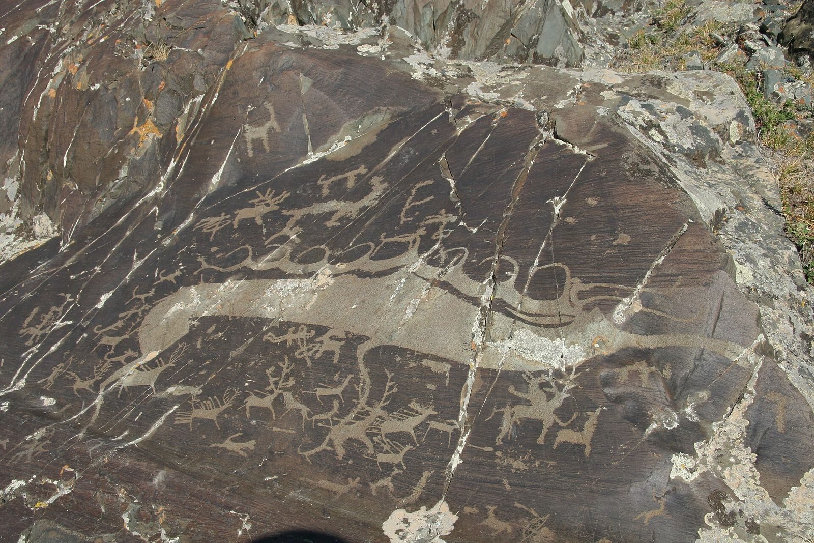
The earliest carvings belong to the Late Pleistocene, the geological epoch before the present-day Holocene. Early Holocene images include people as well as animals, and hunting remains a recurring theme. The Bronze Age, conventionally distinguished by the use of bronze tools and objects, brought scenes of hunters using bows, arrows, spears, and clubs, alongside images of herding and travel with domestic yaks. Animal-drawn carts also appear. Changes in the animals pictured have helped trace environmental shifts from steppe toward forest.
Tsagaan Salaa-Baga Oigor is considered the strongest of the three components as evidence for a continuous sequence of human settlement. Its imagery reflects a wider change from hunting to herding and, later, to a way of life increasingly dependent on horses.
Horse-based lifeways and Turkic riders
Horse riding and pastoral nomadism became prominent in images from the late Bronze Age and early Iron Age. The Iron Age is conventionally associated with the use of iron tools and objects. During its early phase, the region was under Scythian influence. Scythians were ancient nomadic peoples associated with parts of Central Asia and the Eurasian steppe, and horses held a central place in local life. Carvings from this period include detailed scenes of riding and hunting.
Images from the seventh to ninth centuries CE show armed Turkic horsemen, including riders who appear to be charging into battle or hunting. Turkic refers to peoples and languages belonging to the Turkic family. Some later carvings depict people riding deer.
Research and World Heritage inscription
The petroglyphs were discovered in 1963. From 1994 to 2005, an expedition surveyed rock art across the Mongolian Altai, recording more than 10,000 scenes at sites that included Tsagaan Salaa and Baga Oigor. Joint American, Russian, and Mongolian teams also investigated Tsagaan Salaa-Baga Oigor and Upper Tsagaan Gol from the mid-1990s.
Mongolia added the site then called Tsagaan Salaa Rock Painting to its World Heritage Tentative List in 1996. A Tentative List is a national inventory of sites that may be considered for World Heritage nomination. Upper Tsagaan Gol and Aral Tolgoi were added in 2009, and the three complexes were nominated together in 2010. After inspecting the sites that year, ICOMOS, the International Council on Monuments and Sites, recognized their outstanding universal value, meaning importance beyond national borders, but recommended deferring inscription because systematic rock-art records and management-plan implementation needed improvement.
The World Heritage Committee inscribed the complexes in 2011 as a cultural landscape under criterion (iii), which recognizes rare or exceptional evidence of a cultural tradition or civilization. The inscription recognizes the sites as an unusual record of changing North Asian lifeways, including the move from hunting to herding and the establishment of horse-based nomadism. It also recognizes the scale, age, and state of preservation of the complexes.
Remains
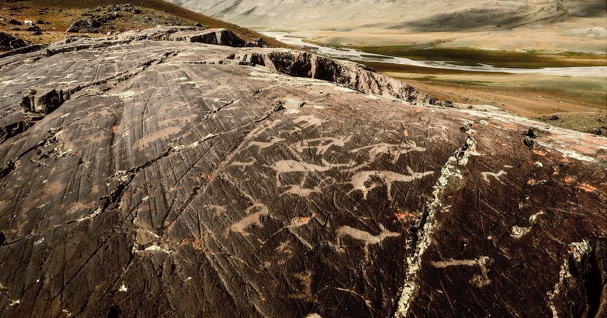
The three complexes occupy separate valleys along the western edge of the Mongolian Altai, near Mongolia’s borders with Russia and China, and lie about 35–40 km apart. Their carved panels are set into sandstone shaped by Pleistocene glaciers; the rock surfaces are polished and bear thin patina layers in varied colors. Together, the designated areas cover 11,300 hectares, with a 10,700-hectare buffer zone. The wider archaeological landscape includes thousands of petroglyphs, hundreds of burial mounds, stone dwellings, altars, and cairns, human-built piles or mounds of stone, some enclosed by walls or fences.
Tsagaan Salaa-Baga Oigor
This complex covers about 2,100 hectares, with a 3,600-hectare buffer zone, and extends along two valleys that formerly provided routes toward the Russian Altai. Its roughly 5,000 rock-art localities each contain between one and 160 images. The carved panels range from late Pleistocene hunting scenes through Bronze Age hunting and herding imagery to later Turkic-period carvings; the latest inscriptions are in Turkic languages. Burial or ritual mounds, dating from approximately the Bronze Age onward, occupy terraces above the valley floor.
Upper Tsagaan Gol
Covering about 9,000 hectares with a 6,300-hectare buffer zone, Upper Tsagaan Gol extends roughly 22 km along the Tsagaan Gol river valley and its main tributaries. Around 5,000 rock-art localities, each with as many as 100 images, occur on rock outcrops and boulders among glacially deposited debris. The carvings include hunting scenes and people travelling on foot or with domestic yaks; some later images show riders on deer. Burial mounds, stone circles, standing stones, and Turkic-period enclosures also form part of the landscape. Some are oriented eastward along the river, while others face the sacred mountain Shiveet Khairkhan. A temple on a hill opposite the mountain remains active and serves the local population.
Aral Tolgoi
The smallest complex covers about 200 hectares and has an 800-hectare buffer zone. It lies about 40 km south of Upper Tsagaan Gol and contains roughly 300 carvings, mostly on low rock surfaces and large boulders southeast of a whale-shaped hill. Most images are attributed to the Late Pleistocene, with relatively few from later periods. Animal figures include large-bodied forms with rounded bellies and slender legs; many of the carvings depict birds described as endemic to the region. Snow, other weathering, and human impact have eroded some images. Goat stones, upright stones bearing images of goats or similar animals, Turkic-period enclosures, and burial mounds occur in the surrounding buffer zone.