Sengen Kofun: A Large Kofun-Period Burial Mound in Japan


Site at a Glance
- Rating
- 3.4
- Popularity
- Very Low
- Country
- Japan
- Primary era
- Classical
- Eras represented
- Classical
- Civilizations
- Unclassified
- Site type
- Burial
- Remains
- Burial Mound
On this page14 sections
History
Sengen Kofun, also known as Sengen Shrine Kofun, is a Kofun-period burial mound in Fuji, Japan, built by a local ruling elite between the mid-fourth century and the early fifth century. Its official archaeological designation is Masukawa I No. 1 Kofun, and it belongs to the Masukawa I Group within the Suzu Kofun Cluster in Masukawa, Shizuoka. The Kofun period, broadly spanning the third to seventh centuries, was an era when powerful rulers and regional leaders were buried in large monumental mounds.
The Suzu Kofun Cluster contains more than 209 burial mounds. Sengen Kofun is the oldest mound in the Masukawa I Group, one of the earliest in the wider cluster, its largest mound, and the central monument of its group. Its dating remains approximate because excavation has not recovered grave goods that can establish a precise date. Estimates place its construction from the middle or later fourth century to the early fifth century, broadly within the early-to-middle Kofun period.
A regional political monument
The size and position of Sengen Kofun indicate that it expressed the authority of a powerful local elite. The mound probably held an important political, social, and cultural position in the Masukawa area. Its location on a hill extending from the foothills of Mount Ashitaka may also have made it visible from Suruga Bay, giving the monument a prominent place in the surrounding landscape.
The identity of the buried person remains uncertain. One influential interpretation identifies the occupant as the ruler or first kuni no miyatsuko of the ancient polity of Surugawa. A kuni no miyatsuko was a hereditary local governor or ruling leader associated with a territorial polity. Surugawa is understood to have included present-day Fuji and Numazu, together with part of Suntō District. Historian Hara Shuzaburo proposed this identification, and it gained support when the nearby Higashisaka Kofun was dated to the early fifth century, making Sengen Kofun probably the earlier of the two major tombs.
Another interpretation links Sengen Kofun and Higashisaka Kofun with the Fuji clan, which later became associated with the administration of Fuji District and the priesthood of Fujisan Hongu Sengen Taisha. This proposal has been questioned because the Fuji clan is not documented as a major regional power before the eighth century. A further possibility connects the mound’s unusual rectangular form with an occupant who had ties to China, either as an immigrant or through close contact with Chinese culture. That interpretation remains a possibility rather than an established identification.
The wider settlement landscape
The communities around the mound occupied a region with substantial settlements spaced along the route later known as the Negata Highway. People cultivated rice in the wetlands of Ukishima Pond and used riverine and marine resources. They also maintained contacts with neighboring settlements. The scale of Sengen Kofun and Higashisaka Kofun has been interpreted as evidence of strong Surugawa authority during the early and middle Kofun period. Later mounds attributed to the third or fourth generation of the ruling line were smaller, suggesting that this political power declined by the end of the middle Kofun period and into the late Kofun period.
Discovery, investigation, and protection
Archaeologist Tsuboi Shogoro discovered the mound in 1901. A 1930 history of Shizuoka and a 1955 field survey by Ono Shinichi incorrectly classified it as a keyhole-shaped mound, partly because earlier survey drawings represented its form inaccurately. A survey commissioned from archaeologist Goto Shuichi around 1955 identified the monument correctly as a front-rear rectangular mound approximately 100 meters long. In June 1957, archaeologist and Shizuoka University professor Naito Akira carried out a more accurate survey in preparation for its protection.
Sengen Kofun was designated a National Historic Site of Japan on July 1, 1957, because of the exceptional value of its large burial mound in the Suruga region. A 1997 survey by the Archaeological Research Laboratory of Shizuoka University reconfirmed its rectangular form and stone surface covering while examining its asymmetrical plan. Fuji City later used ground-penetrating radar in October 2019 to investigate probable underground burial facilities without opening the mound. In June 2020, a UAV laser survey produced three-dimensional data across an area about 150 meters north to south and 300 meters east to west, clarifying the mound’s stepped form and asymmetry. In 2023, Fuji City established a historic-site preservation and improvement committee and included Sengen Kofun in a joint preservation plan with Sen’nin-zuka Kofun and Kotohira Kofun.
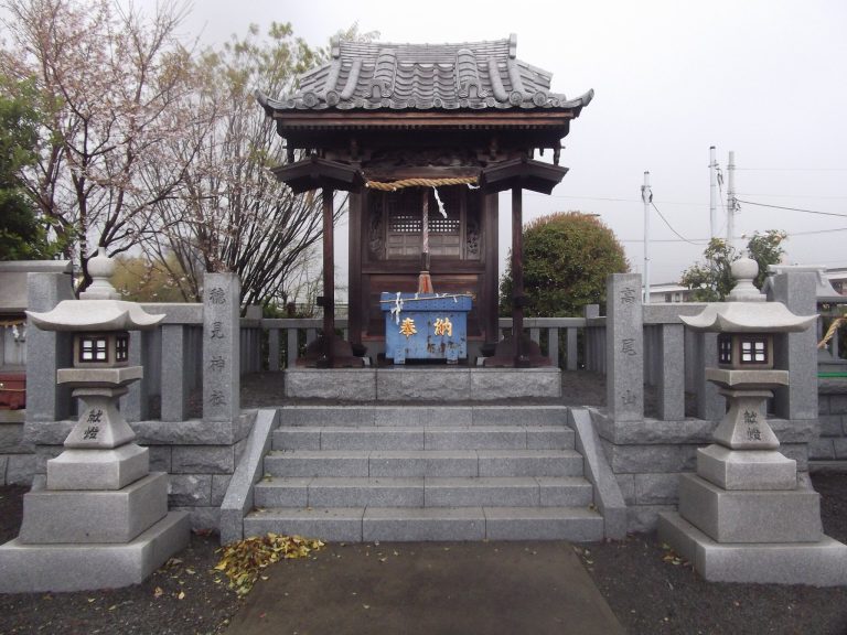
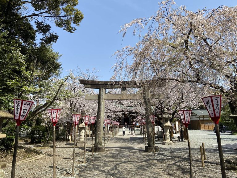
A Shinto shrine stands on the summit, although its foundation date is unknown. The shrine has given the mound several local names, including Sengen-san, Sengen Shrine Kofun, Suzu Sengen Shrine, and Masukawa Sengen Shrine.
Remains
Sengen Kofun is a front-rear rectangular mound, or zenpō-kōhō-fun, formed by a narrower rectangular front section joined to a broader rectangular rear section. This shape differs from the more familiar keyhole mound, whose rear section is circular. The mound follows the 53-meter contour at the tip of a hill descending from the Mount Ashitaka foothills. It measures approximately 100 meters in length, with published figures ranging from about 97 to 98 meters and earlier surveys estimating between approximately 90 and 103 meters. Its maximum width is about 60 meters.
Mound layout and earthworks
Front and rear sections
The front section is approximately 36 meters wide and 8 meters high, while the rear section is approximately 60 meters wide and 11 meters high. The two parts are arranged asymmetrically. The southern side facing the sea is higher and more substantial than the northern side facing the mountain. This design made the mound especially imposing from the plain and from the direction of Suruga Bay, while requiring less earthwork on the less visible northern side. The 2020 laser survey showed that the rear section has two levels and the front section has one. It also revealed a flat terrace projecting from the side of the rear section, a feature that is difficult to see from ground level.
The builders shaped the natural hillside and then added earth to form the monument. Along the side associated with the open moat, the natural ground probably extended to approximately the 5-meter contour. On the southwestern side, the hillside was shaped to about the 8-meter contour before additional earth was placed. Some of the fill probably came from digging the moat. The mound’s form therefore combines the altered hill slope with deliberate construction using deposited earth.
Moat and surrounding ground
Traces of a ditch survive around the mound. An open, waterless section of the moat lay on the northeastern side, between the mound and the adjacent foothill of Mount Ashitaka. The surviving section is approximately 16 meters wide and 50 meters long, and the moat is understood to have extended only along this northeastern side. Numerous horizontal openings on the northern slope at the front end were investigated as subterranean storage pits for sweet potatoes. Their exposed walls reveal the loam layer deposited along the Mount Ashitaka foothills.
Surface covering and summit structure
Stone revetment
The entire mound was covered with river stones approximately 20 to 50 centimeters in diameter. These fukiishi, stones laid over a burial mound’s exterior, stabilized the earthen slopes and created a finished monumental surface. They also helped inhibit vegetation. On the northwestern slope, field use has obscured the stone covering in places. The revetment also forms the base for the shrine structure on the summit.
Sengen Shrine
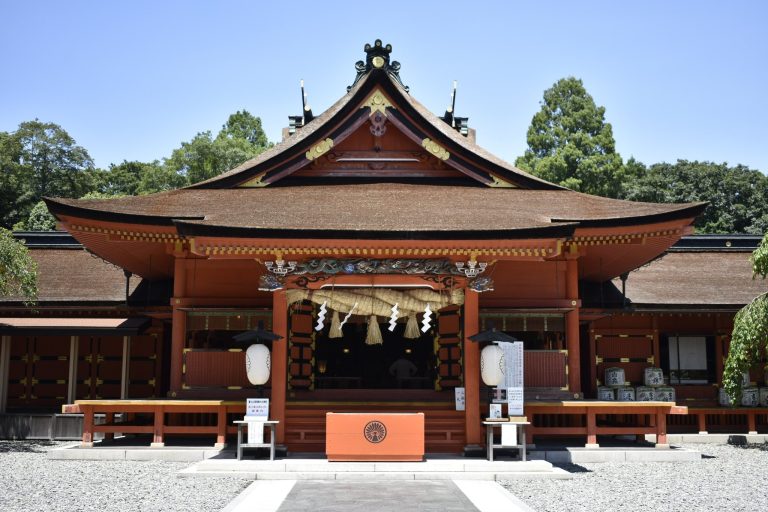
The main sanctuary of Sengen Shrine stands on the rear section of the mound. Its building has a gabled roof, and its principal deity is Konohanasakuya-hime, a Shinto deity associated with Mount Fuji, volcanic power, and blossoming beauty. The shrine’s establishment date is unknown, while its presence accounts for the mound’s continuing local association with the name Sengen.
Burial facility and archaeological evidence
Subsurface burial facility
The burial chamber lies beneath the shrine area and has not been excavated, so its exact form remains uncertain. Ground-penetrating radar detected a strong anomaly beneath the western side of the shrine at a depth of approximately 2.0 to 2.5 meters. The anomaly covers about 9.5 by 6.8 meters, alongside an area measuring approximately 7.4 by 2.2 meters that produced no anomalous response.
The results suggest a burial facility that may have been a vertical shaft stone chamber without ceiling stones or a clay-coffin-like structure. Its arrangement may have been perpendicular to the mound’s central axis. Archaeologists have compared the possible long shaft chamber with examples from the early Kofun period. The absence of ceiling stones would be unusual, however, and the radar evidence does not establish a close relationship with the Yamato polity.
Objects and haniwa
Sue ware is among the finds associated with the mound. The presence of haniwa, ceramic figures and cylinders placed on or around some Kofun-period tombs, remains unresolved. Interpretations have proposed that such objects were present, that they were absent, or that their presence cannot be determined without excavation.
Nearby sites