Rozhdestvenskoye Archaeological Site (Perm): A Medieval Trading and Craft Settlement
Site at a Glance
- Popularity
- Medium
- Country
- Russia
- Primary era
- Medieval
- Eras represented
- Medieval
- Civilizations
- Unclassified
- Site type
- Settlement
- Remains
- Town
On this page12 sections
History
The Rozhdestvenskoye Archaeological Site (Perm) is a medieval settlement in Russia, dated mainly to the 10th century and attributed to local Finno-Ugric inhabitants, speakers of a branch of the Uralic language family. Occupation began in the late 9th century and continued until the mid-14th century. The settlement is associated with the Lomovatov and Rodanov archaeological cultures, classifications based on patterns in material remains.
Early settlement and trade
During the 10th and 11th centuries, the settlement served as a trading and craft post for Volga Bulgaria, a medieval Bulgar polity in the Volga-Kama region. Bulgar merchants and craftspeople lived there alongside the local population. The settlement was enlarged and substantially rebuilt in the 11th century.
Written references and burial grounds
A first written reference to the settlement is dated to the 12th century. Many researchers identify it with Afkula, also rendered Akikul, a place named in Arabic and Egyptian writings from the 13th to the early 15th century. It is regarded as the sole medieval settlement in the Kama region named in eastern writings.
A Muslim cemetery from before the Mongol period lay beside the settlement to the east. Finno-Ugric people described as pagan, from both the settlement and neighboring areas, used a different burial ground 500 metres farther east. The settlement remained in use until the mid-14th century.
Investigation has covered only part of the site. It is designated a cultural heritage site of federal significance in Russia.
Remains
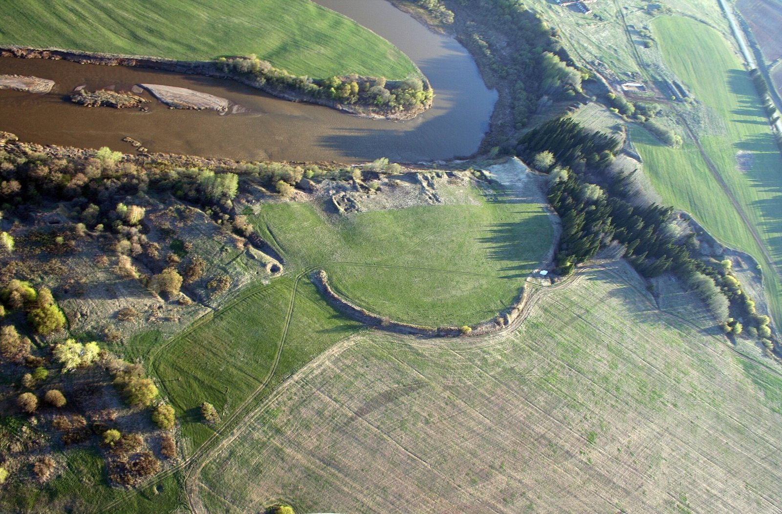
The settlement occupied a high left bank of a river, about 1.5 kilometres southwest of a village. Its 3.6-hectare enclosure contained closely grouped log houses on streets radiating from the central area toward the river. Deep ravines and earthen defenses shaped the settlement’s boundaries.
Enclosure and surrounding defenses
Main settlement boundary
An arc-shaped rampart defended the settlement to the north. A deep ravine with exposed rock formed much of the western and northwestern boundary, and its sides bear traces of deliberate cutting. Another ravine bordered the site to the east. A buried ditch linked to the settlement’s original phase was found along it in 2016.
Citadel and outer settlement
Across the western ravine stood a small, strongly fortified hillfort, a settlement protected by earthworks. It served as a citadel, or defended stronghold, with a substantial rampart and earthen towers. To the north of the main enclosure, beyond its rampart, an unfortified outer settlement extended the occupied area.
Housing and craft activity
Dwellings
Excavated houses were built of logs and measured 180–200 square metres. Upright posts and a timber frame supported their gabled roofs, with posts set in one to three rows along each building. A partition usually divided off the front third of the house, where livestock may have been kept during winter. Houses stood in rows only 1–2 metres apart, forming a dense street plan characteristic of medieval small towns.
Sleeping platforms about two metres wide ran along the walls of the living area, with one or two stoves between them. Planed boards covered the floor between the platforms, while clay surfaced the areas before the stoves. Each stove generally stood above a square storage pit about two metres deep, lined with boards. A wooden platform carried a thick clay base, above which builders formed the stove’s clay vault. The pits held kitchen vessels and food, including cleaned grain prepared for eating.
Workshops and working tools
Excavated work areas include pottery-making, metalworking, blacksmithing, bone-working, and copper-working workshops. A signet ring, an inscribed ring that could serve as a personal seal, was found in a copper-working shop in 2021. It carries the name Akhmat ibn Umar.
Objects and coins
Finds include red-clay pottery made by local and Bulgar craftspeople, agricultural implements such as plowshares, axes, fishing hooks, weapons, and numerous craft tools. Personal objects include bronze and silver ornaments, amulets, bone combs, and implements for cleaning the ears. Children’s toys made of clay and bone also came from the site. Silver coins include Arabic, Bulgar, Central Asian, and Anglo-Saxon issues dating from the 9th to the early 11th century. Copper and silver coins of the Golden Horde, a Mongol successor state that ruled parts of Eurasia, date from the 13th to the early 14th century.
Pendant from burial 37
A silver, trapezoid-shaped pendant came from burial 37, a Lomovatov-culture grave dated to the turn of the 10th and 11th centuries. One side bears the trident associated with Prince Vladimir Sviatoslavich, a ruler of Kievan Rus and member of the Rurikid dynasty, which ruled medieval Rus. The other side shows a sword and hammer. One interpretation identifies that design as the emblem of Olaf Tryggvason, a Norwegian king said in this hypothesis to have been adopted by Vladimir.
The pendant may have been a seal issued for Bulgar merchants to wear as permission for free trade in Rus, the medieval realm ruled by the Rurikids. It may instead, or also, have belonged to a local Chulman merchant acting as an intermediary for Bulgar traders. Chulman is a historical name for the Kama River.