Räuberberg (Görsdorf): Earthworks Attributed to a Medieval Castle
Site at a Glance
- Popularity
- Low
- Country
- Germany
- Primary era
- Medieval
- Eras represented
- Medieval
- Civilizations
- Holy Roman Empire
- Site type
- Military
- Remains
- Castle
On this page10 sections
History
Medieval Setting and Castle
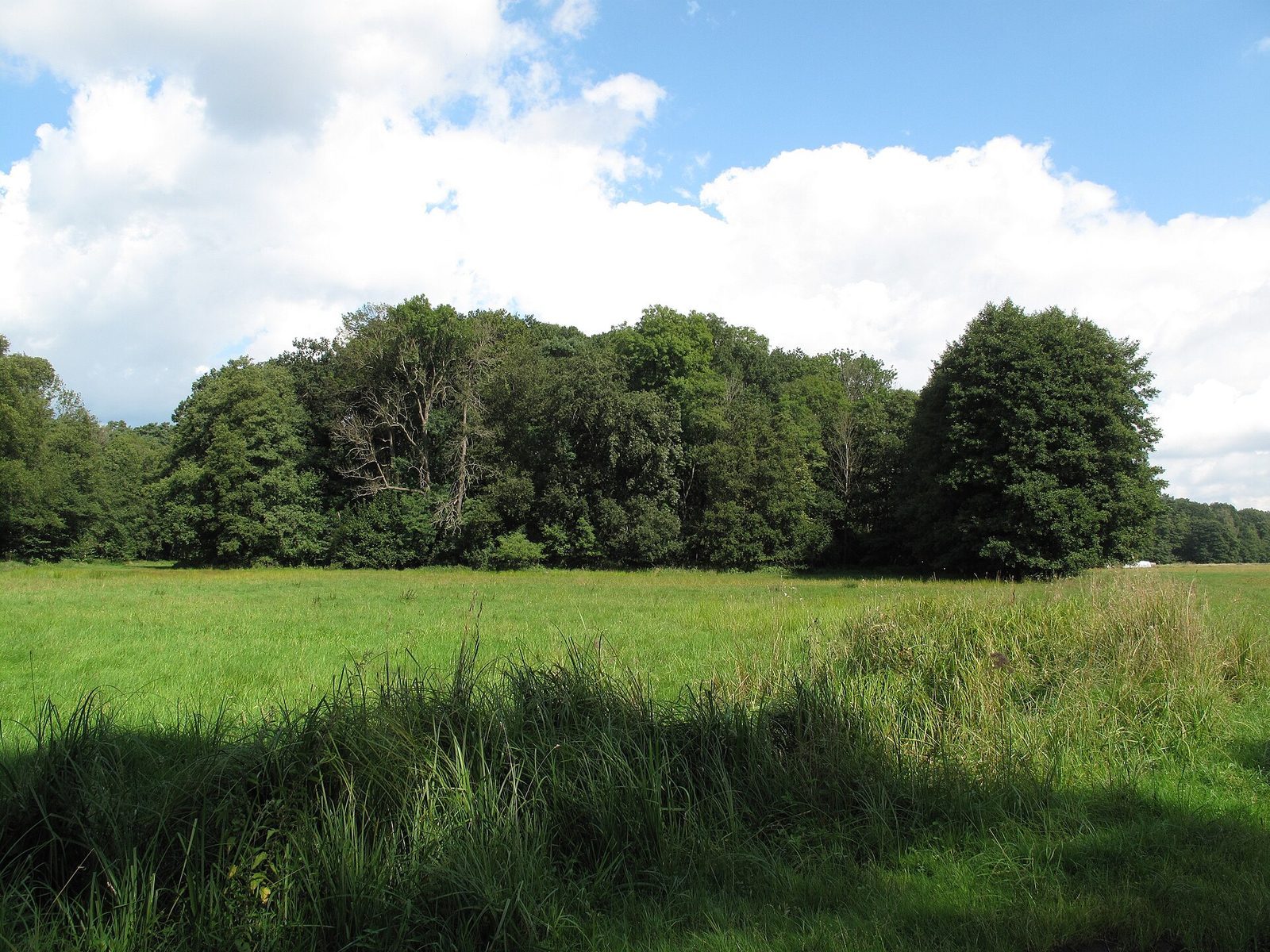
Räuberberg (Görsdorf) is a wooded hill in Germany whose earthworks are attributed to a medieval German noble castle. Archaeological finds place activity on the hill in the 12th and 13th centuries, but no medieval charter or other document names the castle. An earlier interpretation as a Slavic rampart or princely seat has not been substantiated.
The hill lay in a formerly Slavic region settled from Wettin territory during the 12th-century German Eastern Settlement, the medieval expansion of German settlement eastward. The area later became part of the lordship of Beeskow in the Margraviate of Lusatia. Storkow and its surroundings mattered to the Wettin rulers as they incorporated the region into the Holy Roman Empire, the central European political entity, and secured its borders. Storkow was first mentioned in 1209, and its castle was probably established around 1150. If Räuberberg’s fortification also dates to the 12th century, it would belong among the earliest German fortifications of the settlement period in present-day Tauche and Rietz-Neuendorf.
Records for nearby settlements provide a later chronology of local habitation. Kossenblatt was mentioned in 1208, Lindenberg in 1284, Werder in 1376, Limsdorf in 1393, Görsdorf in 1443, Premsdorf in 1460, and Schwenow in 1490. The nearby Drobschmühle, north of Lake Drobsch, appears in a 1376 fief charter as “Drobschmole.” The von Strele lords of Beeskow and Storkow granted it to the knights von Queiß.
Legends and the Name
The hill’s name was probably first recorded on a 1704 map of the Görsdorf district. Local tradition also connected it with the Lüttchen, small beings from Lusatian folklore. They were said to be generally friendly and to have lived on or within the hill. In one version, they left when church bells sounded as Christianity arrived; in another, they departed after curious people watched them.
A separate tale explained Räuberberg as the haunt of robber knights who attacked travelers going from Schwenow, Werder, and Limsdorf to buy goods in Kossenblatt. The robbers supposedly stretched a hidden cord across a narrow road between Lake Drobsch and the hill’s swamp, with a bell warning them when someone stumbled over it. The story also tells of a girl held captive for a year and forced to cook, bake, wash, and mend before she escaped, and of treasure guarded by two black dogs. The writer Günter de Bruyn suggested that the tale might preserve a memory of robber knights using an early German fortification during the political upheavals of the 14th century.
Study and Protection
Interest in the earthworks had begun by the mid-19th century. Leopold von Ledebur described the hill in 1852. Rudolf Virchow later visited but did not excavate because dense roots obstructed the work. Robert Behla discussed the rampart in 1888, and Hermann Busse visited on 24 August 1895 and published an account the following year. In 1933, Walter Dinger wrote that, to his knowledge, no finds were available to establish the rampart’s date or settlement history.
Räuberberg is listed as an archaeological monument under the designation “Medieval German Castle.” It was named a natural monument in 1938, a status confirmed in 1950, and was still described as both a natural and archaeological monument in 2006. Its separate natural-monument status was later revoked. A 2013 draft cited its archaeological protection and its location within the Schwenower Forst Nature Reserve. The site also lies in the Dahme-Heideseen Nature Park and a landscape conservation area; the reserve forms part of the Natura 2000 network.
Remains
The earthworks occupy a sandy, island-like rise in the Blabbergraben lowland, north of Lake Drobsch. The hill reaches 58.1 metres and stands about 18 metres above the surrounding ground. Wet meadows and waterways provided natural protection. The fortification covers a naturally divided hill about 160 metres long and 80 metres wide, with ramparts and ditches around both wooded summits.
Earthworks and Summits
The surviving features include plateaus, banks, and ditches. The almost rectangular plateau on the southern summit is considered the probable location of the inner castle, the principal fortified area. The Blabbergraben now curves around the eastern side of the earthworks. When von Ledebur described the hill in 1852, he said a water ditch enclosed it entirely.
Von Ledebur gave the hill’s circumference at its base as 500 paces and its height as 70 to 80 feet. He described a further rampart and ditch around a summit 40 to 50 feet above the foot of the hill. The enclosed area measured 100 by 60 feet and was divided by a deep cut into unequal southern and northern parts. Busse described the fortification in 1895 as egg-shaped, with two circular ramparts and a circumference of 630 paces. He found the ditch clearer on the east than on the west. The southern approach climbed gradually to the cut between the summits, with a four-foot-high bank along its outer edge; another bank stood to the north. Busse measured the southern summit at 260 paces around and the northern at 226 paces.
Archaeological Evidence
Soil Layer and Finds
Three soil exposures revealed a layer containing traces of human activity above carefully laid fieldstone paving. Finds included horse and wild-boar bones, iron arrowheads, nails, scissors, hut daub, brick fragments, and pottery. The pottery includes 13th-century vessels, hard grey ware, and Upper Lusatian sand-bottom pottery dated to the 13th and 14th centuries. Thin-walled vessels made from well-refined grey clay, with banded decoration, represent a transitional form associated with the late Slavic and early German periods.
Reported Objects
Von Ledebur recorded a report that a heavy iron chain had been found in boggy ground at the hill’s foot in the late 18th century. It was thought to have belonged to a drawbridge. Busse acquired an iron ball measuring four centimetres across in Ahrensdorf; although it was said to have come from the rampart, he doubted that attribution. The finds Busse presented in 1896 were identified by the journal’s editors as coming instead from a Germanic urnfield at nearby Lüttkenbergen near Wulfersdorf.
Woodland and Groundcover
Oaks, scattered pines, and hornbeams form the canopy over the earthworks. Cowslips and wood anemones grow among dense clumps of wood false-brome. In spring, two broad carpets of sky-blue flowers cover the hollow between the rampart hills. This naturalized, non-native groundcover was commonly planted in gardens and landscape parks during the Romantic period. Landowner and forester Carl Starnitzky, who died in 1814, buried his favorite dogs on the hill. Planting by Starnitzky is considered the probable origin of the abundant flowers.