Roman Bridge: An Imperial-Era Crossing over the Riu Mannu
Site at a Glance
- Popularity
- Medium
- Country
- Italy
- Primary era
- Classical
- Eras represented
- Classical, Modern
- Civilizations
- Kingdom of Sardinia, Roman
- Site type
- Infrastructure
- Remains
- Bridge
On this page11 sections
History
Imperial route and winter crossing
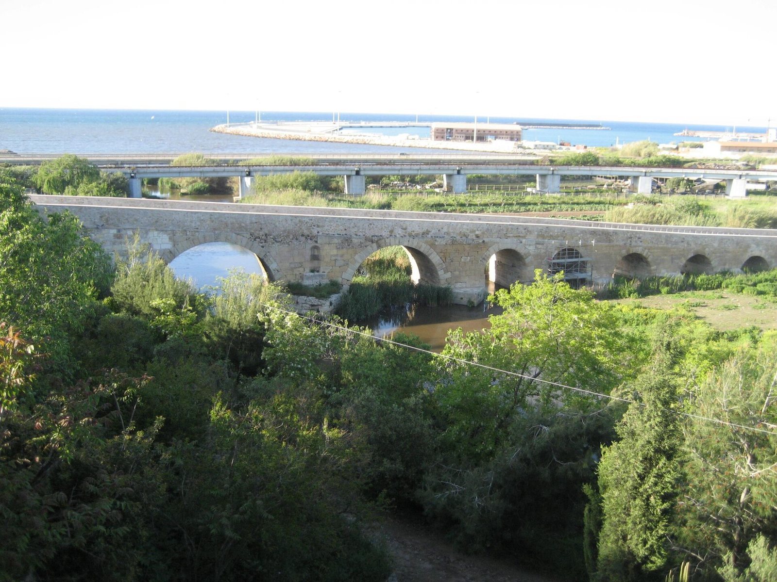
The Roman Bridge is a stone crossing built by the Romans over the Riu Mannu in Italy during the imperial period, when the Roman Empire was governed by emperors. It connected Turris Libisonis, the Roman name for Porto Torres, with the wheat fields of the Nurra in northwestern Sardinia, the Argentiera mines, and Karales, ancient Cagliari. The bridge also served shepherds moving through the area in winter and carts carrying produce. It was described as Sassari’s only safe winter route to the area.
Nineteenth-century maintenance
In 1839, Sassari hired mason Olia Proto to repair the bridge. The work involved chipping damaged masonry, patching it with bricks, preparing the roadway, and paving it with sea pebbles. Carts were barred during paving in 1840, although pedestrians and horses could still cross. That year, architect Giuseppe Pau was also asked to arrange repairs to the parapets.
After Porto Torres gained administrative independence in 1842, it sought neighboring municipalities’ help with maintaining and restoring the bridge. Sassari agreed to contribute, while Alghero did not initially join in. Sassari sent its civic architect to inspect the structure and prepare an estimate in 1849. The following year, Sassari proposed paying three-fifths of repair costs and Porto Torres the remainder, but Porto Torres considered the arrangement too expensive. The municipalities settled their disagreement in 1856, agreeing to share restoration and maintenance costs in those proportions.
A restoration plan approved in 1858 was carried out by mason Antonio Raimondo Usai under the supervision of a civic architect. At Porto Torres’s request, supporting walls with parapets were to be added beside the raised approaches to improve passage for carts and horses. The municipalities also shared maintenance expenses for 1867–1877. In 1877, an engineer judged further repairs urgent and recommended work on the roadway, parapets, landward face, and cutwaters, the projections from bridge piers that divide the flow of water. Porto Torres sought repairs again in 1883 and asked Sassari for a technical inspection in 1885.
Industry, traffic, and restoration
The bridge once gave its name to the broad area on the western bank of the Riu Mannu. Ferromin established industrial plants there in the early twentieth century, and the area is now known as the former Ferromin area. The bridge remained open to light and heavy vehicles until the 1980s, including vehicles travelling to the SIR petrochemical complex. A nearby anti-ship battery also takes its name from the bridge.
Preliminary restoration began in 2020. A final phase of work, intended to consolidate the whole structure after damage from river flow and invasive plants, began in 2024.
Remains
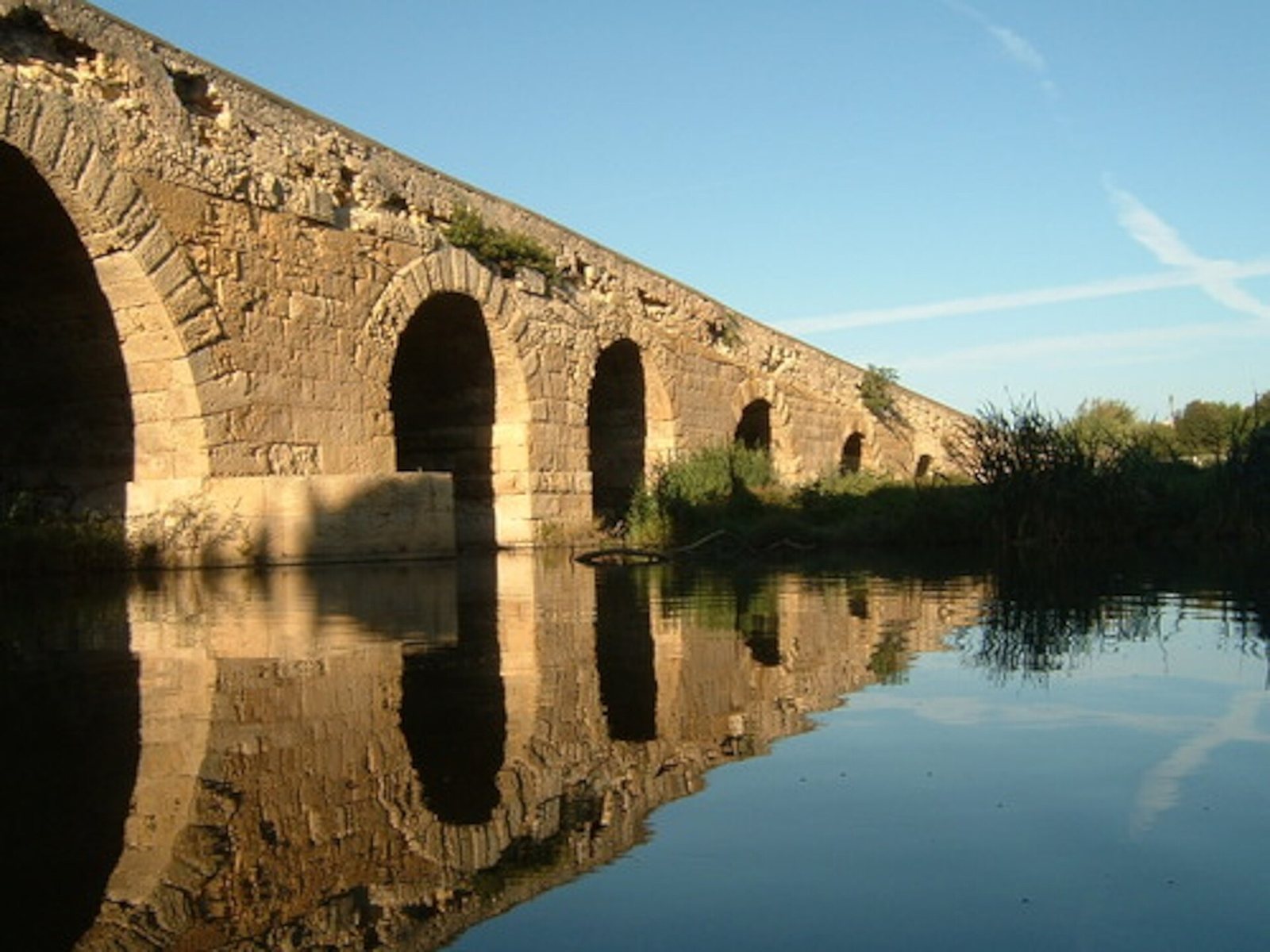
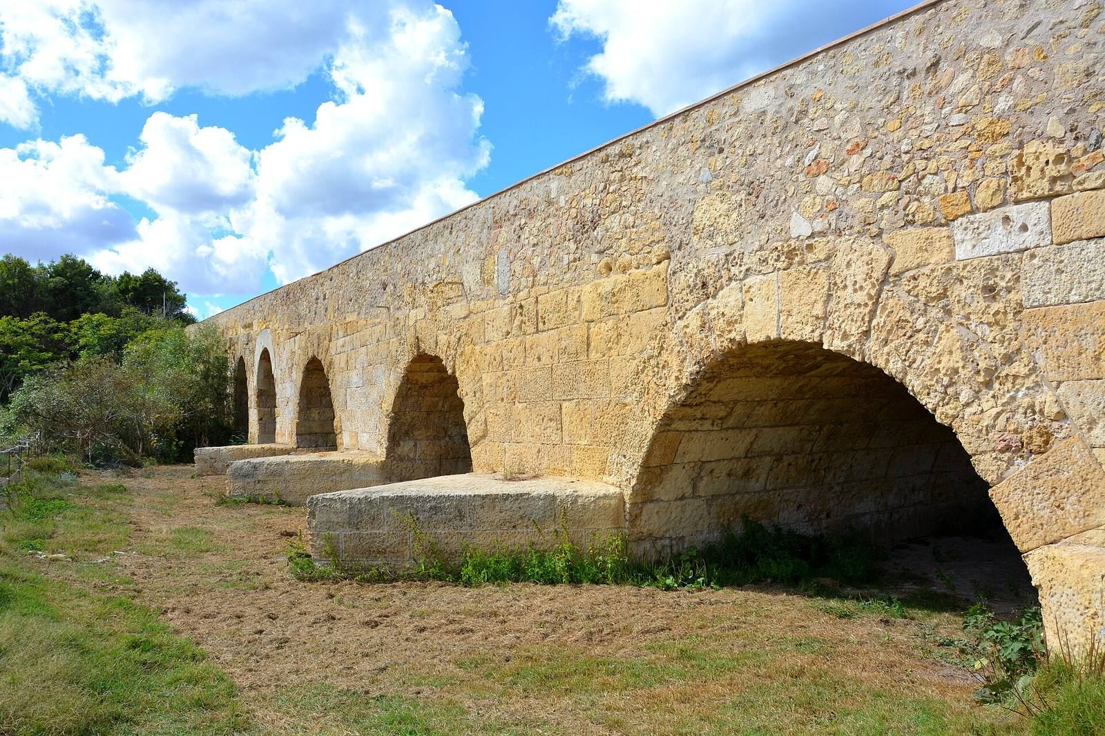
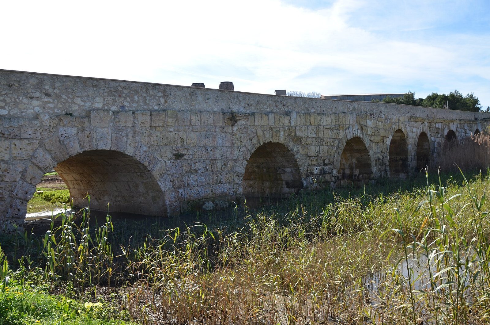
The bridge crosses the Riu Mannu in a line of seven stone arches. It measures 135 metres long and 8 metres wide, and is built from limestone and trachyte. Its raised approaches, roadway, carved details, and surviving masonry preserve features shaped by both construction and later repairs.
Bridge form and construction
Arches and masonry
The seven arches form the main structure, with the two largest framing a pair of niches. Marks on the bridge have been attributed either to the Romans or to the Byzantines, the people of the Eastern Roman Empire. The structure also includes cutwaters, which project from the piers to divide the water flow.
Roadway and approaches
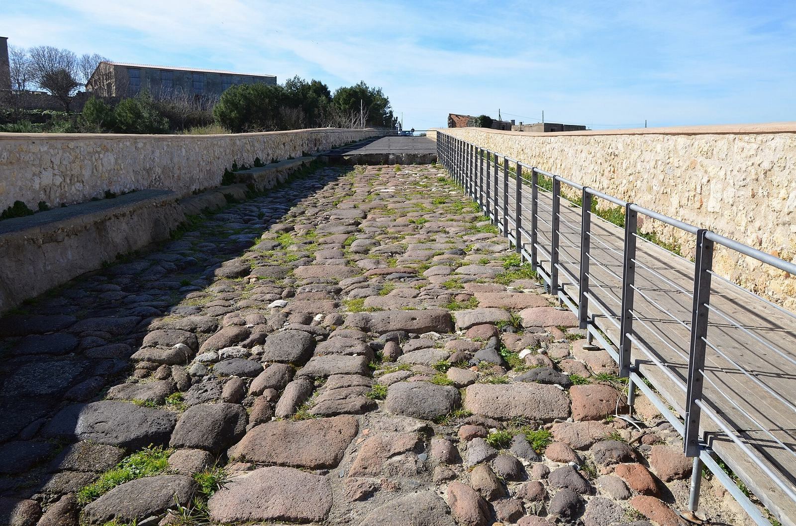
The original roadway is paved with large, roughly worked trachyte stones. Asphalt covered it from the early twentieth century until restoration work begun in 2020 exposed the stone surface again. A raised wooden walkway now provides passage for pedestrians and cyclists without wearing the original paving. The elevated approaches have supporting walls topped with parapets.
Niches and carved imagery
Niches and the southern basin
Both niches between the two largest arches are now empty. A relief in the basin of the southern niche shows a scyphus, a drinking cup used for offerings and often pictured with Dionysus, the Greek god associated with wine, and Heracles, the mythological hero known to the Romans as Hercules. Earlier interpretations proposed that the niches were intended for statues of river deities. Epigrapher Giuseppe Piras, a scholar of inscriptions, suggested that the southern niche held a statue of Dionysus. He connected the god’s protection of the bridge with navigators passing beneath its arch as they left the river port.
Relief on the southern face
The keystone, the central stone at the top of an arch, on the westernmost arch’s southern face bears another carved scene. Piras interpreted it as two panther or tiger heads facing outward, their mouths partly open and fangs visible, drinking wine from a kantharos, a handled wine vessel. A carved element beneath the vessel may represent an altar to the deity or a support for the vessel.