Peñón de Vélez de la Gomera: A Spanish Coastal Fortress
Site at a Glance
- Popularity
- Very High
- Country
- Spain
- Primary era
- Early Modern
- Eras represented
- Early Modern
- Civilizations
- Crown of Castile
- Site type
- Military
- Remains
- Fort
On this page9 sections
History
Peñón de Vélez de la Gomera is a fortified rock on Spain’s North African coast, opposite the former coastal town of Badis. The rock and town formed part of a coastal defensive complex that drew Spanish, Moroccan, Portuguese, and Ottoman interest. Badis stood at the mouth of the Bades River and was identified with Parietina in the ancient Roman route list called the Antonine Itinerary. It was later known as Belis and Gomera; Gomera derives from the Ghomara, a Berber people of the Rif region.
Badis and the coastal defenses
From the fourteenth to the sixteenth century, Badis served as the port of Fez. Timber from the wooded region around it supplied shipbuilding. In 1162, Abd al-Mumin, ruler of the Almohads, a North African Muslim dynasty, ordered coastal defenses and the construction of 100 ships at ports that included Badis. During the sixteenth century, the Ottomans reinforced the bay and rock with four forts. The fortified position on the rock protected Badis and its own defensive complex, which had shipyards.
Spanish occupation and corsair control
Portugal and Castile competed for influence along the North African coast. Under the 1494 Treaty of Tordesillas, Portugal had freedom of action on the coast west of Badis. Spain had occupied Melilla in 1497 and Cazaza in 1505. On 23 July 1508, Spanish commander Pedro Navarro captured and fortified the rock while pursuing pirates who had used it as a refuge. He also seized nearby mainland positions to secure water. Badis, then home to about 7,000 people, belonged to the same strategic complex.
On 20 December 1522, Juan de Villalobos, the garrison commander, mistook a fleet sent by the Moroccan Wattasid dynasty for Spanish reinforcements and opened the gates. The attackers killed the garrison and took the rock and mainland enclave. Mohammad ben Al Mançour then gained control of the island-and-mainland position, which became a stronghold for corsairs, armed sea raiders. Spanish efforts to recover the rock failed in October 1525 and July 1563. In the latter attempt, Sancho de Leiva y Ladrón de Guevara’s forces took the Torres de Alcalá but could not capture the rock.
Sieges and renewed Spanish rule
On 6 September 1564, García Álvarez de Toledo Osorio retook the rock for Spain on the orders of Philip II. The campaign targeted the corsair base at Badis. Its Turkish garrison was killed and the town destroyed. García also reached an agreement with Moroccans to defend the coast together against Turkish attacks. The rock has remained under Spanish sovereignty since 1564.
In 1577, after Muley Ahmed was defeated by his uncle Abul El Malik El Ghazi, he sought refuge at the fortress of Snada and asked the rock’s governor, Juan de Molina, for help in regaining his throne. Spain’s Council of War approved refuge for Ahmed and his family on 13 December. The Portuguese king Sebastian sent six ships with military supplies, which arrived on 20 January 1578. On 14 February, Ahmed assembled troops on a nearby beach under the protection of Spanish guns. After receiving the Portuguese king’s order, the troops sailed for Ceuta on 26 March.
The rock withstood sieges in 1680, 1701, 1755, 1781, and 1790. During Morocco’s 1774 siege of Melilla, a small garrison commanded by Florencio Moreno repelled an army led by Sultan Mohammed III that sought to take the rock. In the early 1870s, Spain’s parliament, the Cortes, debated whether to retain the position. Proposals to abandon or demolish it failed, and its strategic value was reaffirmed.
The rock in modern conflicts and administration
By the early twentieth century, nearly 400 people lived on the rock, including convicts. Its commercial premises included at least five cafés and small shops. During the Rif War, a conflict in northern Morocco in the 1920s between Spanish forces and Rif resistance, Rif forces attacked the rock in 1922. Submarines B-1 and Isaac Peral, supported by the battleship España, evacuated civilians. On 7 April, 50 members of the Spanish Legion, a Spanish Army formation, landed from the steamer Bustamante under heavy fire and strengthened the defenses. Spanish Legion forces later restored Spanish positions, and submarines brought supplies in June.
After Morocco became independent and the Spanish Protectorate of Morocco ended, the rock resumed its status as Spanish territory administered directly by Spain. It had remained outside the protectorate. The position is administered through the Maritime Captaincy of Melilla and has a permanent Spanish Army garrison, including troops from Regulares Group No. 52, a Spanish Army unit. An earthquake in 1930 joined the former island to the mainland.
Remains
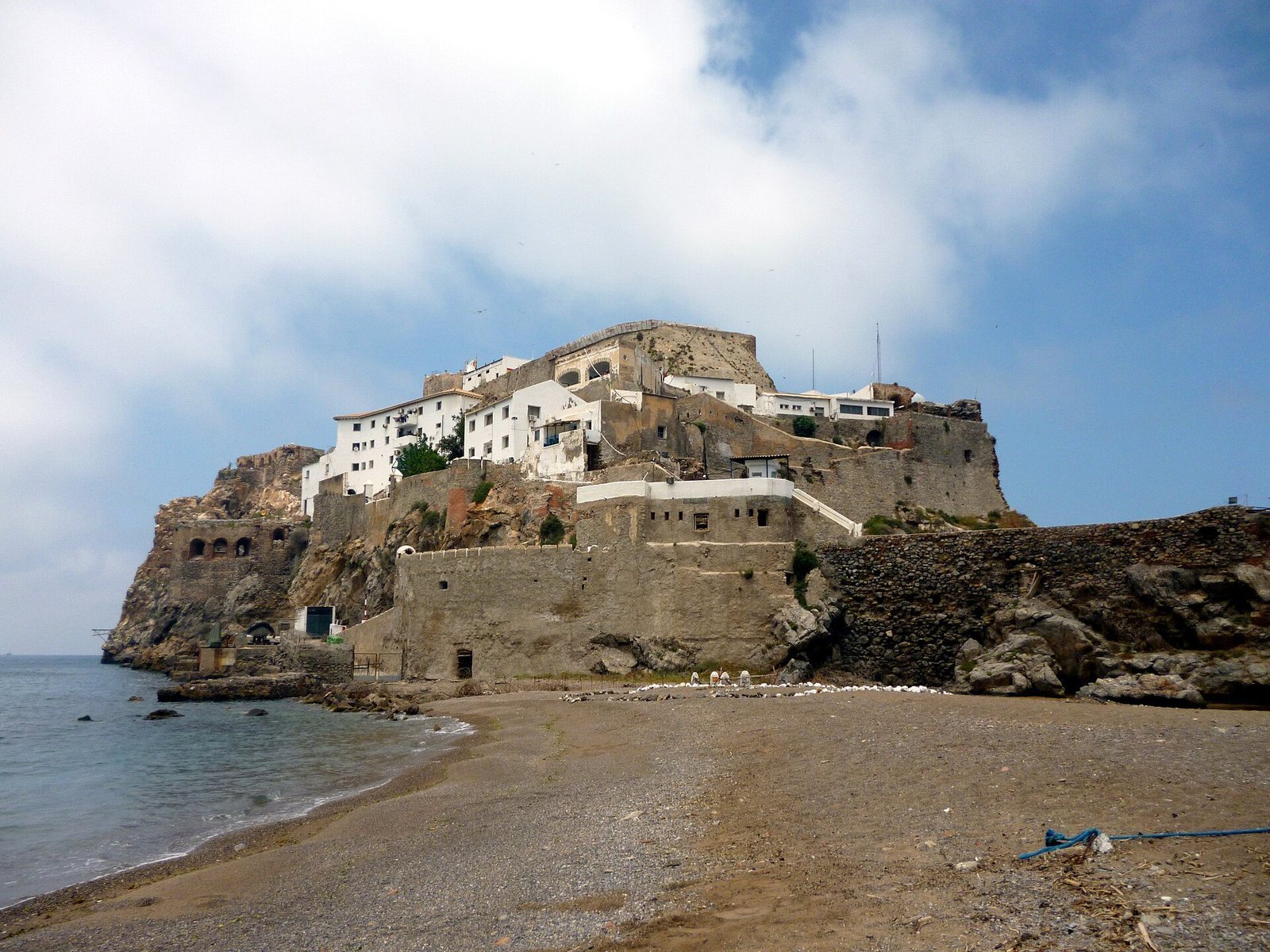
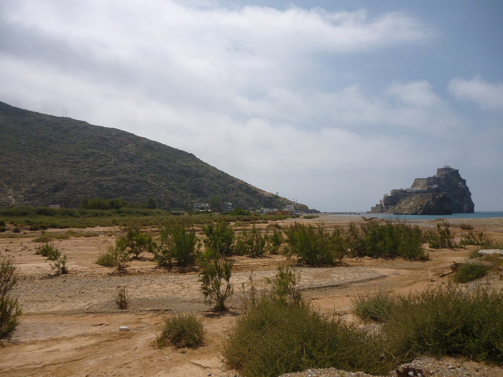
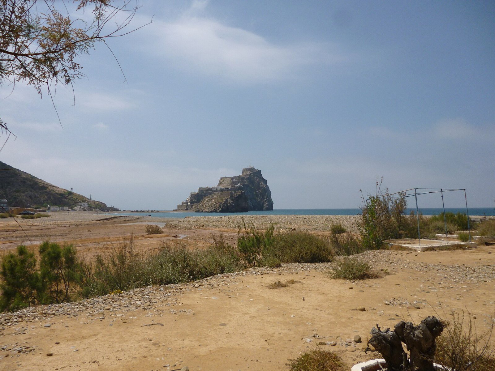
The site comprises a rocky outcrop linked to the mainland by a narrow sandbar. The rock covers about 19,000 square metres, rises to 87 metres, and measures about 260 metres long and 15 to 100 metres wide. Including the sandbar, the peninsula is roughly 400 metres long and 100 metres wide.
Castle complex
The castle complex contains remnants of fortifications and gun batteries from different centuries, alongside a lighthouse, several houses, and a helicopter landing pad. Its surviving structures represent multiple periods of construction.
Mainland defenses and boundary
Four forts once protected the bay and the rock from the mainland. Their ruins are known as the Torres de Alcalá. The defensive territory also included Badis and forts on the surrounding heights. The sandbar connecting the rock to the mainland is about 85 metres long and forms the short Spanish-Moroccan land boundary, initially conceived as an anchorage line.
Water and vegetation
The rock has no freshwater springs and little tree cover. A few fig trees grow there, along with one tall specimen of Prunus laurocerasus. Large cisterns stored water. Supplies had previously come from Málaga, while a small desalination plant now provides water.