Oppidum of Arrola: A Fortified Iron Age Settlement in Spain
Site at a Glance
- Rating
- 4.8
- Popularity
- Very Low
- Country
- Spain
- Primary era
- Iron Age
- Eras represented
- Iron Age
- Civilizations
- Unclassified
- Site type
- Military
- Remains
- Fortified Town
On this page7 sections
History
The Oppidum of Arrola is a fortified Iron Age settlement in Arratzu, Spain, built by local communities on the summit of Mount Arrola between the third and first centuries BC. Also known as the oppidum of Marueleza, it was an enclosed center that organized political, economic, and social life across the Urdaibai basin. The settlement continued into an early Romanizing phase in the first century AD and was regarded as the largest Iron Age settlement in Biscay and one of the most important in the eastern Cantabrian region.
A regional center in the Second Iron Age
Arrola occupied a commanding position between Nabarniz, Arratzu, and Mendata. Its population probably numbered about 400 people and included a small aristocracy, a religious elite, farmers, and craftspeople. The inhabitants cultivated wheat, rye, and millet, kept cattle, sheep, and pigs, practiced mining, and exchanged goods with other settlements. Pottery with Celtiberian characteristics, linked to an Iron Age tradition of central and northeastern Iberia, shows that the community maintained cultural connections beyond its immediate territory.
During the second and first centuries BC, the settlement walls were rebuilt and the inhabited area expanded. The scale of the defenses suggests that Arrola was the principal center in a hierarchy of smaller communities around it, although this interpretation remains connected to the character of the surviving fortifications. About 800 metres to the southeast, the contemporary site of Gastiburu is commonly described as a sanctuary. Its unusual design and substantial construction have been associated with the social organization and resources of the Arrola community.
Romanizing phase and abandonment
A Roman camp was established at Ilunzar on the opposite side of the valley. As Roman power advanced, hilltop settlements such as Arrola were abandoned in favor of communities established nearer rivers and the sea. Arrola’s early Romanizing phase belongs to the first century AD, placing the settlement within this broader transition from Iron Age hilltop centers to new forms of occupation.
The name Marueleza has been interpreted as “Church of Maru” and has been associated with Maru, also called Mari, a prominent female figure in Basque mythology linked in different traditions with mountains, weather, and natural forces. Local tradition has also connected the site with mysterious apparitions.
Discovery and recovery
The settlement was identified in the early nineteenth century. In 1827, Martín Novia Salcedo and the architect Antonio Echevarría surveyed it for the Provincial Council of Biscay, the provincial government responsible for administering Biscay. The first archaeological study followed in 1942, when Blas Tarracena and Augusto Fernández de Avilés emphasized the scale and importance of the defensive structure.
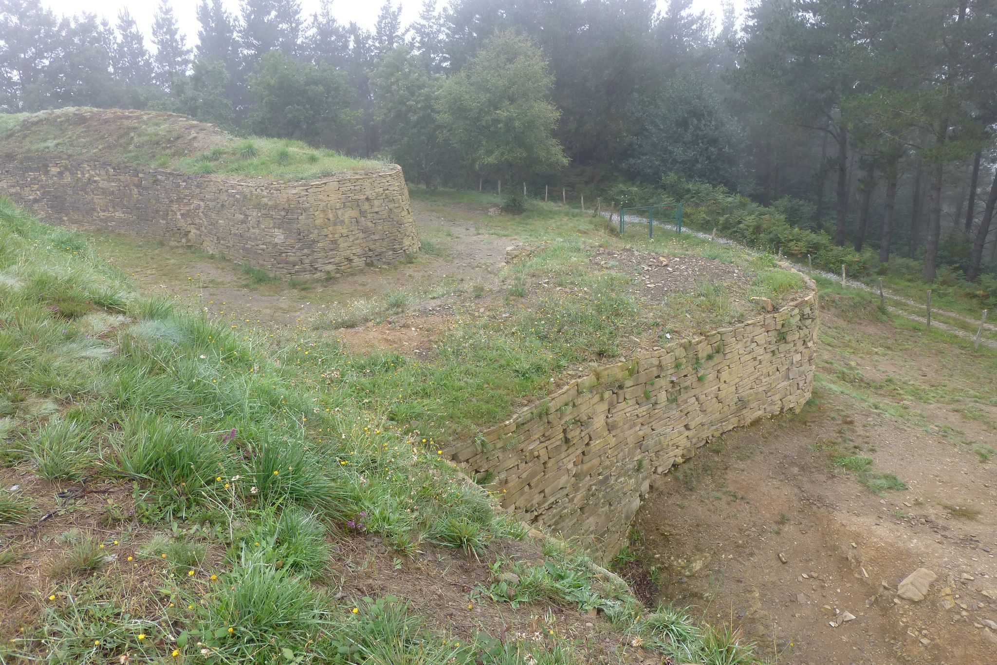
Agricultural and forestry work later damaged and terraced much of the eastern sector, while mining prospecting affected the entrance and earlier archaeological interventions altered parts of the wall. A recovery program begun in 2000 with the University of the Basque Country included land acquisition, regular clearing and mowing, and the reconstruction of damaged sections. More than 50 metres of wall were rebuilt. The program culminated in 2014 with the opening of the archaeological site and a small museum containing finds from the settlement. An interpretation center called Arrolagune also opened in Arratzu that year.
Remains
Fortifications and domestic buildings
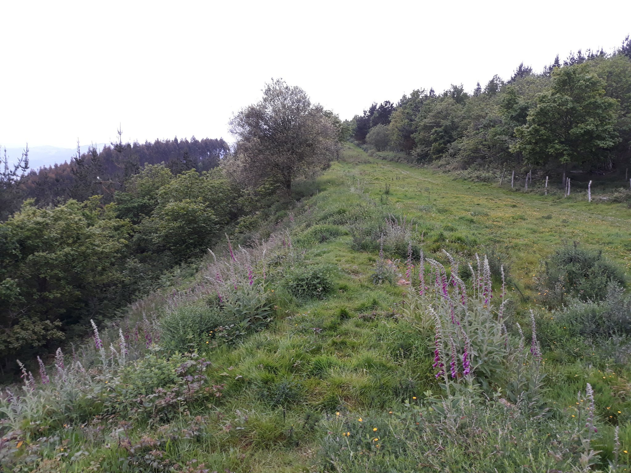
Arrola occupies the summit of Mount Arrola at approximately 537 metres above sea level. Its enclosed area covers about 80,000 square metres, while the wider archaeological area is generally estimated at about 8 hectares, with a possible maximum extent of 13 hectares. A continuous wall enclosed the settlement. It had an earthen core faced with stone, a pronounced outward slope, and dimensions of roughly 5 to 6 metres in height, 7 to 8 metres across the base, and 3 to 3.5 metres across the top. A ditch and a palisade, a barrier made from upright timber posts, strengthened the main wall.
The settlement probably had three entrances, although two have been identified. They used an Iron Age offset arrangement in which overlapping wall sections created a corridor about 10 metres long. The northwest entrance formed a defensive passage between the inner and outer faces of the wall, leaving attackers exposed within the corridor. One entrance has been fully excavated, studied, and reconstructed, while a third is thought to have been destroyed by two forestry roads.
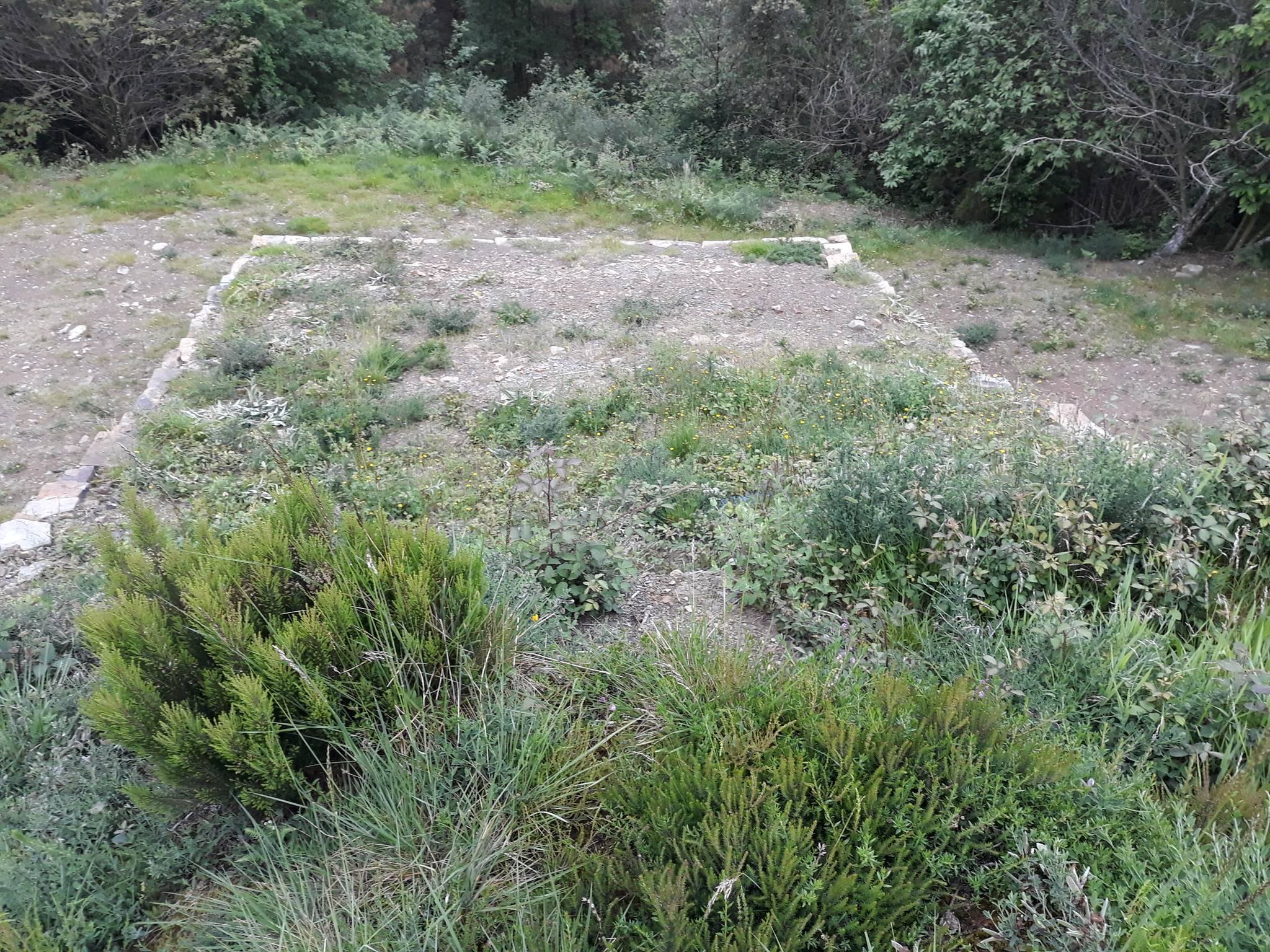
Houses were built against the fortification wall. Rectangular buildings of about 20 square metres stood on stone foundations and used wood, clay, and thatched roofs. The wall supplied one short side of each house as a rear wall, while neighboring buildings shared their side walls. This arrangement placed domestic structures directly against the settlement’s defensive boundary.
Objects recovered from the settlement include Celtiberian-style pottery, hand mills, central-shaft mills, iron tools, bronze ornaments, and implements associated with farming, livestock raising, mining, and exchange. A complete warrior assemblage included the equipment of a fighter who typically carried two spears. At least one undecorated stele with geometric decoration has also been found.
Gastiburu sanctuary
Gastiburu lies about 800 metres southeast of Arrola, between two small rivers. Its plan centers on a pentagonal arrangement. Four large structures occupy four vertices, while a smaller comparable structure stands at the fifth. Additional small circular structures form a line aligned with that fifth vertex. The complex is commonly described as a sanctuary, although its exact purpose remains uncertain and may have involved assemblies or ritual activities connected with the population of Arrola.
The four large structures have horseshoe-shaped plans measuring approximately 18.8 by 19.3 metres, with estimated volumes of 450 to 800 cubic metres. They face a central plaza and contain curved seating or stepped areas reached through two lateral passages. Small masonry walls separated them from the plaza, with two paved openings through those walls. Sandstone slabs paved the intervening surfaces and the central space. Other slabs divided areas within and between the rows of seats; some carry inscribed marks, while others were shaped like animals. Cup-marks and small stone idols have also been found at the site.
The structures were built from stone and clay obtained from nearby quarries. Their interiors were reinforced by tree trunks arranged in an octagonal pattern, with more than 30 trees used in each large structure. Construction required an estimated 2,900 cubic metres of stone and 5,900 cubic metres of clay. The monumental scale, careful construction, central plaza, and lack of ordinary domestic materials distinguish the complex from an industrial or agricultural installation.
Several parts of Gastiburu align with prominent points in the surrounding landscape. The highest point of Arrola aligns with the sanctuary’s central point and with the beginning of the southern wall of the northern structure. Other alignments correspond to Mount Elbizuagamendi, the Labakoatxa pass, the Gaztaintzu-gane ridge, Mount Sollube, and the summit of Astoagana in the Oiz massif. These relationships have been interpreted in connection with the sun’s rising and setting at the winter and summer solstices, the southern direction, and the seasonal timing of agricultural work.
The alignment with Elbizuagamendi corresponds to the winter-solstice sunrise, while Labakoatxa marks the corresponding sunset. Gaztaintzu-gane is associated with the summer-solstice sunrise, and Mount Sollube with the summer-solstice sunset. Astoagana marks the south. The landscape points are unobstructed from Gastiburu, allowing these proposed relationships to be read across the surrounding terrain.