Ocmulgee Mounds National Historical Park: Indigenous Earthworks and Archaeological Sites
Site at a Glance
- Popularity
- Very High
- Country
- United States
- Primary era
- Medieval
- Eras represented
- Medieval, Early Modern, Modern
- Civilizations
- Unclassified
- Site type
- Religious
- Remains
- Sanctuary
On this page22 sections
History
Early Indigenous communities and the Macon Plateau culture
Ocmulgee Mounds National Historical Park preserves Indigenous earthworks and archaeological sites on the Macon Plateau in Georgia, United States. Its principal building phase, about 950–1150 CE, belongs to the Macon Plateau culture, a local expression of South Appalachian Mississippian culture. Mississippian communities were settled societies known in part for building large earthen platform mounds. Human occupation in the area extends back about 12,000 years, through successive Paleoindian, Archaic, and Woodland lifeways before later Muscogee occupation.
The origins of the Macon Plateau culture remain debated. Its builders may have included migrants from the Tennessee Valley who brought Mississippian traditions south, or local people who incorporated practices such as mound building into an earlier Woodland culture. The emergence of Lamar culture may likewise have involved both cultural continuity and the blending of traditions. Between about 950 and 1150, Macon Plateau leaders organized major earthworks and oversaw a settled, socially stratified community. Farming, especially corn, squash, and beans, supported the community alongside smaller-scale tobacco and cotton cultivation, hunting, fishing, and gathering.
Lamar culture and the de Soto expedition
A later community associated with Lamar culture lived downstream from the main ceremonial center. Lamar culture emerged around 1350, and its four named phases, Duvall, Iron Horse, Dyar, and Bell, together date to approximately 1375–1670. In 1540, Spanish conquistador Hernando de Soto’s expedition crossed the chiefdom of Ichisi. The Lamar site may have been Ichisi, but that identification is uncertain. Pigs and infectious diseases introduced by the expedition contributed to Indigenous population losses and social disruption, which likely weakened Mississippian societies.
Muscogee traditions and colonial trade
The Muscogee, also historically known as the Creek, regarded the ancient mounds as sacred and made pilgrimages to them. In Muscogee oral tradition, the area was “the place where we first sat down,” where their ancestors completed a migration from the West. Carolina traders established a post at Ocmulgee in 1690, and Muscogee people settled nearby. During the Yamasee War, a 1715 Indigenous rebellion against Carolina colonists, Ochese Creek people burned the post.
U.S. expansion and Muscogee removal
In 1805, Lower Creek towns, Muscogee communities in the southern part of the confederacy, ceded lands east of the Ocmulgee River to Georgia but retained a three-by-five-mile reserve containing the Macon Plateau mounds and Lamar site. The federal government built Fort Benjamin Hawkins on a hill overlooking the mounds in 1806. It served as a military headquarters and supply depot as well as a trading post, and Macon developed around it. Lower Creek people gathered at Ocmulgee for the last time in 1819; a treaty in 1821 transferred the reserve to the United States. Macon was founded nearby in 1823.
Muscogee removal from the Southeast displaced the community from the area. In 1867, the reorganized Muscogee Nation established a new capital in Indian Territory, the U.S. designation for lands west of the Mississippi to which many Indigenous peoples were forcibly removed. The capital, now in Oklahoma, was named Okmulgee in honor of the Georgia mounds.
Excavation and preservation
Large-scale excavations took place from 1933 to 1942 through the Works Progress Administration, a federal employment program established during the Great Depression. Archaeologist Arthur Randolph Kelly directed the early work. Excavators explored parts of eight mounds and recovered artifacts that revealed extensive trade connections and a complex society. Work in 1934 uncovered the earth lodge, and excavations in 1936 found remains of the 1690 trading post.
Congress authorized federal protection as a national monument in 1934, and the monument was formally established under the National Park Service in 1936. The area became a National Register historic district in 1966 and a Traditional Cultural Property in 1997, the first designation of its kind east of the Mississippi River. In 2019, it became Ocmulgee Mounds National Historical Park, with its authorized area expanded by about 2,100 acres. In 2022, 906 acres were transferred to the park after nearby industrial development was halted. Another 45 acres went to the Ocmulgee Land Trust pending wetlands restoration and later transfer to the park.
Remains
Macon Plateau layout and earthworks
The main archaeological area occupies the east bank of the Ocmulgee River near the Fall Line between the Piedmont and the Atlantic coastal plain. Walnut Creek crosses the protected area and meets the river at its boundary. Mounds A and C marked the settlement’s western side, while Mounds D and E defined part of its eastern side. The occupied area extended north of the line between Mounds C and D, and the ground slopes south toward the swamps along Walnut Creek. A defensive ditch is visible north of the Cornfield Mound. The mounds stood farther apart than was typical of other Mississippian complexes. This spacing may have allowed room for public areas and homes, though the mounds may instead have been built at different times.
Great Temple Mound (Mound A)
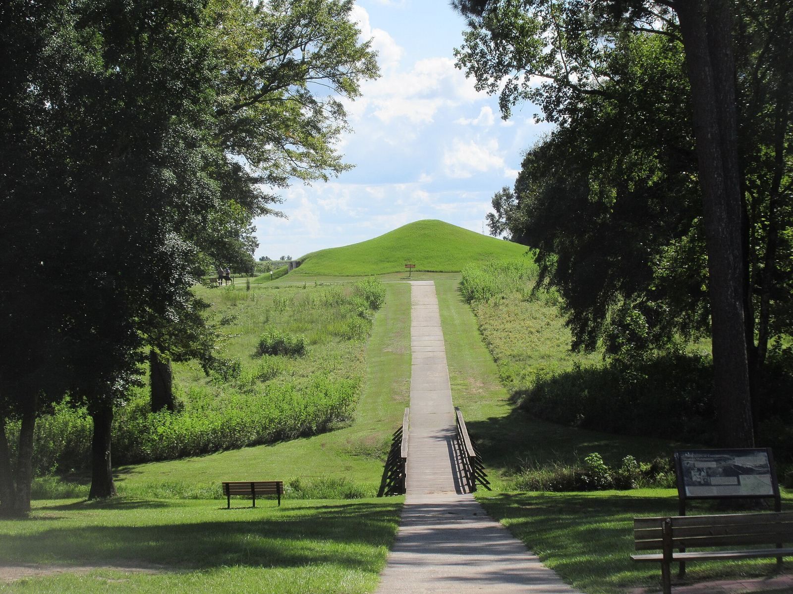
On a bluff above the Ocmulgee River floodplain, the Great Temple Mound is a roughly square, flat-topped earthwork about 91 metres on each side and approximately 15 metres high. Magnetometer surveys revealed a spiral staircase oriented toward the floodplain, an arrangement described as unique among Mississippian sites.
Lesser Temple Mound (Mound B)
The Lesser Temple Mound lies about 100 metres northwest of the Great Temple Mound. It was probably elliptical before railway construction partly destroyed it. The remaining mound, about 3 metres high, has a triangular, flat-topped form with sides of approximately 30 metres.
Funeral Mound (Mound C)
Partly damaged during railway construction, the Funeral Mound survives as an elliptical earthwork about 70 metres east to west and 30 metres north to south. Its centre rises about 8 metres, though the mound was originally higher. At least two mounds, and possibly more, served burial purposes. Practices included cremation, burials of extended or crouched bodies, and later burial of bones gathered into bundles. Some graves contained substantial offerings, including ornaments and ceremonial objects.
Cornfield Mound (Mound D)
North of the railway in the site’s central area, the Cornfield Mound was about 2 metres high when excavated in 1934, with an oval base roughly 67 by 46 metres. Intensive farming eroded it, leaving little of its form visible today.
Southeast Mound (Mound E)
South of the railway and about 300 metres southeast of Mound D, the Southeast Mound is a small oval earthwork. Its base measures approximately 6 by 5 metres, and it stands about 1 metre high.
McDougal and Dunlap mounds
Near the site’s northwestern edge, McDougal Mound lies about 700 metres north of the Cornfield Mound. Its elliptical base measures approximately 30 metres north to south and 12 metres east to west. Road construction and erosion reduced it; it now rises about 4.5 metres above the surrounding ground. Dunlap Mound stands on a low hill in the northern area, about 500 metres from the Cornfield Mound. It is circular, about 16 metres across, and heavily eroded by farming, with a present height of less than 1 metre.
Earth lodge, gardens, and artifacts
Reconstructed earth lodge
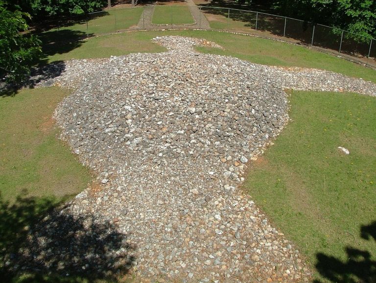
The reconstructed earth lodge is circular, about 13 metres across inside, with a long, narrow entrance. Its excavated remains date to the early eleventh century. They included postholes, a fire area that hardened the packed-clay floor, and a raised earth platform opposite the entrance. The platform was shaped as a stylized bird or eagle and carried a forked-eye design. Three seats were associated with it, while molded seats also lined earthen benches around the room. The seating arrangement includes 47 molded seats, used by leaders or priests.
The lodge was reconstructed by 1941 on the assumption that a wooden building had been covered by an earth mound. That roof interpretation has since been questioned. Comparisons with Muscogee council houses point instead toward lighter construction without an earthen covering, which would have placed less strain on wooden supports in Georgia’s humid climate. Concrete supports and air conditioning were added to the reconstruction after moisture and fungal growth threatened its wood and indoor air.
Garden bed and material finds
Excavators found a ridged garden bed measuring about 16 by 18 metres. Other finds include stone tools, characteristic arrow and spear points, bone needles, ceramic pendants, and copper and shell ornaments. Macon Plateau pottery was undecorated, included handled vessels, and incorporated crushed shell into the clay. Pipes, necklaces, and a lidded pottery vessel shaped like a human head are also among the finds from Ocmulgee.
Railway and trading-post remains
A railway built through the site in 1843 damaged several mounds and other archaeological remains. The trading-post remains lie in the central area between the Funeral Mound and the Southeast Mound. Two buildings stood within a five-sided palisade, a defensive barrier of upright posts or logs, with a ditch along four sides. Excavations recovered Native American graves containing European trade goods, chiefly English.
Lamar site
The Lamar site lies about 3 miles (4.8 kilometres) south of the Macon Plateau, in low-lying river and swamp terrain. It consists of a village and two mounds.
Mound A
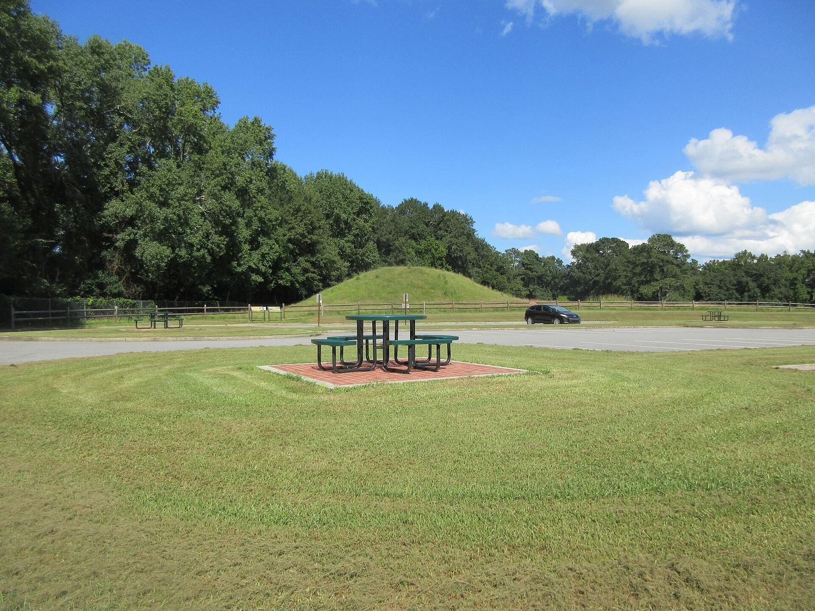
The larger Lamar mound has a square base and a flat summit, rising about 10 metres. An earth lodge may have stood on top.
Mound B, or the Spiral Mound
The rounded Spiral Mound rises about 6 metres and has a rare spiral ramp leading to its summit.
Village
Lamar village houses were rectangular, with clay-plastered walls and roofs made of thatch or sod. A palisade of upright timbers defended the settlement. Lamar pottery is distinguished by complex stamped designs.